
Feed aggregator
SARP East 2025 Oceans Group
10 min read
Preparations for Next Moonwalk Simulations Underway (and Underwater) The 2025 SARP East Oceans Group poses in front of the Dynamic Aviation B-200 aircraft, parked in a hangar at NASA’s Wallops Flight Facility in Virginia. During the internship, students spend a week engaged in Earth science data collection and learning from instruments specialists while flying onboard both the B-200 and NASA’s P-3 aircraft.NASA/Milan Loiacono Return to 2025 SARP Closeout
Faculty Advisors:
Tom Bell, Woods Hole Oceanographic Institute
Graduate Mentor:
Sarah Lang, University of Rhode Island
Oceans Group Introduction Faculty Advisor Tom Bell and Graduate Mentor Sarah Lang Isabella Showman Detecting Coastal Sea Ice Extent and Freshet Event Timing in Prudhoe Bay, Alaska Using Sentinel-1 C-SARIsabella Showman, University of Washington
The detachment of coastal sea ice due to increasing upstream snowmelt causes dramatic seasonal changes in the Arctic Ocean. Termed a freshet, these freshwater pulses influence the timing of sea ice degradation, but the effects are difficult to quantify because of frequent cloud cover and limited ground observations. Sentinel-1 C-SAR (Synthetic Aperture Radar) collects high-spatiotemporal data using microwave radiation backscatter allowing it to see through clouds, making it a valuable tool to identify freshet timing in the Arctic.
We used SAR imagery to classify seasonal sea ice extent for a 45 km transect north of Prudhoe Bay, Alaska. The backscatter signature of SAR is influenced by roughness, and since ocean water is smoother than ice, the backscatter differences allow for the estimation of proportional sea ice cover along the transect. We validated the accuracy of our SAR classifications using shortwave infrared from cloud-free Sentinel-2 images, and found strong agreement between the methods. We then calculated the average annual percent ice cover from 2017 to 2024, serving as a seasonal baseline to compare against individual years. We found mean sea ice decline throughout the spring and summer months and associated freshet event timing to begin in the middle of June. The rate of decline in sea ice cover along the transect has higher variability in the weeks following the onset of sea ice melt.
The use of SAR to track localized seasonal ice melt and identify the timing of spring freshet events allows for a more complete seasonal time series than optical imagery alone. Variability in Arctic freshet timing influences how and when sea ice degradation begins, having potential implications for organisms reliant on sea ice extent and larger-scale surface albedo. This study also lays the groundwork for future investigations to better understand across- watershed variability and environmental factors like river discharge and surface temperature on freshet timing.
Sarah Gryskewicz Investigating the Impacts of the January 2025 California Wildfires on Phytoplankton Blooms in the Pacific OceanSarah Gryskewicz, State University of New York at Oswego
Wildfires are increasing in frequency and intensity across North America as a result of climate change. The release of particulates by these events result in short-range and long-range implications on human and ecophysiological health. Marine ecosystems may also be impacted due to the deposition of these chemical constituents, particularly ash, which can alter nutrient cycling in the water by fertilization and reduce light availability for phytoplankton. Phytoplankton are microscopic organisms that live in marine waters and are responsible for half of the photosynthetic activity on Earth. An area of complex interdisciplinary research concerns the interactions between wildfires and the marine ecosystem. There is a large scientific need to understand biogeochemical cycling between wildfire emissions and phytoplankton blooms.
This study investigates the January 2025 California wildfire impacts on phytoplankton blooms offshore the southern California coast in nutrient limited waters. The Visible Infrared Imaging Radiometer Suite (VIIRS) onboard the Suomi National Polar-orbiting Partnership (SNPP) satellite is used to assess interannual and seasonal variabilities while the Plankton, Aerosol, Cloud, ocean Ecosystem (PACE) satellite was utilized for the additional ocean-based analyses. Variables considered include chlorophyll-a (chl-a) as a proxy for phytoplankton biomass, particulate organic carbon (POC) to assess phytoplankton physiology, and diffuse attenuation at 490 nm (Kd490) to assess light availability. From this analysis, it was found that there was no evident fertilization of a phytoplankton bloom given that chl-a eight-day composites did not deviate significantly from 2012-2025 average geometric mean concentrations. Analyses of the chl-a:POC and chl-a:Kd490 ratios suggest a potential physiological or phytoplankton community shift, but future work using in-situ data is necessary to connect wildfires impacts on phytoplankton communities offshore Southern California. Additionally, the research sets the stage for future work using PACE to investigate impacts on phytoplankton community groups. Future research also involves the expansion of sample wildfire cases and consideration of forested versus urban emission impacts.
Philip Espinal How Well Can Machine Learning Forecast Kelp Biomass Along the Central California Coast?
Philip Espinal, Texas A&M University
Giant Kelp is an integral part of the coastal ecosystem off the Central California Coast because it provides food and shelter for several marine organisms, and supports a multi-million dollar commercial fishing industry. In recent decades, Giant Kelp forests have been in decline due to warming ocean temperatures and overgrazing by marine organisms such as sea urchins. Conservation efforts like outplanting, transplanting, and sea urchin removal are occurring in an effort to restore Giant Kelp populations along the California Coast. Knowing when the environment will be favorable for kelp growth is important to focus conservation resources and effort most efficiently. Observations from the Landsat series of satellites allow for the estimation of kelp biomass density going back to 1984. Two machine learning algorithms, random forests and a simple neural network, were trained on the Landsat observations, coastal wave model output, climate indices, and reanalysis products from 1984 to 2015. Models were evaluated on the mean absolute error (MAE) for predictions from 2016 to 2021, as well the MAE and mean absolute percent error (MAPE) of just the third quarters, when maximum biomass density is typically achieved. The random forest models showed little skill even at the minimum forecast horizon of one quarter, performing similar to a prediction made by a 5-year rolling seasonal average. The neural networks performed significantly better than the random forests and seasonal averages when forecasting one quarter into the future, and performed marginally better at two and four quarters into the future. The neural network trained to forecast one quarter ahead had a third quarter MAPE of 13.4% while the 5-year seasonal average had a MAPE of 42.8%. Models performed poorly in the area surrounding Monterey, greatly overestimating the amount of kelp biomass. This overprediction may be due to the severe reduction in kelp biomass since 2015 due to sea urchin overgrazing. While the predictions did not match the actual outcome, the environment may have in fact still been productive for kelp if not for the presence of sea urchins. Overall, these models can serve as a proof of concept that machine learning models, especially neural networks, can use current environmental conditions to forecast kelp biomass one to two quarters into the future, providing useful operational guidance for conservationists.
Carolyn Chen Sea Surface Temperature as an Indicator of Benthic Symbiont Loss in the Florida Keys: A Comparative Analysis of ECOSTRESS and MODISCarolyn Chen, University of Florida
Coral bleaching events, which pose significant threats to marine biodiversity and reef structure, have increased in frequency and severity over recent decades. Accurate monitoring of sea surface temperature is vital for understanding the drivers of zooxanthellae loss in these foundational habitats. Traditional methods of satellite temperature data collection have relatively coarse spatial resolution (1 km). This can obscure finer-scale thermal variability, especially in nearshore and coastal reef environments where localized temperature anomalies may lead to significant biological impacts. Here, we use ECOSTRESS at a fine spatial resolution (70 m) to investigate the relationships between sea surface temperature and bleaching in the Florida Keys. Thermal imagery from July 24, 2023 was spatially overlaid with in situ coral bleaching survey data to investigate potential thermal stress–bleaching relationships. We then quantified this relationship through correlation analyses at varying spatial thresholds, examining the strength and direction of associations between sea surface temperature and corresponding levels of coral bleaching intensity across survey sites. Parallel analyses were conducted using MODIS for comparative assessment. We were able to determine that ECOSTRESS sea surface temperature had a weak association with bleaching intensity (r² = 0.348, p<0.001). Greater thresholds yielded lower correlation. Comparatively, MODIS showed low correlation at all spatial thresholds. These findings demonstrate the potential of ECOSTRESS for quantifying thermal relationships and lays the groundwork for future work across temporal scales.
Joshua Chapin Impacts of Atmospheric Rivers on Phytoplankton in the Central California Current SystemJoshua Chapin, The University of Alabama in Huntsville
Atmospheric rivers (ARs) are powerful meteorological events that deliver large volumes of freshwater to coastal systems, potentially reshaping oceanographic and ecological conditions. This study investigates the impact of AR-induced freshwater outflow—specifically from the Russian River (RR) and other freshwater sources–on phytoplankton communities in the central California Current System on April 11, 2023. Using Sentinel-3 ocean color reflectance bands within the visual spectrum (e.g., bands 2 through 11), we applied k-means clustering to classify waters with distinct bio-optical properties. To validate and interpret these water types, we integrated data from NASA’s Sub-Mesoscale Ocean Dynamics Experiment (S-MODE) field campaign, including flow-through measurements of temperature, salinity, chlorophyll-a, and particulate organic carbon (POC), along with bottle sample data on nutrients and high-performance liquid chromatography (HPLC) pigments (e.g., fucoxanthin, peridinin, nitrate). These in situ observations revealed physical and biological signatures across the clustered water masses. One cluster is characterized by cold temperatures, low salinity, low chlorophyll-a concentrations. The cluster is also characterized by reduced fucoxanthin (denoting reduced diatom concentrations) and low nitrate. These T/S and bio-optical characteristics suggest an association with terrestrial outflow, potentially linked to AR-driven discharge from the Russian River and adjacent watersheds. However, within the same T/S space, elevated chlorophyll-a concentrations are observed, indicating that some RR water is associated with elevated productivity. . T/S diagrams also indicated that elevated chl-a was associated with mixing of the RR with surrounding waters. In contrast, other clusters were characterized by warmer temperatures, higher salinity, elevated chlorophyll-a concentrations, higher nitrate levels, and higher accessory pigment concentrations such as alloxanthin and prasinoxanthin (associated with this cluster). Overall, these contrasting signatures among clustered water masses illustrate the ecological gradients shaped by AR-driven freshwater delivery. This integrated approach highlights the ecological consequences of terrestrial runoff following AR events and demonstrates the utility of combining satellite-based classifications with high-resolution in situ measurements to monitor phytoplankton variability in dynamic coastal environments.
Eli Mally Predicting Phytoplankton Pigment Groups in Coastal Southern California with PACEEli Mally, University of California, Irvine
Phytoplankton produce half of the world’s oxygen, influence nutrient cycling, and form the basis of the ocean’s food chain. Predicting phytoplankton pigment groups from hyperspectral satellite data, especially in coastal areas where accurate retrievals are challenging, is crucial to gaining a better understanding of ocean ecosystems. Phytoplankton community models from hyperspectral data (such as the MOANA model) have recently become available for the Atlantic, but are not yet available for the Pacific Ocean. To address this observational gap, we created regional models of phytoplankton pigment groups in coastal southern California. We used Level 2 Ocean Color Instrument reflectance data in mid-September 2024 from the NASA PACE satellite. We matched the reflectance data with in situ high performance liquid chromatography (HPLC) data from PACE validation cruises (PACE-PAX) in the Santa Barbara Channel and near Long Beach, with a focus on total chlorophyll, chlorophyll-a, -b, and -c, and five pigments associated with different phytoplankton groups characterized in Kramer et al. 2022 (diatoms, dinoflagellates, haptophytes, green algae, and cyanobacteria). We then performed a principal component regression on the satellite data to find models for each pigment. This project resulted in significant models and R2 values for total chlorophyll (0.911), chlorophyll-a (0.868), -b (0.650), and -c (0.861), 19′-hexanoyloxyfucoxanthin (0.517), peridinin (0.327), zeaxanthin (0.381), fucoxanthin (0.678), and monovinyl chlorophyll-b (0.650). Furthermore, these results help validate PACE satellite measurements, which provide much finer spectral detail on phytoplankton community groups than multispectral data. Further cruises in this area would increase the scope and amount of HPLC samples, and therefore the accuracy and scope of our phytoplankton pigment models.
Return to 2025 SARP Closeout Share Details Last Updated Nov 19, 2025 Related Terms Explore More 2 min read SARP 2025 Closeout Article 5 hours ago 9 min read SARP East 2025 Atmospheric Chemistry Group Article 5 hours ago 10 min read SARP East 2025 Terrestrial Fluxes Group Article 5 hours agoSARP West 2025 Aerosols Group
9 min read
Preparations for Next Moonwalk Simulations Underway (and Underwater) The 2025 SARP West Aerosols Group poses in front of the Dynamic Aviation B-200 aircraft, parked on the tarmac at Guardian Jet Center in Southern California. During the internship, students spend a week engaged in Earth science data collection and learning from instruments specialists while flying onboard both the B-200 and NASA’s P-3 aircraft.NASA/Milan Loiacono Return to 2025 SARP Closeout
Faculty Advisors:
Andreas Beyersdorf, California State University, San Bernardino
Graduate Mentor:
Bradley Ries, University of California, Riverside
Aerosols Group Introduction Faculty Advisor Andreas Beyersdorf Martha Santiago Aerosol Pollution in Two Coastal Agricultural Regions in the United StatesMartha Santiago, Northwestern University
Although air quality has improved across the United States since the passage of the Clean Air
Act in 1970, air pollution remains an issue for millions of Americans. Livestock, fertilizers, and pesticides can release pollutants into the surrounding environment, which may be associated with adverse health effects like asthma and cardiovascular disease, in nearby populations. Because some aerosols are tracers for agriculture, examining aerosol concentrations and composition can help better understand sources and impacts of air pollution. Here, we compare two agricultural regions, the Central Valley in California, which is dominated by fruit, nut, and cattle farms, and the Delmarva Peninsula, which comprises chicken hatcheries and vegetable farms. Using airborne data from the Aerosol Mass Spectrometer (AMS), we compare relative and absolute levels of ammonium (NH4+), chloride (Cl-), nitrates (NO3-), organics, and sulfates (SO42-), and calculate total particulate matter smaller than one micron (PM1). We also examine other agricultural pollutants such as methane (CH4), a tracer for agricultural activity, and compare hotspots between each region. Although both regions are known for high levels of agriculture, our results indicate that their aerosol and trace gas compositions and concentrations vary significantly. On the Delmarva Peninsula, air pollution appears to be a regional issue; average pollutant concentrations are higher but evenly distributed. Conversely, pollution in the Central Valley is localized, as indicated by higher pollutant peaks that overlap over clusters of communities. Understanding differences in composition, concentration, and distribution enables communities and policymakers to identify solutions to address air pollution and to improve air quality.
Eli Garcia Analysis of missed approaches across the Los Angeles basin with a focus on Long Beach aerosol compositionEli Garcia, Trinity College
Aerosols play an important part in the overall air quality, visibility, and human health in urban and rural areas alike. Within the urban sprawl of Los Angeles, many sources of anthropogenic aerosols contribute meaningfully to the improving, yet still below-average air quality of the greater metropolitan area. Because of the relative size and topography of urban Los Angeles, the area can be divided into multiple distinct regions each with distinct sources and compositions of aerosols. To better understand these sources, missed approaches were examined from the NASA Student Airborne Research Program flight campaigns over the last two summers. These missed approaches provide us with an accurate snapshot of the local aerosol composition for people living near these airports, so that we can better understand the sources of these pollutants. For this study, we used aerosol mass spectrometer data to determine the relative amounts of organics, sulfates, nitrates, ammonium, and chlorides. We were also able to collect the total number count of particulate matter and the nonvolatile number count utilizing a condensation particle counter. Data were acquired from six common airports where missed approaches were performed, and we discovered the aerosol composition varies based on the location within the basin. At airports with large amounts of traffic and warehouses, nitrates are a greater portion of total mass, while at airports with a greater concentration of industry, like Long Beach, sulfates are also a greater fraction. By determining what the largest contributing aerosols are and their major sources, efforts can be focused to mitigate these specific polluters.
Kiersten Sundell Mega-Feedlots, Mega-Impact: Differences in Health Outcomes in California’s Imperial ValleyKiersten Sundell, University of Rhode Island
Imperial Valley communities show asthma rates significantly higher than California averages across all age groups, despite relatively low particulate matter (PM2.5 and PM10) readings at regulatory monitoring stations. This health-pollution disconnect indicates potential unmeasured emission sources in a region dominated by industrial cattle feedlots. Imperial Valley hosts California’s largest Concentrated Animal Feeding Operation (CAFO) and slaughterhouse, facilities that confine thousands of cattle and produce large volumes of methane, PM, nitrous oxide, and ammonia, producing complex aerosols linked to respiratory and cardiovascular health impacts. While previous studies have used downwind total suspended particulate filters, dispersion modeling, and supply chain mapping to assess CAFO emissions, these approaches often miss concentrated pollution hotspots. We combine aerosol data from the NASA Student Airborne Research Program, EPA air quality monitoring stations, IPCC calculations, and California wastewater permits to quantify and map emissions from the state’s largest cattle feedlot and slaughterhouse: Brandt Beef in Calipatria and Brawley, California. We mapped these pollutants against health and demographic data in California’s Imperial Valley using data from California Department of Public Health and CalEnviroScreen, finding significant correlations between pollutant spread and prevalence of health indicators such as asthma and cardiovascular disease. Our analysis reveals that Brandt Beef operations emit 26.73 tons of methane and 39.98 tons of nitrous oxide daily. Airborne measurements revealed elevated PM concentrations around facilities, while spatial analysis showed significant correlations between facility proximity and health conditions. These findings indicate that large-scale cattle operations are associated with measurable environmental impact in the surrounding communities, which may be linked to differences in health outcomes, despite compliance with federal air quality standards.
Lilly Kramer Dust Over the Salton SeaLilly Kramer, Oberlin College
Dust storms occur from winds picking up loose sediments, which creates health issues for surrounding populations. The largest dust source in the US is found in California’s Owens Dry Lake. These dust storms are incredibly toxic, carrying carcinogens from the exposed lakebed (playa) into the atmosphere and toward people. The Salton Sea is a lake in California that is rapidly drying, exposing its playa to the environment. In its decline, the Salton Sea mirrors the fate of Owens Lake, which dried up in 1905. A 2024 research paper by Eric C. Edwards (et al.) used a spatially explicit particle transport model to demonstrate increased dust emissions from the Salton Sea. Our research will showcase environmental evidence that the increasing playa creates more dust in the Salton Sea area, corroborating the existing model. This was achieved by analyzing the NASA Student Airborne Research Program flight data over nearly a decade. An Ultra-High Sensitivity Aerosol Spectrometer (UHSAS) and Laser Aerosol Spectrometer (LAS) provided the information on the size of aerosol particles and their quantity. The analysis established a trend of increasing dust particles over the Salton Sea area by looking at particles over 500 nm in diameter. This trend is currently dangerous for the people living near the lake, as increased toxic dust causes significant health issues. This problem will only be exacerbated because if the lake continues its projected path and completely dries up, it could create massive toxic dust storms that extend much farther.
Justin Staley Seasonal Variability in Boundary Layer Vertical Profiles over Los Angeles: A Comparative Analysis of Summer and Winter ConditionsJustin Staley, Villanova University
The planetary boundary layer (PBL) is the lowest part of the atmosphere, in situ air that borders the free troposphere and the Earth’s surface. Characterized by turbulent mixing, PBL plays an important role in climate patterns, weather dynamics, and air quality, and is influenced by external factors such as temperature, geography, and proximity to the ocean. This project analyzes the seasonal differences in PBL characteristics over the greater Los Angeles area by asking how vertical profiles of trace gases and aerosols compare during missed approaches in summer 2025 and winter 2021. Aircraft-based measurements of trace gases (CH₄, NH₄, O₃, NO₃), organic aerosols, and total number count of aerosols, were used to analyze how the PBL structure influences pollutant distribution across urban and coastal regions. Results indicate that summer mornings often exhibit deeper boundary layers from increased solar intensity. In contrast, winter morning profiles exhibit shallower and more stable boundary layers from less warming and more cloud coverage, with weaker vertical mixing. Observed chemical species, particularly O₃ and NH₄, displayed distinct vertical gradients at the PBL top, aiding in defining its height and dynamics. Additionally, ozone concentrations increase above PBL, while total aerosol number counts vary with altitude and location. These findings provide insight into pollutant dispersion, chemical reactivity, implications for regional air quality modeling, and a better understanding of the role of local geography and meteorology in shaping boundary layer behavior in Southern California.
Jacob Garside Biomass Burning Aerosol Fingerprints: Combining Absorption and Trace Gas Measurements for Plume CharacterizationJacob Garside, Plymouth State University
With thousands of wildfires occurring annually in California, understanding smoke composition is critical for air quality and climate assessments. As wildfire severity and intensity are increasing year over year, being able to characterize aerosol plumes becomes more important. This study examines two significant 2025 fires through combined airborne and ground-based measurements: the June 30th Juniper Fire and the 24-day Eaton Fire (January 7th–31st). During the NASA Student Airborne Research Program, the P-3B aircraft intercepted the Juniper Fire plume, enabling a comprehensive analysis of biomass burning aerosols. We investigated whether aerosols and trace gases could serve as definitive fire signatures by comparing aircraft and surface measurements. The study utilized absorption measurements from both the airborne Langley Aerosols Research Group, instrument suite and a ground-based Atmospheric Science and Chemistry mEasuremet NeTwork (ASCENT) aethalometer to derive the absorption Ångström exponent (AAE), while simultaneous CO and CO₂ measurements on the aircraft identified plume intercepts and combustion efficiency. Calculated AAE values of 1.5-1.7 indicated mixed contributions from black carbon and brown carbon, which is characteristic of biomass burning. Elevated CO to CO₂ ratios confirmed inefficient smoldering fires, as high values of CO are usually linked to such fires. These findings demonstrate that integrated AAE and trace gas measurements from multiple platforms effectively characterize smoke composition, providing valuable discrimination between black carbon and brown carbon-dominated plumes for improved atmospheric modeling and public health assessment.
Return to 2025 SARP Closeout Share Details Last Updated Nov 19, 2025 Related Terms Explore More 2 min read SARP 2025 Closeout Article 6 hours ago 9 min read SARP East 2025 Atmospheric Chemistry Group Article 6 hours ago 10 min read SARP East 2025 Terrestrial Fluxes Group Article 6 hours agoSARP West 2025 Aerosols Group
9 min read
Preparations for Next Moonwalk Simulations Underway (and Underwater) The 2025 SARP West Aerosols Group poses in front of the Dynamic Aviation B-200 aircraft, parked on the tarmac at Guardian Jet Center in Southern California. During the internship, students spend a week engaged in Earth science data collection and learning from instruments specialists while flying onboard both the B-200 and NASA’s P-3 aircraft.NASA/Milan Loiacono Return to 2025 SARP CloseoutFaculty Advisors:
Andreas Beyersdorf, California State University, San Bernardino
Graduate Mentor:
Bradley Ries, University of California, Riverside
Aerosols Group Introduction Faculty Advisor Andreas Beyersdorf Martha Santiago Aerosol Pollution in Two Coastal Agricultural Regions in the United StatesMartha Santiago, Northwestern University
Although air quality has improved across the United States since the passage of the Clean Air
Act in 1970, air pollution remains an issue for millions of Americans. Livestock, fertilizers, and pesticides can release pollutants into the surrounding environment, which may be associated with adverse health effects like asthma and cardiovascular disease, in nearby populations. Because some aerosols are tracers for agriculture, examining aerosol concentrations and composition can help better understand sources and impacts of air pollution. Here, we compare two agricultural regions, the Central Valley in California, which is dominated by fruit, nut, and cattle farms, and the Delmarva Peninsula, which comprises chicken hatcheries and vegetable farms. Using airborne data from the Aerosol Mass Spectrometer (AMS), we compare relative and absolute levels of ammonium (NH4+), chloride (Cl-), nitrates (NO3-), organics, and sulfates (SO42-), and calculate total particulate matter smaller than one micron (PM1). We also examine other agricultural pollutants such as methane (CH4), a tracer for agricultural activity, and compare hotspots between each region. Although both regions are known for high levels of agriculture, our results indicate that their aerosol and trace gas compositions and concentrations vary significantly. On the Delmarva Peninsula, air pollution appears to be a regional issue; average pollutant concentrations are higher but evenly distributed. Conversely, pollution in the Central Valley is localized, as indicated by higher pollutant peaks that overlap over clusters of communities. Understanding differences in composition, concentration, and distribution enables communities and policymakers to identify solutions to address air pollution and to improve air quality.
Eli Garcia Analysis of missed approaches across the Los Angeles basin with a focus on Long Beach aerosol compositionEli Garcia, Trinity College
Aerosols play an important part in the overall air quality, visibility, and human health in urban and rural areas alike. Within the urban sprawl of Los Angeles, many sources of anthropogenic aerosols contribute meaningfully to the improving, yet still below-average air quality of the greater metropolitan area. Because of the relative size and topography of urban Los Angeles, the area can be divided into multiple distinct regions each with distinct sources and compositions of aerosols. To better understand these sources, missed approaches were examined from the NASA Student Airborne Research Program flight campaigns over the last two summers. These missed approaches provide us with an accurate snapshot of the local aerosol composition for people living near these airports, so that we can better understand the sources of these pollutants. For this study, we used aerosol mass spectrometer data to determine the relative amounts of organics, sulfates, nitrates, ammonium, and chlorides. We were also able to collect the total number count of particulate matter and the nonvolatile number count utilizing a condensation particle counter. Data were acquired from six common airports where missed approaches were performed, and we discovered the aerosol composition varies based on the location within the basin. At airports with large amounts of traffic and warehouses, nitrates are a greater portion of total mass, while at airports with a greater concentration of industry, like Long Beach, sulfates are also a greater fraction. By determining what the largest contributing aerosols are and their major sources, efforts can be focused to mitigate these specific polluters.
Kiersten Sundell Mega-Feedlots, Mega-Impact: Differences in Health Outcomes in California’s Imperial ValleyKiersten Sundell, University of Rhode Island
Imperial Valley communities show asthma rates significantly higher than California averages across all age groups, despite relatively low particulate matter (PM2.5 and PM10) readings at regulatory monitoring stations. This health-pollution disconnect indicates potential unmeasured emission sources in a region dominated by industrial cattle feedlots. Imperial Valley hosts California’s largest Concentrated Animal Feeding Operation (CAFO) and slaughterhouse, facilities that confine thousands of cattle and produce large volumes of methane, PM, nitrous oxide, and ammonia, producing complex aerosols linked to respiratory and cardiovascular health impacts. While previous studies have used downwind total suspended particulate filters, dispersion modeling, and supply chain mapping to assess CAFO emissions, these approaches often miss concentrated pollution hotspots. We combine aerosol data from the NASA Student Airborne Research Program, EPA air quality monitoring stations, IPCC calculations, and California wastewater permits to quantify and map emissions from the state’s largest cattle feedlot and slaughterhouse: Brandt Beef in Calipatria and Brawley, California. We mapped these pollutants against health and demographic data in California’s Imperial Valley using data from California Department of Public Health and CalEnviroScreen, finding significant correlations between pollutant spread and prevalence of health indicators such as asthma and cardiovascular disease. Our analysis reveals that Brandt Beef operations emit 26.73 tons of methane and 39.98 tons of nitrous oxide daily. Airborne measurements revealed elevated PM concentrations around facilities, while spatial analysis showed significant correlations between facility proximity and health conditions. These findings indicate that large-scale cattle operations are associated with measurable environmental impact in the surrounding communities, which may be linked to differences in health outcomes, despite compliance with federal air quality standards.
Lilly Kramer Dust Over the Salton SeaLilly Kramer, Oberlin College
Dust storms occur from winds picking up loose sediments, which creates health issues for surrounding populations. The largest dust source in the US is found in California’s Owens Dry Lake. These dust storms are incredibly toxic, carrying carcinogens from the exposed lakebed (playa) into the atmosphere and toward people. The Salton Sea is a lake in California that is rapidly drying, exposing its playa to the environment. In its decline, the Salton Sea mirrors the fate of Owens Lake, which dried up in 1905. A 2024 research paper by Eric C. Edwards (et al.) used a spatially explicit particle transport model to demonstrate increased dust emissions from the Salton Sea. Our research will showcase environmental evidence that the increasing playa creates more dust in the Salton Sea area, corroborating the existing model. This was achieved by analyzing the NASA Student Airborne Research Program flight data over nearly a decade. An Ultra-High Sensitivity Aerosol Spectrometer (UHSAS) and Laser Aerosol Spectrometer (LAS) provided the information on the size of aerosol particles and their quantity. The analysis established a trend of increasing dust particles over the Salton Sea area by looking at particles over 500 nm in diameter. This trend is currently dangerous for the people living near the lake, as increased toxic dust causes significant health issues. This problem will only be exacerbated because if the lake continues its projected path and completely dries up, it could create massive toxic dust storms that extend much farther.
Justin Staley Seasonal Variability in Boundary Layer Vertical Profiles over Los Angeles: A Comparative Analysis of Summer and Winter ConditionsJustin Staley, Villanova University
The planetary boundary layer (PBL) is the lowest part of the atmosphere, in situ air that borders the free troposphere and the Earth’s surface. Characterized by turbulent mixing, PBL plays an important role in climate patterns, weather dynamics, and air quality, and is influenced by external factors such as temperature, geography, and proximity to the ocean. This project analyzes the seasonal differences in PBL characteristics over the greater Los Angeles area by asking how vertical profiles of trace gases and aerosols compare during missed approaches in summer 2025 and winter 2021. Aircraft-based measurements of trace gases (CH₄, NH₄, O₃, NO₃), organic aerosols, and total number count of aerosols, were used to analyze how the PBL structure influences pollutant distribution across urban and coastal regions. Results indicate that summer mornings often exhibit deeper boundary layers from increased solar intensity. In contrast, winter morning profiles exhibit shallower and more stable boundary layers from less warming and more cloud coverage, with weaker vertical mixing. Observed chemical species, particularly O₃ and NH₄, displayed distinct vertical gradients at the PBL top, aiding in defining its height and dynamics. Additionally, ozone concentrations increase above PBL, while total aerosol number counts vary with altitude and location. These findings provide insight into pollutant dispersion, chemical reactivity, implications for regional air quality modeling, and a better understanding of the role of local geography and meteorology in shaping boundary layer behavior in Southern California.
Jacob Garside Biomass Burning Aerosol Fingerprints: Combining Absorption and Trace Gas Measurements for Plume CharacterizationJacob Garside, Plymouth State University
With thousands of wildfires occurring annually in California, understanding smoke composition is critical for air quality and climate assessments. As wildfire severity and intensity are increasing year over year, being able to characterize aerosol plumes becomes more important. This study examines two significant 2025 fires through combined airborne and ground-based measurements: the June 30th Juniper Fire and the 24-day Eaton Fire (January 7th–31st). During the NASA Student Airborne Research Program, the P-3B aircraft intercepted the Juniper Fire plume, enabling a comprehensive analysis of biomass burning aerosols. We investigated whether aerosols and trace gases could serve as definitive fire signatures by comparing aircraft and surface measurements. The study utilized absorption measurements from both the airborne Langley Aerosols Research Group, instrument suite and a ground-based Atmospheric Science and Chemistry mEasuremet NeTwork (ASCENT) aethalometer to derive the absorption Ångström exponent (AAE), while simultaneous CO and CO₂ measurements on the aircraft identified plume intercepts and combustion efficiency. Calculated AAE values of 1.5-1.7 indicated mixed contributions from black carbon and brown carbon, which is characteristic of biomass burning. Elevated CO to CO₂ ratios confirmed inefficient smoldering fires, as high values of CO are usually linked to such fires. These findings demonstrate that integrated AAE and trace gas measurements from multiple platforms effectively characterize smoke composition, providing valuable discrimination between black carbon and brown carbon-dominated plumes for improved atmospheric modeling and public health assessment.
Return to 2025 SARP Closeout Share Details Last Updated Nov 19, 2025 Related Terms Explore More 2 min read SARP 2025 Closeout Article 5 hours ago 9 min read SARP East 2025 Atmospheric Chemistry Group Article 5 hours ago 10 min read SARP East 2025 Terrestrial Fluxes Group Article 5 hours agoSARP West 2025 Land Group
11 min read
Preparations for Next Moonwalk Simulations Underway (and Underwater) The 2025 SARP West Land Group poses in front of the Dynamic Aviation B-200 aircraft, parked on the tarmac at Guardian Jet Center in Southern California. During the internship, students spend a week engaged in Earth science data collection and learning from instruments specialists while flying onboard both the B-200 and NASA’s P-3 aircraft.NASA/Milan Loiacono Return to 2025 SARP Closeout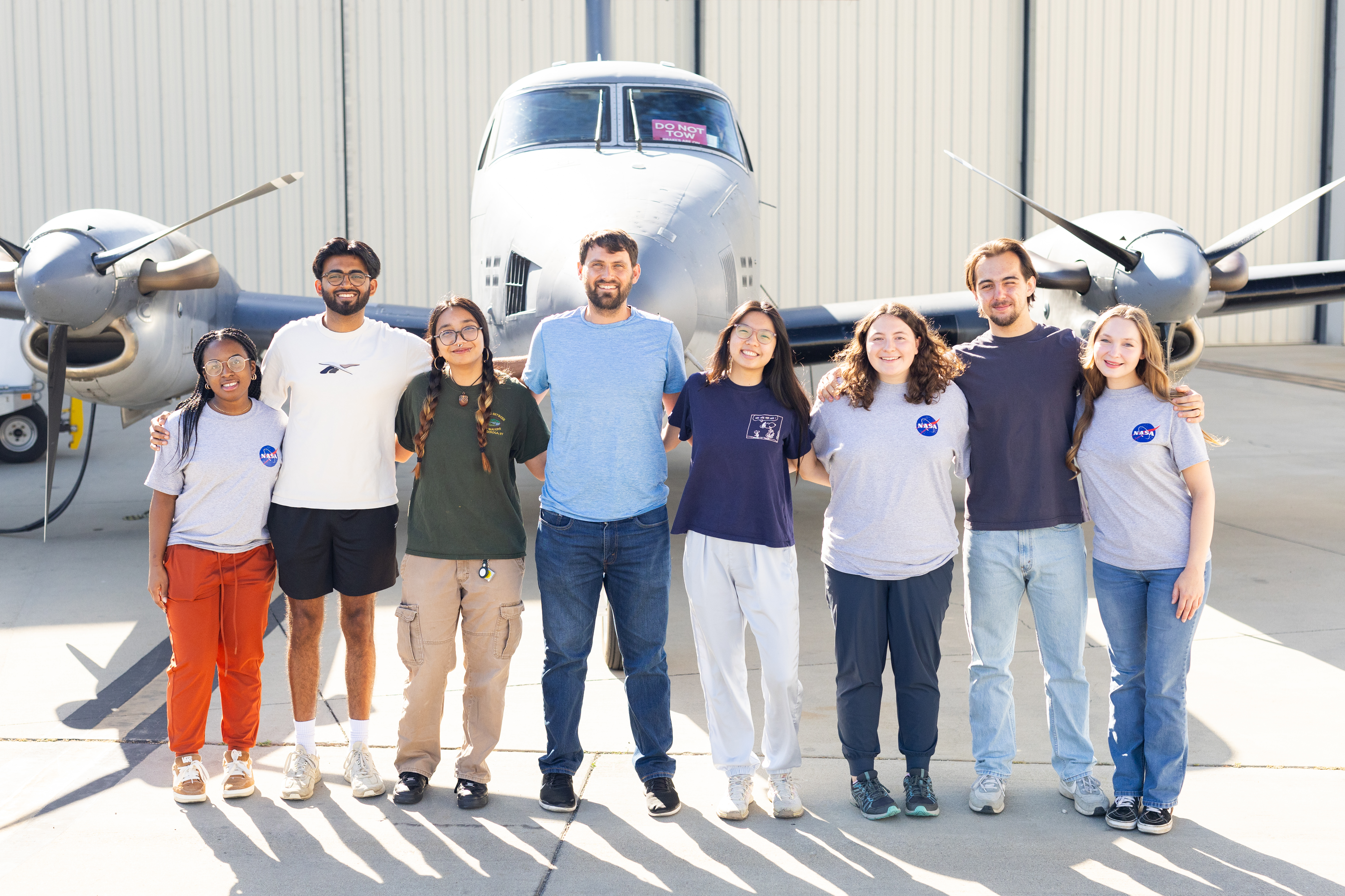
Faculty Advisors:
Daniel Sousa, San Diego State University
Graduate Mentor:
Megan Ward-Baranyay, San Diego State University
Land Group Introduction Faculty Advisor Daniel Sousa Robert Purvis Fractional cover estimates of the epiphytic macrolichen Ramalina menziesii in oak canopies from simulated mixed spectra and airborne imaging spectroscopyRobert Purvis, Western Kentucky University
Lichens, a symbiotic relationship between a fungus (mycobiont) and green algae or cyanobacterium (photobiont), occur globally with great variability in form and function. On the North American west coast, Ramalina menziesii is a robust lichen with net-like morphology found across three distinct biomes. In the mediterranean climate of coastal California, R. menziesii can survive with thallus water content as low as 13%, making the lichen a powerful medium for wildfire spread. As a late-successional community member, changes in wildfire incidence observed in the region have caused R. menziesii coverage to decline. Despite their importance, there is little research on the detection of lichen with imaging spectroscopy, which would provide a potentially novel piece of information to wildland firefighters. The lichen primarily grows on oaks of the region, with the percentage of top-cover ranging from near zero to tree canopy overgrowth due to the lichens’ pendulous growth form. These characteristics may make R. menziesii a good candidate for airborne imaging spectroscopy. Reflectance spectra were collected with a field spectrometer and contact probe from the Figueroa creek area of Sedgwick Reserve in Santa Barbara County, California. From this collection, a spectral library was built (n=70) to contain three endmember types: Quercus lobata (California Valley Oak) leaf (GV; n=34), Q. lobata bark (NPV; n=8), and R. menziesii, (lichen; n=28). This library was sampled using a stratification method and was split into a simulation library (n=41) and an unmixing library (n=29). Mixed spectroscopic pixels at 5% increments of lichen coverage were simulated (n=1344) with random fractions of GV and NPV coverage. Multiple endmember spectral mixture analysis (MESMA) on the simulated pixels recovered the known lichen fractions at an RMSE of 0.25 and R2 of 0.38, with some overestimation of lichen coverage at high GV fractions. Future work will include evaluating the performance of the model with Airborne Visible and Infrared Imaging Spectroscopy (AVIRIS) imagery over Sedgwick Reserve.
Kyra Shimbo Investigating the Influence of Pre-Fire Fuels and Topography on Burn Severity Prediction in the 2024 Lake Fire in Santa Barbara County, CaliforniaKyra Shimbo, University of Rochester
Wildfires can pose significant threats to air and water quality, vegetation, soil health, and public safety. The growing severity, frequency, and intensity of wildfires underscore the need to mitigate their impacts on ecosystems and communities. In California, a total of 8,110 wildfires occurred in 2024—burning over 1 million acres of land and destroying more than 1,800 structures. Prospective modeling of potential burn severity in fire-prone areas can help inform decisions on effectively implementing fire management strategies to reduce wildfire hazards. Previous studies have demonstrated that various combinations of pre-fire environmental characteristics, such as fuels and topography, can explain burn severity patterns. However, identifying the dominant drivers of burn severity and accurately predicting it remains challenging across different landscapes. To gain a stronger understanding of burn severity dynamics, we evaluated the influence of pre-fire fuels and topography on predicting post-fire char fractional cover—a proxy for burn severity—for the 2024 Lake Fire in Santa Barbara County, California. We used a random forest regression model to predict post-fire char fractional cover based on pre-fire measurements of fuel structure, fuel moisture, fuel condition, fuel water stress, and topography. Fuel structure was measured with the Land, Vegetation, and Ice Sensor (LVIS), a full-waveform LiDAR. Fuel moisture, fuel condition, and char fractional cover were derived from surface reflectance collected by the Earth Surface Mineral Dust Source Investigation (EMIT). Variables related to fuel water stress were estimated from the ECOsystem Spaceborne Thermal Radiometer Experiment on Space Station (ECOSTRESS). Topographic variables were acquired from the Shuttle Radar Topography Mission (SRTM). Preliminary results indicate that the model explains 28% of the variance in post-fire burn severity for the Lake Fire (R-squared = 0.28), with canopy height, green vegetation fractional cover, and aspect ranking the highest in predictor importance. Future work could focus on model improvement by incorporating additional pre-fire and active fire weather variables into the model. Overall, this model can be applied to monitoring fuel parameters associated with high burn severity that jeopardize ecosystems and water resources.
Nimay Mahajan Evaluating Spectral Mixture Analysis (SMA) Derived Vegetation Fraction for Improved ET Estimates in the Semi-Arid Ecosystems of the Sierra FoothillsNimay Mahajan, University of Miami
Evapotranspiration (ET) plays a critical role in water and energy cycles, particularly in semi-arid ecosystems. For decades, ET models have used spectral indices like the Normalized Difference Vegetation Index (NDVI) to quantify the abundance of green vegetation. However, NDVI has long-recognized limitations in semi-arid environments, including saturation for densely vegetated pixels and sensitivity to soil reflectance in sparsely vegetated areas. We explore the potential for vegetation fraction (VF) derived from spectral mixture analysis (SMA) of imaging spectroscopy data to provide a more accurate alternative to NDVI for modeling ET. Focusing on a region east of Fresno, California, we leverage data from National Ecological Observatory Network (NEON) flux towers (SJER and SOAP) which provide ground-based measurements of Latent Heat Flux (LE). We derive VF from surface reflectance collected by the Earth Surface Mineral Dust Source Investigation (EMIT) and compare it to the Landsat-based NDVI product currently used by NASA’s Priestley-Taylor Jet Propulsion Laboratory (PT-JPL) model. Land Surface Temperature (LST) from the ECOsystem Spaceborne Thermal Radiometer Experiment on Space Station (ECOSTRESS) is incorporated as the thermal data source for each PT-JPL model run. Both model configurations use the same six environmental variable inputs, differing only in their representation of fractional vegetation cover. Preliminary findings suggest that SMA-derived VF tends to produce more conservative LE estimates than NDVI, especially in areas with sparse or mixed vegetation cover. These VF-based estimates also appear to better align with flux tower observations, indicating that NDVI may be overestimating ET in this region. While both vegetation metrics show broad agreement in spatial structure (r = 0.73), localized LE differences highlight the importance of subpixel vegetation characterization in ET modeling. As orbital imaging spectrometers become more widely deployed, it is clear that improving remote sensing-based ET modeling can help support water monitoring, drought-resilient agriculture, and wildfire hazard assessments.
Patricia Sibulo Comparative Analysis of UAVSAR Derived Flooding Extent During Hurricane Florence (2018) to Urban Flood Hazard ModelsPatricia Sibulo, University of San Francisco
Urban flooding poses major risks to public safety, infrastructure, and city planning. Yet, floods remain difficult to detect, especially during storms, when high precipitation is often accompanied by spatially and temporally persistent cloud cover. Synthetic aperture radar (SAR) sensors, such as airborne Uninhabited Aerial Vehicle Synthetic Aperture Radar (UAVSAR), emit microwave pulses that can image regardless of cloud cover or time of day and respond sensitively to surface water. This is due to both the high dielectric constant and the flat geometry of standing water. Given sufficient resources, airborne SAR is capable of capturing rapidly evolving flood events that unfold on hourly timescales. We investigated how daily airborne SAR can be applied to improve flood hazard mapping and monitoring in urban areas. This study incorporates airborne quad-polarized L-band UAVSAR data acquired for five days during the 2018 Hurricane Florence in North Carolina and flood hazard models developed by the state. From daily inundation extent maps, we computed the total area flooded in the Northeast Cape Fear River Basin spanning the area between the cities of Wilmington and Goldsboro. Spatial overlap between the total flooded area estimated by UAVSAR and the region’s projected flood hazard zones was quantified. A LiDAR-derived digital terrain model (DTM) with a spatial resolution of 3ft was also used to identify low-lying areas prone to pooling. Preliminary findings suggest that roughly 66% of the SAR-detected flood did not appear within the state’s modeled 100-year flood hazard zone. Future work could compare UAVSAR estimates of total flooded area to estimates derived from lower temporal resolution (6-12 days) spaceborne SAR to improve flood mapping globally. These results support the integration of high-temporal-resolution airborne SAR and satellite SAR in urban flood workflows for hazard assessment and active flood monitoring. The recently launched NASA-ISRO SAR (NISAR) mission, with global coverage up to twice every 12 days, is expected to enhance this fusion approach by providing more frequent spaceborne observations. Integrating SAR and LiDAR may enable more accurate, timely assessments in response to flood disasters.
Charlotte Perry Investigating Spaceborne Detection Limits of Geothermally Active Mud Features, Land Surface Temperature, and Surface Mineralogy in the Salton Sea Geothermal FieldCharlotte Perry, Stonehill College
Geothermally active mud features, such as mud pots and mud volcanoes, are manifestations of subsurface geothermal activity. Geothermal activity also provides energy resources. In California’s Salton Trough, geothermal power plants produce roughly 340 Megawatts of electric power annually. Detecting and monitoring geothermal surface features is thus valuable, as these features can be key indicators of geothermal resource potential. Here, we investigated the ability of spaceborne multispectral thermal imaging and imaging spectroscopy to detect and monitor these small-scale (sub-decameter) geothermal mud features near the southeastern edge of the Salton Sea. For this investigation, LST data were obtained from the ECOsystem Spaceborne Thermal Radiometer Experiment on Space Station (ECOSTRESS) and surface mineralogy estimates were provided by the Earth Surface Mineral Dust Source Investigation (EMIT) L2B Estimated Mineral Identification and Band Depth product. To examine temporal variability, we processed four images per sensor acquired over two seasons from two consecutive years, May and August for 2023 and 2024. We conducted t-tests to determine if consistent differences in mineralogy and/or LST were observable between known mud pots and control areas. Preliminary results did not find a statistically significant relationship (p > 0.05) between the presence of small-scale geothermal mud features, spaceborne-acquired surface mineralogy, and LST. This study has identified key spatial resolution limitations to locating and monitoring small geothermal mud features. Future work is suggested to determine the threshold for spatial resolution relative to the size of geothermal features of interest. Effectively locating and monitoring geothermally active areas has implications for improving energy security, quantifying the abundance of critical minerals, investigating the effect of their emissions, and understanding the potential geologic hazards they pose.
Brianna Francis AVIRIS, Altadena, and Asphalt: Assessing the capabilities of airborne imaging spectroscopy in classifying asphalt road conditionBrianna Francis, University of Georgia
Ninety-four percent of paved roads in the United States are surfaced with asphalt. Fire accelerates the aging process of asphalt and causes roads to degrade prematurely. This causes moisture pooling, accelerated pothole formation, and produces hazardous conditions for all motorists. Asphalt can have distinct spectral features depending on its condition. Undamaged asphalt typically has an albedo of 0.05 to 0.10 and is characterized by a notable decrease in reflectance near 1700 nm and 2300 nm due to absorption by the hydrocarbon-based asphalt sealant applied to the top of roads during its initial paving. As road surfaces are subjected to physical and chemical weathering, the hydrocarbon-based sealant is eroded away, revealing the mineral-filled aggregate below. Because of this process, the spectra of weathered asphalt is characterized by a reduction in complex hydrocarbon absorption, an increase in albedo, and an increase in mineral absorptions, especially that of iron oxide near 490 nm. Previous research has applied in situ imaging spectroscopy to identify these absorption features in asphalt roads and correlated them with pavement condition. We evaluated the capabilities of airborne imaging spectroscopy in detecting asphalt damage in Altadena, California after the January 2025 Eaton Fire to assess the accuracy of this method for mapping road damage for repair prioritization. AVIRIS-3 (Airborne Visible Infrared Spectrometer 3) surface reflectance data was collected post-fire over Altadena on January 16, 2025, at a spatial resolution of 1.8m. We compared two spectral methods for road damage classification, the VIS2 band difference and Spectral Angle Mapper (SAM). Results show that road conditions can be classified with an accuracy of 76% for SAM and 85% for VIS2 with a 10% margin of error based on 100 validation samples; however, these methods notably exhibited limited effectiveness in mountainous areas and sensitivity to crack sealing. These findings can contribute to near immediate post–fire recovery efforts by supporting detour planning, repair prioritization, and a smoother restoration process.
Return to 2025 SARP Closeout Share Details Last Updated Nov 19, 2025 Related Terms Explore More 2 min read SARP 2025 Closeout Article 6 hours ago 9 min read SARP East 2025 Atmospheric Chemistry Group Article 6 hours ago 10 min read SARP East 2025 Terrestrial Fluxes Group Article 6 hours agoSARP West 2025 Land Group
11 min read
Preparations for Next Moonwalk Simulations Underway (and Underwater) The 2025 SARP West Land Group poses in front of the Dynamic Aviation B-200 aircraft, parked on the tarmac at Guardian Jet Center in Southern California. During the internship, students spend a week engaged in Earth science data collection and learning from instruments specialists while flying onboard both the B-200 and NASA’s P-3 aircraft.NASA/Milan Loiacono Return to 2025 SARP CloseoutFaculty Advisors:
Daniel Sousa, San Diego State University
Graduate Mentor:
Megan Ward-Baranyay, San Diego State University
Land Group Introduction Faculty Advisor Daniel Sousa Robert Purvis Fractional cover estimates of the epiphytic macrolichen Ramalina menziesii in oak canopies from simulated mixed spectra and airborne imaging spectroscopyRobert Purvis, Western Kentucky University
Lichens, a symbiotic relationship between a fungus (mycobiont) and green algae or cyanobacterium (photobiont), occur globally with great variability in form and function. On the North American west coast, Ramalina menziesii is a robust lichen with net-like morphology found across three distinct biomes. In the mediterranean climate of coastal California, R. menziesii can survive with thallus water content as low as 13%, making the lichen a powerful medium for wildfire spread. As a late-successional community member, changes in wildfire incidence observed in the region have caused R. menziesii coverage to decline. Despite their importance, there is little research on the detection of lichen with imaging spectroscopy, which would provide a potentially novel piece of information to wildland firefighters. The lichen primarily grows on oaks of the region, with the percentage of top-cover ranging from near zero to tree canopy overgrowth due to the lichens’ pendulous growth form. These characteristics may make R. menziesii a good candidate for airborne imaging spectroscopy. Reflectance spectra were collected with a field spectrometer and contact probe from the Figueroa creek area of Sedgwick Reserve in Santa Barbara County, California. From this collection, a spectral library was built (n=70) to contain three endmember types: Quercus lobata (California Valley Oak) leaf (GV; n=34), Q. lobata bark (NPV; n=8), and R. menziesii, (lichen; n=28). This library was sampled using a stratification method and was split into a simulation library (n=41) and an unmixing library (n=29). Mixed spectroscopic pixels at 5% increments of lichen coverage were simulated (n=1344) with random fractions of GV and NPV coverage. Multiple endmember spectral mixture analysis (MESMA) on the simulated pixels recovered the known lichen fractions at an RMSE of 0.25 and R2 of 0.38, with some overestimation of lichen coverage at high GV fractions. Future work will include evaluating the performance of the model with Airborne Visible and Infrared Imaging Spectroscopy (AVIRIS) imagery over Sedgwick Reserve.
Kyra Shimbo Investigating the Influence of Pre-Fire Fuels and Topography on Burn Severity Prediction in the 2024 Lake Fire in Santa Barbara County, CaliforniaKyra Shimbo, University of Rochester
Wildfires can pose significant threats to air and water quality, vegetation, soil health, and public safety. The growing severity, frequency, and intensity of wildfires underscore the need to mitigate their impacts on ecosystems and communities. In California, a total of 8,110 wildfires occurred in 2024—burning over 1 million acres of land and destroying more than 1,800 structures. Prospective modeling of potential burn severity in fire-prone areas can help inform decisions on effectively implementing fire management strategies to reduce wildfire hazards. Previous studies have demonstrated that various combinations of pre-fire environmental characteristics, such as fuels and topography, can explain burn severity patterns. However, identifying the dominant drivers of burn severity and accurately predicting it remains challenging across different landscapes. To gain a stronger understanding of burn severity dynamics, we evaluated the influence of pre-fire fuels and topography on predicting post-fire char fractional cover—a proxy for burn severity—for the 2024 Lake Fire in Santa Barbara County, California. We used a random forest regression model to predict post-fire char fractional cover based on pre-fire measurements of fuel structure, fuel moisture, fuel condition, fuel water stress, and topography. Fuel structure was measured with the Land, Vegetation, and Ice Sensor (LVIS), a full-waveform LiDAR. Fuel moisture, fuel condition, and char fractional cover were derived from surface reflectance collected by the Earth Surface Mineral Dust Source Investigation (EMIT). Variables related to fuel water stress were estimated from the ECOsystem Spaceborne Thermal Radiometer Experiment on Space Station (ECOSTRESS). Topographic variables were acquired from the Shuttle Radar Topography Mission (SRTM). Preliminary results indicate that the model explains 28% of the variance in post-fire burn severity for the Lake Fire (R-squared = 0.28), with canopy height, green vegetation fractional cover, and aspect ranking the highest in predictor importance. Future work could focus on model improvement by incorporating additional pre-fire and active fire weather variables into the model. Overall, this model can be applied to monitoring fuel parameters associated with high burn severity that jeopardize ecosystems and water resources.
Nimay Mahajan Evaluating Spectral Mixture Analysis (SMA) Derived Vegetation Fraction for Improved ET Estimates in the Semi-Arid Ecosystems of the Sierra FoothillsNimay Mahajan, University of Miami
Evapotranspiration (ET) plays a critical role in water and energy cycles, particularly in semi-arid ecosystems. For decades, ET models have used spectral indices like the Normalized Difference Vegetation Index (NDVI) to quantify the abundance of green vegetation. However, NDVI has long-recognized limitations in semi-arid environments, including saturation for densely vegetated pixels and sensitivity to soil reflectance in sparsely vegetated areas. We explore the potential for vegetation fraction (VF) derived from spectral mixture analysis (SMA) of imaging spectroscopy data to provide a more accurate alternative to NDVI for modeling ET. Focusing on a region east of Fresno, California, we leverage data from National Ecological Observatory Network (NEON) flux towers (SJER and SOAP) which provide ground-based measurements of Latent Heat Flux (LE). We derive VF from surface reflectance collected by the Earth Surface Mineral Dust Source Investigation (EMIT) and compare it to the Landsat-based NDVI product currently used by NASA’s Priestley-Taylor Jet Propulsion Laboratory (PT-JPL) model. Land Surface Temperature (LST) from the ECOsystem Spaceborne Thermal Radiometer Experiment on Space Station (ECOSTRESS) is incorporated as the thermal data source for each PT-JPL model run. Both model configurations use the same six environmental variable inputs, differing only in their representation of fractional vegetation cover. Preliminary findings suggest that SMA-derived VF tends to produce more conservative LE estimates than NDVI, especially in areas with sparse or mixed vegetation cover. These VF-based estimates also appear to better align with flux tower observations, indicating that NDVI may be overestimating ET in this region. While both vegetation metrics show broad agreement in spatial structure (r = 0.73), localized LE differences highlight the importance of subpixel vegetation characterization in ET modeling. As orbital imaging spectrometers become more widely deployed, it is clear that improving remote sensing-based ET modeling can help support water monitoring, drought-resilient agriculture, and wildfire hazard assessments.
Patricia Sibulo Comparative Analysis of UAVSAR Derived Flooding Extent During Hurricane Florence (2018) to Urban Flood Hazard ModelsPatricia Sibulo, University of San Francisco
Urban flooding poses major risks to public safety, infrastructure, and city planning. Yet, floods remain difficult to detect, especially during storms, when high precipitation is often accompanied by spatially and temporally persistent cloud cover. Synthetic aperture radar (SAR) sensors, such as airborne Uninhabited Aerial Vehicle Synthetic Aperture Radar (UAVSAR), emit microwave pulses that can image regardless of cloud cover or time of day and respond sensitively to surface water. This is due to both the high dielectric constant and the flat geometry of standing water. Given sufficient resources, airborne SAR is capable of capturing rapidly evolving flood events that unfold on hourly timescales. We investigated how daily airborne SAR can be applied to improve flood hazard mapping and monitoring in urban areas. This study incorporates airborne quad-polarized L-band UAVSAR data acquired for five days during the 2018 Hurricane Florence in North Carolina and flood hazard models developed by the state. From daily inundation extent maps, we computed the total area flooded in the Northeast Cape Fear River Basin spanning the area between the cities of Wilmington and Goldsboro. Spatial overlap between the total flooded area estimated by UAVSAR and the region’s projected flood hazard zones was quantified. A LiDAR-derived digital terrain model (DTM) with a spatial resolution of 3ft was also used to identify low-lying areas prone to pooling. Preliminary findings suggest that roughly 66% of the SAR-detected flood did not appear within the state’s modeled 100-year flood hazard zone. Future work could compare UAVSAR estimates of total flooded area to estimates derived from lower temporal resolution (6-12 days) spaceborne SAR to improve flood mapping globally. These results support the integration of high-temporal-resolution airborne SAR and satellite SAR in urban flood workflows for hazard assessment and active flood monitoring. The recently launched NASA-ISRO SAR (NISAR) mission, with global coverage up to twice every 12 days, is expected to enhance this fusion approach by providing more frequent spaceborne observations. Integrating SAR and LiDAR may enable more accurate, timely assessments in response to flood disasters.
Charlotte Perry Investigating Spaceborne Detection Limits of Geothermally Active Mud Features, Land Surface Temperature, and Surface Mineralogy in the Salton Sea Geothermal FieldCharlotte Perry, Stonehill College
Geothermally active mud features, such as mud pots and mud volcanoes, are manifestations of subsurface geothermal activity. Geothermal activity also provides energy resources. In California’s Salton Trough, geothermal power plants produce roughly 340 Megawatts of electric power annually. Detecting and monitoring geothermal surface features is thus valuable, as these features can be key indicators of geothermal resource potential. Here, we investigated the ability of spaceborne multispectral thermal imaging and imaging spectroscopy to detect and monitor these small-scale (sub-decameter) geothermal mud features near the southeastern edge of the Salton Sea. For this investigation, LST data were obtained from the ECOsystem Spaceborne Thermal Radiometer Experiment on Space Station (ECOSTRESS) and surface mineralogy estimates were provided by the Earth Surface Mineral Dust Source Investigation (EMIT) L2B Estimated Mineral Identification and Band Depth product. To examine temporal variability, we processed four images per sensor acquired over two seasons from two consecutive years, May and August for 2023 and 2024. We conducted t-tests to determine if consistent differences in mineralogy and/or LST were observable between known mud pots and control areas. Preliminary results did not find a statistically significant relationship (p > 0.05) between the presence of small-scale geothermal mud features, spaceborne-acquired surface mineralogy, and LST. This study has identified key spatial resolution limitations to locating and monitoring small geothermal mud features. Future work is suggested to determine the threshold for spatial resolution relative to the size of geothermal features of interest. Effectively locating and monitoring geothermally active areas has implications for improving energy security, quantifying the abundance of critical minerals, investigating the effect of their emissions, and understanding the potential geologic hazards they pose.
Brianna Francis AVIRIS, Altadena, and Asphalt: Assessing the capabilities of airborne imaging spectroscopy in classifying asphalt road conditionBrianna Francis, University of Georgia
Ninety-four percent of paved roads in the United States are surfaced with asphalt. Fire accelerates the aging process of asphalt and causes roads to degrade prematurely. This causes moisture pooling, accelerated pothole formation, and produces hazardous conditions for all motorists. Asphalt can have distinct spectral features depending on its condition. Undamaged asphalt typically has an albedo of 0.05 to 0.10 and is characterized by a notable decrease in reflectance near 1700 nm and 2300 nm due to absorption by the hydrocarbon-based asphalt sealant applied to the top of roads during its initial paving. As road surfaces are subjected to physical and chemical weathering, the hydrocarbon-based sealant is eroded away, revealing the mineral-filled aggregate below. Because of this process, the spectra of weathered asphalt is characterized by a reduction in complex hydrocarbon absorption, an increase in albedo, and an increase in mineral absorptions, especially that of iron oxide near 490 nm. Previous research has applied in situ imaging spectroscopy to identify these absorption features in asphalt roads and correlated them with pavement condition. We evaluated the capabilities of airborne imaging spectroscopy in detecting asphalt damage in Altadena, California after the January 2025 Eaton Fire to assess the accuracy of this method for mapping road damage for repair prioritization. AVIRIS-3 (Airborne Visible Infrared Spectrometer 3) surface reflectance data was collected post-fire over Altadena on January 16, 2025, at a spatial resolution of 1.8m. We compared two spectral methods for road damage classification, the VIS2 band difference and Spectral Angle Mapper (SAM). Results show that road conditions can be classified with an accuracy of 76% for SAM and 85% for VIS2 with a 10% margin of error based on 100 validation samples; however, these methods notably exhibited limited effectiveness in mountainous areas and sensitivity to crack sealing. These findings can contribute to near immediate post–fire recovery efforts by supporting detour planning, repair prioritization, and a smoother restoration process.
Return to 2025 SARP Closeout Share Details Last Updated Nov 19, 2025 Related Terms Explore More 2 min read SARP 2025 Closeout Article 5 hours ago 9 min read SARP East 2025 Atmospheric Chemistry Group Article 5 hours ago 10 min read SARP East 2025 Terrestrial Fluxes Group Article 5 hours agoSARP West 2025 Oceans Group
13 min read
Preparations for Next Moonwalk Simulations Underway (and Underwater) The 2025 SARP West Oceans Group poses in front of the Dynamic Aviation B-200 aircraft, parked on the tarmac at Guardian Jet Center in Southern California. During the internship, students spend a week engaged in Earth science data collection and learning from instruments specialists while flying onboard both the B-200 and NASA’s P-3 aircraft.NASA/Milan Loiacono Return to 2025 SARP Closeout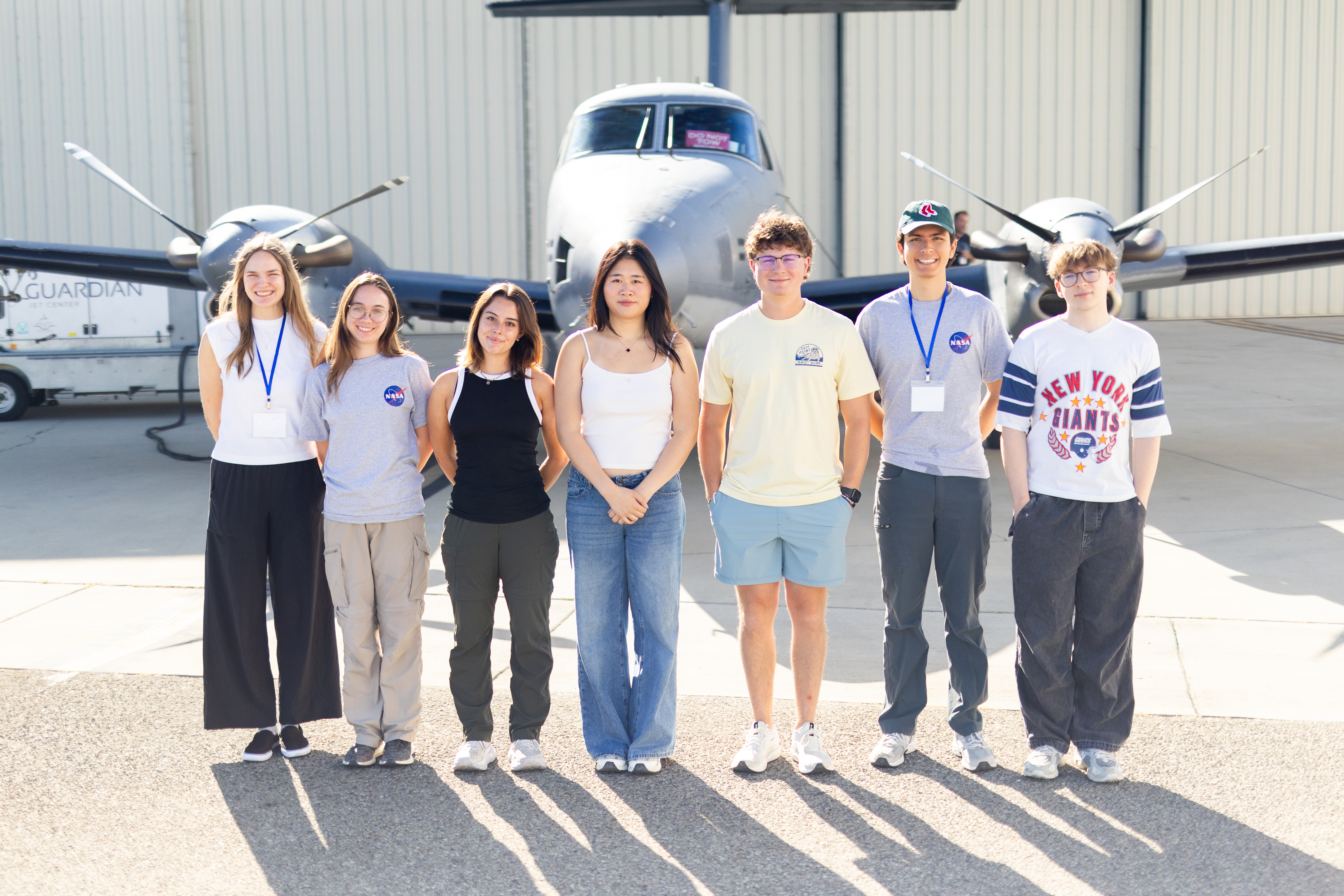
Faculty Advisor:
Henry Houskeper, Woods Hole Oceanographic Institute
Graduate Mentor:
Camille Pawlak, University of California, Los Angeles
Oceans Group Introduction Faculty Advisor Henry Housekeeper Molly McKellar Spatiotemporal dynamics of canopy-forming kelp forests in the Russian province of KamchatkaMaria (Molly) McKellar, University of Wisconsin, Madison
Interannual variability in canopy-forming kelps and the environmental conditions in which kelps thrive have not been studied extensively in the Kamchatka region of eastern Russia. Canopy forming kelps promote diverse and productive coastal ecosystems by boosting coastal resilience and supporting ecological communities. To better understand how kelp in the Kamchatka region contributes to these impacts, we must understand the spatiotemporal dynamics and drivers of kelp forests in the region. In this study, we evaluate spatiotemporal patterns in kelp canopy, including characterizing the climatology and assessing medium and long-term trends. We compare patterns in kelp forest dynamics with biological parameters, such as satellite-derived chlorophyll-a time series, as well as climatological indices, such as the Pacific Decadal Oscillation (PDO) and the Northern Pacific Gyre Oscillation (NPGO). New data from Kelpwatch, a global dataset utilizing Landsat satellite imagery, was used to map kelp canopy area from 1999 to present with quarterly resolution. This study is the first spatially resolved analysis of canopy-forming kelps in the Kamchatka region. Kelp area time series were assessed in three sub-regions corresponding to the eastern, western, and southern margins of Kamchatka. We found that the spatial extent of kelp across the entire region is maximal in the third quarter, which encompasses July 1 to September 30 and corresponds to the latter portion of the northern hemisphere growing season. We observed kelp forest patterns to vary spatially, with the southern subregion indicating a positive trend in climatologically adjusted canopy area. Pearson correlation indicated a strong relationship between phytoplankton and kelp dynamics in the southern subregion, perhaps suggesting the importance of nitrate as a regional driver of kelp forest variability. A weak correlation was found between the PDO and NPGO across the entire Kamchatka region and within the eastern and western subregions. While these results support a primary importance of nutrients to kelp population dynamics in the southern region, more work must be done to understand drivers of nutrients variability in Kamchatka. Further investigation of subregional dynamics is warranted given the climatological and mixing differences between the Sea of Okhotsk and the western Pacific Ocean, which each border Kamchatka. Sea surface temperature may also have an impact on kelp forests and should be considered. Understanding regional patterns and trends in Kamchatka would strengthen our understanding of spatiotemporal variability in kelp at global scales and the key associated drivers, including resolving key oceanic and atmospheric processes or modes. The findings supporting positive trends of kelp area in the southern portion of Kamchatka warrants further future research and investigation.
Grace Woerner Tropical Storm Effects on Ocean Dynamics Measured Through a Multi-Platform Observing ApproachGrace Woerner, North Carolina State University
Elevated low-latitude sea surface temperatures (SSTs) are associated with heightened intensity and frequency of tropical cyclone events. Tropical systems can modify surface marine ecosystems, often to the detriment of coastal communities and fisheries. Characterizing ocean properties before and after storm events can provide insight into storm-driven mixing and corresponding ecosystem responses. However, extreme conditions during tropical storms can impede ocean observing. For example, satellite remote sensing of SST and ocean color during tropical storms is challenged by cloud cover and surface disturbances such as white capping. This study pairs satellite remote sensing observations with in-situ oceanographic data to characterize oceanographic changes in phytoplankton concentrations and SST associated with a tropical cyclone in the western Pacific during March 2024 to April 2025. Chlorophyll-a is a pigment present in phytoplankton and is commonly used as a proxy for estimating phytoplankton abundance. In-situ chlorophyll-a and SST measurements collected by Argo floats were used to validate satellite ocean color observations from the NASA Plankton, Aerosols, Clouds, ocean Ecosystem (PACE) mission and SST from the Multi-scale Ultra-high Resolution (MUR) dataset before and after Typhoon ShanShan, the equivalent of a category four hurricane. The PACE observations indicate agreement with Argo float data, albeit with a slight positive bias and variability in post-storm conditions. MUR SST data also closely matched Argo measurements. It was found that the typhoon passage did not produce a detectable chlorophyll-a anomaly. This finding was further investigated by comparing changes in the mixed layer depth (MLD) and assessing whether the observed storm-induced mixing reached adequate depths to significantly increase surface nitrogen concentrations, prerequisite to inducing a phytoplankton bloom. The findings suggest that while the MLD deepened, deepening was inadequate at regional scales to bring nitrate and other nutrients to the surface. Although Typhoon Shanshan did not generate mixing deeper than the nutricline, more powerful storms or those occurring in waters with shallower nutriclines may more effectively introduce nutrients into surface waters. Limitations such as cloud coverage for satellite observing, plus the sampling frequency, coverage, and sensor availability of Argo float observations, highlight the importance of continued multi-platform observations for ocean environments to advance knowledge of tropical cyclone effects on surface ocean ecosystems.
Alex Lacayo Peruvian Coastal Water Temperature Anomalies Correspond to Variability in El Niño Position and TimingAlex Lacayo, Columbia University
The El Niño–Southern Oscillation (ENSO) is a basin-scale oscillation pattern in the tropical Pacific that drives, via teleconnections, atmospheric and oceanic variability at larger scales. El Niño events are ENSO phenomena defined by anomalously warm sea surface temperatures (SSTs) in low-latitude Pacific domains, and the spatial and temporal expression of El Niño events can vary. Recent literature has established distinct differences between the spatial expression of SST anomalies associated with El Niño events. Elevated SST in the Central (often called “Modoki”) and Eastern equatorial Pacific, for example, have been described as so-called El Niño “flavors” and are associated with different responses across global environments.
This study investigates the relationship between El Niño variability and coastal upwelling within Peru’s Exclusive Economic Zone (EEZ), using satellite-derived SST as a proxy. Coastal upwelling is a vital driver of strongly elevated biological productivity in the Peru EEZ, sustaining one of the globe’s most productive fisheries and the largest anchovy stock worldwide. This analysis evaluates SST anomalies in the Peruvian EEZ as a function of the spatiotemporal dynamics of SST in the tropical Pacific during the onset and evolution of El Niño events spanning the past three decades. The analysis is conducted for two domains in the Peruvian EEZ. The first corresponds to primarily north-south coastline north of Pisco, and the second to the northwest-southeast coastline south of Pisco. Preliminary findings are consistent with Modoki events corresponding to less pronounced warming in Peru during El Niño peaks, along with a lag in post-event upwelling rebound response, compared to Eastern Pacific events. The findings indicate that seasonal timing of El Niño events modify the strength of temperature anomalies in coastal Peru. The subregional comparison suggests that the northern Peruvian EEZ is more impacted by El Niño timing and position variability, likely consistent with its lower latitude and exposure to Kelvin wave propagation. These findings support improved knowledge of how different El Niño expressions influence Peruvian coastal ecosystems, which is critical for assessing ecosystem resilience and informing the management of coastal fisheries.
Melanie Lin Utility of SAR in detection of canopy-forming kelp in South AfricaMelanie Lin, Boston University
Kelp forests are valuable to coastal cities and towns because they support marine ecosystems, benefit economies, and dampen the effects of waves and erosion. This study aims to understand the extent to which synthetic aperture radar (SAR) can be used to accurately map the distribution of the South African canopy-forming kelp, Ecklonia maxima, or sea bamboo. SAR data was obtained from Sentinel-1, which has a five-day revisit time. SAR observations use radio waves, which penetrate clouds, thereby supporting observations of kelp forest habitat in any cloud condition. Despite the potential to use SAR to increase data availability on cloudy days, there are fewer SAR products for kelp canopy—especially sea bamboo—relative to passive optical remote sensing, which is obstructed by clouds. SAR observations were validated by comparing with manually classified optical imagery obtained using Airborne Visible Infrared Imagining Spectrometer – Next Generation (AVIRIS-NG), which was flown on NASA’s Gulfstream III in 2023 as part of The Biodiversity Survey of the Cape (BioSCape). BioSCape was an integrated field and airborne campaign collaboration between the United States and South Africa to study the biodiversity of the Great Cape Floristic Region (GCFR). More commonly used passive optical remote sensing datasets were also assessed using imagery from Landsat that had been classified using a random forest. This research shows that SAR observations yield distinct values between kelp and ocean, indicating potential to use SAR data to map kelp canopy extent in calm oceanic conditions. SAR observations in the VH (vertically transmitted, horizontally received) polarization indicates a larger distinction between kelp and calm ocean water than data in the VV (vertically transmitted, vertically received) polarization. The sensitivity and responsivity of SAR kelp forest retrievals was dependent on the tidal state during the data acquisition. In VH polarized data, a lower tidal state supports more accurate classifications between kelp and calm ocean water than a high tidal state. Waves, which may contain kelp beneath them, obscure kelp backscatter response in SAR data. This study improves understanding of the utility of SAR for mapping sea bamboo extent, which in turn supports future opportunities to develop better understanding of marine biodiversity and coastal resilience in the GCFR where sea bamboo is the dominant canopy-forming taxa.
John Lund Kinetic energy of multiscale oceanic features derived from SWOT altimetryJohn Lund, Adelphi University
Oceanic eddies are circular movements of water that separate the main flow and facilitate oceanic energy transfer across multiple scales, thereby underlying biophysical interactions and modifying climate and ocean dynamics. Oceanic eddies correspond to dynamics spanning geostrophic to ageostrophic processes, spatial scales spanning 0.1 to 100 km, and temporal scales spanning hours to months. Eddies spanning horizontal spatial scales of 0.1 to 10 km and temporal scales of hours to days, termed submesoscale eddies, are difficult to resolve from legacy satellites due to the finer spatial resolution requirements for observing smaller scale features. Conversely, eddies spanning larger horizontal spatial scales and longer temporal scales, termed mesoscale eddies, are more readily resolved using legacy satellite altimeters. This research utilizes observations from the recently launched Surface Water and Ocean Topography’s (SWOT) Ka-band Radar Interferometer (KaRIn) to resolve submesoscale eddies and quantify associated kinetic energy. We contextualize our SSHA observations using the Data Unification and Altimeter Combination System (DUACS)—a project that merges satellite data to observe coarser mesoscale fields on a global scale—to visualize ocean dynamics around SWOT swaths more clearly. Comparing the kinetic energy associated with SWOT-detected features to that estimated from DUACS data supports improved understanding of the relative importance of the submesoscale in global energy transfer. Results from this investigation demonstrate that SWOT supports characterizations of features at the upper bound of the submesoscale to analyze ocean dynamics and energy cascades at specific moments and locations. Resolving the temporal dynamics of submesoscale features remains challenging due to SWOT’s 21-day revisit cycle, which also limits submesoscale characterizations to isolated swaths, but novel SWOT observations nonetheless support snapshot opportunities to constrain the role of submesoscale processes in global energy transfer. Future directions with SWOT include coupling data with high-resolution numerical models or additional satellite missions such as PACE to map a wider region and investigate key controls on biophysical interactions associated with submesoscale processes.
Logan Jewell Machine Learning Classification of Remote Sensing Imagery for Investigating Changes in Natural Oil SeepageLogan Jewell, State University of New York, Brockport
Spatiotemporal variability in oil content of the Santa Barbara Channel (SBC) corresponds to natural hydrocarbon seepage and past anthropogenic spills. The marine geology of the SBC is characterized by a relatively shallow and abundant hydrocarbon reserve beneath faulted anticlines that run parallel to the shore. Natural seepage occurs when pressure in the reserve exceeds hydrostatic, and gaseous bubbles coated in liquid petroleum seep through the sea floor and enter the marine environment. Because gaseous hydrocarbons and oil are both buoyant in seawater, the seepage manifests as oil slicks at the surface of the ocean. Oil has historically been extracted from the reserve by human drilling, potentially alleviating pressure in the reserve, at sites such as Platform Holly, which operated in the SBC from 1966 until production ceased in 2015. Platform Holly is located roughly 3.2 kilometers from the shore and is the only offshore oil platform in California State waters. Since decommissioning, the only mechanism releasing oil in this region of the hydrocarbon reserves is natural seepage. In this study, machine learning via a random forest model is utilized to identify and classify oil slick regions in Sentinel-2 optical images encompassing the decommissioned oil platform Holly and other nearshore waters near Santa Barbara, CA. The random forest model was developed to predict 3 classes, or targets: clear, turbid, and oil-contaminated waters. Sentinel-2 supports a 5-day revisit time, which mitigates cloud obstruction in the region, and 10-meter spatial resolution appropriate for distinguishing small-scale surface features such as slicks. 6 images were manually classified for training, and classification using the random forest supported an additional 27 classified images. A time analysis was conducted using the combined 33 images, which spanned 2019 to present to assess variability in hydrocarbon seepage starting 4 years after decommissioning to present. Preliminary results do not indicate a trend in the area of the natural oil slick from 2019 to 2025. We conducted sensitivity testing by assessing covariance between oil slick area with wind and tidal measurements and found no significant correlation to winds or tides. More frequent imagery spanning a wider temporal range could help to better determine whether oil slick area is changing or stable through time.
Return to 2025 SARP Closeout Share Details Last Updated Nov 19, 2025 Related Terms Explore More 2 min read SARP 2025 Closeout Article 6 hours ago 9 min read SARP East 2025 Atmospheric Chemistry Group Article 6 hours ago 10 min read SARP East 2025 Terrestrial Fluxes Group Article 6 hours agoSARP West 2025 Oceans Group
13 min read
Preparations for Next Moonwalk Simulations Underway (and Underwater) The 2025 SARP West Oceans Group poses in front of the Dynamic Aviation B-200 aircraft, parked on the tarmac at Guardian Jet Center in Southern California. During the internship, students spend a week engaged in Earth science data collection and learning from instruments specialists while flying onboard both the B-200 and NASA’s P-3 aircraft.NASA/Milan Loiacono Return to 2025 SARP CloseoutFaculty Advisor:
Henry Houskeper, Woods Hole Oceanographic Institute
Graduate Mentor:
Camille Pawlak, University of California, Los Angeles
Oceans Group Introduction Faculty Advisor Henry Housekeeper Molly McKellar Spatiotemporal dynamics of canopy-forming kelp forests in the Russian province of KamchatkaMaria (Molly) McKellar, University of Wisconsin, Madison
Interannual variability in canopy-forming kelps and the environmental conditions in which kelps thrive have not been studied extensively in the Kamchatka region of eastern Russia. Canopy forming kelps promote diverse and productive coastal ecosystems by boosting coastal resilience and supporting ecological communities. To better understand how kelp in the Kamchatka region contributes to these impacts, we must understand the spatiotemporal dynamics and drivers of kelp forests in the region. In this study, we evaluate spatiotemporal patterns in kelp canopy, including characterizing the climatology and assessing medium and long-term trends. We compare patterns in kelp forest dynamics with biological parameters, such as satellite-derived chlorophyll-a time series, as well as climatological indices, such as the Pacific Decadal Oscillation (PDO) and the Northern Pacific Gyre Oscillation (NPGO). New data from Kelpwatch, a global dataset utilizing Landsat satellite imagery, was used to map kelp canopy area from 1999 to present with quarterly resolution. This study is the first spatially resolved analysis of canopy-forming kelps in the Kamchatka region. Kelp area time series were assessed in three sub-regions corresponding to the eastern, western, and southern margins of Kamchatka. We found that the spatial extent of kelp across the entire region is maximal in the third quarter, which encompasses July 1 to September 30 and corresponds to the latter portion of the northern hemisphere growing season. We observed kelp forest patterns to vary spatially, with the southern subregion indicating a positive trend in climatologically adjusted canopy area. Pearson correlation indicated a strong relationship between phytoplankton and kelp dynamics in the southern subregion, perhaps suggesting the importance of nitrate as a regional driver of kelp forest variability. A weak correlation was found between the PDO and NPGO across the entire Kamchatka region and within the eastern and western subregions. While these results support a primary importance of nutrients to kelp population dynamics in the southern region, more work must be done to understand drivers of nutrients variability in Kamchatka. Further investigation of subregional dynamics is warranted given the climatological and mixing differences between the Sea of Okhotsk and the western Pacific Ocean, which each border Kamchatka. Sea surface temperature may also have an impact on kelp forests and should be considered. Understanding regional patterns and trends in Kamchatka would strengthen our understanding of spatiotemporal variability in kelp at global scales and the key associated drivers, including resolving key oceanic and atmospheric processes or modes. The findings supporting positive trends of kelp area in the southern portion of Kamchatka warrants further future research and investigation.
Grace Woerner Tropical Storm Effects on Ocean Dynamics Measured Through a Multi-Platform Observing ApproachGrace Woerner, North Carolina State University
Elevated low-latitude sea surface temperatures (SSTs) are associated with heightened intensity and frequency of tropical cyclone events. Tropical systems can modify surface marine ecosystems, often to the detriment of coastal communities and fisheries. Characterizing ocean properties before and after storm events can provide insight into storm-driven mixing and corresponding ecosystem responses. However, extreme conditions during tropical storms can impede ocean observing. For example, satellite remote sensing of SST and ocean color during tropical storms is challenged by cloud cover and surface disturbances such as white capping. This study pairs satellite remote sensing observations with in-situ oceanographic data to characterize oceanographic changes in phytoplankton concentrations and SST associated with a tropical cyclone in the western Pacific during March 2024 to April 2025. Chlorophyll-a is a pigment present in phytoplankton and is commonly used as a proxy for estimating phytoplankton abundance. In-situ chlorophyll-a and SST measurements collected by Argo floats were used to validate satellite ocean color observations from the NASA Plankton, Aerosols, Clouds, ocean Ecosystem (PACE) mission and SST from the Multi-scale Ultra-high Resolution (MUR) dataset before and after Typhoon ShanShan, the equivalent of a category four hurricane. The PACE observations indicate agreement with Argo float data, albeit with a slight positive bias and variability in post-storm conditions. MUR SST data also closely matched Argo measurements. It was found that the typhoon passage did not produce a detectable chlorophyll-a anomaly. This finding was further investigated by comparing changes in the mixed layer depth (MLD) and assessing whether the observed storm-induced mixing reached adequate depths to significantly increase surface nitrogen concentrations, prerequisite to inducing a phytoplankton bloom. The findings suggest that while the MLD deepened, deepening was inadequate at regional scales to bring nitrate and other nutrients to the surface. Although Typhoon Shanshan did not generate mixing deeper than the nutricline, more powerful storms or those occurring in waters with shallower nutriclines may more effectively introduce nutrients into surface waters. Limitations such as cloud coverage for satellite observing, plus the sampling frequency, coverage, and sensor availability of Argo float observations, highlight the importance of continued multi-platform observations for ocean environments to advance knowledge of tropical cyclone effects on surface ocean ecosystems.
Alex Lacayo Peruvian Coastal Water Temperature Anomalies Correspond to Variability in El Niño Position and TimingAlex Lacayo, Columbia University
The El Niño–Southern Oscillation (ENSO) is a basin-scale oscillation pattern in the tropical Pacific that drives, via teleconnections, atmospheric and oceanic variability at larger scales. El Niño events are ENSO phenomena defined by anomalously warm sea surface temperatures (SSTs) in low-latitude Pacific domains, and the spatial and temporal expression of El Niño events can vary. Recent literature has established distinct differences between the spatial expression of SST anomalies associated with El Niño events. Elevated SST in the Central (often called “Modoki”) and Eastern equatorial Pacific, for example, have been described as so-called El Niño “flavors” and are associated with different responses across global environments.
This study investigates the relationship between El Niño variability and coastal upwelling within Peru’s Exclusive Economic Zone (EEZ), using satellite-derived SST as a proxy. Coastal upwelling is a vital driver of strongly elevated biological productivity in the Peru EEZ, sustaining one of the globe’s most productive fisheries and the largest anchovy stock worldwide. This analysis evaluates SST anomalies in the Peruvian EEZ as a function of the spatiotemporal dynamics of SST in the tropical Pacific during the onset and evolution of El Niño events spanning the past three decades. The analysis is conducted for two domains in the Peruvian EEZ. The first corresponds to primarily north-south coastline north of Pisco, and the second to the northwest-southeast coastline south of Pisco. Preliminary findings are consistent with Modoki events corresponding to less pronounced warming in Peru during El Niño peaks, along with a lag in post-event upwelling rebound response, compared to Eastern Pacific events. The findings indicate that seasonal timing of El Niño events modify the strength of temperature anomalies in coastal Peru. The subregional comparison suggests that the northern Peruvian EEZ is more impacted by El Niño timing and position variability, likely consistent with its lower latitude and exposure to Kelvin wave propagation. These findings support improved knowledge of how different El Niño expressions influence Peruvian coastal ecosystems, which is critical for assessing ecosystem resilience and informing the management of coastal fisheries.
Melanie Lin Utility of SAR in detection of canopy-forming kelp in South AfricaMelanie Lin, Boston University
Kelp forests are valuable to coastal cities and towns because they support marine ecosystems, benefit economies, and dampen the effects of waves and erosion. This study aims to understand the extent to which synthetic aperture radar (SAR) can be used to accurately map the distribution of the South African canopy-forming kelp, Ecklonia maxima, or sea bamboo. SAR data was obtained from Sentinel-1, which has a five-day revisit time. SAR observations use radio waves, which penetrate clouds, thereby supporting observations of kelp forest habitat in any cloud condition. Despite the potential to use SAR to increase data availability on cloudy days, there are fewer SAR products for kelp canopy—especially sea bamboo—relative to passive optical remote sensing, which is obstructed by clouds. SAR observations were validated by comparing with manually classified optical imagery obtained using Airborne Visible Infrared Imagining Spectrometer – Next Generation (AVIRIS-NG), which was flown on NASA’s Gulfstream III in 2023 as part of The Biodiversity Survey of the Cape (BioSCape). BioSCape was an integrated field and airborne campaign collaboration between the United States and South Africa to study the biodiversity of the Great Cape Floristic Region (GCFR). More commonly used passive optical remote sensing datasets were also assessed using imagery from Landsat that had been classified using a random forest. This research shows that SAR observations yield distinct values between kelp and ocean, indicating potential to use SAR data to map kelp canopy extent in calm oceanic conditions. SAR observations in the VH (vertically transmitted, horizontally received) polarization indicates a larger distinction between kelp and calm ocean water than data in the VV (vertically transmitted, vertically received) polarization. The sensitivity and responsivity of SAR kelp forest retrievals was dependent on the tidal state during the data acquisition. In VH polarized data, a lower tidal state supports more accurate classifications between kelp and calm ocean water than a high tidal state. Waves, which may contain kelp beneath them, obscure kelp backscatter response in SAR data. This study improves understanding of the utility of SAR for mapping sea bamboo extent, which in turn supports future opportunities to develop better understanding of marine biodiversity and coastal resilience in the GCFR where sea bamboo is the dominant canopy-forming taxa.
John Lund Kinetic energy of multiscale oceanic features derived from SWOT altimetryJohn Lund, Adelphi University
Oceanic eddies are circular movements of water that separate the main flow and facilitate oceanic energy transfer across multiple scales, thereby underlying biophysical interactions and modifying climate and ocean dynamics. Oceanic eddies correspond to dynamics spanning geostrophic to ageostrophic processes, spatial scales spanning 0.1 to 100 km, and temporal scales spanning hours to months. Eddies spanning horizontal spatial scales of 0.1 to 10 km and temporal scales of hours to days, termed submesoscale eddies, are difficult to resolve from legacy satellites due to the finer spatial resolution requirements for observing smaller scale features. Conversely, eddies spanning larger horizontal spatial scales and longer temporal scales, termed mesoscale eddies, are more readily resolved using legacy satellite altimeters. This research utilizes observations from the recently launched Surface Water and Ocean Topography’s (SWOT) Ka-band Radar Interferometer (KaRIn) to resolve submesoscale eddies and quantify associated kinetic energy. We contextualize our SSHA observations using the Data Unification and Altimeter Combination System (DUACS)—a project that merges satellite data to observe coarser mesoscale fields on a global scale—to visualize ocean dynamics around SWOT swaths more clearly. Comparing the kinetic energy associated with SWOT-detected features to that estimated from DUACS data supports improved understanding of the relative importance of the submesoscale in global energy transfer. Results from this investigation demonstrate that SWOT supports characterizations of features at the upper bound of the submesoscale to analyze ocean dynamics and energy cascades at specific moments and locations. Resolving the temporal dynamics of submesoscale features remains challenging due to SWOT’s 21-day revisit cycle, which also limits submesoscale characterizations to isolated swaths, but novel SWOT observations nonetheless support snapshot opportunities to constrain the role of submesoscale processes in global energy transfer. Future directions with SWOT include coupling data with high-resolution numerical models or additional satellite missions such as PACE to map a wider region and investigate key controls on biophysical interactions associated with submesoscale processes.
Logan Jewell Machine Learning Classification of Remote Sensing Imagery for Investigating Changes in Natural Oil SeepageLogan Jewell, State University of New York, Brockport
Spatiotemporal variability in oil content of the Santa Barbara Channel (SBC) corresponds to natural hydrocarbon seepage and past anthropogenic spills. The marine geology of the SBC is characterized by a relatively shallow and abundant hydrocarbon reserve beneath faulted anticlines that run parallel to the shore. Natural seepage occurs when pressure in the reserve exceeds hydrostatic, and gaseous bubbles coated in liquid petroleum seep through the sea floor and enter the marine environment. Because gaseous hydrocarbons and oil are both buoyant in seawater, the seepage manifests as oil slicks at the surface of the ocean. Oil has historically been extracted from the reserve by human drilling, potentially alleviating pressure in the reserve, at sites such as Platform Holly, which operated in the SBC from 1966 until production ceased in 2015. Platform Holly is located roughly 3.2 kilometers from the shore and is the only offshore oil platform in California State waters. Since decommissioning, the only mechanism releasing oil in this region of the hydrocarbon reserves is natural seepage. In this study, machine learning via a random forest model is utilized to identify and classify oil slick regions in Sentinel-2 optical images encompassing the decommissioned oil platform Holly and other nearshore waters near Santa Barbara, CA. The random forest model was developed to predict 3 classes, or targets: clear, turbid, and oil-contaminated waters. Sentinel-2 supports a 5-day revisit time, which mitigates cloud obstruction in the region, and 10-meter spatial resolution appropriate for distinguishing small-scale surface features such as slicks. 6 images were manually classified for training, and classification using the random forest supported an additional 27 classified images. A time analysis was conducted using the combined 33 images, which spanned 2019 to present to assess variability in hydrocarbon seepage starting 4 years after decommissioning to present. Preliminary results do not indicate a trend in the area of the natural oil slick from 2019 to 2025. We conducted sensitivity testing by assessing covariance between oil slick area with wind and tidal measurements and found no significant correlation to winds or tides. More frequent imagery spanning a wider temporal range could help to better determine whether oil slick area is changing or stable through time.
Return to 2025 SARP Closeout Share Details Last Updated Nov 19, 2025 Related Terms Explore More 2 min read SARP 2025 Closeout Article 5 hours ago 9 min read SARP East 2025 Atmospheric Chemistry Group Article 5 hours ago 10 min read SARP East 2025 Terrestrial Fluxes Group Article 5 hours agoSARP West 2025 Whole Air Sampling Group
8 min read
Preparations for Next Moonwalk Simulations Underway (and Underwater) The 2025 SARP West Whole Air Sampling (WAS) Group poses in front of the Dynamic Aviation B-200 aircraft, parked on the tarmac at Guardian Jet Center in Southern California. During the internship, students spend a week engaged in Earth science data collection and learning from instruments specialists while flying onboard both the B-200 and NASA’s P-3 aircraft.NASA/Milan Loiacono Return to 2025 SARP Closeout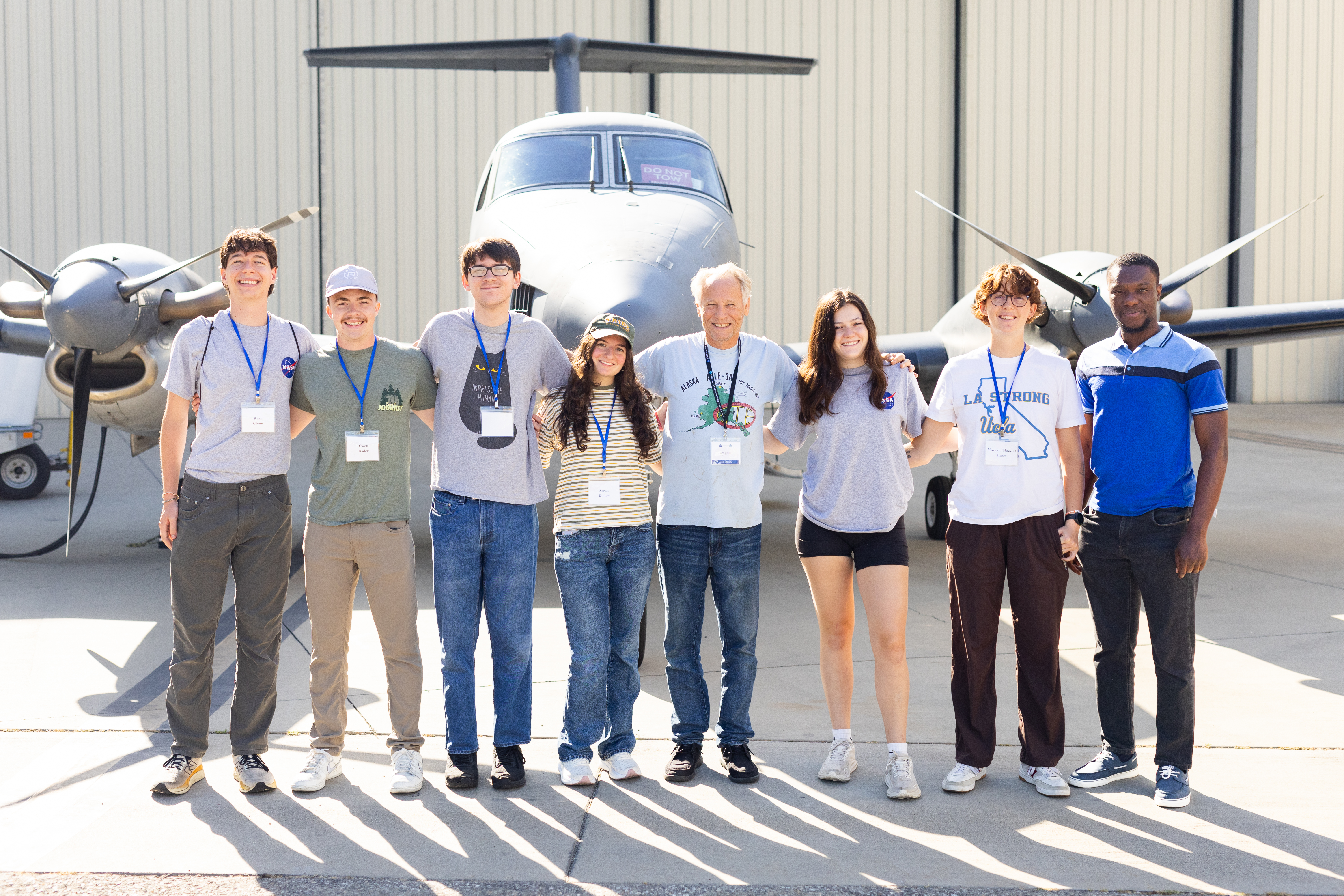
Faculty Advisor:
Donald Blake, University of California, Irvine
Graduate Mentor:
Oluwaseun Moses Akinola, University of Connecticut
Whole Air Sampling Group Introduction Faculty Advisor Donald Blake Sarah Kinlaw Impact of Dairies on Ozone Production in Ontario, CASarah Kinlaw, College of William & Mary
In the center of Ontario, California’s urban sprawl sits 5 square miles of livestock farming, including many dairies. Emissions from silage from dairy farms result in significant amounts of ethanol and methanol entering the atmosphere. These volatile organic compounds (VOCs) can participate in the formation of tropospheric ozone through oxidation and photolytic processes. Ozone is known to have negative impacts on humans, agriculture, and the climate. Of concern is that the dairy regions and regions downwind will likely have enhanced levels of ozone. In this study, 19 samples were collected from dairy farms and downwind sites over two days. The extent of enhancement in reactive species was determined by comparing concentrations of speciated VOCs, collected from air samples from the downwind sampling sites, with estimated upwind background concentrations. The “ozone production potential” (OFP) was estimated by multiplying the mixing ratios of VOCs of interest by their respective hydroxyl rate constants, and it was found that methanol and ethanol were the major VOC contributors to OFP. HYSPLIT trajectory modeling was used to determine the dispersion patterns of air masses originating from the dairy farm area and identify potentially impacted downwind communities. This analysis emphasizes the need for more robust air quality and agricultural management with a focus on directing policies to improve air quality at a local and regional scales.
Ryan Glenn Examining the Chemical Composition and Evolution of Palisades Fire Gas EmissionsRyan Glenn, Dartmouth College
Wildland-urban-interface (WUI) fires in the US are increasing in frequency and intensity with disproportionately large impacts on air quality and human health. The 2025 Palisades Fire alone destroyed nearly 7,000 structures and displaced more than 30,000 people. Despite their significance, they remain understudied compared to wildland fires, especially in regard to emission composition, evolution, and ozone formation potential. Here we analyze trace gases and volatile organic compounds (VOCs) collected via air canisters during the Palisades Fire and use the Framework for 0-D Atmospheric Modeling (FOAM) box model to simulate their evolution. Gas chromatography-mass spectrometry reveals high daytime VOC concentrations despite the increase of the boundary layer. C1-C4 oxygenates exhibited by far the highest reactivity and concentrations, accompanied by alkanes, alkenes, aromatics, biogenic, and chlorinated compounds indicative of the combustion of anthropogenic materials. Using the sampling data to constrain the FOAM box model, we characterize the regime as primarily VOC-limited and identify acetaldehyde and methanol as key ozone precursors and nitric acid as the primary nitrogen oxide (NOx) sink. These findings suggest that targeted reductions in oxygenates will be most effective in mitigating ozone formation from WUI fire emissions. This study has significant implications for wildfire air quality management and highlights the need for further research comparing WUI and wildland fire emission chemistry.
Riley Gallen Temporal and Spatial Analysis of Nitrogen Dioxide (NO₂) in Long Beach: Assessing Its Role in Ozone Formation and Impact on Nearby Communities/Coastal EcosystemsRiley Gallen, University of Florida
Nitrogen dioxide (NO₂), a key precursor to ozone formation, is emitted from various combustion sources including vehicles, cargo ships, and power plants. In Long Beach, California, these sources are concentrated around highways and the busy port, thus raising concerns about localized air pollution and its broader environmental impact. This project investigates NO₂ concentrations over Long Beach using NASA’s B200 and DC-8 aircraft flight data from 2019, 2021, and 2025. Data were analyzed through latitude–longitude mapping and altitude comparisons to assess temporal trends and spatial distribution of NO₂. The 2021 dataset, collected during pandemic-related port congestion, showed elevated NO₂ levels, though seasonal differences required comparison between 2019 and 2025 for consistency. Overall, NO₂ concentrations increased in 2025 relative to 2019. HYSPLIT wind trajectory modeling often carried pollutants inland, particularly toward the communities of Wilmington and West Long Beach, which already experience elevated respiratory health risks due to pollution exposure. Although the scope of this study was not to determine the exact NO₂ sources in Long Beach, the prevailing wind patterns as indicated from the HYSPLIT model suggests the port as a likely source. While inland transport dominated during the selected flight days, wind patterns are unpredictable. This variability suggests that NO2 and its photochemical transformation into ozone could occur over adjacent marine ecosystems such as Bolsa Bay State Marine Conservation Area and Albone Cove State Marine Conservation Area. Collectively, this study highlights the potential impacts of NO₂ exposure on local communities and nearby coastal ecosystems and emphasizes the need for continued monitoring and apportionment of sources of NO2 in urban coastal regions.
Owen Rader Quantifying the Impact of Meteorological Variables on Wildland Fire SpreadOwen Rader, University of Delaware
Past studies have revealed that wildfire is becoming more extreme due to increasing hydroclimate variability. Using Los Angeles County’s Eaton Fire, a primarily wind-driven fire, as a case study, I simulate the fire under isolated meteorological variables with a focus on quantifying the impacts of wind speed simulations on the fire’s spread. A comprehensive analysis of the Eaton Fire’s spread can indicate how Wildland Urban Interface (WUI), a growing transition zone particularly in Southern California, is vulnerable to enhanced fire activity under different meteorological conditions. This study aims to demonstrate how fuel metrics behave under different wind conditions, thus providing valuable insight into the potential rates of spread and response times to wildfire-encroached WUI areas. To achieve this, LANDFIRE surface/canopy fuel products and topographical products are used as pre-model run fire parametrizations using FLAMMAP’s built-in Landscape file generator, using variable wind speeds while holding other values constant, to output fuel-load metrics. Following this, I utilized ARSITE, a built-in application to FLAMMAP, to simulate several scenarios over time, using real-time ERA5 Reanalysis meteorological data from the wildfire event period, and quantified the impacts of variable wind speeds. These model runs can provide valuable insights into how fires behave under varying meteorological conditions, which can be further quantified through future research to better understand how a shift towards hydroclimate extremes impacts WUI fires.
Stephen Shaner Analysis of Bromoform Concentrations and Impact in CaliforniaStephen Shaner, University of Maryland, Baltimore County
Bromoform is a haloalkane which is commonly found over the ocean, with major sources being marine organisms such as phytoplankton and macroalgae. This compound has been measured around California during the NASA Student Airborne Research Program flights campaigns since 2010. Within this sampled period, 2014 showed significantly higher bromoform concentrations than any other measured year. In this study, the concentrations of bromoform from 2010–2022 were analyzed and consistently higher than average concentrations were evident over the Los Angeles, Long Beach, and Inland Empire area. The effect on ozone concentrations in the atmosphere caused by the higher concentrations was measured using the Framework for 0D atmospheric modeling (F0AM). It was found that at its peak of 28 ppt, bromoform decreases ozone concentration by 0.14% at the altitude where the sample was taken. However, the potential impact in the stratosphere of Br radicals which come from Bromoform is expected to be higher due to its reaction rates with various molecules commonly found in the stratosphere.
Maggie Rasic Shifting Seas and Changing Chemistry: Gaseous Emissions in Upper Newport BayMaggie Rasic, University of California, Los Angeles
Coastal wetlands are ecologically rich environments that provide critical regulatory services, including carbon storage and nutrient cycling. However, these ecosystems are vulnerable to the impacts of sea level rise, which may alter biogeochemical cycles and enhance the production of trace gases. This study analyzed whole air samples collected across six sites spanning from San Diego Creek to Upper Newport Bay to investigate the spatial and temporal patterns of volatile organic compound (VOC) emissions at the study areas, with a focus on halomethanes and methane. Results showed increasing concentrations of halomethanes (specifically CHBr₃, CH₃Br, and CH₃Cl) as sample sites increase in proximity to the mouth of Newport Bay. Further research could indicate possible relationships between salinity, microbial activity, and halogenated compound production. Additionally, at the site closest to the ocean, a notably elevated concentration of methane was observed, a common byproduct of anaerobic microbial decomposition in wetlands. These findings suggest that sea level rise could intensify the production of both halomethanes and methane in coastal wetlands. Given their roles as potent greenhouse gases and, in the case of halomethanes, as stratospheric ozone-depleting substances, this emphasizes the importance of monitoring trace gas fluxes in dynamic coastal environments.
Return to 2025 SARP Closeout Share Details Last Updated Nov 19, 2025 Related Terms Explore More 2 min read SARP 2025 Closeout Article 6 hours ago 9 min read SARP East 2025 Atmospheric Chemistry Group Article 6 hours ago 10 min read SARP East 2025 Terrestrial Fluxes Group Article 6 hours agoSARP West 2025 Whole Air Sampling Group
8 min read
Preparations for Next Moonwalk Simulations Underway (and Underwater) The 2025 SARP West Whole Air Sampling (WAS) Group poses in front of the Dynamic Aviation B-200 aircraft, parked on the tarmac at Guardian Jet Center in Southern California. During the internship, students spend a week engaged in Earth science data collection and learning from instruments specialists while flying onboard both the B-200 and NASA’s P-3 aircraft.NASA/Milan Loiacono Return to 2025 SARP CloseoutFaculty Advisor:
Donald Blake, University of California, Irvine
Graduate Mentor:
Oluwaseun Moses Akinola, University of Connecticut
Whole Air Sampling Group Introduction Faculty Advisor Donald Blake Sarah Kinlaw Impact of Dairies on Ozone Production in Ontario, CASarah Kinlaw, College of William & Mary
In the center of Ontario, California’s urban sprawl sits 5 square miles of livestock farming, including many dairies. Emissions from silage from dairy farms result in significant amounts of ethanol and methanol entering the atmosphere. These volatile organic compounds (VOCs) can participate in the formation of tropospheric ozone through oxidation and photolytic processes. Ozone is known to have negative impacts on humans, agriculture, and the climate. Of concern is that the dairy regions and regions downwind will likely have enhanced levels of ozone. In this study, 19 samples were collected from dairy farms and downwind sites over two days. The extent of enhancement in reactive species was determined by comparing concentrations of speciated VOCs, collected from air samples from the downwind sampling sites, with estimated upwind background concentrations. The “ozone production potential” (OFP) was estimated by multiplying the mixing ratios of VOCs of interest by their respective hydroxyl rate constants, and it was found that methanol and ethanol were the major VOC contributors to OFP. HYSPLIT trajectory modeling was used to determine the dispersion patterns of air masses originating from the dairy farm area and identify potentially impacted downwind communities. This analysis emphasizes the need for more robust air quality and agricultural management with a focus on directing policies to improve air quality at a local and regional scales.
Ryan Glenn Examining the Chemical Composition and Evolution of Palisades Fire Gas EmissionsRyan Glenn, Dartmouth College
Wildland-urban-interface (WUI) fires in the US are increasing in frequency and intensity with disproportionately large impacts on air quality and human health. The 2025 Palisades Fire alone destroyed nearly 7,000 structures and displaced more than 30,000 people. Despite their significance, they remain understudied compared to wildland fires, especially in regard to emission composition, evolution, and ozone formation potential. Here we analyze trace gases and volatile organic compounds (VOCs) collected via air canisters during the Palisades Fire and use the Framework for 0-D Atmospheric Modeling (FOAM) box model to simulate their evolution. Gas chromatography-mass spectrometry reveals high daytime VOC concentrations despite the increase of the boundary layer. C1-C4 oxygenates exhibited by far the highest reactivity and concentrations, accompanied by alkanes, alkenes, aromatics, biogenic, and chlorinated compounds indicative of the combustion of anthropogenic materials. Using the sampling data to constrain the FOAM box model, we characterize the regime as primarily VOC-limited and identify acetaldehyde and methanol as key ozone precursors and nitric acid as the primary nitrogen oxide (NOx) sink. These findings suggest that targeted reductions in oxygenates will be most effective in mitigating ozone formation from WUI fire emissions. This study has significant implications for wildfire air quality management and highlights the need for further research comparing WUI and wildland fire emission chemistry.
Riley Gallen Temporal and Spatial Analysis of Nitrogen Dioxide (NO₂) in Long Beach: Assessing Its Role in Ozone Formation and Impact on Nearby Communities/Coastal EcosystemsRiley Gallen, University of Florida
Nitrogen dioxide (NO₂), a key precursor to ozone formation, is emitted from various combustion sources including vehicles, cargo ships, and power plants. In Long Beach, California, these sources are concentrated around highways and the busy port, thus raising concerns about localized air pollution and its broader environmental impact. This project investigates NO₂ concentrations over Long Beach using NASA’s B200 and DC-8 aircraft flight data from 2019, 2021, and 2025. Data were analyzed through latitude–longitude mapping and altitude comparisons to assess temporal trends and spatial distribution of NO₂. The 2021 dataset, collected during pandemic-related port congestion, showed elevated NO₂ levels, though seasonal differences required comparison between 2019 and 2025 for consistency. Overall, NO₂ concentrations increased in 2025 relative to 2019. HYSPLIT wind trajectory modeling often carried pollutants inland, particularly toward the communities of Wilmington and West Long Beach, which already experience elevated respiratory health risks due to pollution exposure. Although the scope of this study was not to determine the exact NO₂ sources in Long Beach, the prevailing wind patterns as indicated from the HYSPLIT model suggests the port as a likely source. While inland transport dominated during the selected flight days, wind patterns are unpredictable. This variability suggests that NO2 and its photochemical transformation into ozone could occur over adjacent marine ecosystems such as Bolsa Bay State Marine Conservation Area and Albone Cove State Marine Conservation Area. Collectively, this study highlights the potential impacts of NO₂ exposure on local communities and nearby coastal ecosystems and emphasizes the need for continued monitoring and apportionment of sources of NO2 in urban coastal regions.
Owen Rader Quantifying the Impact of Meteorological Variables on Wildland Fire SpreadOwen Rader, University of Delaware
Past studies have revealed that wildfire is becoming more extreme due to increasing hydroclimate variability. Using Los Angeles County’s Eaton Fire, a primarily wind-driven fire, as a case study, I simulate the fire under isolated meteorological variables with a focus on quantifying the impacts of wind speed simulations on the fire’s spread. A comprehensive analysis of the Eaton Fire’s spread can indicate how Wildland Urban Interface (WUI), a growing transition zone particularly in Southern California, is vulnerable to enhanced fire activity under different meteorological conditions. This study aims to demonstrate how fuel metrics behave under different wind conditions, thus providing valuable insight into the potential rates of spread and response times to wildfire-encroached WUI areas. To achieve this, LANDFIRE surface/canopy fuel products and topographical products are used as pre-model run fire parametrizations using FLAMMAP’s built-in Landscape file generator, using variable wind speeds while holding other values constant, to output fuel-load metrics. Following this, I utilized ARSITE, a built-in application to FLAMMAP, to simulate several scenarios over time, using real-time ERA5 Reanalysis meteorological data from the wildfire event period, and quantified the impacts of variable wind speeds. These model runs can provide valuable insights into how fires behave under varying meteorological conditions, which can be further quantified through future research to better understand how a shift towards hydroclimate extremes impacts WUI fires.
Stephen Shaner Analysis of Bromoform Concentrations and Impact in CaliforniaStephen Shaner, University of Maryland, Baltimore County
Bromoform is a haloalkane which is commonly found over the ocean, with major sources being marine organisms such as phytoplankton and macroalgae. This compound has been measured around California during the NASA Student Airborne Research Program flights campaigns since 2010. Within this sampled period, 2014 showed significantly higher bromoform concentrations than any other measured year. In this study, the concentrations of bromoform from 2010–2022 were analyzed and consistently higher than average concentrations were evident over the Los Angeles, Long Beach, and Inland Empire area. The effect on ozone concentrations in the atmosphere caused by the higher concentrations was measured using the Framework for 0D atmospheric modeling (F0AM). It was found that at its peak of 28 ppt, bromoform decreases ozone concentration by 0.14% at the altitude where the sample was taken. However, the potential impact in the stratosphere of Br radicals which come from Bromoform is expected to be higher due to its reaction rates with various molecules commonly found in the stratosphere.
Maggie Rasic Shifting Seas and Changing Chemistry: Gaseous Emissions in Upper Newport BayMaggie Rasic, University of California, Los Angeles
Coastal wetlands are ecologically rich environments that provide critical regulatory services, including carbon storage and nutrient cycling. However, these ecosystems are vulnerable to the impacts of sea level rise, which may alter biogeochemical cycles and enhance the production of trace gases. This study analyzed whole air samples collected across six sites spanning from San Diego Creek to Upper Newport Bay to investigate the spatial and temporal patterns of volatile organic compound (VOC) emissions at the study areas, with a focus on halomethanes and methane. Results showed increasing concentrations of halomethanes (specifically CHBr₃, CH₃Br, and CH₃Cl) as sample sites increase in proximity to the mouth of Newport Bay. Further research could indicate possible relationships between salinity, microbial activity, and halogenated compound production. Additionally, at the site closest to the ocean, a notably elevated concentration of methane was observed, a common byproduct of anaerobic microbial decomposition in wetlands. These findings suggest that sea level rise could intensify the production of both halomethanes and methane in coastal wetlands. Given their roles as potent greenhouse gases and, in the case of halomethanes, as stratospheric ozone-depleting substances, this emphasizes the importance of monitoring trace gas fluxes in dynamic coastal environments.
Return to 2025 SARP Closeout Share Details Last Updated Nov 19, 2025 Related Terms Explore More 2 min read SARP 2025 Closeout Article 5 hours ago 9 min read SARP East 2025 Atmospheric Chemistry Group Article 5 hours ago 10 min read SARP East 2025 Terrestrial Fluxes Group Article 5 hours agoNASA’s New Images Reveal Best Look Yet at Interstellar Comet 3I/ATLAS
NASA spacecraft across the inner solar system captured new views of Comet 3I/ATLAS—the third known interstellar object
The JWST Makes Some Headway Understanding Little Red Dots
Researchers using the NASA/ESA/CSA James Webb Space Telescope have confirmed an actively growing supermassive black hole within a galaxy just 570 million years after the Big Bang. Part of a class of small, very distant galaxies that have mystified astronomers, CANUCS-LRD-z8.6 represents a vital piece of this puzzle that challenges existing theories about the formation of galaxies and black holes in the early Universe. The discovery connects early black holes with the luminous quasars we observe today.
We’ve found an unexpected structure in the solar system’s Kuiper belt
We’ve found an unexpected structure in the solar system’s Kuiper belt
Kissing May Have Evolved 21.5 Million Years Ago in Ancestor of Great Apes and Humans
Humans and their ancestors have likely been kissing for a very long time
Massive Study Debunks One of RFK Jr’s Biggest Claims about Fluoride in Tap Water
Researchers tracked thousands of Americans for decades, finding no links between ingesting recommended levels of fluoride and lower cognitive skills
Mosquito proboscis repurposed as a fine nozzle for 3D printing
Mosquito proboscis repurposed as a fine nozzle for 3D printing
Climate heating has reached even deepest parts of the Arctic Ocean
Climate heating has reached even deepest parts of the Arctic Ocean
The James Webb Telescope May Have Seen the First Stars in the Universe
Although these findings from JWST are yet to be confirmed, they mark the closest astronomers have come to locating the universe’s most ancient stars