
NASA
Life After Microgravity: Astronauts Reflect on Post-Flight Recovery
Space changes you. It strengthens some muscles, weakens others, shifts fluids within your body, and realigns your sense of balance. NASA’s Human Research Program works to understand—and sometimes even counter—those changes so astronauts can thrive on future deep space missions.
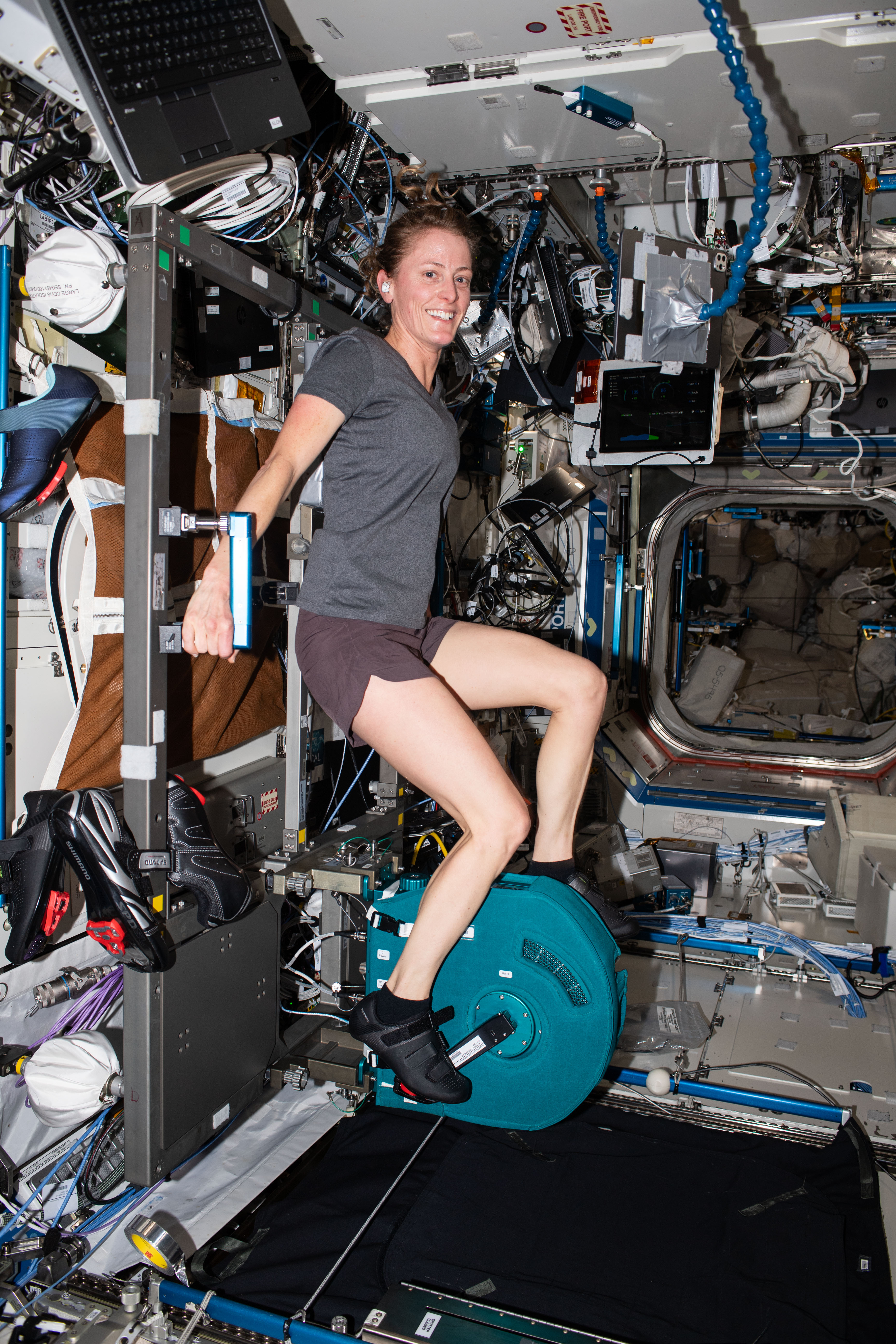
NASA astronaut Loral O’Hara pedals on the Cycle Ergometer Vibration Isolation System (CEVIS) inside the International Space Station’s Destiny laboratory module.NASAAstronauts aboard the International Space Station work out roughly two hours a day to protect bone density, muscle strength and the cardiovascular system, but the longer they are in microgravity, the harder it can be for the brain and body to readapt to gravity’s pull. After months in orbit, returning astronauts often describe Earth as heavy, loud, and strangely still. Some reacclimate within days, while other astronauts take longer to fully recover.
Adjusting to Gravity
NASA’s SpaceX Crew-7 astronaut Jasmin Moghbeli after landing in the Gulf of America on March 12, 2024, completing 197 days in space.NASA/Joel KowskyThe crew of NASA’s SpaceX Crew-7 mission— NASA astronaut Jasmin Moghbeli, ESA (European Space Agency) astronaut Andreas Mogensen, JAXA (Japan Aerospace Exploration Agency) astronaut Satoshi Furukawa, and Roscosmos cosmonaut Konstantin Borisov—landed in March 2024 after nearly 200 days in space. One of the first tests volunteer crew members completed was walking with their eyes open and then closed.
“With eyes closed, it was almost impossible to walk in a straight line,” Mogensen said. In space, vision is the primary way astronauts orient themselves, but back on Earth, the brain must relearn how to use inner-ear balance signals. Moghbeli joked her first attempt at the exercise looked like “a nice tap dance.”
“I felt very wobbly for the first two days,” Moghbeli said. “My neck was very tired from holding up my head.” She added that, overall, her body readapted to gravity quickly.
Astronauts each recover on their own timetable and may encounter different challenges. Mogensen said his coordination took time to return. Furukawa noted that he could not look down without feeling nauseated. “Day by day, I recovered and got more stable,” he said.
NASA astronaut Loral O’Hara after landing in a remote area near the town of Zhezkazgan, Kazakhstan, on April 6, 2024.NASA/Bill IngallsNASA astronaut Loral O’Hara returned in April 2024 after 204 days in space. She said she felt almost completely back to normal a week after returning to Earth. O’Hara added that her prior experience as an ocean engineer gave her insight into space missions. “Having those small teams in the field working with a team somewhere else back on shore with more resources is a good analog for the space station and all the missions we’re hoping to do in the future,” she said.
NASA astronaut Nichole Ayers, who flew her first space mission with NASA’s SpaceX Crew-10, noted that the brain quickly adapts to weightlessness by tuning out the vestibular system, which controls balance. “Then, within days of being back on Earth, it remembers again—it’s amazing how fast the body readjusts,” she said.
Expedition 69 NASA astronaut Frank Rubio outside the Soyuz MS-23 spacecraft after landing near the town of Zhezkazgan, Kazakhstan, on Sept. 27, 2023. NASA/Bill IngallsWhen NASA astronaut Frank Rubio landed in Kazakhstan in September 2023, he had just completed a record 371-day mission—the longest single U.S. spaceflight.
Rubio said his body adjusted to gravity right away, though his feet and lower back were sore after more than a year without weight on them. Thanks to consistent workouts, Rubio said he felt mostly recovered within a couple of weeks.
Mentally, extending his mission from six months to a year was a challenge. “It was a mixed emotional roller coaster,” he said, but regular video calls with family kept him grounded. “It was almost overwhelming how much love and support we received.”
Crew-8 astronauts Matt Dominick, Jeanette Epps, Michael Barratt, and cosmonaut Alexander Grebenkin splashed down in October 2024 after 235 days on station. Dominick found sitting on hard surfaces uncomfortable at first. Epps felt the heaviness of Earth immediately. “You have to move and exercise every day, regardless of how exhausted you feel,” she said.
Barratt, veteran astronaut and board certified in internal and aerospace medicine, explained that recovery differs for each crew member, and that every return teaches NASA something new.
Still a Challenge, Even for Space Veterans
NASA astronaut Suni Williams is helped out of a SpaceX Dragon spacecraft aboard the SpaceX recovery ship after splashing down off the coast of Tallahassee, Florida, March 18, 2025. NASA/Keegan BarberVeteran NASA astronauts Suni Williams and Butch Wilmore returned from a nine-month mission with Crew-9 in early 2025. Despite her extensive spaceflight experience, Williams said re-adapting to gravity can still be tough. “The weight and heaviness of things is surprising,” she said. Like others, she pushed herself to move daily to regain strength and balance.
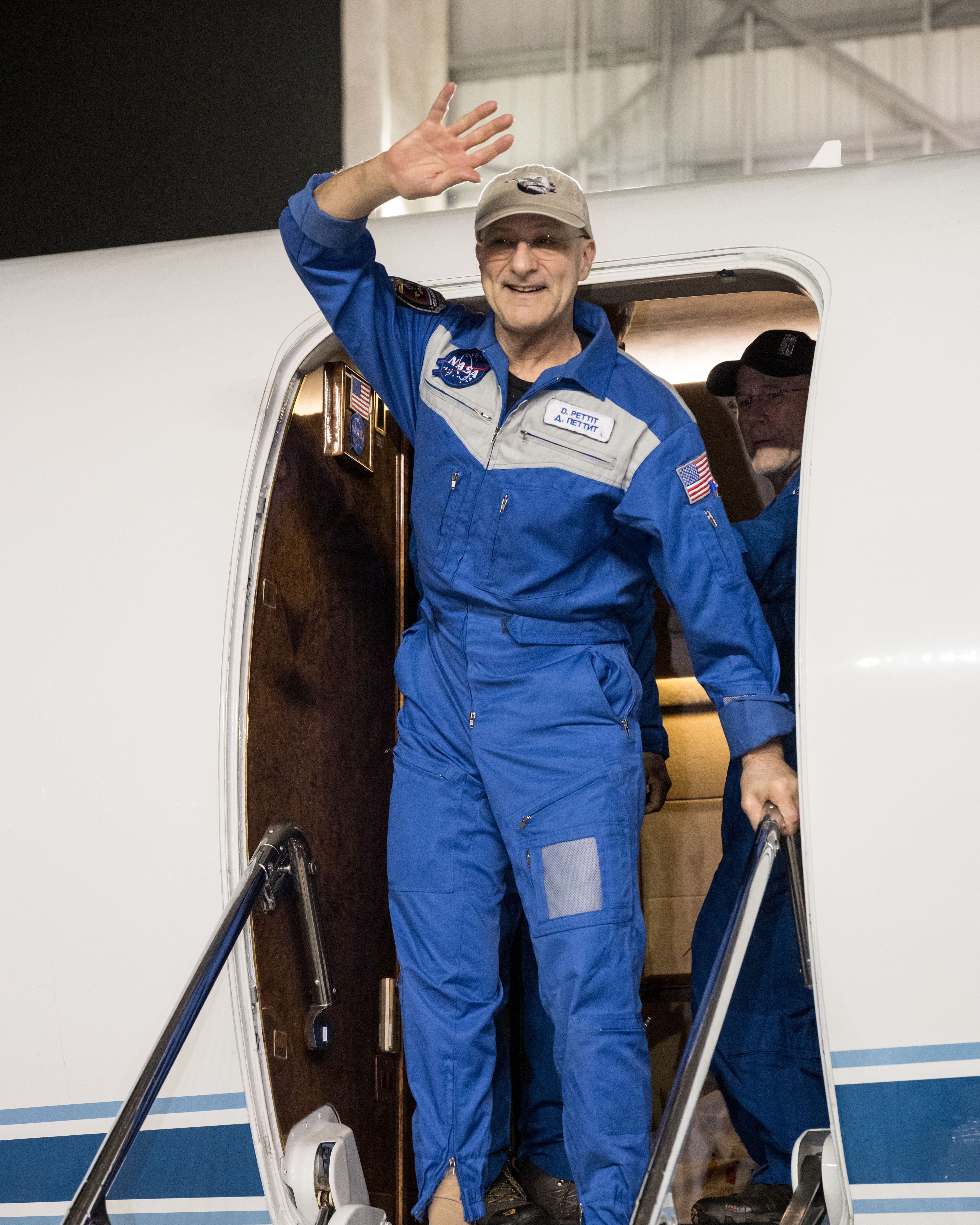
NASA astronaut Don Pettit arrives at Ellington Field in Houston on April 20, 2025, after returning to Earth aboard the Soyuz MS-25 spacecraft. NASA/Robert MarkowitzNASA astronaut Don Pettit, also a veteran flyer, came home in April 2025 after 220 days on the space station. At 70 years old, he is NASA’s oldest active astronaut—but experience did not make gravity gentler. During landing, he says he was kept busy, “emptying the contents of my stomach onto the steppes of Kazakhstan.” Microgravity had eased the aches in his joints and muscles, but Earth’s pull brought them back all at once.
Pettit said his recovery felt similar to earlier missions. “I still feel like a little kid inside,” he said. The hardest part, he explained, isn’t regaining strength in big muscle groups, but retraining the small, often-overlooked muscles unused in space. “It’s a learning process to get used to gravity again.”
Recovery happens day by day—with help from exercise, support systems, and a little humor. No matter how long an astronaut is in space, every journey back to Earth is unique.
The Human Research Program help scientists understand how spaceflight environments affect astronaut health and performance and informs strategies to keep crews healthy for future missions to the Moon, Mars, and beyond. The program studies astronauts before, during, and after spaceflight to learn how the human body adapts to living and working in space. It also collects data through Earth-based analog missions that can help keep astronauts safer for future space exploration.
To learn more about how microgravity affects the human body and develop new ways to help astronauts stay healthy, for example, its scientists conduct bedrest studies – asking dozens of volunteers to spend 60 days in bed with their heads tilted down at a specific angle. Lying in this position tricks the body into responding as it would if the body was in space which allows scientists to trial interventions to hopefully counter some of microgravity’s effects. Such studies, through led by NASA, occur at the German Aerospace Center’s Cologne campus at a facility called :envihab – a combination of “environment” and “habitat.”
Additional Earth-based insights come from the Crew Health and Performance Exploration Analog (CHAPEA) and the Human Exploration Research Analog (HERA) at NASA’s Johnson Space Center in Houston. Both analogs recreate the remote conditions and scenarios of deep space exploration here on Earth with volunteer crews who agree to live and work in the isolation of ground-based habitats and endure challenges like delayed communication that simulates the type of interactions that will occur during deep space journeys to and from Mars. Findings from these ground-based missions and others will help NASA refine its future interventions, strategies, and protocols for astronauts in space.
NASA and its partners have supported humans continuously living and working in space since November 2000. After nearly 25 years of continuous human presence, the space station remains the sole space-based proving ground for training and research for deep space missions, enabling NASA’s Artemis campaign, lunar exploration, and future Mars missions.
Explore More 7 min read A Few Things Artemis Will Teach Us About Living and Working on the Moon Article 6 years ago 3 min read Inside NASA’s New Orion Mission Evaluation Room for Artemis II Article 2 weeks ago 12 min read 15 Ways the International Space Station Benefits Humanity Back on Earth Article 3 years agoPerseverance Meets the Megabreccia
- Perseverance Home
- Science
- News and Features
- Multimedia
- Mars Missions
- Mars Home
2 min read
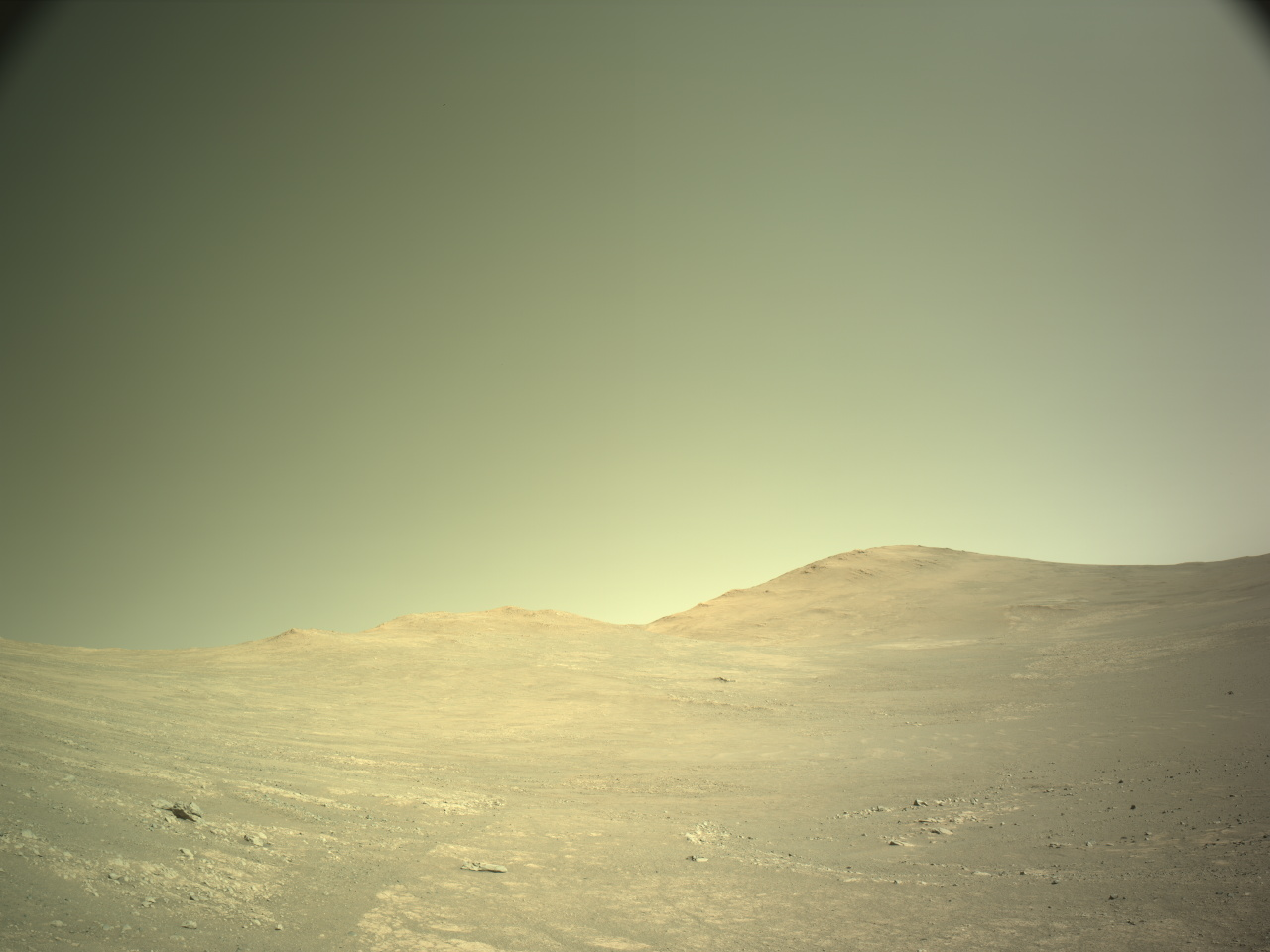
Perseverance Meets the Megabreccia NASA’s Mars Perseverance rover acquired this image of the “Scotiafjellet” workspace on Aug. 31, 2025, using its onboard Left Navigation Camera (Navcam). The camera is located high on the rover’s mast and aids in driving. This image was acquired on Sol 1610, or Martian day 1,610 of the Mars 2020 mission, at the local mean solar time of 14:52:20. NASA/JPL-CaltechWritten by By Henry Manelski, Ph.D. student at Purdue University
Last week, the Perseverance rover began an exciting new journey. Driving northwest of the Soroya ridge, Perseverance entered an area filled with a diverse range of boulders that the science team believes could hold clues to Mars’ early history. The terrain we are exploring is known as megabreccia: a chaotic mixture of broken rock fragments likely produced during ancient asteroid impacts. Some blocks may have originated in the gargantuan Isidis impact event, which created a 1,200-mile-wide crater (about 1,930 kilometers) just east of Jezero. Studying megabreccia could help us link Jezero’s geology to the wider region around Isidis Basin, tying local observations to Mars’ global history.
The rover is now beginning a systematic exploration of these rocks, starting at Scotiafjellet. If they are truly megabreccia, they could contain pieces of deep crustal material, offering a rare glimpse into Mars’ interior. These rocks likely predate the deltaic and volcanic deposits we explored earlier in Jezero Crater, making them some of the oldest accessible rocks Perseverance will ever encounter. They may therefore reveal to what extent water was present on ancient Mars — a key question as we continue our search for signs of past life on the Red Planet. In short, by venturing into this jumbled terrain, Perseverance is giving us a front-row seat to the earliest chapters of Mars’ story.
-
Want to read more posts from the Perseverance team?
-
Want to learn more about Perseverance’s science instruments?
Article
4 days ago 2 min read Over Soroya Ridge & Onward!
Article
2 weeks ago 3 min read Curiosity Blog, Sols 4638-4640: Imaging Extravaganza Atop a Ridge
Article
2 weeks ago Keep Exploring Discover More Topics From NASA Mars
Mars is the fourth planet from the Sun, and the seventh largest. It’s the only planet we know of inhabited…
All Mars ResourcesExplore this collection of Mars images, videos, resources, PDFs, and toolkits. Discover valuable content designed to inform, educate, and inspire,…
Rover BasicsEach robotic explorer sent to the Red Planet has its own unique capabilities driven by science. Many attributes of a…
Mars Exploration: Science GoalsThe key to understanding the past, present or future potential for life on Mars can be found in NASA’s four…
Perseverance Meets the Megabreccia
- Perseverance Home
- Science
- News and Features
- Multimedia
- Mars Missions
- Mars Home
2 min read
Perseverance Meets the Megabreccia NASA’s Mars Perseverance rover acquired this image of the “Scotiafjellet” workspace on Aug. 31, 2025, using its onboard Left Navigation Camera (Navcam). The camera is located high on the rover’s mast and aids in driving. This image was acquired on Sol 1610, or Martian day 1,610 of the Mars 2020 mission, at the local mean solar time of 14:52:20. NASA/JPL-CaltechWritten by By Henry Manelski, Ph.D. student at Purdue University
Last week, the Perseverance rover began an exciting new journey. Driving northwest of the Soroya ridge, Perseverance entered an area filled with a diverse range of boulders that the science team believes could hold clues to Mars’ early history. The terrain we are exploring is known as megabreccia: a chaotic mixture of broken rock fragments likely produced during ancient asteroid impacts. Some blocks may have originated in the gargantuan Isidis impact event, which created a 1,200-mile-wide crater (about 1,930 kilometers) just east of Jezero. Studying megabreccia could help us link Jezero’s geology to the wider region around Isidis Basin, tying local observations to Mars’ global history.
The rover is now beginning a systematic exploration of these rocks, starting at Scotiafjellet. If they are truly megabreccia, they could contain pieces of deep crustal material, offering a rare glimpse into Mars’ interior. These rocks likely predate the deltaic and volcanic deposits we explored earlier in Jezero Crater, making them some of the oldest accessible rocks Perseverance will ever encounter. They may therefore reveal to what extent water was present on ancient Mars — a key question as we continue our search for signs of past life on the Red Planet. In short, by venturing into this jumbled terrain, Perseverance is giving us a front-row seat to the earliest chapters of Mars’ story.
-
Want to read more posts from the Perseverance team?
-
Want to learn more about Perseverance’s science instruments?
Article
4 days ago 2 min read Over Soroya Ridge & Onward!
Article
2 weeks ago 3 min read Curiosity Blog, Sols 4638-4640: Imaging Extravaganza Atop a Ridge
Article
2 weeks ago Keep Exploring Discover More Topics From NASA Mars
Mars is the fourth planet from the Sun, and the seventh largest. It’s the only planet we know of inhabited…
All Mars ResourcesExplore this collection of Mars images, videos, resources, PDFs, and toolkits. Discover valuable content designed to inform, educate, and inspire,…
Rover BasicsEach robotic explorer sent to the Red Planet has its own unique capabilities driven by science. Many attributes of a…
Mars Exploration: Science GoalsThe key to understanding the past, present or future potential for life on Mars can be found in NASA’s four…
NASA Sets Coverage for Northrop Grumman CRS-23, SpaceX Falcon 9 Launch
NASA, Northrop Grumman, and SpaceX are targeting no earlier than 6:11 p.m. EDT, Sunday, Sept. 14, for the next launch to deliver science investigations, supplies, and equipment to the International Space Station. The mission is known as NASA’s Northrop Grumman Commercial Resupply Services 23, or Northrop Grumman CRS-23.
Watch the agency’s launch and arrival coverage on NASA+, Amazon Prime, and more. Learn how to watch NASA content through a variety of platforms, including social media.
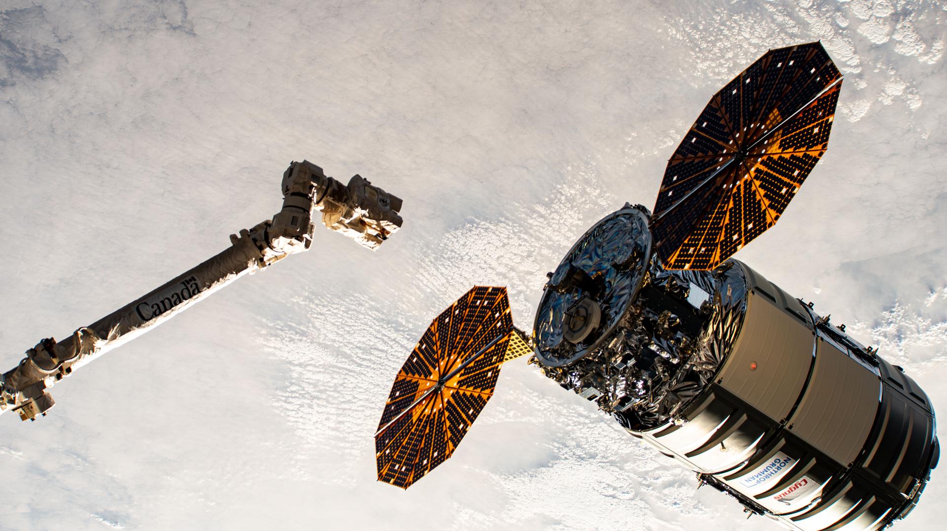
Filled with more than 11,000 pounds of supplies, the Northrop Grumman Cygnus XL spacecraft, carried on a SpaceX Falcon 9 rocket, will launch from Space Launch Complex 40 at Cape Canaveral Space Force Station in Florida. This mission will be the first flight of the Cygnus XL, the larger, more cargo-capable version of the company’s solar-powered spacecraft.
Following arrival, astronauts aboard the space station will use the Canadarm2 to grapple Cygnus XL on Wednesday, Sept. 17, before robotically installing the spacecraft to the Unity module’s Earth-facing port for cargo unloading.
Highlights of space station research and technology demonstrations, facilitated by delivery aboard this Cygnus XL, include materials to produce semiconductor crystals in space and equipment to develop improvements for cryogenic fuel tanks. The spacecraft also will deliver a specialized UV light system to prevent the growth of microbe communities that form in water systems and supplies to produce pharmaceutical crystals that could treat cancer and other diseases.
Media interested in speaking to a science subject matter expert should contact Sandra Jones at: sandra.p.jones@nasa.gov. A copy of NASA’s media accreditation policy is available on the agency’s website.
The Cygnus XL spacecraft is scheduled to remain at the orbiting laboratory until March before it departs and burns up in the Earth’s atmosphere. Northrop Grumman has named the spacecraft the S.S. William “Willie” McCool, in honor of the NASA astronaut who perished in 2003 during the space shuttle Columbia accident.
NASA’s mission coverage is as follows (all times Eastern and subject to change based on real-time operations):
Wednesday, Sept. 10:
1 p.m. – International Space Station National Laboratory Science Webinar with the following participants:
- Dr. Liz Warren, associate chief scientist, NASA’s International Space Station Program Research Office
- Phillip Irace, science program director, International Space Station National Laboratory
- Paul Westerhoff, regents professor, School of Sustainable Engineering and the Built Environment, Arizona State University
- Robert Garmise, director of formulation development; exploratory biopharmaceuticals, Bristol Myers Squibb
- Joel Sercel, founder and CEO, TransAstra Corporation and Mike Lewis, senior vice president, customer innovation, Voyager Technologies
- Mohammad Kassemi, research professor, Case Western University
Media who wish to participate must register for Zoom access no later than one hour before the start of the webinar.
The webinar will be recorded and shared to the International Space Station National Lab’s YouTube channel following the event. Ask questions in advance using social accounts @ISS_CASIS and @Space_Station.
Friday, Sept 12
11:30 a.m. – Prelaunch media teleconference with the following participants:
- Dina Contella, deputy manager, NASA’s International Space Station Program
- Dr. Liz Warren, associate chief scientist, NASA’s International Space Station Program Research Office
- Ryan Tintner, vice president, Civil Space Systems, Northrop Grumman
- Jared Metter, director, Flight Reliability, SpaceX
Media who wish to participate by phone must request dial-in information by 5 p.m., Thursday, Sept. 11, by contacting the NASA Johnson newsroom at 281-483-5111 or jsccommu@mail.nasa.gov.
Audio of the teleconference will stream live on the agency’s website and YouTube.
5:50 p.m. – Launch coverage begins on NASA+ and Amazon Prime
6:11 p.m. – Launch
Wednesday, Sept. 17:
5 a.m. – Arrival coverage begins on NASA+ and Amazon Prime
6:35 a.m. – Capture
8 a.m. – Installation coverage begins on NASA+ and Amazon Prime
NASA website launch coverage
Launch day coverage of the mission will be available on the NASA website. Coverage will include live streaming and blog updates beginning no earlier than 5:50 p.m. on Sept. 14, as the countdown milestones occur. On-demand streaming video on NASA+ and photos of the launch will be available shortly after liftoff. For questions about countdown coverage, contact the NASA Kennedy newsroom at 321-867-2468. Follow countdown coverage on our International Space Station blog for updates.
Attend Launch Virtually
Members of the public can register to attend this launch virtually. NASA’s virtual guest program for this mission also includes curated launch resources, notifications about related opportunities or changes, and a stamp for the NASA virtual guest passport following launch.
Watch, Engage on Social Media
Let people know you’re watching the mission on X, Facebook, and Instagram by following and tagging these accounts:
X: @NASA, @NASASpaceOps, @NASAKennedy, @Space_Station, @ISS_CASIS
Facebook: NASA, NASAKennedy, ISS, ISS National Lab
Instagram: @NASA, @NASAKennedy, @ISS, @ISSNationalLab
Coverage en Espanol
Did you know NASA has a Spanish section called NASA en Espanol? Check out NASA en Espanol on X, Instagram, Facebook, and YouTube for additional mission coverage.
Para obtener información sobre cobertura en español en el Centro Espacial Kennedy o si desea solicitar entrevistas en español, comuníquese con Antonia Jaramillo o Messod Bendayan a: antonia.jaramillobotero@nasa.gov o messod.c.bendayan@nasa.gov.
Learn more about the mission at:
https://www.nasa.gov/mission/nasas-northrop-grumman-crs-23/
-end-
Josh Finch / Jimi Russell
Headquarters, Washington
202-358-1100
joshua.a.finch@nasa.gov / james.j.russell@nasa.gov
Steven Siceloff
Kennedy Space Center, Fla.
321-876-2468
steven.p.siceloff@nasa.gov
Sandra Jones / Joseph Zakrzewski
Johnson Space Center, Houston
281-483-5111
sandra.p.jones@nasa.gov / joseph.a.zakrzewski@nasa.gov
NASA to Share Details of New Perseverance Mars Rover Finding
NASA will host a media teleconference at 11 a.m. EDT Wednesday, Sept. 10, to discuss the analysis of a rock sampled by the agency’s Perseverance Mars rover last year, which is the subject of a forthcoming science paper.
The sample, called “Sapphire Canyon,” was collected in July 2024 from a set of rocky outcrops on the edges of Neretva Vallis, a river valley carved by water rushing into Jezero Crater long ago.
Audio and visuals of the call will stream on the agency’s website at:
Participants in the teleconference include:
- Acting NASA Administrator Sean Duffy
- Nicky Fox, associate administrator, Science Mission Directorate, NASA Headquarters in Washington
- Lindsay Hays, Senior Scientist for Mars Exploration, Planetary Science Division, NASA Headquarters
- Katie Stack Morgan, Perseverance Project Scientist, NASA’s Jet Propulsion Laboratory in Southern California
- Joel Hurowitz, planetary scientist, Stony Brook University, New York
To ask questions by phone, members of the media must RSVP no later than two hours before the start of the event to: rexana.v.vizza@jpl.nasa.gov. NASA’s media accreditation policy is available online.
Since landing in the Red Planet’s Jezero Crater in February 2021, Perseverance has collected 30 samples. The rover still has six empty sample tubes to fill, and it continues to collect detailed information about geologic targets that it hasn’t sampled by using its abrasion tool. Among the rover’s science instruments is a weather station that provides environmental information for future human missions, as well as swatches of spacesuit material so that NASA can study how it fares on Mars.
Managed for NASA by Caltech, JPL built and manages operations of the Perseverance rover on behalf of the agency’s Science Mission Directorate as part of NASA’s Mars Exploration Program portfolio.
To learn more about Perseverance visit:
https://www.nasa.gov/perseverance
-end-
Bethany Stevens / Karen Fox
Headquarters, Washington
202-358-1600
bethany.c.stevens@nasa.gov / karen.c.fox@nasa.gov
DC Agle
Jet Propulsion Laboratory, Pasadena, Calif.
818-393-9011
agle@jpl.nasa.gov
NASA Astronaut Frank Rubio in Space Station Cupola
NASA Astronaut Frank Rubio in Space Station Cupola
NASA astronaut Frank Rubio poses for a picture in the International Space Station’s cupola on Oct. 1, 2022.
Rubio was selected as a NASA astronaut in 2017. He trained as a flight engineer and member of the Expedition 68 crew. Rubio, along with cosmonauts Sergey Prokopyev and Dmitry Petelin of Roscosmos, launched Sept. 21, 2022, on the Soyuz MS-22 spacecraft from the Baikonur Cosmodrome in Kazakhstan to the space station.
While aboard the orbital laboratory, Rubio and his fellow crew members conducted dozens of scientific investigations and technology demonstrations, including growing tomato plants to study hydroponic and aeroponic techniques, participating in crew health experiments, and studying how materials react in microgravity. Research like this and other activity on the orbital outpost will inform long-duration missions like Artemis and future human expeditions to Mars.
Rubio spent 371 days in space, surpassing NASA’s single spaceflight record for continuous days in space made by astronaut Mark Vande Hei. Rubio and his crewmates landed in Kazakhstan on Sept. 27, 2023. Rubio’s mission is the longest single spaceflight by a U.S. astronaut in history.
Image credit: NASA/Frank Rubio
NASA Webb Looks at Earth-Sized, Habitable-Zone Exoplanet TRAPPIST-1 e
- Webb
- News
- Overview
- Science
- Observatory
- Multimedia
- Team
- More
Artwork: NASA, ESA, CSA, STScI, Joseph Olmsted (STScI)
Scientists are in the midst of observing the exoplanet TRAPPIST-1 e with NASA’s James Webb Space Telescope. Careful analysis of the results so far presents several potential scenarios for what the planet’s atmosphere and surface may be like, as NASA science missions lay key groundwork to answer the question, “are we alone in the universe?”
“Webb’s infrared instruments are giving us more detail than we’ve ever had access to before, and the initial four observations we’ve been able to make of planet e are showing us what we will have to work with when the rest of the information comes in,” said Néstor Espinoza of the Space Telescope Science Institute in Baltimore, Maryland, a principal investigator on the research team. Two scientific papers detailing the team’s initial results are published in the Astrophysical Journal Letters.
Image A: Trappist-1 e (Artist’s Concept) This artist’s concept shows the volatile red dwarf star TRAPPIST-1 and its four most closely orbiting planets, all of which have been observed by NASA’s James Webb Space Telescope. Webb has found no definitive signs of an atmosphere around any of these worlds yet. Artwork: NASA, ESA, CSA, STScI, Joseph Olmsted (STScI)Of the seven Earth-sized worlds orbiting the red dwarf star TRAPPIST-1, planet e is of particular interest because it orbits the star at a distance where water on the surface is theoretically possible — not too hot, not too cold — but only if the planet has an atmosphere. That’s where Webb comes in. Researchers aimed the telescope’s powerful NIRSpec (Near-Infrared Spectrograph) instrument at the system as planet e transited, or passed in front of, its star. Starlight passing through the planet’s atmosphere, if there is one, will be partially absorbed, and the corresponding dips in the light spectrum that reaches Webb will tell astronomers what chemicals are found there. With each additional transit, the atmospheric contents become clearer as more data is collected.
Primary atmosphere unlikelyThough multiple possibilities remain open for planet e because only four transits have been analyzed so far, the researchers feel confident that the planet does not still have its primary, or original, atmosphere. TRAPPIST-1 is a very active star, with frequent flares, so it is not surprising to researchers that any hydrogen-helium atmosphere with which the planet may have formed would have been stripped off by stellar radiation. However many planets, including Earth, build up a heavier secondary atmosphere after losing their primary atmosphere. It is possible that planet e was never able to do this and does not have a secondary atmosphere. Yet researchers say there is an equal chance there is an atmosphere, and the team developed novel approaches to working with Webb’s data to determine planet e’s potential atmospheres and surface environments.
World of (fewer) possibilitiesThe researchers say it is unlikely that the atmosphere of TRAPPIST-1 e is dominated by carbon dioxide, analogous to the thick atmosphere of Venus and the thin atmosphere of Mars. However, the researchers also are careful to note that there are no direct parallels with our solar system.
“TRAPPIST-1 is a very different star from our Sun, and so the planetary system around it is also very different, which challenges both our observational and theoretical assumptions,” said team member Nikole Lewis, an associate professor of astronomy at Cornell University.
If there is liquid water on TRAPPIST-1 e, the researchers say it would be accompanied by a greenhouse effect, in which various gases, particularly carbon dioxide, keep the atmosphere stable and the planet warm.
“A little greenhouse effect goes a long way,” said Lewis, and the measurements do not rule out adequate carbon dioxide to sustain some water on the surface. According to the team’s analysis, the water could take the form of a global ocean, or cover a smaller area of the planet where the star is at perpetual noon, surrounded by ice. This would be possible because, due to the TRAPPIST-1 planets’ sizes and close orbits to their star, it is thought that they all are tidally locked, with one side always facing the star and one side always in darkness.
Image B: TRAPPIST-1 e Transmission Spectrum (NIRSpec) This graphic compares data collected by Webb’s NIRSpec (Near-Infrared Spectrograph) with computer models of exoplanet TRAPPIST-1 e with (blue) and without (orange) an atmosphere. Narrow colored bands show the most likely locations of data points for each model. Illustration: NASA, ESA, CSA, STScI, Joseph Olmsted (STScI) Innovative new methodEspinoza and co-principal investigator Natalie Allen of Johns Hopkins University are leading a team that is currently making 15 additional observations of planet e, with an innovative twist. The scientists are timing the observations so that Webb catches both planets b and e transiting the star one right after the other. After previous Webb observations of planet b, the planet orbiting closest to TRAPPIST-1, scientists are fairly confident it is a bare rock without an atmosphere. This means that signals detected during planet b’s transit can be attributed to the star only, and because planet e transits at nearly the same time, there will be less complication from the star’s variability. Scientists plan to compare the data from both planets, and any indications of chemicals that show up only in planet e’s spectrum can be attributed to its atmosphere.
“We are really still in the early stages of learning what kind of amazing science we can do with Webb. It’s incredible to measure the details of starlight around Earth-sized planets 40 light-years away and learn what it might be like there, if life could be possible there,” said Ana Glidden, a post-doctoral researcher at Massachusetts Institute of Technology’s Kavli Institute for Astrophysics and Space Research, who led the research on possible atmospheres for planet e. “We’re in a new age of exploration that’s very exciting to be a part of,” she said.
The four transits of TRAPPIST-1 e analyzed in the new papers published today were collected by the JWST Telescope Scientist Team’s DREAMS (Deep Reconnaissance of Exoplanet Atmospheres using Multi-instrument Spectroscopy) collaboration.
The James Webb Space Telescope is the world’s premier space science observatory. Webb is solving mysteries in our solar system, looking beyond to distant worlds around other stars, and probing the mysterious structures and origins of our universe and our place in it. Webb is an international program led by NASA with its partners, ESA (European Space Agency) and CSA (Canadian Space Agency).
To learn more about Webb, visit:
Related InformationWebb Blog: Reconnaissance of Potentially Habitable Worlds with NASA’s Webb
Video: How to Study Exoplanets
Video: How do we learn about a planet’s Atmosphere?
View more about Exoplanets
Related For Kids En Español Related Images & Videos Trappist-1 e (Artist’s Concept)This artist’s concept shows the volatile red dwarf star TRAPPIST-1 and its four most closely orbiting planets, all of which have been observed by NASA’s James Webb Space Telescope. Webb has found no definitive signs of an atmosphere around any of these worlds yet.
TRAPPIST-1 e Transmission Spectrum (NIRSpec)
This graphic compares data collected by Webb’s NIRSpec (Near-Infrared Spectrograph) with computer models of exoplanet TRAPPIST-1 e with (blue) and without (orange) an atmosphere. Narrow colored bands show the most likely locations of data points for each model.
Laura Betz
NASA’s Goddard Space Flight Center
Greenbelt, Maryland
laura.e.betz@nasa.gov
Leah Ramsay
Space Telescope Science Institute
Baltimore, Maryland
Hannah Braun
Space Telescope Science Institute
Baltimore, Maryland
- The science paper by N. Espinoza et al.
- The science paper by A. Glidden et al.
- JWST Telescope Science Team
Keep Exploring Related Topics James Webb Space Telescope
Space Telescope
Exoplanets
Exoplanet Stories
Universe
NASA Launches 2026 Lunabotics Challenge
As college students across the country embark upon the academic year, NASA is giving them something else to look forward to – the agency’s 2026 Lunabotics Challenge. Teams interested in participating can submit their applications and supporting materials through NASA’s Stem Gateway portal beginning Monday, Sept. 8.
Key dates and challenge details are available in the 2026 Lunabotics Challenge Guidebook. Once all applications and supporting materials are received and evaluated, NASA will notify the selected teams to begin the challenge.
Student teams participating in this year’s challenge will create robots capable of building berms out of lunar regolith – the loose, fragmental material on the Moon’s surface. Structures like these will be important during lunar missions as blast protection during lunar landings and launches, shading for cryogenic propellant tank farms, radiation shielding around nuclear power plants, and other uses critical to future Moon missions.
“We are excited to continue the Lunabotics competition for universities as NASA develops new Moon to Mars technologies for the Artemis program,” said Robert Mueller, senior technologist at NASA, as well as co-founder and chief judge of the Lunabotics competition. “Excavating and moving regolith is a fundamental need to build infrastructure on the Moon and Mars and this competition creates 21st century skills in the future workforce.”
An in-person qualifying event will be held May 12-17, 2026, at the University of Central Florida’s Space Institute’s Exolith Lab in Orlando. From this round, the top 10 teams will be invited to bring their robots to the final competition on May 19-21, at the Kennedy Space Center Visitor Complex’s Artemis Arena in Florida, which has an area filled with a lunar regolith simulant. The team scoring the most points will receive the Lunabotics Grand Prize and participate in an exhibition-style event at NASA Kennedy.
By encouraging innovative construction techniques and assessing student designs and data the same way it does its own prototypes, NASA casts a wider net to find innovative solutions to challenges inherent in future Artemis missions, like developing future lunar excavators, in-situ resource utilization capabilities, and living on the Moon or Mars. With its multidisciplinary approach, Lunabotics also serves as a workforce pipeline, with teams gaining valuable hands-on experience in computer coding, engineering, manufacturing, fabricating, and other crucial skills, while also receiving technical expertise in space technology development.
NASA’s Lunabotics Challenge, held annually since 2010, is one of several Artemis Student Challenges. The two-semester competition provides U.S. college and technical school teams an opportunity to design, build, and operate a prototype lunar robot using NASA systems engineering processes. Competitions help NASA get innovative design and operational data, reduce risks, and cultivate new ideas needed to return to the Moon under the Artemis campaign to prepare for human exploration of Mars.
To learn more about Lunabotics, visit:
https://www.nasa.gov/learning-resources/lunabotics-challenge/
Widely Attended Gatherings (WAGs) Determinations
2025
Evening with the Stars 9.10.25
Greater Houston Partnership Reception 6.12.25
Space Foundation and German Embassy Reception 6.5.25
H2M Conference and Events 5.28-29.25
American Rocketry Challenge Reception 5.17.25
Rockets on the Hill Reception 5.16.25
Dayton Development Coalition Event 5.13.25
2025 Space Heroes and Legends Gala
Thunderbird School and Global Management Reception
40th Space Symposium Main Events
SPI/GWU/USRA Symposium.3.27.25
Goddard Memorial Dinner.3.21.25
2025 Satellite Exhibition Event.3.10.25 to 3.13.25
67th Laureate Awards Dinner.3.6.25
Bae Systems SPHEREx Launch.2.27.25
2025 Artemis Suppliers Conference
Creole-Queen NOLA Reception.1.13.25
2025 New Glenn Mission 1 Launch Event
2025 Firefly Blue Origin Launch Reception
2024
Aero Club Award Dinner.12.13.24
Space Foundation Event.12.13.24
Commercial Space Federation Joint Event.12.9.24
The Arthur C. Clarke Foundation Event.11.21.24
Planet Labs PBC Reception.11.20.24
Blue Origin and KBR Dinner.10.30.24
36th Annual Dr. Wernher von Braun Memorial Dinner
2024 Keystone Space Conference
WIA Reception and Awards Dinner.10.10.24
2024 JPL Europa Clipper Launch Reception.10.8.24
AIA & Amazon Reception.8.26.24
Farnborough Air Show.7.20-21.24
Artemis II SLS Roll Out Reception.7.15.24
Astroscale Reception Tokyo.7.12.24
Brooke Owens Fellowship Dinner.7.11.24
Greater Cleveland Partnership.6.13-14.24
Coalition for Deep Space Exploration Return to the Moon.6.5.24
The 2024 Infinite Exhibit Grand Opening
AIA and German Embassy Reception.6.4.24
AIA and British Embassy Reception.5.22.24
Space Foundation Event.5.16.24
Foundation Fratelli Tutti Dinners.5.10-11.24
H2M Conference and Event.5.7-8.24
Crowell & Moring Reception.4.16.24
2024 Space Heroes and Legends Awards Dinner
SpaceX Symposium Reception.4.10.24
39th Space Symposium Supplemental
39th Space Symposium Main Events
Goddard Memorial Dinner.3.22.24
AIA and Amazon Reception.3.19.24
Embassy of Australia and Space Foundation.2.29.24
2024 Artemis Suppliers Conference
2024 Aerospace Days Legislative Reception
IDGA 17th Annual Event.1.23 – 24.24
Latino Biden-Harris Appointees Reception.1.11.24
2024 Axiom Space AX-3 Launch Reception
2023
2023 Astrobotic PM1 PreLaunch Reception
AERO Club Awards Dinner.12.15.23
SCL and GBM Foundation Reception.12.11.23
LASP and Ball Aerospace Reception.12.11.23
L Oreal USA for Women Event.11.16.23
KBR Welcome Reception.11.14.23
Museum of Natural History Board Events 11.2.23
2023 Von Braun Memorial Dinner
Planet Labs PBC Reception.10.26.23
WIA Reception and Award Dinner.10.12.23
National Space Club Banquet 2023
Space Foundation and Airbus.10.3.23
2023 VASBA HR AUVSI Gala and Symposium
AIA Congress Space Reception.9.7.23
Space Foundation Reception 7.19.23
Chamber of Commerce Reception.7.13.23
ECI Fellows Meeting.7.12 to 7.14.23
Embassy of Italy and Virgin Galactic.7.12.23
Brook Owens Fellowship Dinner 7.13.23
Comteck and Airbus Space Defense 07.11.23.
2023 Axiom Space AX-2 Launch Event WAG
AIAA Awards Gala Event 5.18.23
38th Space Symposium 4.16 to 4.20.23
Planet Labs PGC Reception.4.13.23
2023 TEMPO Pre-Launch Reception
Coalition for Deep Space Exploration SLS Orion EGS Gateway Suppliers 3.26.23
Orion SLS Conference 3.27 to 3.28.23
2023 Agency WAG Debus Award Banquet
VHMC And Boeing Reception 3.18.23
Ball Aerospace Kinship Reception 3.15.23
SpaceX Satellite Reception 3.13.23
Goddard Memorial Dinner 3.10.23
Space Foundation Event 2.16.23
BDB National Engineers Week 2023 Banquet
MSBR Lunch 2.28.23
STA Luncheon 2.7.23
WSBR Reception 2.1.23
SPI GWU SWF Reception 1.31.23
Artemis I Splashdown 01.17.23
MSBR Lunch 1.17.23
2022
GRC An Evening With the Stars 8.30.22
JPL 25 Years on Mars Reception 7.27.22
SPI GWU Dinner 7.6.22
Berlin Air Show 6.22-26.22
MSBR Lunch 6.21.22
KSC Gateway VIP Rception 6.14.22
MSBR Dinner Gala 6.10.22
NAA Robert J. Collier Awards Dinner 6.9.22
Advanced Space and Rocket Lab Capstone Event 6.8.22
AIA Challenger Center Reception 6.2.22
2022 H2M Summit 5.17-19.22
MSBR Lunch 5.17.22
FCW GovExec Awards Dinner 5.12.22
Meta Reception 5.4.22
JSC RNASA Luncheon and Dinner 4.29.22
Coalition for Deep Space Reception 4.28.22
SLS Orion EGS Suppliers Conference 4.28-29.22
SPI GWU Dinner 4.27.22
AIAA Awards Gala Dinner 4.27.22
MSBR Luncheon 4.19.2022
Arianespace Northrop Grumman JWST Reception 4.5.22
37th Space Symposium 4.4 to 7.22
Axiom Space Launch Event 3.30.22
Heinrich Boell Foundation Dinner 3.30.22
Aarianespace Reception 3.23.22
SIA Conference Events 3.21-23.22 Revised
Satellite Industry Association Reception 3.21.22
Goddard Memorial Dinner 3.18.22
GOES-T Post-Launch Reception 3.1.22
Goes-T L3 Harris Reception 3.1.22
Christopher Newport University Dinner 02.23.22
NG-17 CRS Launch Events VA 2.19.22
SPI GWU Dinner 02.04.2022
MSBR Dinner 01.18.2022
KSC CCTS Spaceport Summit 1.11-12.22
2021
JWST Launch 12.25.21
Aero Club Awards Reception 12.17.21
KSC NSC Celebrate Space 12.10.21
AGI Ansys Reception 12.10.21
KSC Ball Aerospace IXPE Launch Celebration Reception 12.7.21
WIA Awards Dinner 12.2.21
National Space Council Recognition Reception 12.1.21
SPI Dinner 11.16.21
AIAA ASCEND Event 11.15.21
AIAA Ascend 2021 Reception Dinner Las Vegs 11.14.21
KSC Astronaut Hall of Fame Event 11.13.21
KSC DNC Taste of Space Event 11.5.21
SPI Dinner 11.2.21
IAC Closing Gala 10.29.21
GRC Evening With The Stars 10.27.21
Goddard Memorial Awards Dinner 10.22.21
IAC 2021
Lucy Post Launch Dinner 10.16.21
KSC Lucy Launch Mission Events 10.12-13.21
United Airlines Reception 10.12.21
Blue Origin Launch 10.12.21
SPI Dinner on or about 9.28.21
Goddard Memorial Dinner 9.17.21 CANCELLED
SPI Dinner 9.7.21
RNASA Awards Dinner and Luncheon 9.3.21
GRC Evening With the Stars 8.31.21
FED100 Gala Awards Dinner 8.27.21
Addendum to 36th Space Symposium 8.22-26.21
36th Space Symposium 8.22-26.21
KSC ASF Innovators Gala 8.14.21
NG16 Launch Events 8.10.21
LaRC Virginia Space Reception 7.30.21
KSC 2021 Debus Award Dinner 7.30.21
Coalition for Deep Space 07.22.21
KSC Lockheed WAS Star Center Reception 7.15.21
2020
United Launch Alliance Satellite 2020 Reception 3.10.20
SpaceX Reception 3.9.20
U.S. Chamber of Commerce 2020 Aviation Summit 3.5.20
Maryland Space Business Roundtable Lunch 2.18.20
SLS Orion Suppliers Conference 2.12.20
Coalition for Deep Space Exploration Reception 2.11.20
Northrop Grumman NG-13 CRS Launch Events 2.9.20
VA UAS AeroSpace Legislative Reception 1.29.20
MSBR Lunch 1.21.20
Guidance Keough School of Global Affairs 1.16.20
Boeing Orbital Flight Test Launch Events 12.20.19
Virgin Space Reception 12.17.19
SEA Summit 12.17.19
Wright Memorial Dinner 12.13.19
Analytical Graphics AGI Reception 12.13.19
Ball Reception 12.10.19
MSBR Lunch 12.3.19
Plant Reception 11.20.19
JSC Spacecom Conference VIP Reception 11.20.19
JSC Spacecom Conference Reception 11.19.19
SAIC BSU STEM Roundtable 11.07.19
Apollo UK Productions Ltd 7.10.19
SpaceX Satellite Reception 5.6.19
SPI GWU Dinner 5.1.19
AIAA Reception 4.30.19
MSBR Lunch 1.21.20
MSBR Lunch 1.21.20
Jeni Morrison Continues a Family Legacy of Service at NASA
A child of the Space Shuttle Program, Jeni Morrison grew up walking the grounds of NASA’s Johnson Space Center in Houston with her parents and listening to family stories about human spaceflight.
Now, with more than 15 years at NASA, Morrison serves as one of Johnson’s Environmental Programs managers. She ensures the center complies with laws that protect its resources by overseeing regulatory compliance for cultural and natural resources, stormwater and drinking water programs, and the National Environmental Policy Act. She also safeguards Johnson’s historic legacy as Johnson’s Cultural Resources manager.
Jeni Morrison in the mall area at NASA’s Johnson Space Center in Houston, where employees often see local wildlife, including turtles, birds, deer, and the occasional alligator.“I make sure our actions comply with the National Historic Preservation act, since the center is considered a historic district with two National Historic Landmarks onsite,” Morrison said. “I make sure we respect and document Johnson’s heritage while paving the way for new efforts and mission objectives.”
Morrison takes pride in finding solutions that increase efficiency while protecting resources. One example was a project with Johnson’s Geographic Information System team to create an interactive material and chemical spill plan map. The new system helps responders quickly trace spill paths above and underground to deploy resources faster, reducing cleanup costs and minimizing environmental impacts.
“Every improvement we make not only saves time and resources, but strengthens our ability to support NASA’s mission,” she said.
By the very nature of our work, NASA makes history all the time. That history is important for all people, both to remember the sacrifices and accomplishments of so many, but also to ensure we don’t repeat mistakes as we strive for even bolder achievements.Jeni Morrison
Environmental Program Manager
Jeni Morrison presents an overview of environmental compliance and center initiatives to employees at NASA’s Johnson Space Center in 2014. NASA/Lauren HarnettFor Morrison, success often comes down to teamwork. She has learned to adapt her style to colleagues’ needs to strengthen collaboration.
“By making the effort to accommodate others’ communication styles and learn from different perspectives, we create better, more efficient work,” she said. “Thankfully, so many people here at NASA are willing to teach and to share their experiences.”
Her message to the Artemis Generation is simple: Always keep learning!
“You never know when a side conversation could give you an answer to a problem you are facing down the line,” she said. “You must be willing to ask questions and learn something new to find those connections.”
Jeni Morrison (second from right) with the Biobased Coolant Project Team at NASA’s Johnson Space Center in 2018. The team tested biobased metalworking coolants and identified a product that outperformed petroleum-based options, meeting flight hardware specifications while reducing waste disposal costs and labor hours. Even as a young child visiting NASA Johnson, I could feel the sense of adventure, accomplishment, and the drive to reach new heights of human capability. I realize that those experiences gave me a fascination with learning and an inherent need to find ways to do things better.jENI mORRISON
Environmental Program Manager
Her passion for learning and discovery connects to a family tradition at NASA. Her grandfather contributed to multiple Apollo missions, including helping solve the oxygen tank malfunction on Apollo 13. Her mother worked at the center transcribing astronaut recordings and writing proposals, and her father flew experiments aboard the space shuttle and International Space Station. Morrison’s sister and extended family also worked at Johnson.
Now her son is growing up on the center grounds while attending the JSC Child Care Center. “As the fourth generation to be at Johnson, he is already talking about how he loves science and can’t wait to do his own experiments,” she said.
For Morrison, carrying that family legacy forward through environmental stewardship is a privilege. “Being able to contribute to NASA’s mission through environmental compliance feels like the best of both worlds for me,” Morrison said. “It combines my love of science and NASA with my drive to find more efficient ways to operate while protecting this incredible site and everything it represents.”
Explore More 4 min read Mark Cavanaugh: Integrating Safety into the Orion Spacecraft Article 1 month ago 6 min read She Speaks for the Samples: Meet Dr. Juliane Gross, Artemis Campaign Sample Curation Lead Article 5 months ago 5 min read Johnson’s Jason Foster Recognized for New Technology Reporting Record Article 3 months agoJeni Morrison Continues a Family Legacy of Service at NASA
A child of the Space Shuttle Program, Jeni Morrison grew up walking the grounds of NASA’s Johnson Space Center in Houston with her parents and listening to family stories about human spaceflight.
Now, with more than 15 years at NASA, Morrison serves as one of Johnson’s Environmental Programs managers. She ensures the center complies with laws that protect its resources by overseeing regulatory compliance for cultural and natural resources, stormwater and drinking water programs, and the National Environmental Policy Act. She also safeguards Johnson’s historic legacy as Johnson’s Cultural Resources manager.
Jeni Morrison in the mall area at NASA’s Johnson Space Center in Houston, where employees often see local wildlife, including turtles, birds, deer, and the occasional alligator.“I make sure our actions comply with the National Historic Preservation act, since the center is considered a historic district with two National Historic Landmarks onsite,” Morrison said. “I make sure we respect and document Johnson’s heritage while paving the way for new efforts and mission objectives.”
Morrison takes pride in finding solutions that increase efficiency while protecting resources. One example was a project with Johnson’s Geographic Information System team to create an interactive material and chemical spill plan map. The new system helps responders quickly trace spill paths above and underground to deploy resources faster, reducing cleanup costs and minimizing environmental impacts.
“Every improvement we make not only saves time and resources, but strengthens our ability to support NASA’s mission,” she said.
By the very nature of our work, NASA makes history all the time. That history is important for all people, both to remember the sacrifices and accomplishments of so many, but also to ensure we don’t repeat mistakes as we strive for even bolder achievements.Jeni Morrison
Environmental Program Manager
Jeni Morrison presents an overview of environmental compliance and center initiatives to employees at NASA’s Johnson Space Center in 2014. NASA/Lauren HarnettFor Morrison, success often comes down to teamwork. She has learned to adapt her style to colleagues’ needs to strengthen collaboration.
“By making the effort to accommodate others’ communication styles and learn from different perspectives, we create better, more efficient work,” she said. “Thankfully, so many people here at NASA are willing to teach and to share their experiences.”
Her message to the Artemis Generation is simple: Always keep learning!
“You never know when a side conversation could give you an answer to a problem you are facing down the line,” she said. “You must be willing to ask questions and learn something new to find those connections.”
Jeni Morrison (second from right) with the Biobased Coolant Project Team at NASA’s Johnson Space Center in 2018. The team tested biobased metalworking coolants and identified a product that outperformed petroleum-based options, meeting flight hardware specifications while reducing waste disposal costs and labor hours. Even as a young child visiting NASA Johnson, I could feel the sense of adventure, accomplishment, and the drive to reach new heights of human capability. I realize that those experiences gave me a fascination with learning and an inherent need to find ways to do things better.jENI mORRISON
Environmental Program Manager
Her passion for learning and discovery connects to a family tradition at NASA. Her grandfather contributed to multiple Apollo missions, including helping solve the oxygen tank malfunction on Apollo 13. Her mother worked at the center transcribing astronaut recordings and writing proposals, and her father flew experiments aboard the space shuttle and International Space Station. Morrison’s sister and extended family also worked at Johnson.
Now her son is growing up on the center grounds while attending the JSC Child Care Center. “As the fourth generation to be at Johnson, he is already talking about how he loves science and can’t wait to do his own experiments,” she said.
For Morrison, carrying that family legacy forward through environmental stewardship is a privilege. “Being able to contribute to NASA’s mission through environmental compliance feels like the best of both worlds for me,” Morrison said. “It combines my love of science and NASA with my drive to find more efficient ways to operate while protecting this incredible site and everything it represents.”
Explore More 4 min read Mark Cavanaugh: Integrating Safety into the Orion Spacecraft Article 1 month ago 6 min read She Speaks for the Samples: Meet Dr. Juliane Gross, Artemis Campaign Sample Curation Lead Article 5 months ago 5 min read Johnson’s Jason Foster Recognized for New Technology Reporting Record Article 3 months agoNASA Seeks Industry Input on Next Phase of Commercial Space Stations
NASA is requesting feedback from American companies on the next phase of its commercial space stations strategy to ensure a seamless transition of activities in low Earth orbit from the International Space Station.
The agency released a draft Phase 2 Announcement for Partnership Proposals (AFPP) Friday, asking for feedback from industry partners by 1 p.m. EDT Friday, Sept. 12. NASA will hold an informational industry briefing on Monday, Sept. 8, to provide a top-level summary of the documents and expectations.
Under the direction of acting NASA Administrator Sean Duffy, the agency reassessed the commercial space stations acquisition strategy to ensure mission continuity, affordability, and national alignment, and to reduce the potential for a gap of a crew-capable platform in low Earth orbit.
“NASA has led in low Earth orbit for 25 years and counting. Now, as we prepare for deorbiting the International Space Station in 2030, we’re calling on our commercial space partners to maintain this historic human presence,” Duffy said. “The American space industry is booming. Insight from these innovative companies will be invaluable as we work to chart the next phase of commercial space stations.”
In Phase 2, NASA intends to support industry’s design and demonstration of commercial stations through multiple funded Space Act Agreements, selected through a full and open competition.
“NASA is committed to continuing our partnership with industry to ensure a continuity in low Earth orbit,” said Angela Hart, manager, Commercial Low Earth Orbit Development Program at NASA’s Johnson Space Center in Houston. “The work done under our Phase 1 contracts and agreements have put us in a prime position to be successful for this next funded Space Act Agreement phase. By leveraging these agreements, we provide additional flexibility to our commercial partners to define the best path forward to provide NASA a safe and affordable crewed demonstration.”
The Phase 2 agreements are expected to include funded milestones leading to critical design review readiness and an in-space crewed demonstration of four crew members for a minimum of 30 days. Agreements are expected to include up to a five-year period of performance.
The agency’s phased approach will culminate in a follow-on Phase 3 using Federal Acquisition Regulation-based contract(s) to purchase station services through a full and open competition. This final phase will also provide formal design acceptance and certification, ensuring the commercial stations meet NASA’s safety requirements.
NASA remains committed to fostering innovation and collaboration within the American space industry.
The agency’s commercial strategy for low Earth orbit will provide the government with reliable and safe services at a lower cost, enabling the agency to focus on the next step in humanity’s exploration of the solar system while also continuing to use low Earth orbit as an ideal environment for training and a proving ground for Artemis missions to the Moon and Mars.
Learn more about commercial space stations at:
https://www.nasa.gov/commercialspacestations
Keep Exploring Discover More Topics From NASALow Earth Orbit Economy
Commercial Space Stations
Commercial Space News
Humans In Space
NASA Seeks Industry Input on Next Phase of Commercial Space Stations
NASA is requesting feedback from American companies on the next phase of its commercial space stations strategy to ensure a seamless transition of activities in low Earth orbit from the International Space Station.
The agency released a draft Phase 2 Announcement for Partnership Proposals (AFPP) Friday, asking for feedback from industry partners by 1 p.m. EDT Friday, Sept. 12. NASA will hold an informational industry briefing on Monday, Sept. 8, to provide a top-level summary of the documents and expectations.
Under the direction of acting NASA Administrator Sean Duffy, the agency reassessed the commercial space stations acquisition strategy to ensure mission continuity, affordability, and national alignment, and to reduce the potential for a gap of a crew-capable platform in low Earth orbit.
“NASA has led in low Earth orbit for 25 years and counting. Now, as we prepare for deorbiting the International Space Station in 2030, we’re calling on our commercial space partners to maintain this historic human presence,” Duffy said. “The American space industry is booming. Insight from these innovative companies will be invaluable as we work to chart the next phase of commercial space stations.”
In Phase 2, NASA intends to support industry’s design and demonstration of commercial stations through multiple funded Space Act Agreements, selected through a full and open competition.
“NASA is committed to continuing our partnership with industry to ensure a continuity in low Earth orbit,” said Angela Hart, manager, Commercial Low Earth Orbit Development Program at NASA’s Johnson Space Center in Houston. “The work done under our Phase 1 contracts and agreements have put us in a prime position to be successful for this next funded Space Act Agreement phase. By leveraging these agreements, we provide additional flexibility to our commercial partners to define the best path forward to provide NASA a safe and affordable crewed demonstration.”
The Phase 2 agreements are expected to include funded milestones leading to critical design review readiness and an in-space crewed demonstration of four crew members for a minimum of 30 days. Agreements are expected to include up to a five-year period of performance.
The agency’s phased approach will culminate in a follow-on Phase 3 using Federal Acquisition Regulation-based contract(s) to purchase station services through a full and open competition. This final phase will also provide formal design acceptance and certification, ensuring the commercial stations meet NASA’s safety requirements.
NASA remains committed to fostering innovation and collaboration within the American space industry.
The agency’s commercial strategy for low Earth orbit will provide the government with reliable and safe services at a lower cost, enabling the agency to focus on the next step in humanity’s exploration of the solar system while also continuing to use low Earth orbit as an ideal environment for training and a proving ground for Artemis missions to the Moon and Mars.
Learn more about commercial space stations at:
https://www.nasa.gov/commercialspacestations
Keep Exploring Discover More Topics From NASALow Earth Orbit Economy
Commercial Space Stations
Commercial Space News
Humans In Space
NASA Announces CHAPEA Crew for Year-Long Mars Mission Simulation
Four research volunteers will soon participate in NASA’s year-long simulation of a Mars mission inside a habitat at the agency’s Johnson Space Center in Houston. This mission will provide NASA with foundational data to inform human exploration of the Moon, Mars, and beyond.
Ross Elder, Ellen Ellis, Matthew Montgomery, and James Spicer enter into the 1,700-square-foot Mars Dune Alpha habitat on Sunday, Oct. 19, to begin their mission. The team will live and work like astronauts for 378 days, concluding their mission on Oct. 31, 2026. Emily Phillips and Laura Marie serve as the mission’s alternate crew members.
Through a series of Earth-based missions called CHAPEA (Crew Health and Performance Exploration Analog), carried out in the 3D-printed habitat, NASA aims to evaluate certain human health and performance factors ahead of future Mars missions. The crew will undergo realistic resource limitations, equipment failures, communication delays, isolation and confinement, and other stressors, along with simulated high-tempo extravehicular activities. These scenarios allow NASA to make informed trades between risks and interventions for long-duration exploration missions.
“As NASA gears up for crewed Artemis missions, CHAPEA and other ground analogs are helping to determine which capabilities could best support future crews in overcoming the human health and performance challenges of living and operating beyond Earth’s resources – all before we send humans to Mars,” said Sara Whiting, project scientist with NASA’s Human Research Program at NASA Johnson.
Crew members will carry out scientific research and operational tasks, including simulated Mars walks, growing a vegetable garden, robotic operations, and more. Technologies specifically designed for Mars and deep space exploration will also be tested, including a potable water dispenser and diagnostic medical equipment.
“The simulation will allow us to collect cognitive and physical performance data to give us more insight into the potential impacts of the resource restrictions and long-duration missions to Mars on crew health and performance,” said Grace Douglas, CHAPEA principal investigator. “Ultimately, this information will help NASA make informed decisions to design and plan for a successful human mission to Mars.”
This mission, facilitated by NASA’s Human Research Program, is the second one-year Mars surface simulation conducted through CHAPEA. The first mission concluded on July 6, 2024.
The Human Research Program pursues methods and technologies to support safe, productive human space travel. Through applied research conducted in laboratories, simulations, and aboard the International Space Station, the program investigates the effects spaceflight has on human bodies and behaviors to keep astronauts healthy and mission-ready.
Primary CrewRoss Elder, Commander
Ross Elder, from Williamstown, West Virginia, is a major and experimental test pilot in the United States Air Force. At the time of his selection, he served as the director of operations of the 461st Flight Test Squadron. He has piloted over 35 military aircraft and accumulated more than 1,800 flying hours, including 200 combat hours, primarily in the F-35, F-15E/EX, F-16, and A-10C. His flight test experience focuses on envelope expansion, crewed-uncrewed teaming, artificial intelligence, autonomy, mission systems, and weapons modernization.
Elder earned a Bachelor of Science in astronautical engineering from the U.S. Air Force Academy in Colorado Springs, Colorado, and commissioned as an Air Force officer upon graduation. He earned a Master of Science in mechanical engineering from the University of Colorado in Colorado Springs and a master’s degree in flight test engineering from the U.S. Air Force Test Pilot School at Edwards Air Force Base in California.
Ellen Ellis, Medical Officer
Ellen Ellis, from North Kingstown, Rhode Island, is a colonel and an acquisitions officer in the United States Space Force. She currently serves as a senior materiel leader in the National Reconnaissance Office (NRO) Communications Systems Directorate. She is responsible for fielding commercial cloud and traditional information technology hosting solutions and building modernized data centers for the NRO. She previously served as an Intercontinental Ballistic Missile operations officer and GPS satellite engineer, and she also developed geospatial intelligence payloads and ground processing systems.
She earned a Bachelor of Science in aerospace engineering at Syracuse University in New York and holds four master’s degrees, including a Master of Science in systems engineering from the Naval Postgraduate School in California, and a Master of Science in emergency and disaster management from Georgetown University in Washington.
Matthew Montgomery, Science Officer
Matthew Montgomery, from Los Angeles, is a hardware engineering design consultant who works with technology startup companies to develop, commercialize, and scale their products. His focus areas include LED lighting, robotics, controlled environment agriculture, and embedded control systems.
Montgomery earned a Bachelor of Science and a Master of Science in electrical engineering from the University of Central Florida. He is also a founder and co-owner of Floating Lava Studios, a film production company based in Los Angeles.
James Spicer, Flight Engineer
James Spicer is a technical director in the aerospace and defense industry. His experience includes building radio and optical satellite communications networks; space data relay networks for human spaceflight; position, navigation, and timing research; and hands-on spacecraft design, integration, and tests.
Spicer earned a Bachelor of Science and Master of Science in aeronautics and astronautics, and holds a Notation in Science Communication from Stanford University in California. He also holds commercial pilot and glider pilot licenses.
Emily Phillips
Emily Phillips, from Waynesburg, Pennsylvania, is a captain and pilot in the United States Marine Corps. She currently serves as a forward air controller and air officer attached to an infantry battalion stationed at the Marine Corps Air Ground Combat Center in Twentynine Palms, California.
Phillips earned a Bachelor of Science in computer science from the U.S. Naval Academy in Annapolis and commissioned as a Marine Corps officer upon graduation. She attended flight school, earning her Naval Aviator wings and qualifying as an F/A-18C Hornet pilot. Phillips has completed multiple deployments to Europe and Southeast Asia.
Laura Marie
Born in the United Kingdom, Laura Marie immigrated to the U.S. in 2016. She is a commercial airline pilot specializing in flight safety, currently operating passenger flights in Washington.
Marie began her aviation career in 2019 and has amassed over 2,800 flight hours. She holds a Bachelor of Arts in philosophy and a Master of Science in aeronautics from Liberty University in Lynchburg, Virginia. In addition to her Airline Transport Pilot License, she also possesses flight instructor and advanced ground instructor licenses. Outside the flight deck, Marie dedicates her time to mentoring and supporting aspiring pilots as they navigate their careers.
Living in Space
Artemis
Human Research Program
CHAPEA
Orion Mission Evaluation Room
Orion Mission Evaluation Room (MER) team member works during an Artemis II mission simulation on Aug. 19, 2025, from the new Orion MER inside the Mission Control Center at NASA’s Johnson Space Center in Houston.
As NASA’s Orion spacecraft is carrying crew around the Moon on the Artemis II mission, a team of expert engineers in the Mission Control Center at NASA’s Johnson Space Center in Houston will be meticulously monitoring the spacecraft along its journey. They’ll be operating from a new space in the mission control complex built to host the Orion Mission Evaluation Room (MER). Through the success of Orion and the Artemis missions, NASA will return humanity to the Moon and prepare to land an American on the surface of Mars.
