
NASA
Inside NASA’s New Orion Mission Evaluation Room for Artemis II
As NASA’s Orion spacecraft is carrying crew around the Moon on the Artemis II mission, a team of expert engineers in the Mission Control Center at NASA’s Johnson Space Center in Houston will be meticulously monitoring the spacecraft along its journey. They’ll be operating from a new space in the mission control complex built to host the Orion Mission Evaluation Room (MER). Through the success of Orion and the Artemis missions, NASA will return humanity to the Moon and prepare to land an American on the surface of Mars.
Inside the Mission Evaluation Room, dozens of engineers will be monitoring the spacecraft and collecting data, while the flight control team located in mission control’s White Flight Control Room is simultaneously operating and sending commands to Orion during the flight. The flight control team will rely on the engineering expertise of the evaluation room to help with unexpected spacecraft behaviors that may arise during the mission and help analyze Orion’s performance data.
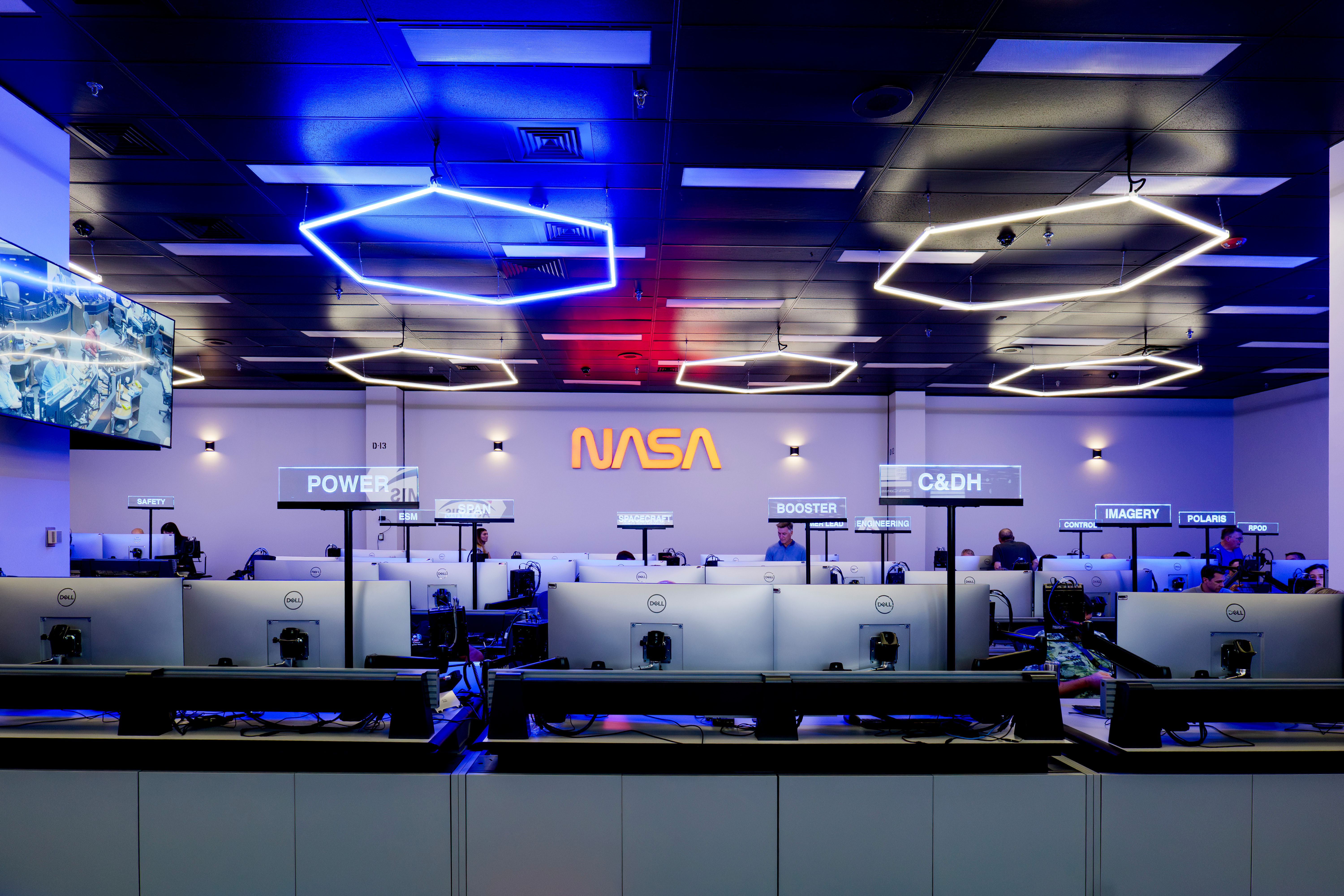
The new Orion Mission Evaluation Room inside the Mission Control Center at NASA’s Johnson Space Center in Houston.NASA/Rad SinyakThe Mission Evaluation Room team is made up of engineers from NASA, Lockheed Martin, ESA (European Space Agency), and Airbus who bring deep, expert knowledge of the spacecraft’s subsystems and functions to the mission. These functions are represented across 24 consoles, usually staffed by two engineers in their respective discipline, often hosting additional support personnel during planned dynamic phases of the mission or test objectives.
“The operations team is flying the spacecraft, but they are relying on the Mission Evaluation Room’s reachback engineering capability from the NASA, industry, and international Orion team that has designed, built, and tested this spacecraft.”Trey PerrymAn
Lead for Orion Mission and Integration Systems at NASA Johnson
Perryman guides the Artemis II Orion Mission Evaluation Room alongside Jen Madsen, deputy manager for Orion’s Avionics, Power, and Software.
With crew aboard, Orion will put more systems to the test, requiring more expertise to monitor new systems not previously flown. To support these needs, and safe, successful flights of Orion to the Moon, NASA officially opened the all-new facility in mission control to host the Orion Mission Evaluation Room on Aug. 15.
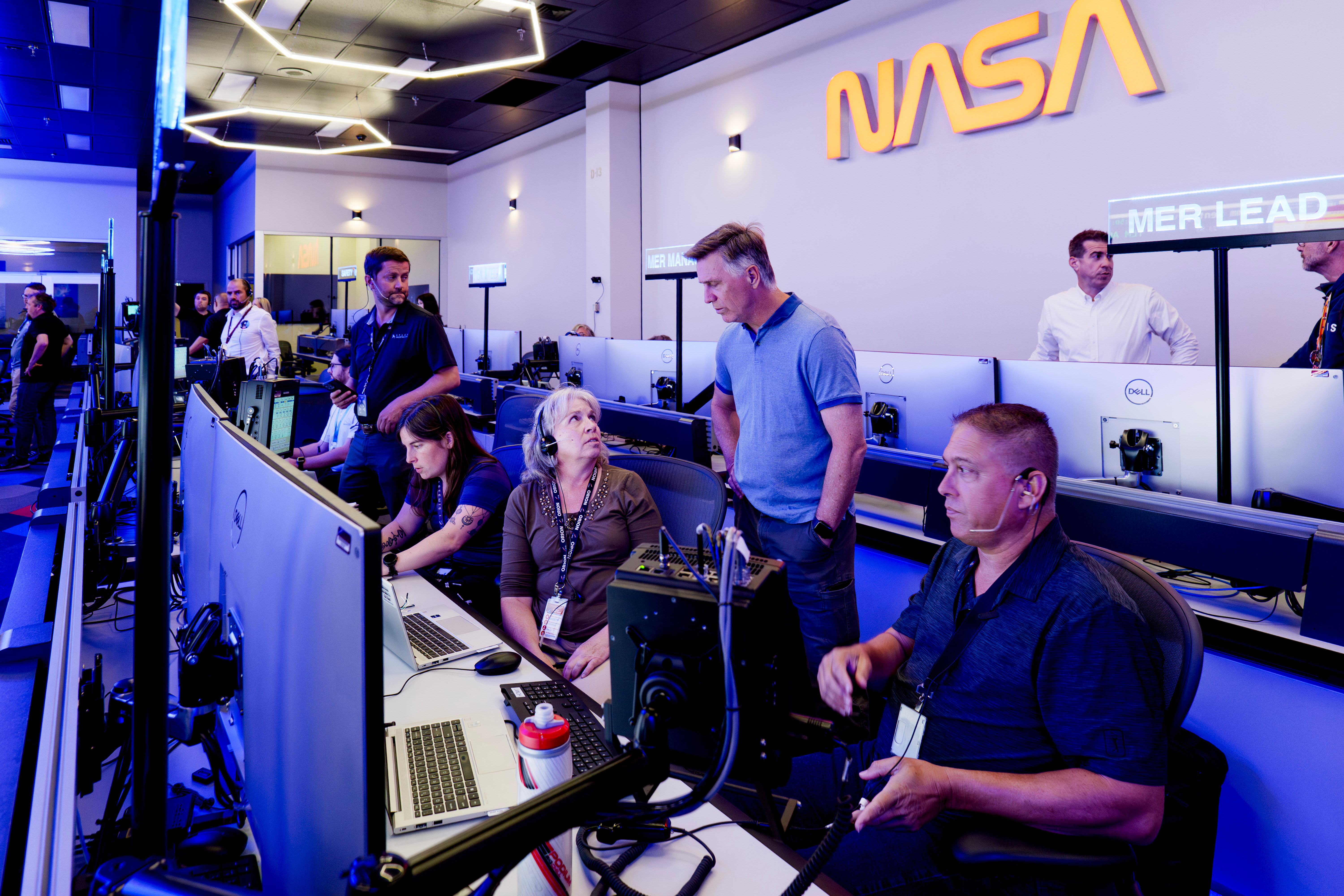
The Orion Mission Evaluation Room team works during an Artemis II mission simulation on Aug. 19, 2025, from the new space inside the Mission Control Center at NASA’s Johnson Space Center in Houston.NASA/Rad SinyakDuring Artemis II, the evaluation room will operate in three daily shifts, beginning about 48 hours prior to liftoff. The room is staffed around the clock throughout the nearly 10 day mission, up until the spacecraft has been safely secured inside the U.S. Navy ship that will recover it after splashdown.
Another key function of the evaluation room is collecting and analyzing the large amount of data Orion will produce during the flight, which will help inform the room’s team on the spacecraft’s performance.
“Data collection is hugely significant,” Perryman said. “We’ll do an analysis and assessment of all the data we’ve collected, and compare it against what we were expecting from the spacecraft. While a lot of that data comparison will take place during the mission, we’ll also do deeper analysis after the mission is over to see what we learned.”
The Orion Mission Evaluation Room team works during an Artemis II mission simulation on Aug. 19, 2025, from the new space inside the Mission Control Center at NASA’s Johnson Space Center in Houston.NASA/Rad SinyakIf unplanned situations arise during the mission, the Mission Evaluation Room has additional layers of ability to support any specific need that presents itself. This includes various engineering support from different NASA centers, Lockheed Martin’s Integrated Test Lab, ESA’s European Space Research and Technology Center, and more.
“It’s been amazing to have helped design and build Orion from the beginning – and now, we’ll be able to see the culmination of all those years of work in this new Mission Evaluation Room."Jen Madsen
Deputy Manager for Orion’s Avionics, Power, and Software
“We’ll see our spacecraft carrying our crew to the Moon on these screens and still be continuously learning about all of its capabilities,” said Madsen.
The Artemis II test flight will send NASA astronauts Reid Wiseman, Victor Glover, and Christina Koch, and CSA (Canadian Space Agency) astronaut Jeremy Hansen around the Moon and return them safely back home. This first crewed flight under NASA’s Artemis campaign will set the stage for NASA to return Americans to the lunar surface and help the agency and its commercial and international partners prepare for future human missions to Mars.
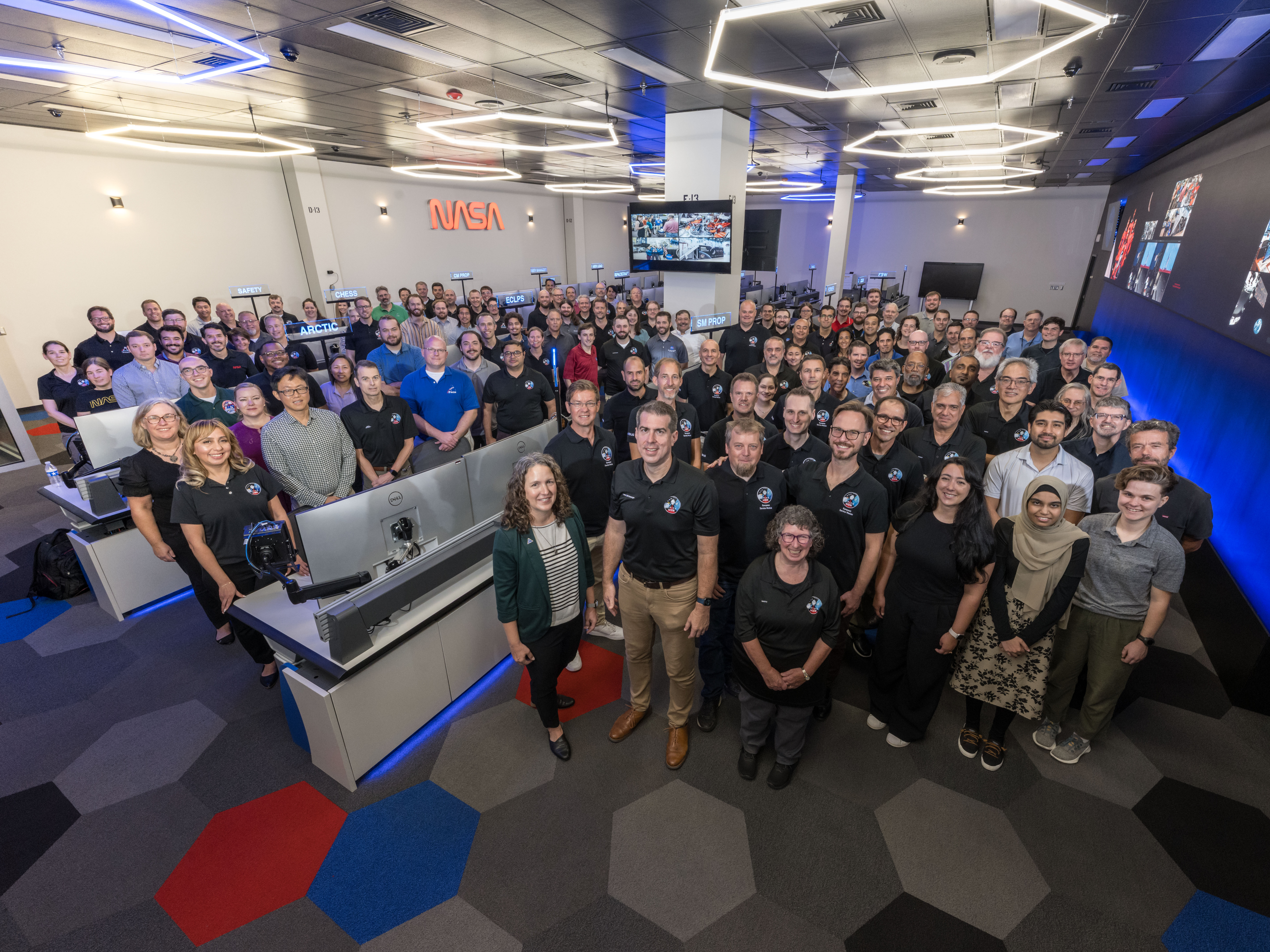
The Orion Mission Evaluation Room Team gathers for a group photo on Aug. 18, 2025.NASA/Josh Valcarcel Share Details Last Updated Aug 26, 2025 Related Terms Explore More 3 min read Lindy Garay: Supporting Space Station Safety and Success Article 2 days ago 3 min read NASA Shares Final Contenders for Artemis II Moon Mascot Design Contest Article 4 days ago 5 min read NASA’s Bennu Samples Reveal Complex Origins, Dramatic TransformationAsteroid Bennu, sampled by NASA’s OSIRIS-REx mission in 2020, is a mixture of dust that…
Article 4 days ago Keep Exploring Discover More Topics From NASAMissions
Humans in Space
Climate Change
Solar System
Reaching Out
This image released on Aug. 20, 2025, combines new radio data from the Australia Telescope Compact Array with X-ray data from NASA’s Chandra X-ray Observatory. Chandra first released an image of this pulsar and its surrounding hand-shaped nebula in 2009. The new data provides a fresh view of this exploded star and its environment, which could help scientists understand its peculiar properties and shape.
Image credit: X-ray: NASA/CXC/Univ. of Hong Kong/S. Zhang et al.; Radio: ATNF/CSIRO/ATCA; H-alpha: UK STFC/Royal Observatory Edinburgh; Image Processing: NASA/CXC/SAO/N. Wolk
NASA Test Deploys Roman Space Telescope Solar Panels, ‘Visor’
On Aug. 7 and 8, NASA’s Nancy Grace Roman Space Telescope team assessed the observatory’s solar panels and a visor-like sunshade called the deployable aperture cover — two components that will be stowed for launch and unfold in space. Engineers confirmed their successful operation during a closely monitored sequence in simulated space-like conditions. On the first day, Roman’s four outer solar panels were deployed one at a time, each unfolding over 30 seconds with 30-second pauses between them. The visor followed in a separate test the next day. These assessments help ensure Roman will perform as expected in space. Roman is slated to launch no later than May 2027, with the team working toward a potential early launch as soon as fall 2026.
Click here to learn more about Roman Share Details Last Updated Aug 26, 2025 EditorAshley BalzerContactAshley Balzerashley.m.balzer@nasa.gov Related TermsNASA Stennis Provides Ideal Setting for Range Operations
Think of NASA’s Stennis Space Center, and one likely thinks of rocket propulsion testing. The site has a long history of testing to support the nation’s space efforts, including the current Artemis program to send astronauts to the Moon to prepare for future human exploration of Mars.
However, NASA Stennis also is working to become a key supporter of more terrestrial exploration. Indeed, in terms of unmanned range operations, NASA Stennis has it all – layers of restricted airspace, a closed canal system, and acres upon acres of protected terrain.
Field TestU.S. Naval Research Laboratory personnel conduct a field experiment involving an unmanned aerial system at NASA Stennis in March 2024. (NASA/Danny Nowlin)NASA/Danny Nowlin Marine OperationU.S. Naval Research laboratory personnel conduct tests on The Blue Boat made by Blue Robotics, an unmanned surface vessel, at NOAA’s National Data Buoy Center basin at NASA Stennis on Dec. 19, 2024.NASA/Danny Nowlin Bird’s-Eye ViewAn unmanned aerial system provides a bird’s-eye view of an RS-25 on Feb. 22, 2024, on the Fred Haise Test Stand at NASA Stennis. NASAThe NASA site near Bay St. Louis, Mississippi, is an ideal location for all types of air, marine, and ground testing, said Range Operations Manager Jason Peterson. “My job is to understand the customer, and their requirements and limitations, to help them succeed,” he added. “What makes NASA Stennis unique is our federally protected area for users to operate.”
The need to learn about unmanned systems, such as drones or underwater vehicles, in a safe environment is growing as technology advances. Think of it like learning to drive a car in a parking lot before hitting the road.
NASA Stennis has already begun leveraging these capabilities. In 2024, the center established an agreement with Skydweller Aero Inc. to utilize restricted airspace for flight testing of autonomous, solar-powered aircraft. This first-of-its-kind agreement paves the way for future collaborations as NASA Stennis expands its customer-based operations beyond onsite tenants.
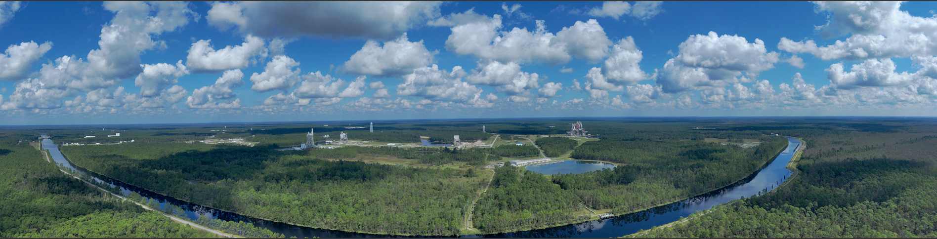
An unmanned aerial system provides a panoramic view of the NASA Stennis test complex and canal system. NASA Look to the SkyNASA Stennis has its own protected airspace, similar to how airports control the skies around them. The Federal Aviation Administration (FAA) first established this restricted airspace in 1966 and expanded it in 2016 to support both NASA missions and U.S. Department of Defense operations.
NASA Stennis is one of only two non-military restricted airspaces in the nation. It operates two main airspace zones – a propulsion testing area extending from ground level up to 12,000 feet for safely testing rocket engines without interfering with regular air traffic, and an aircraft operations zone covering 100 square miles up to 6,000 feet, with 15 dedicated acres for drone launch and recovery.
NASA Stennis staff provide comprehensive support including safety reviews, coordination between aircraft operators and FAA air traffic controllers, and constant communication with range safety personnel to ensure all operations are conducted safely.
Marine OperationsThe centerpiece of the NASA Stennis marine range is its extensive 7.5-mile canal system, protected by a lock-and-dam system that connects to Pearl River tributaries. This network accommodates various marine platforms including traditional watercraft, autonomous underwater vehicles, remotely operated vehicles, unmanned surface vessels, and aerial drones requiring water landing capabilities.
The controlled environment provides protection from adverse weather and interference, making it ideal for testing sensitive or proprietary technologies. The facility is particularly valuable for emerging technologies in autonomous systems, sensor integration, and multi-domain operations where air, surface, and underwater platforms operate in coordination.
Ground LevelNASA Stennis facilities are located on 13,800 acres of fenced-in property, surrounded by an additional 125,000 acres of protected land known as the acoustical buffer zone. This area was established primarily through permanent lease to allow testing of large rocket hardware without disturbing area residents and is closely monitored without permanent habitable structures.
“The location helps reduce hazards to the public when testing new technology,” Peterson said. “With supporting infrastructure for office space, storage, or manufacturing, this makes NASA Stennis a great place to test, train, operate, and even manufacture.”
The NASA Stennis federal city already hosts more than 50 federal, state, academic, public, and private aerospace, technology, and research organizations, with room for more. All tenants share operating costs while pursuing individual missions.
‘Open for Business’NASA Stennis leaders are keenly aware of the opportunity such unique capabilities afford. The center’s 2024-2028 strategic plan states NASA Stennis will leverage these unique capabilities to support testing and operation of uncrewed systems.
Leaders are working to identify opportunities to maximize site capabilities and develop an effective business model. “NASA Stennis is open for business, and we want to provide a user-friendly range for operators to test vehicles by creating an environment that is safe, cost-effective, and focused on mission success,” Peterson said.
For information about range operations at NASA’s Stennis Space Center, visit:
Range and Airspace Operations – NASA
For information about Stennis Space Center, visit:
https://www.nasa.gov/stennis
NASA Stennis Provides Ideal Setting for Range Operations
Think of NASA’s Stennis Space Center, and one likely thinks of rocket propulsion testing. The site has a long history of testing to support the nation’s space efforts, including the current Artemis program to send astronauts to the Moon to prepare for future human exploration of Mars.
However, NASA Stennis also is working to become a key supporter of more terrestrial exploration. Indeed, in terms of unmanned range operations, NASA Stennis has it all – layers of restricted airspace, a closed canal system, and acres upon acres of protected terrain.
Field TestU.S. Naval Research Laboratory personnel conduct a field experiment involving an unmanned aerial system at NASA Stennis in March 2024. (NASA/Danny Nowlin)NASA/Danny Nowlin Marine OperationU.S. Naval Research laboratory personnel conduct tests on The Blue Boat made by Blue Robotics, an unmanned surface vessel, at NOAA’s National Data Buoy Center basin at NASA Stennis on Dec. 19, 2024.NASA/Danny Nowlin Bird’s-Eye ViewAn unmanned aerial system provides a bird’s-eye view of an RS-25 on Feb. 22, 2024, on the Fred Haise Test Stand at NASA Stennis. NASAThe NASA site near Bay St. Louis, Mississippi, is an ideal location for all types of air, marine, and ground testing, said Range Operations Manager Jason Peterson. “My job is to understand the customer, and their requirements and limitations, to help them succeed,” he added. “What makes NASA Stennis unique is our federally protected area for users to operate.”
The need to learn about unmanned systems, such as drones or underwater vehicles, in a safe environment is growing as technology advances. Think of it like learning to drive a car in a parking lot before hitting the road.
NASA Stennis has already begun leveraging these capabilities. In 2024, the center established an agreement with Skydweller Aero Inc. to utilize restricted airspace for flight testing of autonomous, solar-powered aircraft. This first-of-its-kind agreement paves the way for future collaborations as NASA Stennis expands its customer-based operations beyond onsite tenants.
An unmanned aerial system provides a panoramic view of the NASA Stennis test complex and canal system. NASA Look to the SkyNASA Stennis has its own protected airspace, similar to how airports control the skies around them. The Federal Aviation Administration (FAA) first established this restricted airspace in 1966 and expanded it in 2016 to support both NASA missions and U.S. Department of Defense operations.
NASA Stennis is one of only two non-military restricted airspaces in the nation. It operates two main airspace zones – a propulsion testing area extending from ground level up to 12,000 feet for safely testing rocket engines without interfering with regular air traffic, and an aircraft operations zone covering 100 square miles up to 6,000 feet, with 15 dedicated acres for drone launch and recovery.
NASA Stennis staff provide comprehensive support including safety reviews, coordination between aircraft operators and FAA air traffic controllers, and constant communication with range safety personnel to ensure all operations are conducted safely.
Marine OperationsThe centerpiece of the NASA Stennis marine range is its extensive 7.5-mile canal system, protected by a lock-and-dam system that connects to Pearl River tributaries. This network accommodates various marine platforms including traditional watercraft, autonomous underwater vehicles, remotely operated vehicles, unmanned surface vessels, and aerial drones requiring water landing capabilities.
The controlled environment provides protection from adverse weather and interference, making it ideal for testing sensitive or proprietary technologies. The facility is particularly valuable for emerging technologies in autonomous systems, sensor integration, and multi-domain operations where air, surface, and underwater platforms operate in coordination.
Ground LevelNASA Stennis facilities are located on 13,800 acres of fenced-in property, surrounded by an additional 125,000 acres of protected land known as the acoustical buffer zone. This area was established primarily through permanent lease to allow testing of large rocket hardware without disturbing area residents and is closely monitored without permanent habitable structures.
“The location helps reduce hazards to the public when testing new technology,” Peterson said. “With supporting infrastructure for office space, storage, or manufacturing, this makes NASA Stennis a great place to test, train, operate, and even manufacture.”
The NASA Stennis federal city already hosts more than 50 federal, state, academic, public, and private aerospace, technology, and research organizations, with room for more. All tenants share operating costs while pursuing individual missions.
‘Open for Business’NASA Stennis leaders are keenly aware of the opportunity such unique capabilities afford. The center’s 2024-2028 strategic plan states NASA Stennis will leverage these unique capabilities to support testing and operation of uncrewed systems.
Leaders are working to identify opportunities to maximize site capabilities and develop an effective business model. “NASA Stennis is open for business, and we want to provide a user-friendly range for operators to test vehicles by creating an environment that is safe, cost-effective, and focused on mission success,” Peterson said.
For information about range operations at NASA’s Stennis Space Center, visit:
Range and Airspace Operations – NASA
For information about Stennis Space Center, visit:
https://www.nasa.gov/stennis
NASA Test Deploys Roman Space Telescope Solar Panels, ‘Visor’
On Aug. 7 and 8, NASA’s Nancy Grace Roman Space Telescope team assessed the observatory’s solar panels and a visor-like sunshade called the deployable aperture cover — two components that will be stowed for launch and unfold in space. Engineers confirmed their successful operation during a closely monitored sequence in simulated space-like conditions. On the first day, Roman’s four outer solar panels were deployed one at a time, each unfolding over 30 seconds with 30-second pauses between them. The visor followed in a separate test the next day. These assessments help ensure Roman will perform as expected in space. Roman is slated to launch no later than May 2027, with the team working toward a potential early launch as soon as fall 2026.
Click here to learn more about Roman Share Details Last Updated Aug 26, 2025 EditorAshley BalzerContactAshley Balzerashley.m.balzer@nasa.gov Related TermsCuriosity Blog, Sols 4638-4640: Imaging Extravaganza Atop a Ridge
- Curiosity Home
- Science
- News and Features
- Multimedia
- Mars Missions
- Mars Home
3 min read
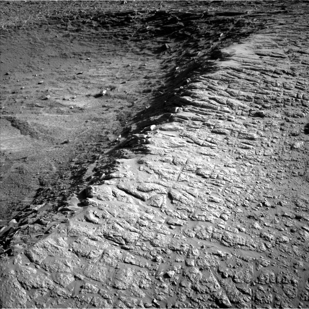
Curiosity Blog, Sols 4638-4640: Imaging Extravaganza Atop a Ridge NASA’s Mars rover Curiosity acquired this image on Aug. 21, 2025, looking across the ridge that the rover is currently parked near the edge of, looking down into the “Thumb” region that mission planners hope to be exploring next week. Curiosity captured this image using its Left Navigation Camera on Sol 4636, or Martian day 4,636 of the MArs Science Laboratory mission, at 16:09:13 UTC.NASA/JPL-CaltechWritten by Conor Hayes, Graduate Student at York University
Earth planning date: Friday, Aug. 22, 2025
Curiosity is continuing its winding path through the mysterious boxwork structures that have been a major focus of the last several months of the mission. After driving away from “Río Frío,” we are now parked on top of a ridge overlooking a topographic depression that we’ve nicknamed the “Thumb.” The image on this post shows that ridge running along the “thumb’s” edge. Our goal today is to characterize this ridge before we drive down into the Thumb.
Because we had a lot of power and three sols available to play around with, this weekend plan is packed with a lot of good science. The boxwork structures in our immediate vicinity get a lot of attention, with Mastcam images planned of the targets “Wallatiri,” “Wallatiri 2,” “Mojo,” “Samaipata,” “Fort Samaipata,” and “Río Lluta,” as well as a nearby trough. ChemCam will be taking LIBS measurements of both Samaipata and Fort Saaipata as well. Samaipata gets even more attention from MAHLI, in addition to the targets “Vitichi” and “Tartagalita,” both of which will also be observed by APXS.
The boxwork structures don’t get all of the fun today, though. In addition to all of the boxwork observations, Mastcam will be documenting the ChemCam AEGIS target from Monday’s plan, and will also be doing some more imaging of the “Mishe Mokwa” butte. The highlight of Mastcam’s work in this plan (at least in my opinion) is the large 44-image mosaic of the north crater rim, taking advantage of the particularly low dust content of the atmosphere at this time of year. ChemCam will be taking several RMI images of Mishe Mokwa and a distant outcrop at “Dragones” that we will be driving towards over the next several months, as well as the usual post-drive AEGIS.
Rounding out this plan is a collection of observations of the atmosphere. In addition to typical DAN, REMS, and RAD activities, Curiosity’s Navcams will be put to work with a dust-devil movie, dust-devil survey, five cloud movies, and two line-of-sight observations of the north crater rim. Mastcam also gets involved in the environmental fun with a tau to track the amount of dust in the air.
Even with all of these activities, we decided that we aren’t yet done with this area. The drive in today’s plan is a short bump of about 2 meters (about 6.6 feet), so we’re all looking forward to continuing our investigation of this ridge on Monday.
-
Want to read more posts from the Curiosity team?
-
Want to learn more about Curiosity’s science instruments?
Mars is the fourth planet from the Sun, and the seventh largest. It’s the only planet we know of inhabited…
All Mars ResourcesExplore this collection of Mars images, videos, resources, PDFs, and toolkits. Discover valuable content designed to inform, educate, and inspire,…
Rover BasicsEach robotic explorer sent to the Red Planet has its own unique capabilities driven by science. Many attributes of a…
Mars Exploration: Science GoalsThe key to understanding the past, present or future potential for life on Mars can be found in NASA’s four…
Curiosity Blog, Sols 4638-4640: Imaging Extravaganza Atop a Ridge
- Curiosity Home
- Science
- News and Features
- Multimedia
- Mars Missions
- Mars Home
3 min read
Curiosity Blog, Sols 4638-4640: Imaging Extravaganza Atop a Ridge NASA’s Mars rover Curiosity acquired this image on Aug. 21, 2025, looking across the ridge that the rover is currently parked near the edge of, looking down into the “Thumb” region that mission planners hope to be exploring next week. Curiosity captured this image using its Left Navigation Camera on Sol 4636, or Martian day 4,636 of the MArs Science Laboratory mission, at 16:09:13 UTC.NASA/JPL-CaltechWritten by Conor Hayes, Graduate Student at York University
Earth planning date: Friday, Aug. 22, 2025
Curiosity is continuing its winding path through the mysterious boxwork structures that have been a major focus of the last several months of the mission. After driving away from “Río Frío,” we are now parked on top of a ridge overlooking a topographic depression that we’ve nicknamed the “Thumb.” The image on this post shows that ridge running along the “thumb’s” edge. Our goal today is to characterize this ridge before we drive down into the Thumb.
Because we had a lot of power and three sols available to play around with, this weekend plan is packed with a lot of good science. The boxwork structures in our immediate vicinity get a lot of attention, with Mastcam images planned of the targets “Wallatiri,” “Wallatiri 2,” “Mojo,” “Samaipata,” “Fort Samaipata,” and “Río Lluta,” as well as a nearby trough. ChemCam will be taking LIBS measurements of both Samaipata and Fort Saaipata as well. Samaipata gets even more attention from MAHLI, in addition to the targets “Vitichi” and “Tartagalita,” both of which will also be observed by APXS.
The boxwork structures don’t get all of the fun today, though. In addition to all of the boxwork observations, Mastcam will be documenting the ChemCam AEGIS target from Monday’s plan, and will also be doing some more imaging of the “Mishe Mokwa” butte. The highlight of Mastcam’s work in this plan (at least in my opinion) is the large 44-image mosaic of the north crater rim, taking advantage of the particularly low dust content of the atmosphere at this time of year. ChemCam will be taking several RMI images of Mishe Mokwa and a distant outcrop at “Dragones” that we will be driving towards over the next several months, as well as the usual post-drive AEGIS.
Rounding out this plan is a collection of observations of the atmosphere. In addition to typical DAN, REMS, and RAD activities, Curiosity’s Navcams will be put to work with a dust-devil movie, dust-devil survey, five cloud movies, and two line-of-sight observations of the north crater rim. Mastcam also gets involved in the environmental fun with a tau to track the amount of dust in the air.
Even with all of these activities, we decided that we aren’t yet done with this area. The drive in today’s plan is a short bump of about 2 meters (about 6.6 feet), so we’re all looking forward to continuing our investigation of this ridge on Monday.
-
Want to read more posts from the Curiosity team?
-
Want to learn more about Curiosity’s science instruments?
Mars is the fourth planet from the Sun, and the seventh largest. It’s the only planet we know of inhabited…
All Mars ResourcesExplore this collection of Mars images, videos, resources, PDFs, and toolkits. Discover valuable content designed to inform, educate, and inspire,…
Rover BasicsEach robotic explorer sent to the Red Planet has its own unique capabilities driven by science. Many attributes of a…
Mars Exploration: Science GoalsThe key to understanding the past, present or future potential for life on Mars can be found in NASA’s four…
From NASA Citizen Scientist to Astronaut Training: An Interview with Benedetta Facini
Titans Space Industries, a commercial space company, selected a new cohort of astronaut candidates this spring – and among them is NASA citizen scientist, Benedetta Facini. She has participated in not one, but many NASA citizen science projects: Cloudspotting on Mars, Active Asteroids, Daily Minor Planet, GLOBE, Exoasteroids and International Astronomical Collaboration (IASC). We asked her a few questions about her work with NASA and her path to becoming an astronaut candidate.
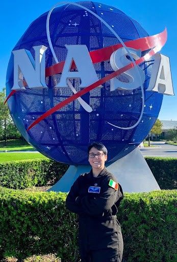
Benedetta Facini visiting Kennedy Space Center in 2023Credit: B.F.Q: How did you learn about NASA Citizen Science?
A: Through colleagues and social media, I often came across people talking about Citizen Science, and this immediately caught my curiosity. I did some online research on the subject, and I asked some colleagues already involved in it. Finally, I managed to find the way to participate by exploring the programs offered by NASA Citizen Science, which impressed me with their variety.
Q: What would you say you have gained from working on these NASA projects?
A: Curiosity in discovering new things and a lot of patience: many projects indeed require attention and, as mentioned, patience. I was pleased to discover that even NASA relies on “ordinary people” to carry out research, giving them the opportunity to learn new things using simple tools.
I also gained hands-on experience in analyzing real data and identifying celestial objects to contribute to real research efforts. My favorite part was to learn to recognize the pattern of clouds in data collected by the Mars Climate Sounder on the Mars Reconnaissance Orbiter.
I have learned the importance of international collaboration: I know many citizen scientists now, and interacting with them teaches me a lot every day.
Q. What do you do when you’re not working on citizen science?
A: I am a student and a science communicator. I share my knowledge and enthusiasm through social media, schools, webinars around the world, and space festivals across Italy where I have the opportunity to engage with a wide audience, from young students to adults.
Recently, I achieved a major milestone: I was selected as an Astronaut Candidate by the commercial space company, Titans Space Industries. I am thrilled to soon begin the basic training, which marks the first step toward realizing my dream of becoming an astronaut and contributing directly to human spaceflight and scientific research.
Q. What do you need to do to become an astronaut?
A: Gain as much experience as possible. During astronaut selection, not only academic achievements are evaluated, but also professional and personal experiences.
Every skill can be useful during the selection process: the ability to work in a team, which is essential during space missions; survival skills; experience as a diver, skydiver, or pilot; knowledge of other languages; and the ability to adapt to different situations.
I would also like to debunk a myth: you don’t need to be Einstein and fit as an Olympic level athlete; you just need to be good at what you do and be healthy.
Q: How has citizen science helped you with your career?
A: Citizen Science was very helpful for my career as a science communicator, as it gave me the opportunity to show people that anyone can contribute to the space sector. At the same time, it has allowed me to become a mentor and a point of reference for many students (mainly with the IASC project).
The hands-on experience I gained in analyzing real data was also very helpful for my academic career, too. I had never had real data to work with before, and this experience proved extremely valuable for the practical courses in my physics degree program.
Q. Do you have any advice you’d like to share for other citizen scientists or for people who want to become astronauts?
A: For other citizen scientists my advice is to stay curious and persistent.
Don’t be afraid to ask for help and interact with other colleagues because the goal of the NASA Citizen Science program is international collaboration and every small contribution can make a difference.
For aspiring astronauts, my advice is to gain as much experience as possible. Academic results are important but hands-on skills, teamwork, adaptability, and real experiences are also important.
Stay passionate and never lose your curiosity; the astronaut path is challenging; don’t give up after an eventual first rejection. You will always meet people trying to make you change your mind and your dream, even people from your family, but don’t stop in front of obstacles. The greatest regret is knowing you didn’t try to make your dream come true.
Quoting my inspiration, Italian astronaut Paolo Nespoli: “You need to have the ability and the courage to dream of impossible things. Everyone can dream of things that are possible. Dream of something impossible, one of those things that, when you say it out loud, people look at you and say: “Sure, study hard and you’ll make it,” but deep down no one really believes it. Those are the impossible things that are worth trying to do!”
Q: Thank you for sharing your story with us! Is there anything else you would like to add?
A: I would like to thank the team behind NASA Citizen Science.
These projects play a crucial role in keeping students’ passion for science alive and guiding them toward a potential career in this field.
Knowing that I have contributed to helping scientists is incredibly motivating and encourages me and students around the world to keep going, stay curious, and continue pursuing our path in the science field.
The opportunity to participate in these projects while learning is inspiring and it reinforces the idea that everyone, regardless of their background, can make a real impact in the scientific community.
Share Details Last Updated Aug 25, 2025 Related Terms Explore More 5 min read Astronomers Map Stellar ‘Polka Dots’ Using NASA’s TESS, Kepler Article 5 hours ago 9 min read Harmonized Landsat and Sentinel-2: Collaboration Drives Innovation Article 5 hours ago 2 min read Hubble Observes Noteworthy Nearby Spiral Galaxy Article 3 days agoFrom NASA Citizen Scientist to Astronaut Training: An Interview with Benedetta Facini
Titans Space Industries, a commercial space company, selected a new cohort of astronaut candidates this spring – and among them is NASA citizen scientist, Benedetta Facini. She has participated in not one, but many NASA citizen science projects: Cloudspotting on Mars, Active Asteroids, Daily Minor Planet, GLOBE, Exoasteroids and International Astronomical Collaboration (IASC). We asked her a few questions about her work with NASA and her path to becoming an astronaut candidate.
Benedetta Facini visiting Kennedy Space Center in 2023Credit: B.F.Q: How did you learn about NASA Citizen Science?
A: Through colleagues and social media, I often came across people talking about Citizen Science, and this immediately caught my curiosity. I did some online research on the subject, and I asked some colleagues already involved in it. Finally, I managed to find the way to participate by exploring the programs offered by NASA Citizen Science, which impressed me with their variety.
Q: What would you say you have gained from working on these NASA projects?
A: Curiosity in discovering new things and a lot of patience: many projects indeed require attention and, as mentioned, patience. I was pleased to discover that even NASA relies on “ordinary people” to carry out research, giving them the opportunity to learn new things using simple tools.
I also gained hands-on experience in analyzing real data and identifying celestial objects to contribute to real research efforts. My favorite part was to learn to recognize the pattern of clouds in data collected by the Mars Climate Sounder on the Mars Reconnaissance Orbiter.
I have learned the importance of international collaboration: I know many citizen scientists now, and interacting with them teaches me a lot every day.
Q. What do you do when you’re not working on citizen science?
A: I am a student and a science communicator. I share my knowledge and enthusiasm through social media, schools, webinars around the world, and space festivals across Italy where I have the opportunity to engage with a wide audience, from young students to adults.
Recently, I achieved a major milestone: I was selected as an Astronaut Candidate by the commercial space company, Titans Space Industries. I am thrilled to soon begin the basic training, which marks the first step toward realizing my dream of becoming an astronaut and contributing directly to human spaceflight and scientific research.
Q. What do you need to do to become an astronaut?
A: Gain as much experience as possible. During astronaut selection, not only academic achievements are evaluated, but also professional and personal experiences.
Every skill can be useful during the selection process: the ability to work in a team, which is essential during space missions; survival skills; experience as a diver, skydiver, or pilot; knowledge of other languages; and the ability to adapt to different situations.
I would also like to debunk a myth: you don’t need to be Einstein and fit as an Olympic level athlete; you just need to be good at what you do and be healthy.
Q: How has citizen science helped you with your career?
A: Citizen Science was very helpful for my career as a science communicator, as it gave me the opportunity to show people that anyone can contribute to the space sector. At the same time, it has allowed me to become a mentor and a point of reference for many students (mainly with the IASC project).
The hands-on experience I gained in analyzing real data was also very helpful for my academic career, too. I had never had real data to work with before, and this experience proved extremely valuable for the practical courses in my physics degree program.
Q. Do you have any advice you’d like to share for other citizen scientists or for people who want to become astronauts?
A: For other citizen scientists my advice is to stay curious and persistent.
Don’t be afraid to ask for help and interact with other colleagues because the goal of the NASA Citizen Science program is international collaboration and every small contribution can make a difference.
For aspiring astronauts, my advice is to gain as much experience as possible. Academic results are important but hands-on skills, teamwork, adaptability, and real experiences are also important.
Stay passionate and never lose your curiosity; the astronaut path is challenging; don’t give up after an eventual first rejection. You will always meet people trying to make you change your mind and your dream, even people from your family, but don’t stop in front of obstacles. The greatest regret is knowing you didn’t try to make your dream come true.
Quoting my inspiration, Italian astronaut Paolo Nespoli: “You need to have the ability and the courage to dream of impossible things. Everyone can dream of things that are possible. Dream of something impossible, one of those things that, when you say it out loud, people look at you and say: “Sure, study hard and you’ll make it,” but deep down no one really believes it. Those are the impossible things that are worth trying to do!”
Q: Thank you for sharing your story with us! Is there anything else you would like to add?
A: I would like to thank the team behind NASA Citizen Science.
These projects play a crucial role in keeping students’ passion for science alive and guiding them toward a potential career in this field.
Knowing that I have contributed to helping scientists is incredibly motivating and encourages me and students around the world to keep going, stay curious, and continue pursuing our path in the science field.
The opportunity to participate in these projects while learning is inspiring and it reinforces the idea that everyone, regardless of their background, can make a real impact in the scientific community.
Share Details Last Updated Aug 25, 2025 Related Terms Explore More 5 min read Astronomers Map Stellar ‘Polka Dots’ Using NASA’s TESS, Kepler Article 5 hours ago 9 min read Harmonized Landsat and Sentinel-2: Collaboration Drives Innovation Article 5 hours ago 2 min read Hubble Observes Noteworthy Nearby Spiral Galaxy Article 3 days agoNASA’s X-59 at Sunrise
NASA’s X-59 at Sunrise
NASA’s X-59 quiet supersonic research aircraft sits on the ramp at sunrise before ground tests at Lockheed Martin’s Skunk Works facility in Palmdale, California, on July 18, 2025. Following completion of low-speed taxi tests in July 2025 in Palmdale, California, medium- and high-speed taxi tests mark the final steps before the aircraft takes to the skies for the first time.
The X-59 is the centerpiece of NASA’s Quesst mission, which aims to demonstrate quiet supersonic flight by reducing the loud sonic boom to a quieter “thump.” Proving the X-plane’s airworthiness is the first step on the path to gathering data in support of the mission. The flight data will help inform U.S. and international regulators as they consider new noise standards for supersonic commercial flight over land.
Image Credit: Lockheed Martin Corporation
