
NASA
Mapping Perseverance’s Route With AI
NASA/JPL-Caltech/UofA Photojournal Navigation Downloads Mapping Perseverance’s Route With AI
PNG (1,003.24 KB)
Description
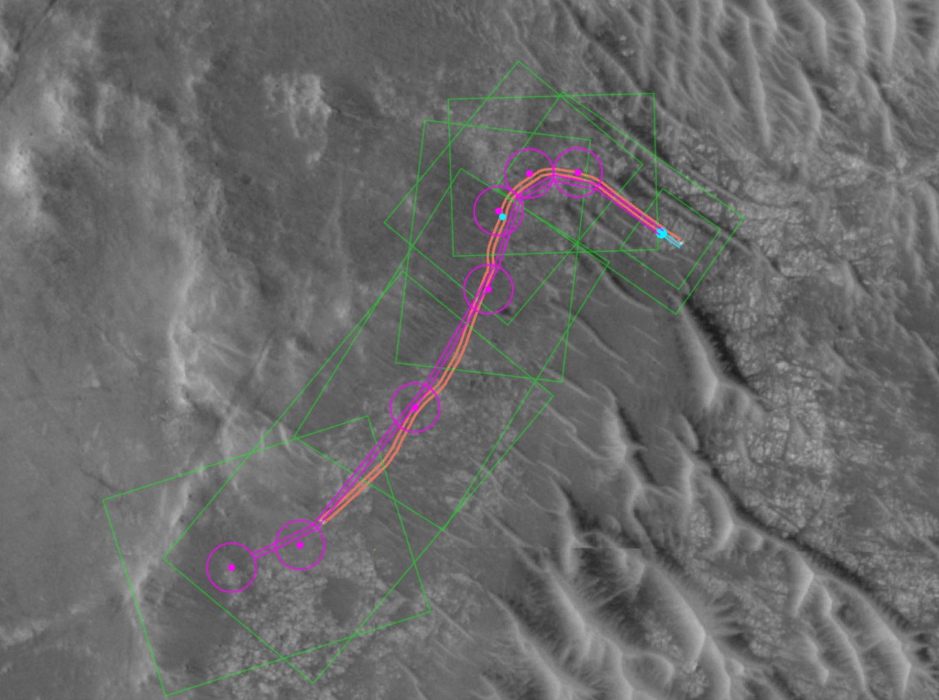
This annotated image from NASA’s HiRISE (High Resolution Imaging Science Experiment) camera aboard the agency’s Mars Reconnaissance Orbiter image depicts the AI-planned route and the actual route taken by NASA’s Perseverance Mars rover during its 807-foot (246-meter) drive on Dec. 10, 2025, the 1,709th Martian day, or sol, of the mission. The drive was the second of two demonstrations — the first being on Dec. 8 — showing that generative artificial intelligence could be incorporated in the rover’s route planning.
The magenta lines depict the path the rover’s wheels would take if it were to follow AI-processed waypoints, which are indicated with the magenta circles. (Waypoints are fixed locations where the rover takes up a new set of instructions.) The orange lines are based on data downlinked after the drive was complete and depict the actual path the rover took. The short, bold segments of the blue lines at the start of the route, in the upper right, show the portion of the drive that was determined by the mission’s rover drivers and based on imagery taken by the rover of the surface ahead. The surface areas in pale green boxes are called “keep-in zones.” Perseverance’s self-driving software is only allowed to pick routes inside those zones.
The graphic was generated using Hyperdrive, part of the software suite used to plan rover drives and manage the massive influx of engineering data from the Perseverance rover.
NASA’s Jet Propulsion Laboratory, which is managed for the agency by Caltech, built and manages operations of the Perseverance rover.
For more about Perseverance: science.nasa.gov/mission/mars-2020-perseverance/
The University of Arizona in Tucson, operates HiRISE, which was built by BAE Systems in Boulder, Colorado. JPL manages the Mars Reconnaissance Orbiter for SMD.
Keep Exploring Discover More Topics From Photojournal
Photojournal
Search Photojournal
Photojournal’s Latest Content
Feedback
NASA’s Commercial Satellite Data Acquisition Program Releases Archived and Tasked Multispectral Data from Satellogic
- CSDA
- Commercial Data
- CSDA Vendors
- Program Activities
- Pilot Research Projects
- FAQs
- News
3 min read
NASA’s Commercial Satellite Data Acquisition Program Releases Archived and Tasked Multispectral Data from Satellogic This image of an urban area outside of New Orleans, Louisiana, shows the high resolution available from Satellogic’s level 1D Orthorectified multispectral archive and tasked data product now available in the CSDA Program’s Satellite Data Explorer. Credit: CSDA“The mission of the CSDA Program is to identify, evaluate, and acquire data from commercial sources that support NASA’s Earth science research and application goals,” said CSDA Project Manager Dana Ostrenga. “The addition of this product from Satellogic to the SDX demonstrates the CSDA Program’s ongoing commitment to that mission, as well as to our objective of bringing high-quality, Earth observation data from NASA’s commercial partners to the Earth Science community.”
This Level 1D product, which is equivalent to a NASA-defined Level 1C data product, is derived from satellites in Satellogic’s NewSat constellation, each of which carries a multispectral camera offering four bands in visible (red, green, and blue) and near-infrared part of the electromagnetic spectrum. The product provides images covering 25,000 square kilometers (km2) of the Satellogic archive.
Researchers interested in accessing this data product in SDX can use their Earthdata Login for authentication and initiate data download requests. The product includes all associated metadata and documentation, and its use is governed by the United States government plus End User License Agreement (USG EULA)
About SDXThe SDX allows users to search, discover, and access a variety of Global Navigation Satellite System (GNSS), digital elevation model (DEM), synthetic aperture radar (SAR), multispectral, and precipitation radar data acquired through the CSDA program. It also provides streamlined data download, automated quota tracking, and a new coverage map that provides a high-level overview of the spatial coverage of the data discoverable through the SDX for any specified month and year. For a summary of the NASA commercial partner datasets available in SDX, visit the SDX website.
To order data from SDX, users must create an account with and be logged in to NASA Earthdata. (The initial attempt to use SDX will redirect users to Earthdata Login, where they will be prompted to enter their Earthdata credentials and accept the terms of the EULA.) Users must agree to the terms of the EULA before any data can be requested. Note: All data requests must be approved by CSDA data managers.
About the CSDA ProgramNASA’s Earth Science Division (ESD) established the CSDA Program to identify, evaluate, and acquire data from commercial providers that to support NASA’s Earth science research and applications. NASA recognizes the potential of commercial satellite constellations to advance Earth System Science and applications for societal benefit and believes commercially acquired data may also can augment the Earth observations acquired by NASA, and other U.S. government agencies, and NASA’s international partners.
All data from CSDA contract-awarded vendors are evaluated by the investigator-led CSDA project teams that assess the value of adding a vendor’s data to CSDA’s data holdings based on their quality and how they might benefit in the context of NASA Earth science research and applications. To learn more about the program, its commercial partners, data evaluation process, and more, visit the CSDA website.
Learning ResourcesFor more information on the CSDA Program’s SDX, see the SDX user guide.
Detailed information about the Level 1D products is available on the Satellogic website.
Share Details Last Updated Jan 30, 2026 Related Terms Explore More 3 min read Extreme January ColdFollowing a significant winter storm, frigid temperatures lingered in late January 2026 across a vast…
Article
15 hours ago
4 min read The West Faces Snow Drought
Very wet—but very warm—weather in the western U.S. has left many mountainous regions looking at…
Article
2 days ago
3 min read Students Across New England Contribute to Climate Science Through NASA’s GLOBE Green Down
In fall 2025, more than 50 educators and over 1,500 young people across Maine and…
Article
1 week ago
Keep Exploring Discover Related Topics
Missions
Humans in Space
Climate Change
Solar System
NASA’s Perseverance Rover Completes First AI-Planned Drive on Mars
NASA/JPL-Caltech
The team for the six-wheeled scientist used a vision-capable AI to create a safe route over the Red Planet’s surface without the input of human route planners.
NASA’s Perseverance Mars rover has completed the first drives on another world that were planned by artificial intelligence. Executed on Dec. 8 and 10, and led by the agency’s Jet Propulsion Laboratory in Southern California, the demonstration used generative AI to create waypoints for Perseverance, a complex decision-making task typically performed manually by the mission’s human rover planners.
“This demonstration shows how far our capabilities have advanced and broadens how we will explore other worlds,” said NASA Administrator Jared Isaacman. “Autonomous technologies like this can help missions to operate more efficiently, respond to challenging terrain, and increase science return as distance from Earth grows. It’s a strong example of teams applying new technology carefully and responsibly in real operations.”
During the demonstration, the team leveraged a type of generative AI called vision-language models to analyze existing data from JPL’s surface mission dataset. The AI used the same imagery and data that human planners rely on to generate waypoints — fixed locations where the rover takes up a new set of instructions — so that Perseverance could safely navigate the challenging Martian terrain.
The initiative was led out of JPL’s Rover Operations Center (ROC) in collaboration with Anthropic, using the company’s Claude AI models.
This animation was created using data acquired during Perseverance’s Dec. 10, 2025, drive on Jezero Crater’s rim. Pale blue lines depict the track the rover’s wheels take. Black lines snaking out in front of the rover show the path options the rover is considering. The white terrain is a height map based on rover data. The blue circle that appears near the end of the animation is a waypoint.NASA/JPL-Caltech Progress for Mars, beyond
Mars is on average about 140 million miles (225 million kilometers) away from Earth. This vast distance creates a significant communication lag, making real-time remote operation — or “joy-sticking” — of a rover impossible. Instead, for the past 28 years, over several missions, rover routes have been planned and executed by human “drivers,” who analyze the terrain and status data to sketch a route using waypoints, which are usually spaced no more than 330 feet (100 meters) apart to avoid any potential hazards. Then they send the plans via NASA’s Deep Space Network to the rover, which executes them.
But for Perseverance’s drives on the 1,707 and 1,709 Martian days, or sols, of the mission, the team did something different: Generative AI provided the analysis of the high-resolution orbital imagery from the HiRISE (High Resolution Imaging Science Experiment) camera aboard NASA’s Mars Reconnaissance Orbiter and terrain-slope data from digital elevation models. After identifying critical terrain features — bedrock, outcrops, hazardous boulder fields, sand ripples, and the like — it generated a continuous path complete with waypoints.
To ensure the AI’s instructions were fully compatible with the rover’s flight software, the engineering team also processed the drive commands through JPL’s “digital twin” (virtual replica of the rover), verifying over 500,000 telemetry variables before sending commands to Mars.
On Dec. 8, with generative AI waypoints in its memory, Perseverance drove 689 feet (210 meters). Two days later, it drove 807 feet (246 meters).
“The fundamental elements of generative AI are showing a lot of promise in streamlining the pillars of autonomous navigation for off-planet driving: perception (seeing the rocks and ripples), localization (knowing where we are), and planning and control (deciding and executing the safest path),” said Vandi Verma, a space roboticist at JPL and a member of the Perseverance engineering team. “We are moving towards a day where generative AI and other smart tools will help our surface rovers handle kilometer-scale drives while minimizing operator workload, and flag interesting surface features for our science team by scouring huge volumes of rover images.”
“Imagine intelligent systems not only on the ground at Earth, but also in edge applications in our rovers, helicopters, drones, and other surface elements trained with the collective wisdom of our NASA engineers, scientists, and astronauts,” said Matt Wallace, manager of JPL’s Exploration Systems Office. “That is the game-changing technology we need to establish the infrastructure and systems required for a permanent human presence on the Moon and take the U.S. to Mars and beyond.”
This annotated orbital image depicts the AI-planned (depicted in magenta) and actual (orange) routes the Perseverance Mars rover took during its Dec. 10, 2025, drive at Jezero Crater. The drive was the second of two demonstrations showing that generative AI could be incorporated into rover route planning.NASA/JPL-Caltech/UofA More about PerseveranceManaged for NASA by Caltech, JPL is home to the Rover Operations Center (ROC). It also manages operations of the Perseverance rover on behalf of the agency’s Science Mission Directorate as part of NASA’s Mars Exploration Program portfolio.
For more information on the ROC, visit:
News Media Contacts
DC Agle
Jet Propulsion Laboratory, Pasadena, Calif.
818-393-9011
agle@jpl.nasa.gov
Karen Fox / Molly Wasser
NASA Headquarters, Washington
202-358-1600
karen.c.fox@nasa.gov / molly.l.wasser@nasa.gov
2026-008
Explore More 2 min read NASA Honor Awards for Cold Atom Lab Team MembersNASA OUTSTANDING PUBLIC LEADERSHIP MEDAL Awarded for notable leadership accomplishments that have significantly influenced NASA’s…
Article 2 days ago 6 min read NASA-ISRO Radar Mission Peers Through Clouds to See Mississippi River Delta Article 3 days ago 5 min read Networks Keeping NASA’s Artemis II Mission Connected Article 5 days ago Keep Exploring Discover More Topics From NASA Mars 2020: Perseverance RoverNASA’s Mars Perseverance rover seeks signs of ancient life and collects samples of rock and regolith for possible Earth return.
Perseverance Rover Location MapNASA’s Perseverance rover landed in Jezero Crater, an area with an ancient delta, on Feb. 18, 2021. Scroll and pan…
Mars ExplorationMars is the only planet we know of inhabited entirely by robots. Learn more about the Mars Missions.
Mars: FactsMars is one of the most explored bodies in our solar system, and it’s the only planet where we’ve sent…
NASA’s Perseverance Rover Completes First AI-Planned Drive on Mars
NASA/JPL-Caltech
The team for the six-wheeled scientist used a vision-capable AI to create a safe route over the Red Planet’s surface without the input of human route planners.
NASA’s Perseverance Mars rover has completed the first drives on another world that were planned by artificial intelligence. Executed on Dec. 8 and 10, and led by the agency’s Jet Propulsion Laboratory in Southern California, the demonstration used generative AI to create waypoints for Perseverance, a complex decision-making task typically performed manually by the mission’s human rover planners.
“This demonstration shows how far our capabilities have advanced and broadens how we will explore other worlds,” said NASA Administrator Jared Isaacman. “Autonomous technologies like this can help missions to operate more efficiently, respond to challenging terrain, and increase science return as distance from Earth grows. It’s a strong example of teams applying new technology carefully and responsibly in real operations.”
During the demonstration, the team leveraged a type of generative AI called vision-language models to analyze existing data from JPL’s surface mission dataset. The AI used the same imagery and data that human planners rely on to generate waypoints — fixed locations where the rover takes up a new set of instructions — so that Perseverance could safely navigate the challenging Martian terrain.
The initiative was led out of JPL’s Rover Operations Center (ROC) in collaboration with Anthropic, using the company’s Claude AI models.
This animation was created using data acquired during Perseverance’s Dec. 10, 2025, drive on Jezero Crater’s rim. Pale blue lines depict the track the rover’s wheels take. Black lines snaking out in front of the rover show the path options the rover is considering. The white terrain is a height map based on rover data. The blue circle that appears near the end of the animation is a waypoint.NASA/JPL-Caltech Progress for Mars, beyond
Mars is on average about 140 million miles (225 million kilometers) away from Earth. This vast distance creates a significant communication lag, making real-time remote operation — or “joy-sticking” — of a rover impossible. Instead, for the past 28 years, over several missions, rover routes have been planned and executed by human “drivers,” who analyze the terrain and status data to sketch a route using waypoints, which are usually spaced no more than 330 feet (100 meters) apart to avoid any potential hazards. Then they send the plans via NASA’s Deep Space Network to the rover, which executes them.
But for Perseverance’s drives on the 1,707 and 1,709 Martian days, or sols, of the mission, the team did something different: Generative AI provided the analysis of the high-resolution orbital imagery from the HiRISE (High Resolution Imaging Science Experiment) camera aboard NASA’s Mars Reconnaissance Orbiter and terrain-slope data from digital elevation models. After identifying critical terrain features — bedrock, outcrops, hazardous boulder fields, sand ripples, and the like — it generated a continuous path complete with waypoints.
To ensure the AI’s instructions were fully compatible with the rover’s flight software, the engineering team also processed the drive commands through JPL’s “digital twin” (virtual replica of the rover), verifying over 500,000 telemetry variables before sending commands to Mars.
On Dec. 8, with generative AI waypoints in its memory, Perseverance drove 689 feet (210 meters). Two days later, it drove 807 feet (246 meters).
“The fundamental elements of generative AI are showing a lot of promise in streamlining the pillars of autonomous navigation for off-planet driving: perception (seeing the rocks and ripples), localization (knowing where we are), and planning and control (deciding and executing the safest path),” said Vandi Verma, a space roboticist at JPL and a member of the Perseverance engineering team. “We are moving towards a day where generative AI and other smart tools will help our surface rovers handle kilometer-scale drives while minimizing operator workload, and flag interesting surface features for our science team by scouring huge volumes of rover images.”
“Imagine intelligent systems not only on the ground at Earth, but also in edge applications in our rovers, helicopters, drones, and other surface elements trained with the collective wisdom of our NASA engineers, scientists, and astronauts,” said Matt Wallace, manager of JPL’s Exploration Systems Office. “That is the game-changing technology we need to establish the infrastructure and systems required for a permanent human presence on the Moon and take the U.S. to Mars and beyond.”
This annotated orbital image depicts the AI-planned (depicted in magenta) and actual (orange) routes the Perseverance Mars rover took during its Dec. 10, 2025, drive at Jezero Crater. The drive was the second of two demonstrations showing that generative AI could be incorporated into rover route planning.NASA/JPL-Caltech/UofA More about PerseveranceManaged for NASA by Caltech, JPL is home to the Rover Operations Center (ROC). It also manages operations of the Perseverance rover on behalf of the agency’s Science Mission Directorate as part of NASA’s Mars Exploration Program portfolio.
For more information on the ROC, visit:
News Media Contacts
DC Agle
Jet Propulsion Laboratory, Pasadena, Calif.
818-393-9011
agle@jpl.nasa.gov
Karen Fox / Molly Wasser
NASA Headquarters, Washington
202-358-1600
karen.c.fox@nasa.gov / molly.l.wasser@nasa.gov
2026-008
Explore More 2 min read NASA Honor Awards for Cold Atom Lab Team MembersNASA OUTSTANDING PUBLIC LEADERSHIP MEDAL Awarded for notable leadership accomplishments that have significantly influenced NASA’s…
Article 2 days ago 6 min read NASA-ISRO Radar Mission Peers Through Clouds to See Mississippi River Delta Article 3 days ago 5 min read Networks Keeping NASA’s Artemis II Mission Connected Article 4 days ago Keep Exploring Discover More Topics From NASA Mars 2020: Perseverance RoverNASA’s Mars Perseverance rover seeks signs of ancient life and collects samples of rock and regolith for possible Earth return.
Perseverance Rover Location MapNASA’s Perseverance rover landed in Jezero Crater, an area with an ancient delta, on Feb. 18, 2021. Scroll and pan…
Mars ExplorationMars is the only planet we know of inhabited entirely by robots. Learn more about the Mars Missions.
Mars: FactsMars is one of the most explored bodies in our solar system, and it’s the only planet where we’ve sent…
What’s Up: February 2026 Skywatching Tips from NASA
NASA’s Artemis II mission has its first opportunity to launch to the moon, Orion the Hunter takes center stage, and a planetary parade marches across the night sky.
Skywatching Highlights- Feb: Artemis II launch window opens.
- Feb: Orion the Hunter ideal viewing
- Mid-Late Feb: Planetary Parade
The Moon could have human visitors for the first time since 1972, the constellation Orion will be clear to see, and a planetary parade will sparkle across the skies.
That’s What’s Up, this February.
The Moon could have some visitors soon!
NASA’s Artemis II mission will send astronauts to fly around the Moon. The first opportunities for launch are this February.
This mission will pave the way for Artemis III, which will be the first time we’ve sent humans to the lunar surface since the final Apollo mission, Apollo 17, in 1972.
So this month, look up to the Moon shining bright in the night sky and there might be somebody looking back down at you.
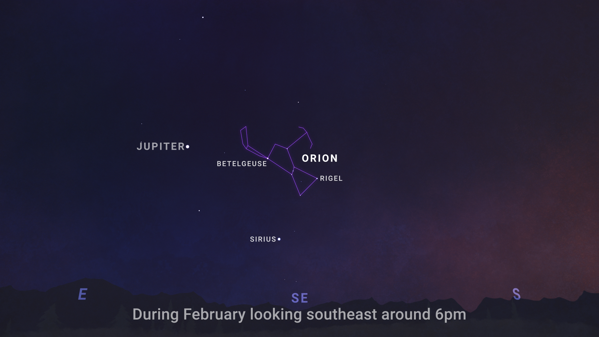
Can you spot Orion the Hunter in the night sky?
NASA/JPL-CaltechYou might be able to see the line of three stars that make up Orion’s Belt, but that belt is a part of a larger constellation called Orion, named for the hunter in Greek mythology.
Above Orion’s belt, the hunter’s right shoulder is actually Betelgeuse (or Alpha Orionis), one of the brightest stars in the night sky!
NASA/JPL-CaltechMost visible in the winter, February is one of the clearest times to see Orion in the sky.
From dusk through the night, look to the southern sky and try and spot the hunter for yourself.
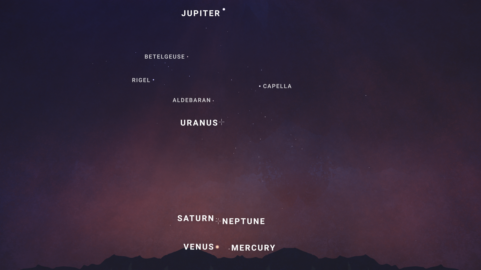
A planetary parade will march across the sky this month!
NASA/JPL-CaltechMid-February, Saturn will drop down toward the horizon as Venus and Mercury climb upward in the sky, meeting together in the west to southwestern sky.
Jupiter will find itself high in the sky.
And even Uranus, found in the southern sky, and Neptune, found nearby Saturn, will join the parade—though you’ll need binoculars or a telescope to spot these two far-off planets.
The planets will be visible soon after sunset throughout the month of February, but they’ll be lined up best toward the end of the month.
So, go outside and see how many planets you can find!
Here are the phases of the Moon for February.
NASA/JPL-CaltechYou can stay up to date on all of NASA’s missions exploring the solar system and beyond at science.nasa.gov.
I’m Chelsea Gohd from NASA’s Jet Propulsion Laboratory, and that’s What’s Up for this month.
Keep Exploring Discover More Topics From NASA
What’s Up
Skywatching
Galaxies
Stars
What’s Up: February 2026 Skywatching Tips from NASA
NASA’s Artemis II mission has its first opportunity to launch to the moon, Orion the Hunter takes center stage, and a planetary parade marches across the night sky.
Skywatching Highlights- Feb: Artemis II launch window opens.
- Feb: Orion the Hunter ideal viewing
- Mid-Late Feb: Planetary Parade
The Moon could have human visitors for the first time since 1972, the constellation Orion will be clear to see, and a planetary parade will sparkle across the skies.
That’s What’s Up, this February.
The Moon could have some visitors soon!
NASA’s Artemis II mission will send astronauts to fly around the Moon. The first opportunities for launch are this February.
This mission will pave the way for Artemis III, which will be the first time we’ve sent humans to the lunar surface since the final Apollo mission, Apollo 17, in 1972.
So this month, look up to the Moon shining bright in the night sky and there might be somebody looking back down at you.
Can you spot Orion the Hunter in the night sky?
NASA/JPL-CaltechYou might be able to see the line of three stars that make up Orion’s Belt, but that belt is a part of a larger constellation called Orion, named for the hunter in Greek mythology.
Above Orion’s belt, the hunter’s right shoulder is actually Betelgeuse (or Alpha Orionis), one of the brightest stars in the night sky!
NASA/JPL-CaltechMost visible in the winter, February is one of the clearest times to see Orion in the sky.
From dusk through the night, look to the southern sky and try and spot the hunter for yourself.
A planetary parade will march across the sky this month!
NASA/JPL-CaltechMid-February, Saturn will drop down toward the horizon as Venus and Mercury climb upward in the sky, meeting together in the west to southwestern sky.
Jupiter will find itself high in the sky.
And even Uranus, found in the southern sky, and Neptune, found nearby Saturn, will join the parade—though you’ll need binoculars or a telescope to spot these two far-off planets.
The planets will be visible soon after sunset throughout the month of February, but they’ll be lined up best toward the end of the month.
So, go outside and see how many planets you can find!
Here are the phases of the Moon for February.
NASA/JPL-CaltechYou can stay up to date on all of NASA’s missions exploring the solar system and beyond at science.nasa.gov.
I’m Chelsea Gohd from NASA’s Jet Propulsion Laboratory, and that’s What’s Up for this month.
Keep Exploring Discover More Topics From NASA
What’s Up
Skywatching
Galaxies
Stars
Preparing for Artemis II: Training for a Mission Around the Moon
Four astronauts will soon travel beyond low Earth orbit and fly around the Moon on Artemis II, a mission that will test NASA’s systems and hardware for human exploration of deep space.
Since June 2023, NASA astronauts Reid Wiseman, Victor Glover, Christina Koch, and CSA (Canadian Space Agency) astronaut Jeremy Hansen have been preparing for their lunar journey. The approximately 10-day mission will test the SLS (Space Launch System) rocket and Orion spacecraft, named Integrity by the crew, while requiring the quartet to operate with greater autonomy and make critical decisions far from Earth.
Training for Artemis II is all risk mitigation. By preparing the astronauts and flight controllers for what they might encounter, we enable mission success.Artemis II Chief Training Officer
Jacki Mahaffey
Unlike missions to the International Space Station, Artemis II offers no nearby safe harbor and no option to be back on Earth within hours of a problem. Training reflects that reality. Crews are prepared not just to follow procedures, but to understand spacecraft systems well enough to adapt when conditions change.
Training began with mission fundamentals, including how Orion and SLS systems function individually and together. From there, the crew progressed through phases of training that moved from routine on-orbit operations to more complex mission segments such as ascent, entry, and landing. Each phase builds on the last as the crew moves closer to flight.
In parallel, astronauts trained in medical operations, exercise systems, spacesuits, and daily life aboard Orion. Together, these elements form a single, integrated mission timeline.
Observing the Moon Through the Lens The Artemis II crew practices lunar photography at NASA’s Johnson Space Center in Houston.NASA/Kelsey YoungA key part of Artemis II training includes lunar observation and photography. At NASA’s Johnson Space Center in Houston, astronauts studied the Moon’s far side, learning to identify crater shapes, surface textures, color variations, and reflectivity.
Although Artemis II will not land on the Moon, the crew will conduct detailed observations from lunar orbit to prepare for future Artemis missions.
Flight Training at Ellington Field Artemis II crew members Reid Wiseman and Christina Koch during T-38F flight training at Ellington Field.NASA/Josh ValcarcelIn addition to classroom instruction and simulations, the Artemis II crew trains in T-38 jet aircraft at Johnson’s Ellington Field. The T-38 exposes astronauts to high-workload, dynamic flight conditions that build spatial awareness and adaptability, skills that translate directly to decision-making under pressure in spaceflight.
Protecting Crew Health in Deep Space The Artemis II crew don their Orion Crew Survival System spacesuits for post landing emergency egress inside the Orion Mockup at Johnson’s Space Vehicle Mockup Facility.NASA/James BlairThe crew donned their Orion Crew Survival System spacesuits during training to support testing of Orion’s environmental control and life support systems. The suit provides pressure, oxygen, and thermal protection during launch, entry, and contingency scenarios while Orion’s life support systems manage cabin oxygen, water, temperature, and overall crew health throughout the mission.
Mastering Orion Systems and Simulations Artemis II Commander Reid Wiseman (front) and Pilot Victor Glover participate in an Artemis II entry simulation at Johnson Space Center.NASA/Bill StaffordInside the Orion Mission Simulator at Johnson, the crew rehearsed every phase of the mission, from routine operations to emergency response. Simulations are designed to teach astronauts how to diagnose failures, manage competing priorities, and make decisions with delayed communication from Earth.
Through this process, the quartet learned every aspect of the Orion crew module’s interior, including how to navigate onboard displays and execute the procedures used to fly and monitor the spacecraft.
Science Preparation and Geology Training Artemis II Mission Specialist Christina Koch stands in a windswept volcanic field during geology training in Iceland, where volcanic terrain serves as an analog for lunar landscapes. NASA/Robert MarkowitzWhile Artemis II astronauts will not land on the Moon, the geology fundamentals they develop during field training in remote environments are critical to meeting the mission’s science objectives.
During the mission, the crew will examine a targeted set of surface features, including craters and regolith, from orbit. Astronauts will document variations in color, reflectivity, and texture to help scientists interpret geologic history.
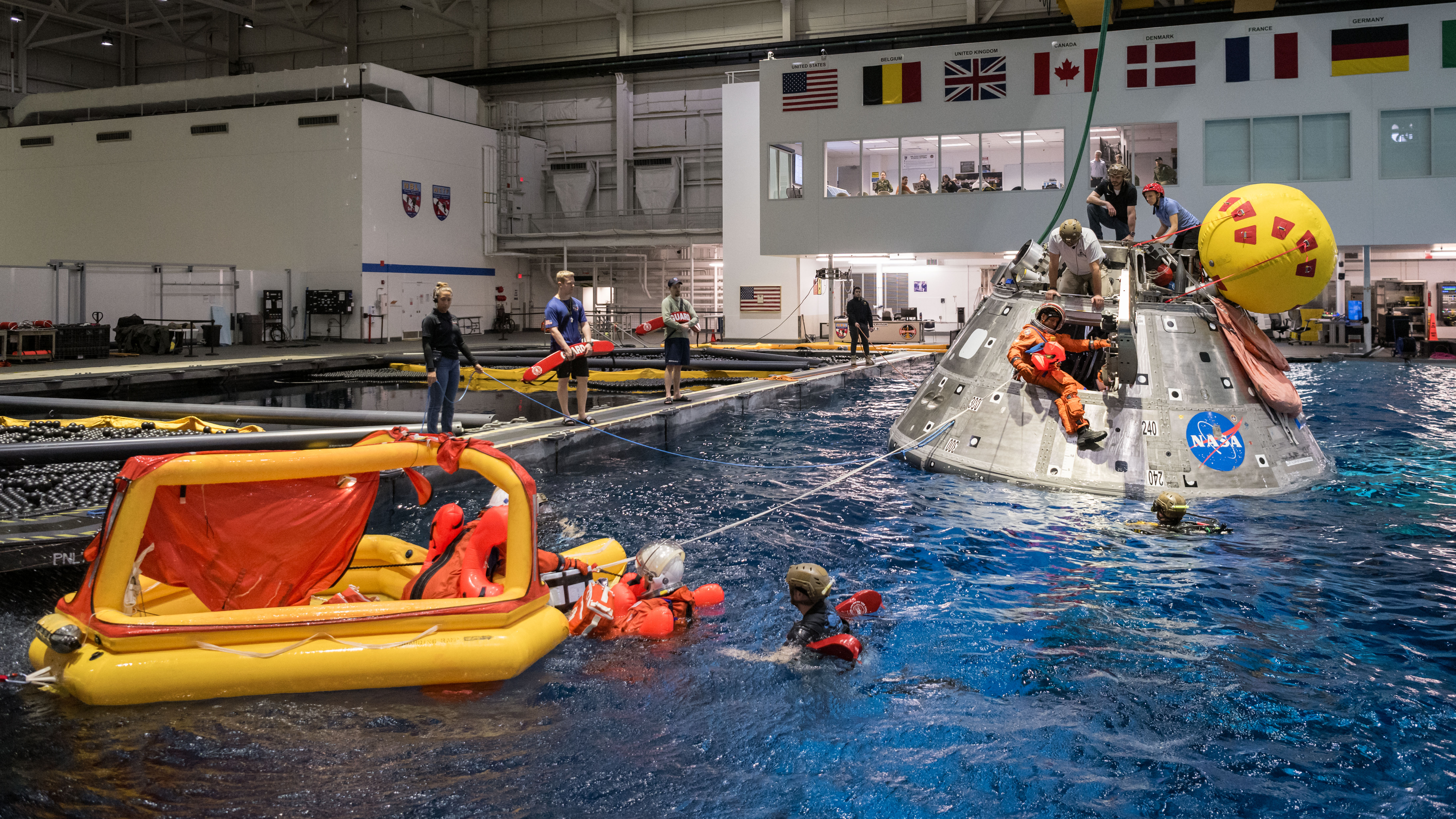
Preparing for Splashdown and Recovery The Artemis II astronauts during water survival recovery training at NASA’s Neutral Buoyancy Laboratory. NASA/Josh ValcarcelThe mission will conclude when the Artemis II mission splashes down.
The crew worked through splashdown and recovery operations at the agency’s Neutral Buoyancy Laboratory. They rehearsed how to exit the Orion spacecraft safely in different scenarios, stabilize the spacecraft, and board a raft – skills they will rely on after returning from their mission around the Moon.
The Crew is Go for Launch Artemis II crew members (left to right) Reid Wiseman, Victor Glover, Christina Koch, and Jeremy Hansen stand in the white room on the crew access arm of the mobile launcher at Launch Pad 39B at NASA’s Kennedy Space Center in Florida.NASA/Frank MichauxThe Artemis II crew also completed integrated ground systems tests at NASA’s Kennedy Space Center in Florida. These included suited tests, full mission rehearsals, and launch-day dry runs that walked astronauts through every step, from traveling to the launch pad to entering Orion at Launch Pad 39B.
As Artemis II moves closer to launch, the focus shifts from preparation to readiness as the crew enters the next era of exploration beyond low Earth orbit.
About the AuthorSumer Loggins Share Details Last Updated Jan 30, 2026 Related Terms Explore More 3 min read NASA Johnson Celebrates 25 Years in Space with Community Day Article 3 days ago 3 min read I Am Artemis: Doug Parkinson Article 3 days ago 5 min read Networks Keeping NASA’s Artemis II Mission Connected Article 5 days ago Keep Exploring Discover More Topics From NASAMissions
Humans in Space
Climate Change
Solar System
Preparing for Artemis II: Training for a Mission Around the Moon
Four astronauts will soon travel beyond low Earth orbit and fly around the Moon on Artemis II, a mission that will test NASA’s systems and hardware for human exploration of deep space.
Since June 2023, NASA astronauts Reid Wiseman, Victor Glover, Christina Koch, and CSA (Canadian Space Agency) astronaut Jeremy Hansen have been preparing for their lunar journey. The approximately 10-day mission will test the SLS (Space Launch System) rocket and Orion spacecraft, named Integrity by the crew, while requiring the quartet to operate with greater autonomy and make critical decisions far from Earth.
Training for Artemis II is all risk mitigation. By preparing the astronauts and flight controllers for what they might encounter, we enable mission success.Artemis II Chief Training Officer
Jacki Mahaffey
Unlike missions to the International Space Station, Artemis II offers no nearby safe harbor and no option to be back on Earth within hours of a problem. Training reflects that reality. Crews are prepared not just to follow procedures, but to understand spacecraft systems well enough to adapt when conditions change.
Training began with mission fundamentals, including how Orion and SLS systems function individually and together. From there, the crew progressed through phases of training that moved from routine on-orbit operations to more complex mission segments such as ascent, entry, and landing. Each phase builds on the last as the crew moves closer to flight.
In parallel, astronauts trained in medical operations, exercise systems, spacesuits, and daily life aboard Orion. Together, these elements form a single, integrated mission timeline.
Observing the Moon Through the Lens The Artemis II crew practices lunar photography at NASA’s Johnson Space Center in Houston.NASA/Kelsey YoungA key part of Artemis II training includes lunar observation and photography. At NASA’s Johnson Space Center in Houston, astronauts studied the Moon’s far side, learning to identify crater shapes, surface textures, color variations, and reflectivity.
Although Artemis II will not land on the Moon, the crew will conduct detailed observations from lunar orbit to prepare for future Artemis missions.
Flight Training at Ellington Field Artemis II crew members Reid Wiseman and Christina Koch during T-38F flight training at Ellington Field.NASA/Josh ValcarcelIn addition to classroom instruction and simulations, the Artemis II crew trains in T-38 jet aircraft at Johnson’s Ellington Field. The T-38 exposes astronauts to high-workload, dynamic flight conditions that build spatial awareness and adaptability, skills that translate directly to decision-making under pressure in spaceflight.
Protecting Crew Health in Deep Space The Artemis II crew don their Orion Crew Survival System spacesuits for post landing emergency egress inside the Orion Mockup at Johnson’s Space Vehicle Mockup Facility.NASA/James BlairThe crew donned their Orion Crew Survival System spacesuits during training to support testing of Orion’s environmental control and life support systems. The suit provides pressure, oxygen, and thermal protection during launch, entry, and contingency scenarios while Orion’s life support systems manage cabin oxygen, water, temperature, and overall crew health throughout the mission.
Mastering Orion Systems and Simulations Artemis II Commander Reid Wiseman (front) and Pilot Victor Glover participate in an Artemis II entry simulation at Johnson Space Center.NASA/Bill StaffordInside the Orion Mission Simulator at Johnson, the crew rehearsed every phase of the mission, from routine operations to emergency response. Simulations are designed to teach astronauts how to diagnose failures, manage competing priorities, and make decisions with delayed communication from Earth.
Through this process, the quartet learned every aspect of the Orion crew module’s interior, including how to navigate onboard displays and execute the procedures used to fly and monitor the spacecraft.
Science Preparation and Geology Training Artemis II Mission Specialist Christina Koch stands in a windswept volcanic field during geology training in Iceland, where volcanic terrain serves as an analog for lunar landscapes. NASA/Robert MarkowitzWhile Artemis II astronauts will not land on the Moon, the geology fundamentals they develop during field training in remote environments are critical to meeting the mission’s science objectives.
During the mission, the crew will examine a targeted set of surface features, including craters and regolith, from orbit. Astronauts will document variations in color, reflectivity, and texture to help scientists interpret geologic history.
Preparing for Splashdown and Recovery The Artemis II astronauts during water survival recovery training at NASA’s Neutral Buoyancy Laboratory. NASA/Josh ValcarcelThe mission will conclude when the Artemis II mission splashes down.
The crew worked through splashdown and recovery operations at the agency’s Neutral Buoyancy Laboratory. They rehearsed how to exit the Orion spacecraft safely in different scenarios, stabilize the spacecraft, and board a raft – skills they will rely on after returning from their mission around the Moon.
The Crew is Go for Launch Artemis II crew members (left to right) Reid Wiseman, Victor Glover, Christina Koch, and Jeremy Hansen stand in the white room on the crew access arm of the mobile launcher at Launch Pad 39B at NASA’s Kennedy Space Center in Florida.NASA/Frank MichauxThe Artemis II crew also completed integrated ground systems tests at NASA’s Kennedy Space Center in Florida. These included suited tests, full mission rehearsals, and launch-day dry runs that walked astronauts through every step, from traveling to the launch pad to entering Orion at Launch Pad 39B.
As Artemis II moves closer to launch, the focus shifts from preparation to readiness as the crew enters the next era of exploration beyond low Earth orbit.
About the AuthorSumer Loggins Share Details Last Updated Jan 30, 2026 Related Terms Explore More 3 min read NASA Johnson Celebrates 25 Years in Space with Community Day Article 3 days ago 3 min read I Am Artemis: Doug Parkinson Article 3 days ago 5 min read Networks Keeping NASA’s Artemis II Mission Connected Article 4 days ago Keep Exploring Discover More Topics From NASAMissions
Humans in Space
Climate Change
Solar System
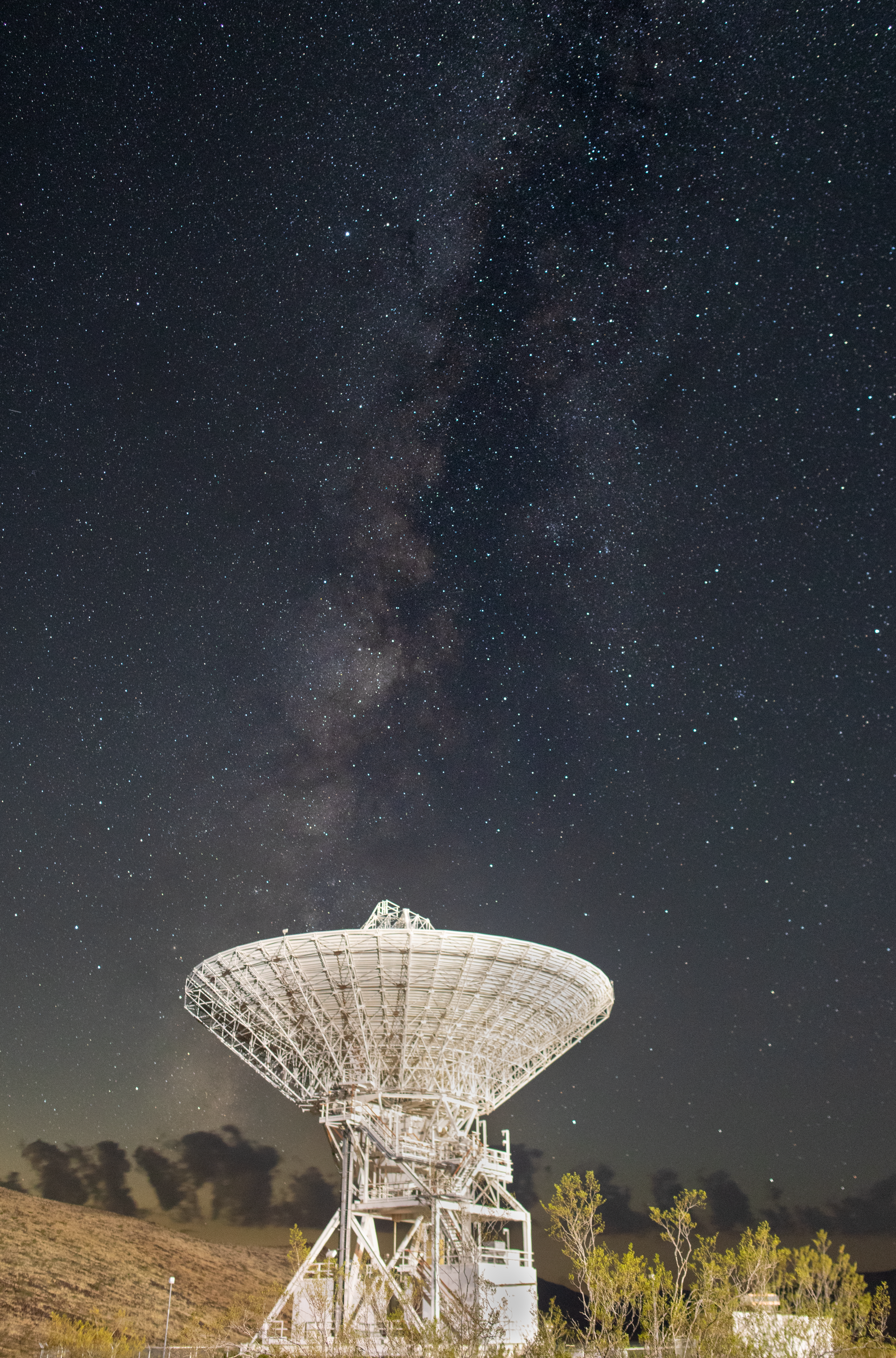
Goldstone’s DSS-15 Antenna and the Milky Way
Deep Space Station 15, one of the 112-foot antennas at the Goldstone Deep Space Communications Complex near Barstow, California, looks skyward, with the stars of the Milky Way overhead, in September 2025. Goldstone is part of NASA’s Deep Space Network (DSN), which operates three complexes around the globe that support communications with dozens of deep space missions.
The DSN is NASA’s international array of giant radio antennas that supports interplanetary spacecraft missions, plus a few that orbit Earth. The DSN also provides radar and radio astronomy observations that improve our understanding of the solar system and the larger universe.
Through Artemis, NASA is establishing an enduring presence in space and exploring more of the Moon than ever before. To achieve this, Artemis missions rely on both the Deep Space Network and the Near Space Network. These networks, with oversight by NASA’s SCaN (Space Communications and Navigation) Program office, use global infrastructure and relay satellites to ensure seamless communications and tracking as Orion launches, orbits Earth, travels to the Moon, and returns home.
Image credit: NASA/JPL-Caltech
Goldstone’s DSS-15 Antenna and the Milky Way
Artemis II Recovery Training
Off the coast of California, NASA’s Artemis Landing and Recovery team and the Department of War that will work together to retrieve the Artemis II crew and Orion spacecraft following their return to Earth and splashdown in the Pacific Ocean are performing a final simulation of their activities, called a just-in-time training, at sea on Tuesday, Jan. 27, 2026. During the training, teams use the Crew Module Test Article, a full-scale mockup of the Orion spacecraft, to simulate as close as possible the conditions they can expect to encounter during splashdown of the Artemis II mission. NASA’s first crewed test flight in the Artemis campaign, the approximately 10-day Artemis II mission will send NASA astronauts Reid Wiseman, Victor Glover, and Christina Koch, and CSA (Canadian Space Agency) astronaut Jeremy Hansen around the Moon and farther than any humans have ever been from Earth.
Image credit: NASA/Kenny Allen
U.S.-India NISAR Satellite Images Mississippi River Delta Region
NASA/JPL-Caltech Photojournal Navigation Downloads U.S.-India NISAR Satellite Images Mississippi River Delta Region
PNG (80.09 MB)
PIA26620 Figure A
JPEG (440.47 MB)
Description
The NISAR (NASA-ISRO Synthetic Aperture Radar) Earth-observing satellite’s L-band synthetic aperture radar (SAR) instrument captured this image of the Mississippi River Delta region in southeastern Louisiana on Nov. 29, 2025.
The colors in the image represent varying types of cover, which tend to reflect microwaves from the radar differently. Portions of New Orleans appear green, a sign that the radar’s signals may be scattering from buildings that are oriented at different angles relative to the satellite’s orbit. Parts of the city appear magenta where streets that run parallel to the satellite’s flight track cause the signals to bounce strongly and brightly off buildings and back to the instrument.
The resolution of the image is fine enough to make clear, right of center, the Lake Pontchartrain Causeway — twin bridges that, at nearly 24 miles (39 kilometers) in length, make up the world’s longest continuous bridge over water.
The bright green areas to the west of the Mississippi River, which snakes from Baton Rouge in the upper left to New Orleans in the lower right, are healthy forests. There, tree canopies and other vegetation are causing NISAR’s microwaves to bounce in numerous directions before returning to the satellite. Meanwhile, the yellow-and-magenta-speckled hues of Maurepas Swamp, directly west of Lake Pontchartrain and the smaller Lake Maurepas, indicate that the tree populations in that wetland forest ecosystem have thinned.
On either bank of the Mississippi, the image shows parcels of varying shapes, sizes, and cover. Darker areas suggest fallow farm plots, while bright magenta indicates that tall plants, such as crops, may be present.
Figure AFigure A is a version of the same image with labels, locator inset, scale, or compass.
The L-band system uses a 9-inch (24-centimeter) wavelength that enables its signal to penetrate forest canopies and measure soil moisture as well as motion of ice surfaces and land down to fractions of an inch — the latter information being key to understanding how the land surface moves before, during, and after earthquakes, volcanic eruptions, and landslides.
The S-band radar, provided by the Indian Space Research Organisation’s Space Applications Centre, uses a 4-inch (10-centimeter) microwave signal that’s more sensitive to small vegetation, which makes it effective at monitoring certain types of agriculture and grassland ecosystems.
Launched in July 2025, NISAR is collecting data that will benefit humanity by helping researchers around the world better understand changes in our planet’s surface, including its ice sheets, glaciers, and sea ice. It also will capture changes in forest and wetland ecosystems and track movement and deformation of our planet’s crust by phenomena such as earthquakes, landslides, and volcanic activity. The global and rapid coverage from NISAR will provide unprecedented support for disaster response, producing data to assist in mitigating and assessing damage, with observations before and after catastrophic events available in short time frames.
Find more information about NISAR here: https://science.nasa.gov/mission/nisar/
Keep Exploring Discover More Topics From Photojournal
Photojournal
Search Photojournal
Photojournal’s Latest Content
Feedback
Ammonia-Bearing Compounds Discovered at Surface of Jupiter’s Moon Europa
NASA/JPL-Caltech Photojournal Navigation Downloads Ammonia-Bearing Compounds Discovered at Surface of Jupiter’s Moon Europa
PNG (4.09 MB)
Description
Advanced analysis of decades-old data from NASA’s Galileo spacecraft identifies ammonia-bearing compounds discovered on the surface of Jupiter’s moon Europa, as shown in this composite image. Zooming in on an area about 250 miles (about 400 kilometers) wide, the black-and-white mosaic to the right is composed of multiple images from Galileo’s Solid-State Imaging camera. Overlaid are representations of data from the spacecraft’s Near-Infrared Mapping Spectrometer (NIMS) instrument: Red pixels mark locations where ammonia-bearing compounds were detected; purple pixels indicate no detections of the compounds. The NIMS data was captured during Galileo’s 11th orbit of Jupiter in 1997.
Dark, crisscrossing bands in the underlying image represent fracturing of Europa’s icy surface. Detection of ammonia-bearing compounds near such features could indicate that they were actively placed there by cryo-volcanic processes bringing liquid water up from Europa’s vast subsurface ocean.
Launched in 1989 and managed by the agency’s Jet Propulsion Laboratory in Southern California, NASA’s Galileo mission concluded its extended mission to the Jupiter system in September 2003. Caltech manages JPL for NASA.
Keep Exploring Discover More Topics From Photojournal
Photojournal
Search Photojournal
Photojournal’s Latest Content
Feedback
NASA Analysis Shows La Niña Limited Sea Level Rise in 2025
NASA/JPL-Caltech Photojournal Navigation Downloads NASA Analysis Shows La Niña Limited Sea Level Rise in 2025
PNG (2.39 MB)
Description
This graph shows the rise in global mean sea level from 1993 to 2025 based on data from a series of five international satellites. The solid red line indicates the trajectory of this increase, which has more than doubled over the three decades. The dotted red line projects future sea level rise.
A NASA analysis found that the average height of Earth’s oceans increased by 0.03 inches (0.08 centimeters) in 2025, a rate of increase that was lower than the 0.23 inches (0.59 centimeters) seen in 2024. It was also below the long-term expected rate of 0.17 inches (0.44 centimeters) per year based on the rate of rise since the early 1990s.
Though sea levels have increasingly trended upward, years during which the rise in the average height was less usually have occurred during La Niñas — the part of the El Niño-Southern Oscillation cycle that cools the eastern Pacific Ocean, often leading to heavy rainfall over the equatorial portions of South America.
The La Niña that started in 2025 and has extended into early 2026 has been relatively mild. Even so, the extra precipitation it has poured on the Amazon River basin contributed to an overall shift of water from ocean to land. This effect tends to temporarily lower sea levels, offsetting the rise caused by melting glaciers and ice sheets and warming of the oceans, which raises the sea levels through the expansion of water when the temperature increases. The net result in 2025 was a lower-than-average sea level rise. Faster-rising sea levels are likely to resume as the extra water in the Amazon basin makes its way to the oceans.
Researchers at NASA’s Jet Propulsion Laboratory in Southern California conducted the analysis based on more than 30 years of satellite observations, starting with the U.S.-French TOPEX/Poseidon mission, which launched in 1992, through the Sentinel-6 Michael Freilich mission, which launched in November 2020 and is the current reference satellite for sea level measurements. Sentinel-6B, which launched in November 2025, will take over for its predecessor after a cross-calibration period.
Photojournal
Search Photojournal
Photojournal’s Latest Content
Feedback
