
Feed aggregator
NASA-ISRO Satellite Sends First Radar Images of Earth’s Surface
The NISAR (NASA-ISRO Synthetic Aperture Radar) Earth-observing radar satellite’s first images of our planet’s surface are in, and they offer a glimpse of things to come as the joint mission between NASA and ISRO (Indian Space Research Organisation) approaches full science operations later this year.
“Launched under President Trump in conjunction with India, NISAR’s first images are a testament to what can be achieved when we unite around a shared vision of innovation and discovery,” said acting NASA Administrator Sean Duffy. “This is only the beginning. NASA will continue to build upon the incredible scientific advancements of the past and present as we pursue our goal to maintain our nation’s space dominance through Gold Standard Science.”
Images from the spacecraft, which was launched by ISRO on July 30, display the level of detail with which NISAR scans Earth to provide unique, actionable information to decision-makers in a diverse range of areas, including disaster response, infrastructure monitoring, and agricultural management.
“By understanding how our home planet works, we can produce models and analysis of how other planets in our solar system and beyond work as we prepare to send humanity on an epic journey back to the Moon and onward to Mars,” said NASA Associate Administrator Amit Kshatriya. “The successful capture of these first images from NISAR is a remarkable example of how partnership and collaboration between two nations, on opposite sides of the world, can achieve great things together for the benefit of all.”
On Aug. 21, the satellite’s L-band synthetic aperture radar (SAR) system, which was provided by NASA’s Jet Propulsion Laboratory in Southern California, captured Mount Desert Island on the Maine coast. Dark areas represent water, while green areas are forest, and magenta areas are hard or regular surfaces, such as bare ground and buildings. The L-band radar system can resolve objects as small as 15 feet (5 meters), enabling the image to display narrow waterways cutting across the island, as well as the islets dotting the waters around it.
Then, on Aug. 23, the L-band SAR captured data of a portion of northeastern North Dakota straddling Grand Forks and Walsh counties. The image shows forests and wetlands on the banks of the Forest River passing through the center of the frame from west to east and farmland to the north and south. The dark agricultural plots show fallow fields, while the lighter colors represent the presence of pasture or crops, such as soybean and corn. Circular patterns indicate the use of center-pivot irrigation.
On Aug. 23, NISAR imaged land adjacent to northeastern North Dakota’s Forest River. Light-colored wetlands and forests line the river’s banks, while circular and rectangular plots throughout the image appear in shades that indicate the land may be pasture or cropland with corn or soy.Credit: NASA/JPL-Caltech
The images demonstrate how the L-band SAR can discern what type of land cover — low-lying vegetation, trees, and human structures — is present in each area. This capability is vital both for monitoring the gain and loss of forest and wetland ecosystems, as well as for tracking the progress of crops through growing seasons around the world.
“These initial images are just a preview of the hard-hitting science that NISAR will produce — data and insights that will enable scientists to study Earth’s changing land and ice surfaces in unprecedented detail while equipping decision-makers to respond to natural disasters and other challenges,” said Nicky Fox, associate administrator, Science Mission Directorate at NASA Headquarters in Washington. “They are also a testament to the years of hard work of hundreds of scientists and engineers from both sides of the world to build an observatory with the most advanced radar system ever launched by NASA and ISRO.”
The L-band system uses a 10-inch (25-centimeter) wavelength that enables its signal to penetrate forest canopies and measure soil moisture and motion of ice surfaces and land down to fractions of an inch, which is a key measurement in understanding how the land surface moves before, during, and after earthquakes, volcanic eruptions, and landslides.
The preliminary L-band images are an example of what the mission team will be able to produce when the science phase begins in November. The satellite was raised into its operational 464-mile (747-kilometer) orbit in mid-September.
The NISAR mission also includes an S-band radar, provided by ISRO’s Space Applications Centre, that uses a 4-inch (10-centimeter) microwave signal that is more sensitive to small vegetation, making it effective at monitoring certain types of agriculture and grassland ecosystems.
The spacecraft is the first to carry both L- and S-band radars. The satellite will monitor Earth’s land and ice surfaces twice every 12 days, collecting data using the spacecraft’s drum-shaped antenna reflector, which measures 39 feet (12 meters) wide — the largest NASA has ever sent into space.
The NISAR mission is a partnership between NASA and ISRO spanning years of technical and programmatic collaboration. The successful launch and deployment of NISAR builds on a strong heritage of cooperation between the United States and India in space.
The Space Applications Centre provided the mission’s S-band SAR. The U R Rao Satellite Centre provided the spacecraft bus. The launch vehicle was provided by Vikram Sarabhai Space Centre, and launch services were through Satish Dhawan Space Centre. Key operations, including boom and radar antenna reflector deployment, are now being executed and monitored by the ISRO Telemetry, Tracking and Command Network’s global system of ground stations.
Managed by Caltech in Pasadena, NASA JPL leads the U.S. component of the project. In addition to the L-band SAR, reflector, and boom, JPL also provided the high-rate communication subsystem for science data, a solid-state data recorder, and payload data subsystem. NASA’s Goddard Space Flight Center in Greenbelt, Maryland, manages the Near Space Network, which receives NISAR’s L-band data.
To learn more about NISAR, visit:
-end-
Liz Vlock
Headquarters, Washington
202-358-1600
elizabeth.a.vlock@nasa.gov
Andrew Wang / Jane J. Lee
Jet Propulsion Laboratory, Pasadena, Calif.
626-379-6874 / 818-354-0307
andrew.wang@jpl.nasa.gov / jane.j.lee@jpl.nasa.gov
NASA-ISRO Satellite Sends First Radar Images of Earth’s Surface
The NISAR (NASA-ISRO Synthetic Aperture Radar) Earth-observing radar satellite’s first images of our planet’s surface are in, and they offer a glimpse of things to come as the joint mission between NASA and ISRO (Indian Space Research Organisation) approaches full science operations later this year.
“Launched under President Trump in conjunction with India, NISAR’s first images are a testament to what can be achieved when we unite around a shared vision of innovation and discovery,” said acting NASA Administrator Sean Duffy. “This is only the beginning. NASA will continue to build upon the incredible scientific advancements of the past and present as we pursue our goal to maintain our nation’s space dominance through Gold Standard Science.”
Images from the spacecraft, which was launched by ISRO on July 30, display the level of detail with which NISAR scans Earth to provide unique, actionable information to decision-makers in a diverse range of areas, including disaster response, infrastructure monitoring, and agricultural management.
“By understanding how our home planet works, we can produce models and analysis of how other planets in our solar system and beyond work as we prepare to send humanity on an epic journey back to the Moon and onward to Mars,” said NASA Associate Administrator Amit Kshatriya. “The successful capture of these first images from NISAR is a remarkable example of how partnership and collaboration between two nations, on opposite sides of the world, can achieve great things together for the benefit of all.”
On Aug. 21, the satellite’s L-band synthetic aperture radar (SAR) system, which was provided by NASA’s Jet Propulsion Laboratory in Southern California, captured Mount Desert Island on the Maine coast. Dark areas represent water, while green areas are forest, and magenta areas are hard or regular surfaces, such as bare ground and buildings. The L-band radar system can resolve objects as small as 15 feet (5 meters), enabling the image to display narrow waterways cutting across the island, as well as the islets dotting the waters around it.
Then, on Aug. 23, the L-band SAR captured data of a portion of northeastern North Dakota straddling Grand Forks and Walsh counties. The image shows forests and wetlands on the banks of the Forest River passing through the center of the frame from west to east and farmland to the north and south. The dark agricultural plots show fallow fields, while the lighter colors represent the presence of pasture or crops, such as soybean and corn. Circular patterns indicate the use of center-pivot irrigation.
On Aug. 23, NISAR imaged land adjacent to northeastern North Dakota’s Forest River. Light-colored wetlands and forests line the river’s banks, while circular and rectangular plots throughout the image appear in shades that indicate the land may be pasture or cropland with corn or soy.Credit: NASA/JPL-CaltechThe images demonstrate how the L-band SAR can discern what type of land cover — low-lying vegetation, trees, and human structures — is present in each area. This capability is vital both for monitoring the gain and loss of forest and wetland ecosystems, as well as for tracking the progress of crops through growing seasons around the world.
“These initial images are just a preview of the hard-hitting science that NISAR will produce — data and insights that will enable scientists to study Earth’s changing land and ice surfaces in unprecedented detail while equipping decision-makers to respond to natural disasters and other challenges,” said Nicky Fox, associate administrator, Science Mission Directorate at NASA Headquarters in Washington. “They are also a testament to the years of hard work of hundreds of scientists and engineers from both sides of the world to build an observatory with the most advanced radar system ever launched by NASA and ISRO.”
The L-band system uses a 10-inch (25-centimeter) wavelength that enables its signal to penetrate forest canopies and measure soil moisture and motion of ice surfaces and land down to fractions of an inch, which is a key measurement in understanding how the land surface moves before, during, and after earthquakes, volcanic eruptions, and landslides.
The preliminary L-band images are an example of what the mission team will be able to produce when the science phase begins in November. The satellite was raised into its operational 464-mile (747-kilometer) orbit in mid-September.
The NISAR mission also includes an S-band radar, provided by ISRO’s Space Applications Centre, that uses a 4-inch (10-centimeter) microwave signal that is more sensitive to small vegetation, making it effective at monitoring certain types of agriculture and grassland ecosystems.
The spacecraft is the first to carry both L- and S-band radars. The satellite will monitor Earth’s land and ice surfaces twice every 12 days, collecting data using the spacecraft’s drum-shaped antenna reflector, which measures 39 feet (12 meters) wide — the largest NASA has ever sent into space.
The NISAR mission is a partnership between NASA and ISRO spanning years of technical and programmatic collaboration. The successful launch and deployment of NISAR builds on a strong heritage of cooperation between the United States and India in space.
The Space Applications Centre provided the mission’s S-band SAR. The U R Rao Satellite Centre provided the spacecraft bus. The launch vehicle was provided by Vikram Sarabhai Space Centre, and launch services were through Satish Dhawan Space Centre. Key operations, including boom and radar antenna reflector deployment, are now being executed and monitored by the ISRO Telemetry, Tracking and Command Network’s global system of ground stations.
Managed by Caltech in Pasadena, NASA JPL leads the U.S. component of the project. In addition to the L-band SAR, reflector, and boom, JPL also provided the high-rate communication subsystem for science data, a solid-state data recorder, and payload data subsystem. NASA’s Goddard Space Flight Center in Greenbelt, Maryland, manages the Near Space Network, which receives NISAR’s L-band data.
To learn more about NISAR, visit:
-end-
Liz Vlock
Headquarters, Washington
202-358-1600
elizabeth.a.vlock@nasa.gov
Andrew Wang / Jane J. Lee
Jet Propulsion Laboratory, Pasadena, Calif.
626-379-6874 / 818-354-0307
andrew.wang@jpl.nasa.gov / jane.j.lee@jpl.nasa.gov
Punch Cards, Pipeline Problems, and the Future of Women in Computing
Carla Brodley, founding executive director of the Center for Inclusive Computing at Northeastern University, explains how to make computer science education more accessible to everyone
NASA & STEM Learning Ecosystems: Opportunities & Benefits for Everyone
2 min read
NASA & STEM Learning Ecosystems: Opportunities & Benefits for EveryoneSTEM learning ecosystems are intentionally designed, community-wide partnerships that enable all Americans to actively participate in science, technology, engineering, and math (STEM) throughout their lifetimes. Lifelong STEM learning helps people build critical knowledge and skills, access economic opportunities, drive innovation, and make informed decisions in a changing world. STEM learning ecosystems draw on expertise and resources to provide access to these benefits for the entire community.
NASA’s Science Activation (SciAct) program, a competitively-selected network of collaborative projects that connect NASA science with people of all ages and backgrounds, includes new and growing STEM learning ecosystems in American communities from Alaska to Maine and creates free, high-quality resources that educators across the country can use to share the excitement of Earth and space science.
To further support connections among STEM learning ecosystems and NASA, the SciAct STEM Ecosystems project held a meeting in Saint Paul, Minnesota on August 4-6, 2025. Approximately 100 educators, evaluators, subject matter experts, and other STEM learning facilitators from around the nation participated to share approaches, learn about resources, and build relationships. The gathering offered an opportunity to connect NASA SciAct teams with each other and with external networks and learning ecosystems for mutual benefit.
Meeting goals included sharing ways to create effective partnerships and engage learners in Earth and space science, discovering NASA resources and assets to use in STEM education efforts, and strengthening connections among participants. To accomplish these goals, meeting activities included plenaries, breakout sessions, and networking opportunities.
Led by Arizona State University, the SciAct STEM Ecosystems project is a collaboration among several regional partnerships/SciAct project teams: Arctic and Earth SIGNs, Learning Ecosystems Northeast, Rural Activation and Innovation Network, and the Smoky Mountains STEM Collaborative. The project also partners with the National Informal STEM Education Network to create professional resources.
For those who were unable to attend in person, the STEM Ecosystems project makes a variety of resources available online: https://www.nisenet.org/stem-learning-ecosystems.
SciAct STEM Ecosystems is supported by NASA under cooperative agreement award number 80NSSC21M0007 and is part of NASA’s Science Activation Portfolio. Learn more about how Science Activation connects NASA science experts, real content, and experiences with community leaders to do science in ways that activate minds and promote deeper understanding of our world and beyond: https://science.nasa.gov/learn/about-science-activation/.
Meeting participants took advantage of opportunities to network and strengthen their relationships. Emily Maletz/NISE Network Share Details Last Updated Sep 25, 2025 Editor NASA Science Editorial Team Related Terms Explore More 3 min read Educators Incorporate Locally-Relevant NASA Earth Data to Build Data Literacy in the Classroom
Article
6 days ago
4 min read NASA Interns Apply NASA data to Real-World Problems to Advance Space Research and Aerospace Innovation
Article
1 week ago
5 min read Connecting Educators with NASA Data: Learning Ecosystems Northeast in Action
Article
1 week ago
Keep Exploring Discover More Topics From NASA James Webb Space Telescope
Webb is the premier observatory of the next decade, serving thousands of astronomers worldwide. It studies every phase in the…
Perseverance Rover
This rover and its aerial sidekick were assigned to study the geology of Mars and seek signs of ancient microbial…
Parker Solar Probe
On a mission to “touch the Sun,” NASA’s Parker Solar Probe became the first spacecraft to fly through the corona…
Juno
NASA’s Juno spacecraft entered orbit around Jupiter in 2016, the first explorer to peer below the planet’s dense clouds to…
NASA & STEM Learning Ecosystems: Opportunities & Benefits for Everyone
2 min read
NASA & STEM Learning Ecosystems: Opportunities & Benefits for EveryoneSTEM learning ecosystems are intentionally designed, community-wide partnerships that enable all Americans to actively participate in science, technology, engineering, and math (STEM) throughout their lifetimes. Lifelong STEM learning helps people build critical knowledge and skills, access economic opportunities, drive innovation, and make informed decisions in a changing world. STEM learning ecosystems draw on expertise and resources to provide access to these benefits for the entire community.
NASA’s Science Activation (SciAct) program, a competitively-selected network of collaborative projects that connect NASA science with people of all ages and backgrounds, includes new and growing STEM learning ecosystems in American communities from Alaska to Maine and creates free, high-quality resources that educators across the country can use to share the excitement of Earth and space science.
To further support connections among STEM learning ecosystems and NASA, the SciAct STEM Ecosystems project held a meeting in Saint Paul, Minnesota on August 4-6, 2025. Approximately 100 educators, evaluators, subject matter experts, and other STEM learning facilitators from around the nation participated to share approaches, learn about resources, and build relationships. The gathering offered an opportunity to connect NASA SciAct teams with each other and with external networks and learning ecosystems for mutual benefit.
Meeting goals included sharing ways to create effective partnerships and engage learners in Earth and space science, discovering NASA resources and assets to use in STEM education efforts, and strengthening connections among participants. To accomplish these goals, meeting activities included plenaries, breakout sessions, and networking opportunities.
Led by Arizona State University, the SciAct STEM Ecosystems project is a collaboration among several regional partnerships/SciAct project teams: Arctic and Earth SIGNs, Learning Ecosystems Northeast, Rural Activation and Innovation Network, and the Smoky Mountains STEM Collaborative. The project also partners with the National Informal STEM Education Network to create professional resources.
For those who were unable to attend in person, the STEM Ecosystems project makes a variety of resources available online: https://www.nisenet.org/stem-learning-ecosystems.
SciAct STEM Ecosystems is supported by NASA under cooperative agreement award number 80NSSC21M0007 and is part of NASA’s Science Activation Portfolio. Learn more about how Science Activation connects NASA science experts, real content, and experiences with community leaders to do science in ways that activate minds and promote deeper understanding of our world and beyond: https://science.nasa.gov/learn/about-science-activation/.
Meeting participants took advantage of opportunities to network and strengthen their relationships. Emily Maletz/NISE Network Share Details Last Updated Sep 25, 2025 Editor NASA Science Editorial Team Related Terms Explore More 3 min read Educators Incorporate Locally-Relevant NASA Earth Data to Build Data Literacy in the ClassroomArticle
6 days ago
4 min read NASA Interns Apply NASA data to Real-World Problems to Advance Space Research and Aerospace Innovation
Article
1 week ago
5 min read Connecting Educators with NASA Data: Learning Ecosystems Northeast in Action
Article
1 week ago
Keep Exploring Discover More Topics From NASA James Webb Space Telescope
Webb is the premier observatory of the next decade, serving thousands of astronomers worldwide. It studies every phase in the…
Perseverance Rover
This rover and its aerial sidekick were assigned to study the geology of Mars and seek signs of ancient microbial…
Parker Solar Probe
On a mission to “touch the Sun,” NASA’s Parker Solar Probe became the first spacecraft to fly through the corona…
Juno
NASA’s Juno spacecraft entered orbit around Jupiter in 2016, the first explorer to peer below the planet’s dense clouds to…
NASA Astronaut Chris Williams to Discuss Upcoming Launch, Mission
NASA will host a news conference at 2 p.m. EDT Wednesday, Oct. 1, from the agency’s Johnson Space Center in Houston to highlight the upcoming mission of astronaut Chris Williams to the International Space Station.
The news conference will stream live on NASA’s website and YouTube channel. Learn how to watch NASA content through a variety of platforms, including social media.
The Soyuz MS-28 spacecraft, targeted to launch Nov. 27 from the Baikonur Cosmodrome in Kazakhstan, will carry Williams on his first flight, as well as Sergey Kud-Sverchkov and Sergey Mikaev of Roscosmos, to the space station for an eight-month mission as part of Expeditions 73/74.
Media interested in participating must contact the newsroom at NASA Johnson no later than 5 p.m., Monday, Sept. 29, at 281-483-5111 or jsccommu@mail.nasa.gov. A copy of NASA’s media accreditation policy is online. Media interested in participating by phone must contact the Johnson newsroom by 10 a.m. the day of the event.
Selected as a candidate in 2021, Williams graduated with the 23rd astronaut class in 2024. He began training for his first space station flight assignment immediately after completing initial astronaut candidate training.
Williams was born in New York City, and considers Potomac, Maryland, his hometown. He holds a bachelor’s degree in physics from Stanford University in California and a doctorate in physics from the Massachusetts Institute of Technology in Cambridge, where his research focused on astrophysics. Williams completed medical physics residency training at Harvard Medical School in Boston. He was working as a clinical physicist and researcher at the Brigham and Women’s Hospital in Boston when he was selected as an astronaut candidate.
The International Space Station is a convergence of science, technology, and human innovation enabling research not possible on Earth. For nearly 25 years, NASA has supported a continuous U.S. human presence aboard the orbiting laboratory, where astronauts have learned to live and work in space for extended periods of time. The space station is a springboard for developing a low Earth economy and NASA’s next great leaps in human exploration at the Moon under the Artemis campaign and Mars.
Learn more about the International Space Station:
https://www.nasa.gov/international-space-station
-end-
Jimi Russell / Joshua Finch
Headquarters, Washington
202-358-1100
james.j.russell@nasa.gov / joshua.a.finch@nasa.gov
Shaneequa Vereen
Johnson Space Center, Houston
281-483-5111
shaneequa.y.vereen@nasa.gov
Nanoparticles may be the secret ingredient in making ultimate plastics
Nanoparticles may be the secret ingredient in making ultimate plastics
NASA Glenn Reinforces Role in Aerospace Innovation During Ohio Space Week
Ohio Space Week, Sept. 8–13, highlighted the state’s aerospace legacy and the role NASA’s Glenn Research Center has in advancing space technology.
The week kicked off with the American Astronautical Society’s Glenn Space Technology Symposium, Sept. 8–10, hosted by Case Western Reserve University. Experts, students, and industry leaders gathered to discuss emerging space technologies. NASA Glenn Director Dr. Jimmy Kenyon delivered opening remarks, and astronaut Doug “Wheels” Wheelock gave a keynote on his spaceflight experience.
On Sept. 11, Team NEO hosted the Sixth Annual Ohio Space Forum at NASA Glenn, bringing together leaders from aerospace, government, academia, and research. The forum spotlighted Ohio’s leadership in space innovation, including advances in nuclear electric and nuclear thermal propulsion. Key participants included NASA Associate Administrator Amit Kshatriya, astronaut Sunita “Suni” Williams, several local and state officials, and other community partners. 3News Chief Meteorologist Betsy Kling emceed the event.
The City Club of Cleveland welcomed astronauts Williams and Wheelock for a presentation to the local community, Sept. 11, and Cleveland Guardians fans cheered as Williams threw out the first pitch during the game at Progressive Field later that day.
NASA Glenn experts conduct a wind tunnel demonstration using a portable wind tunnel for visitors during Discovery Days at Great Lakes Science Center in Cleveland on Friday, Sept. 12, 2025. Credit: NASA/Lily Hammel Visitors view items that are part of the “Evolution of the Spacesuit” exhibit during Discovery Days at Great Lakes Science Center in Cleveland on Friday, Sept. 12, 2025.Credit: NASA/Lily Hammel Astronaut Sunita Williams has fun on the sidelines before she throws out the first pitch prior to a Guardians game at Progressive Field in Cleveland on Thursday, Sept. 11, 2025. Credit: NASA/Lily Hammel A family takes a photo with Astronaut Doug Wheelock during Discovery Days at Great Lakes Science Center in Cleveland on Friday, Sept. 12, 2025. Credit: NASA/Lily Hammel Two young visitors at Discovery Days at Great Lakes Science Center in Cleveland on Friday, Sept. 12, 2025, share the NASA spotlight. Credit: NASA/Lily Hammel Guests interact with several aeronautics-focused exhibits in the Great Lakes Science Center promenade area on Friday, Sept. 12, 2025, during Discovery Days.Credit: NASA/Lily Hammel NASA Astronauts Doug Wheelock, left, and Sunita Willams at The City Club of Cleveland luncheon on Thursday, Sept. 11, 2025. NASA Glenn Center Director Dr. Jimmy Kenyon stands at the podium and addresses the audience. Credit: NASA/Lily Hammel Using the Lunar Habitat Power Grid model, NASA Glenn Research Center experts demonstrate how payloads will need power to achieve a viable human presence on the Moon during Discovery Days at Great Lakes Science Center in Cleveland on Friday, Sept. 12, 2025.Credit: NASA/Lily Hammel NASA Glenn Research Center’s astronaut mascot stands behind the NASA worm logo during Discovery Days at Great Lakes Science Center in Cleveland on Friday, Sept. 12, 2025. Credit: NASA/Lily Hammel During Discovery Days at Great Lakes Science Center in Cleveland on Friday, Sept. 12, NASA Glenn Research Center experts share with visitors about primary fuel cells, which convert propellants into electricity, and regenerative fuel cells, which store electrical energy like rechargeable batteries.Credit: NASA/Lily Hammel Astronaut Sunita Williams talks with students in Great Lakes Science Center’s DOME Theater during Discovery Days in Cleveland on Friday, Sept. 12, 2025. Credit: NASA/Lily Hammel Left to right: Moderator Brian Miske, Americas Space Leader, KPMG radio, with panelists Amit Kshatriya, NASA associate administrator; Jacki Cortese, senior director, Civil Space: Blue Origin; and Robert Lightfoot, president, Lockheed Martin Space (former NASA associate administrator) discuss balancing innovation, risk, and readiness in space during the Ohio Space Forum. Credit: NASA/Jef JanisDiscovery Days, the capstone of Ohio Space Week, welcomed nearly 5,000 visitors to Cleveland’s Great Lakes Science Center — home of the NASA Glenn Visitor Center — on Sept. 12–13. This immersive event brought NASA beyond its gates and into the community, offering the public a firsthand look at major missions and cutting-edge technology.
Visitors explored interactive demonstrations and exhibits led by NASA Glenn experts, highlighting innovations that support NASA’s Artemis missions and future exploration of Mars and beyond, including developments in power, propulsion, and communications.
The astronauts were on hand during Discovery Days to talk with students and guests – inspiring the next generation of explorers through direct engagement and storytelling.
From the Wright brothers’ first flight to pioneering advancements in space exploration, Ohio has been at the forefront of aerospace innovation for generations. Ohio Space Week celebrated these deep-rooted contributions to the aeronautics and space industries, highlighting the people, institutions, and businesses that continue to shape the future of flight and exploration.
Return to Newsletter Explore More 3 min read NASA Glenn’s AeroSpace Frontiers Newsletter Takes a Bow Article 14 hours ago 1 min read Glenn Highlights Space Exploration at Minnesota State Fair Article 14 hours ago 2 min read NASA Names Glenn’s Steven Sinacore to Lead Fission Surface Power Article 14 hours agoNASA Glenn Reinforces Role in Aerospace Innovation During Ohio Space Week
Ohio Space Week, Sept. 8–13, highlighted the state’s aerospace legacy and the role NASA’s Glenn Research Center has in advancing space technology.
The week kicked off with the American Astronautical Society’s Glenn Space Technology Symposium, Sept. 8–10, hosted by Case Western Reserve University. Experts, students, and industry leaders gathered to discuss emerging space technologies. NASA Glenn Director Dr. Jimmy Kenyon delivered opening remarks, and astronaut Doug “Wheels” Wheelock gave a keynote on his spaceflight experience.
On Sept. 11, Team NEO hosted the Sixth Annual Ohio Space Forum at NASA Glenn, bringing together leaders from aerospace, government, academia, and research. The forum spotlighted Ohio’s leadership in space innovation, including advances in nuclear electric and nuclear thermal propulsion. Key participants included NASA Associate Administrator Amit Kshatriya, astronaut Sunita “Suni” Williams, several local and state officials, and other community partners. 3News Chief Meteorologist Betsy Kling emceed the event.
The City Club of Cleveland welcomed astronauts Williams and Wheelock for a presentation to the local community, Sept. 11, and Cleveland Guardians fans cheered as Williams threw out the first pitch during the game at Progressive Field later that day.
NASA Glenn experts conduct a wind tunnel demonstration using a portable wind tunnel for visitors during Discovery Days at Great Lakes Science Center in Cleveland on Friday, Sept. 12, 2025. Credit: NASA/Lily Hammel Visitors view items that are part of the “Evolution of the Spacesuit” exhibit during Discovery Days at Great Lakes Science Center in Cleveland on Friday, Sept. 12, 2025.Credit: NASA/Lily Hammel Astronaut Sunita Williams has fun on the sidelines before she throws out the first pitch prior to a Guardians game at Progressive Field in Cleveland on Thursday, Sept. 11, 2025. Credit: NASA/Lily Hammel A family takes a photo with Astronaut Doug Wheelock during Discovery Days at Great Lakes Science Center in Cleveland on Friday, Sept. 12, 2025. Credit: NASA/Lily Hammel Two young visitors at Discovery Days at Great Lakes Science Center in Cleveland on Friday, Sept. 12, 2025, share the NASA spotlight. Credit: NASA/Lily Hammel Guests interact with several aeronautics-focused exhibits in the Great Lakes Science Center promenade area on Friday, Sept. 12, 2025, during Discovery Days.Credit: NASA/Lily Hammel NASA Astronauts Doug Wheelock, left, and Sunita Willams at The City Club of Cleveland luncheon on Thursday, Sept. 11, 2025. NASA Glenn Center Director Dr. Jimmy Kenyon stands at the podium and addresses the audience. Credit: NASA/Lily Hammel Using the Lunar Habitat Power Grid model, NASA Glenn Research Center experts demonstrate how payloads will need power to achieve a viable human presence on the Moon during Discovery Days at Great Lakes Science Center in Cleveland on Friday, Sept. 12, 2025.Credit: NASA/Lily Hammel NASA Glenn Research Center’s astronaut mascot stands behind the NASA worm logo during Discovery Days at Great Lakes Science Center in Cleveland on Friday, Sept. 12, 2025. Credit: NASA/Lily Hammel During Discovery Days at Great Lakes Science Center in Cleveland on Friday, Sept. 12, NASA Glenn Research Center experts share with visitors about primary fuel cells, which convert propellants into electricity, and regenerative fuel cells, which store electrical energy like rechargeable batteries.Credit: NASA/Lily Hammel Astronaut Sunita Williams talks with students in Great Lakes Science Center’s DOME Theater during Discovery Days in Cleveland on Friday, Sept. 12, 2025. Credit: NASA/Lily Hammel Left to right: Moderator Brian Miske, Americas Space Leader, KPMG radio, with panelists Amit Kshatriya, NASA associate administrator; Jacki Cortese, senior director, Civil Space: Blue Origin; and Robert Lightfoot, president, Lockheed Martin Space (former NASA associate administrator) discuss balancing innovation, risk, and readiness in space during the Ohio Space Forum. Credit: NASA/Jef JanisDiscovery Days, the capstone of Ohio Space Week, welcomed nearly 5,000 visitors to Cleveland’s Great Lakes Science Center — home of the NASA Glenn Visitor Center — on Sept. 12–13. This immersive event brought NASA beyond its gates and into the community, offering the public a firsthand look at major missions and cutting-edge technology.
Visitors explored interactive demonstrations and exhibits led by NASA Glenn experts, highlighting innovations that support NASA’s Artemis missions and future exploration of Mars and beyond, including developments in power, propulsion, and communications.
The astronauts were on hand during Discovery Days to talk with students and guests – inspiring the next generation of explorers through direct engagement and storytelling.
From the Wright brothers’ first flight to pioneering advancements in space exploration, Ohio has been at the forefront of aerospace innovation for generations. Ohio Space Week celebrated these deep-rooted contributions to the aeronautics and space industries, highlighting the people, institutions, and businesses that continue to shape the future of flight and exploration.
Return to Newsletter Explore More 3 min read NASA Glenn’s AeroSpace Frontiers Newsletter Takes a Bow Article 11 hours ago 1 min read Glenn Highlights Space Exploration at Minnesota State Fair Article 11 hours ago 2 min read NASA Names Glenn’s Steven Sinacore to Lead Fission Surface Power Article 11 hours agoNASA Glenn’s AeroSpace Frontiers Newsletter Takes a Bow
3 min read
Preparations for Next Moonwalk Simulations Underway (and Underwater)Since April 1999, the AeroSpace Frontiers (AF) newsletter has shared information monthly on NASA Glenn Research Center’s people, projects, and progress. If you were looking for news on any of these topics, there was a good chance you could read all about them in AF each month.
The newsletter has evolved in the last 26 years, changing with the times, to improve how and when we communicate with our audiences. From updating the hard copy layout to offering the issue online, we adjusted and enhanced AF to meet our customers’ needs.
As methods of sharing news and information are now available that allow us to reach you sooner, we are shifting our focus to these platforms and discontinuing our monthly newsletter. This September issue will be our last.
We hope you’ll stay connected with us through our official website and social media channels: Facebook, X, Instagram, LinkedIn, and YouTube. We thank you for your readership!
Before closing, we want to celebrate and reflect on the newsletter’s remarkable tenure (and interesting names) over the years.
Credit: NASA
The Story Behind the Name: A Look Back
While the center published a newsletter continually (with a brief pause in the early 1960s) since its opening in 1942, its name, layout, and content evolved over the decades. It began in 1942 as Wing Tips, an internal biweekly newsletter, and was later renamed Orbit in October 1958 as the National Advisory Committee for Aeronautics transitioned to NASA. In 1961, the center paused the newsletter’s publication to focus its resources on the early space program.
The publication reemerged in 1964 as Lewis News and expanded to a larger newsletter format in 1969, in conjunction with the Apollo 11 Moon landing. This format continued until 1995, when Lewis News moved to a monthly schedule with expanded, but physically smaller, issues as part of an overall effort to reduce spending.
Then, in 1999 – prior to the center being renamed NASA’s John H. Glenn Research Center – employees and center management were surveyed for a new newsletter title that would not be tied to future changes in research activities or center names. The group selected AeroSpace Frontiers to represent the modernization of the newsletter’s appearance and its expanded subject matter. It was now a monthly news magazine that included a variety of graphics and photographs, as well as additional content that addressed audiences beyond the center.
About Our Amazing Editor Portrait of editor Doreen Zudell, taken in 1990 at NASA’s Glenn Research Center in Cleveland. At that time, the center newsletter was known as Lewis News.Credit: NASA
Doreen Zudell has served as the editor of AeroSpace Frontiers (AF) since the first issue in 1999 and has been a driving force behind the publication ever since. In addition to writing and editing stories each month, she also has navigated many format changes over the years.
Editor Doreen Zudell interviews NASA astronaut Doug Wheelock at NASA’s Glenn Research Center in Cleveland in 2019.Credit: NASA/Marvin Smith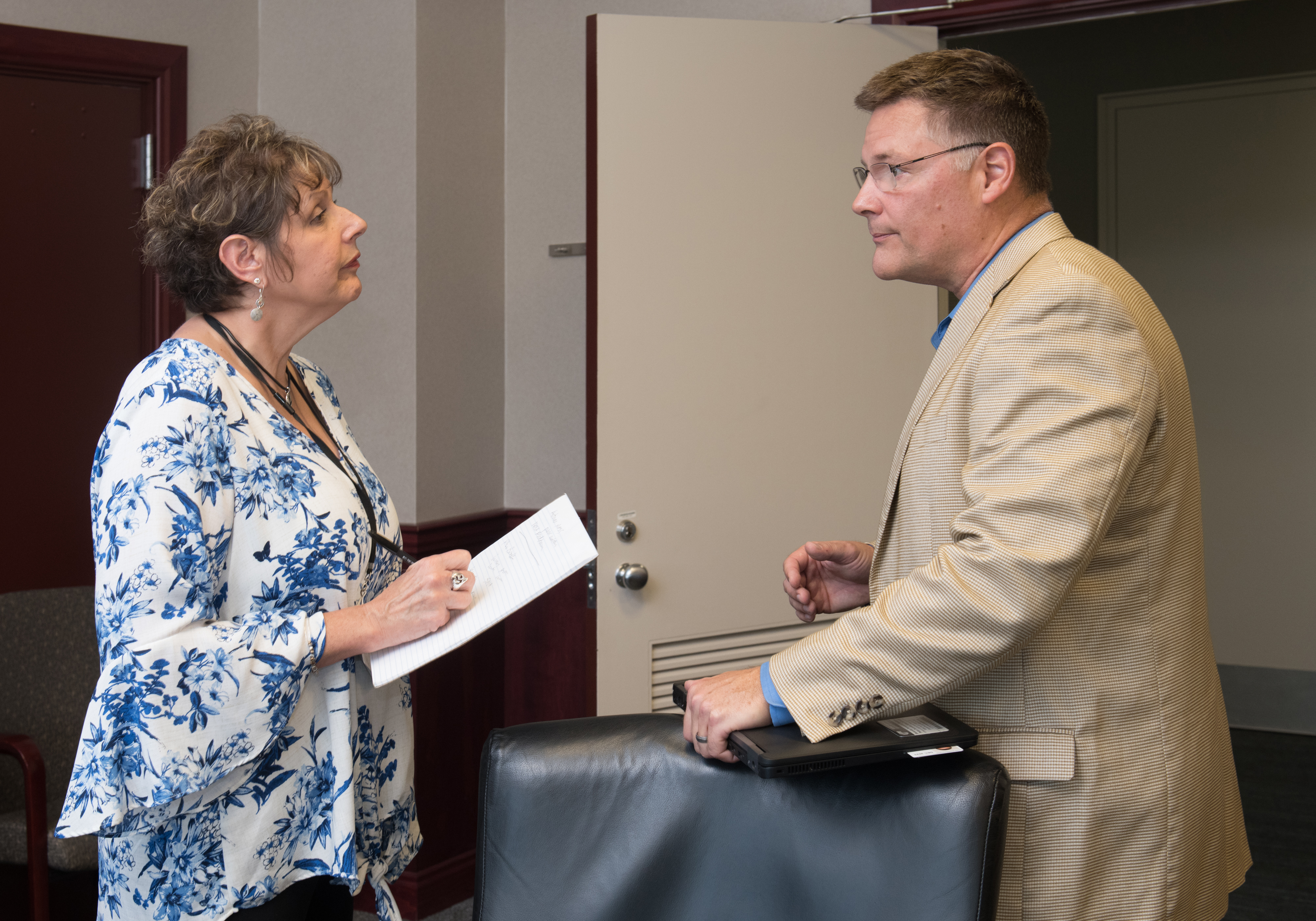
“We appreciate Doreen’s knowledge, experience, and passion for sharing Glenn’s news and accomplishments with AF readers,” said NASA Glenn Office of Communications Director Kristen Parker. “Her compassion, journalistic flair, and dedication to putting employees’ needs first is evident in everything she does.”
Return to Newsletter Explore More 2 min read NASA Glenn Reinforces Role in Aerospace Innovation During Ohio Space Week Article 14 hours ago 1 min read Glenn Highlights Space Exploration at Minnesota State Fair Article 14 hours ago 2 min read NASA Names Glenn’s Steven Sinacore to Lead Fission Surface Power Article 14 hours agoNASA Glenn’s AeroSpace Frontiers Newsletter Takes a Bow
3 min read
Preparations for Next Moonwalk Simulations Underway (and Underwater)Since April 1999, the AeroSpace Frontiers (AF) newsletter has shared information monthly on NASA Glenn Research Center’s people, projects, and progress. If you were looking for news on any of these topics, there was a good chance you could read all about them in AF each month.
The newsletter has evolved in the last 26 years, changing with the times, to improve how and when we communicate with our audiences. From updating the hard copy layout to offering the issue online, we adjusted and enhanced AF to meet our customers’ needs.
As methods of sharing news and information are now available that allow us to reach you sooner, we are shifting our focus to these platforms and discontinuing our monthly newsletter. This September issue will be our last.
We hope you’ll stay connected with us through our official website and social media channels: Facebook, X, Instagram, LinkedIn, and YouTube. We thank you for your readership!
Before closing, we want to celebrate and reflect on the newsletter’s remarkable tenure (and interesting names) over the years.
Credit: NASAThe Story Behind the Name: A Look Back
While the center published a newsletter continually (with a brief pause in the early 1960s) since its opening in 1942, its name, layout, and content evolved over the decades. It began in 1942 as Wing Tips, an internal biweekly newsletter, and was later renamed Orbit in October 1958 as the National Advisory Committee for Aeronautics transitioned to NASA. In 1961, the center paused the newsletter’s publication to focus its resources on the early space program.
The publication reemerged in 1964 as Lewis News and expanded to a larger newsletter format in 1969, in conjunction with the Apollo 11 Moon landing. This format continued until 1995, when Lewis News moved to a monthly schedule with expanded, but physically smaller, issues as part of an overall effort to reduce spending.
Then, in 1999 – prior to the center being renamed NASA’s John H. Glenn Research Center – employees and center management were surveyed for a new newsletter title that would not be tied to future changes in research activities or center names. The group selected AeroSpace Frontiers to represent the modernization of the newsletter’s appearance and its expanded subject matter. It was now a monthly news magazine that included a variety of graphics and photographs, as well as additional content that addressed audiences beyond the center.
About Our Amazing Editor Portrait of editor Doreen Zudell, taken in 1990 at NASA’s Glenn Research Center in Cleveland. At that time, the center newsletter was known as Lewis News.Credit: NASADoreen Zudell has served as the editor of AeroSpace Frontiers (AF) since the first issue in 1999 and has been a driving force behind the publication ever since. In addition to writing and editing stories each month, she also has navigated many format changes over the years.
Editor Doreen Zudell interviews NASA astronaut Doug Wheelock at NASA’s Glenn Research Center in Cleveland in 2019.Credit: NASA/Marvin Smith“We appreciate Doreen’s knowledge, experience, and passion for sharing Glenn’s news and accomplishments with AF readers,” said NASA Glenn Office of Communications Director Kristen Parker. “Her compassion, journalistic flair, and dedication to putting employees’ needs first is evident in everything she does.”
Return to Newsletter Explore More 2 min read NASA Glenn Reinforces Role in Aerospace Innovation During Ohio Space Week Article 11 hours ago 1 min read Glenn Highlights Space Exploration at Minnesota State Fair Article 11 hours ago 2 min read NASA Names Glenn’s Steven Sinacore to Lead Fission Surface Power Article 11 hours agoGlenn Highlights Space Exploration at Minnesota State Fair
1 min read
Preparations for Next Moonwalk Simulations Underway (and Underwater) Visitors at the Minnesota State Fair get an up-close look at a Moon rock on Friday, Aug. 22, 2025. Credit: NASA/Christopher Richards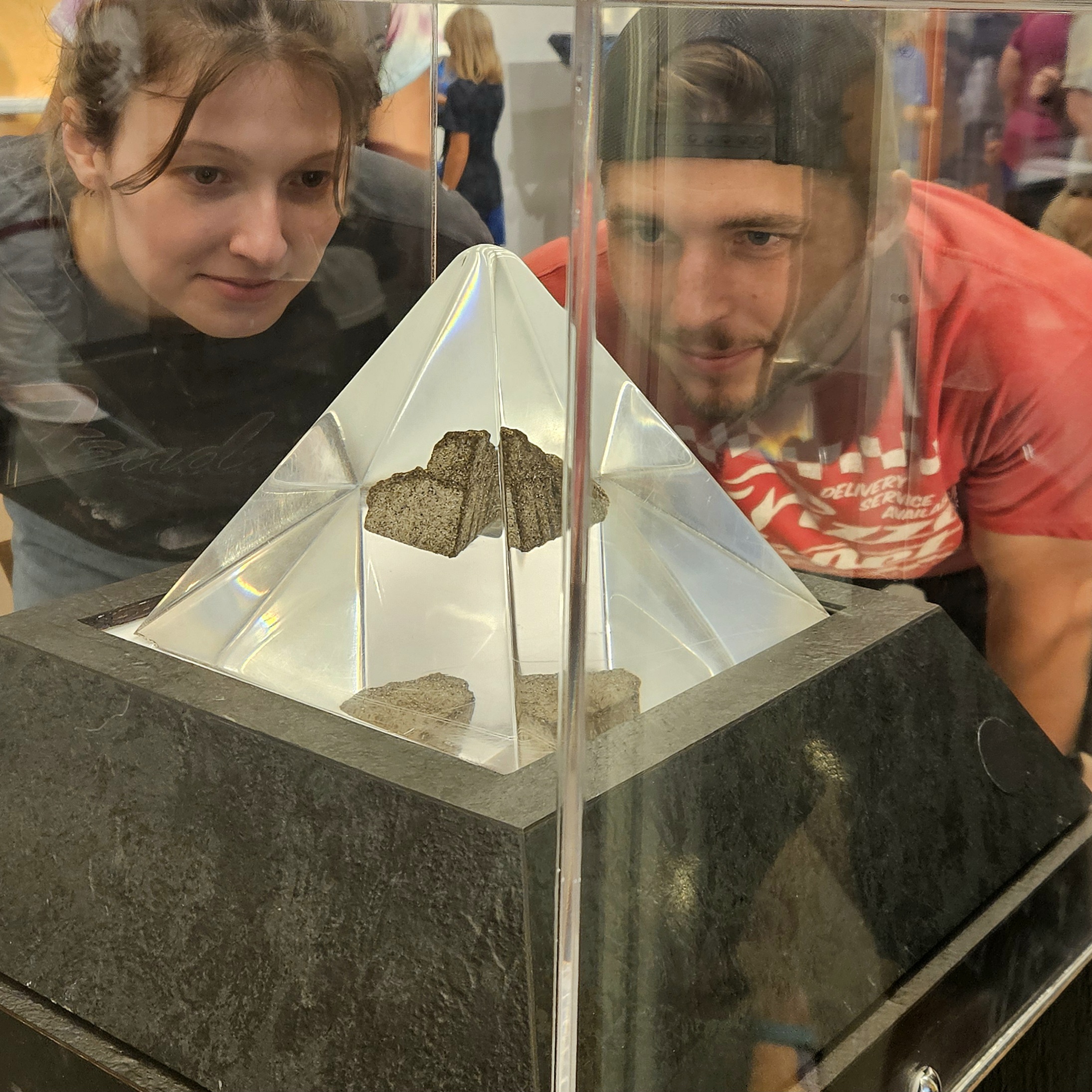
NASA brought the excitement of space exploration to the Minnesota State Fair from Aug. 21–24, offering exhibits and interactive experiences for the whole family. Led by NASA’s Glenn Research Center in Cleveland, the agency showcased the future of space exploration and the technologies making it possible — from next-generation spacesuits to the Artemis missions that will return humans to the Moon.
A major attraction was Glenn’s “Suits and Boots” exhibit, along with an Apollo 15 Moon rock, which drew large crowds to the North End Event Center. Glenn staff, joined by Mike Lammers, deputy chief of the Flight Director’s Office at NASA’s Johnson Space Center in Houston, engaged with both media and fairgoers to highlight spacesuit advancements, Glenn’s unique role as the only NASA center in the Midwest, and upcoming plans for returning to the Moon and journeying to Mars through Artemis.
Mike Lammers, Minnesota native and deputy chief of the Flight Director’s Office at NASA’s Johnson Space Center in Houston, talks with visitors at the Minnesota State Fair on Friday, Aug. 22, 2025. Credit: NASA/Christopher Richards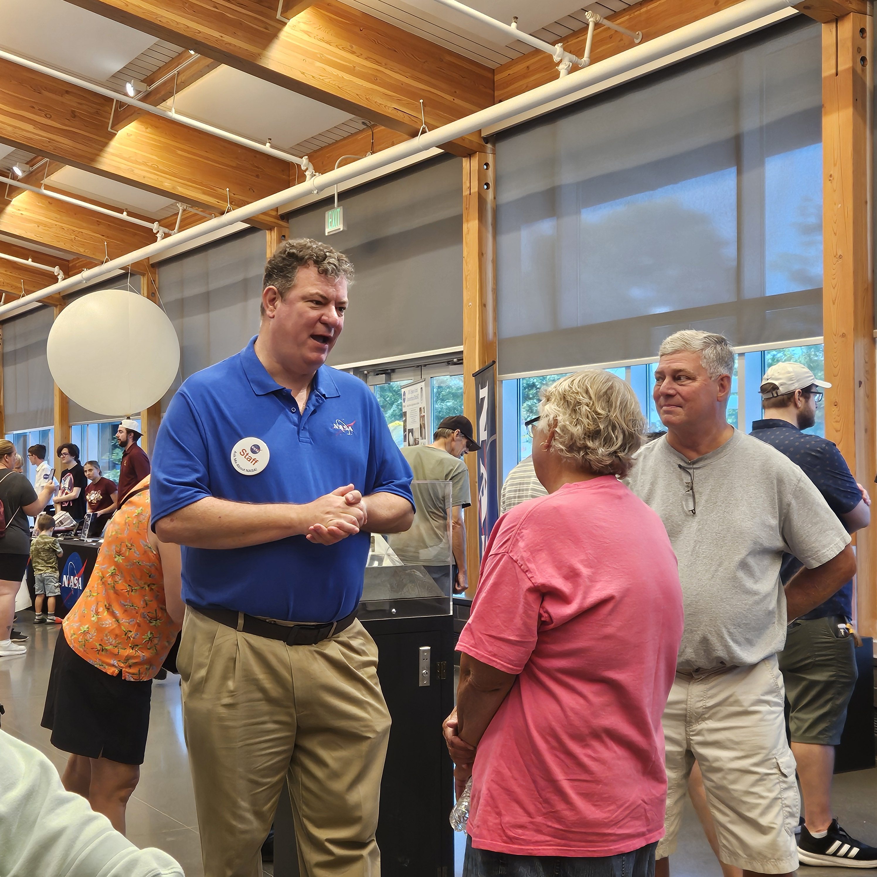
The team reached an estimated 57,000 people directly, with additional exposure through traditional and social media efforts.
Return to Newsletter Explore More 2 min read NASA Glenn Reinforces Role in Aerospace Innovation During Ohio Space Week Article 14 hours ago 3 min read NASA Glenn’s AeroSpace Frontiers Newsletter Takes a Bow Article 14 hours ago 2 min read NASA Names Glenn’s Steven Sinacore to Lead Fission Surface Power Article 14 hours agoGlenn Highlights Space Exploration at Minnesota State Fair
1 min read
Preparations for Next Moonwalk Simulations Underway (and Underwater) Visitors at the Minnesota State Fair get an up-close look at a Moon rock on Friday, Aug. 22, 2025. Credit: NASA/Christopher RichardsNASA brought the excitement of space exploration to the Minnesota State Fair from Aug. 21–24, offering exhibits and interactive experiences for the whole family. Led by NASA’s Glenn Research Center in Cleveland, the agency showcased the future of space exploration and the technologies making it possible — from next-generation spacesuits to the Artemis missions that will return humans to the Moon.
A major attraction was Glenn’s “Suits and Boots” exhibit, along with an Apollo 15 Moon rock, which drew large crowds to the North End Event Center. Glenn staff, joined by Mike Lammers, deputy chief of the Flight Director’s Office at NASA’s Johnson Space Center in Houston, engaged with both media and fairgoers to highlight spacesuit advancements, Glenn’s unique role as the only NASA center in the Midwest, and upcoming plans for returning to the Moon and journeying to Mars through Artemis.
Mike Lammers, Minnesota native and deputy chief of the Flight Director’s Office at NASA’s Johnson Space Center in Houston, talks with visitors at the Minnesota State Fair on Friday, Aug. 22, 2025. Credit: NASA/Christopher RichardsThe team reached an estimated 57,000 people directly, with additional exposure through traditional and social media efforts.
Return to Newsletter Explore More 2 min read NASA Glenn Reinforces Role in Aerospace Innovation During Ohio Space Week Article 11 hours ago 3 min read NASA Glenn’s AeroSpace Frontiers Newsletter Takes a Bow Article 11 hours ago 2 min read NASA Names Glenn’s Steven Sinacore to Lead Fission Surface Power Article 11 hours agoCheetahs naturally turned into mummies in caves in Saudi Arabia
Cheetahs naturally turned into mummies in caves in Saudi Arabia
Good Conversations Don’t Require Everybody to Agree, Neuroscience Shows
Brain imaging is illuminating the patterns linked to productive, positive dialogue, and those insights could help people connect with others
Bird Flu and Human Flu Viruses Could Mix in Cow Udders and Spark a Pandemic
Cells in cow udders could act as a site for human flu and bird flu viruses to swap genes and generate dangerous novel strains