
Feed aggregator
Artemis II Crew Launch Day Rehearsal
Artemis II Crew Launch Day Rehearsal
From left to right, CSA (Canadian Space Agency) astronaut Jeremy Hansen and NASA astronauts Christina Koch, Victor Glover, and Reid Wiseman stand outside before boarding their Orion spacecraft inside the Vehicle Assembly Building at NASA’s Kennedy Space Center in Florida as part of the Artemis II countdown demonstration test, Saturday, Dec. 20, 2025. Because the SLS (Space Launch System) rocket upon which they will launch is not yet at the launch pad, the crew boarded Orion inside NASA Kennedy’s Vehicle Assembly Building, where engineers are conducting final preparations on the spacecraft, rocket, and ground systems. During the rehearsal, teams went through all the steps that will be taken on launch day, winding the clock down to just a few seconds before liftoff.
Through the Artemis campaign, NASA will send astronauts to explore the Moon for scientific discovery, economic benefits, and to build the foundation for the first crewed missions to Mars, for the benefit of all.
See more photos from the countdown demonstration test.
Image credit: NASA/Aubrey Gemignani
How to extend and improve your life by getting more creative
How to extend and improve your life by getting more creative
Artemis II Flight Crew, Teams Conduct Demonstration Ahead of Launch
NASA’s launch and mission teams, along with the Artemis II crew, completed a key test Dec. 20, a countdown demonstration test, ahead of the Artemis II flight around the Moon early next year. The astronauts, supported by launch and flight control teams, dressed in their launch and entry suits, boarded their spacecraft on top of its towering rocket at the agency’s Kennedy Space Center in Florida to validate their launch date timeline.
Winding the clock down to a point just before liftoff, the rehearsal enabled NASA teams to practice the exact steps teams will take as they move toward launch of the test flight.
This test marks the passage of a key milestone on America’s journey to the launchpad. We have many more to go, but I’m encouraged by the expertise and precision demonstrated by our teams as we continue NASA’s ambitious lunar exploration legacy.Jared Isaacman
NASA Administrator
While launch teams in the firing rooms of Kennedy’s Launch Control Center ran through procedures just as they would on launch day, the Artemis II crew members – NASA astronauts Reid Wiseman, Victor Glover, and Christina Koch, and CSA (Canadian Space Agency) astronaut Jeremy Hansen – donned their Orion crew survival system spacesuits in the Astronaut Crew Quarters inside Kennedy’s Neil A. Armstrong Operations and Checkout Building.
From left, NASA astronauts Victor Glover, Artemis II pilot, and Reid Wiseman, Artemis II commander, undergo spacesuit checks inside the crew quarters suit-up room in the Neil A. Armstrong Operations and Checkout Building part of the countdown demonstration test at NASA Kennedy on Saturday, Dec. 20, 2025. NASA/Glenn Benson
Once suited, the crew made the same walk taken by Gemini, Apollo, space shuttle, and Commercial Crew Program astronauts launching from Florida’s Space Coast during the last six decades. Through the suit-up room, down the hallway, and after a quick ride on an elevator, the Artemis II crew exited the building through the double doors featuring dozens of human spaceflight mission patch stickers.
The Artemis astronaut van waited outside to take the crew members to their SLS (Space Launch System) rocket. On the actual launch day, the four astronauts will complete a 20-minute ride to Kennedy’s Launch Complex 39B ahead of liftoff. But, for the countdown test the destination was High Bay 3 of Kennedy’s Vehicle Assembly Building, where the Artemis II Moon rocket is undergoing final processing and checkouts before rolling out to the launch pad. A convoy of support vehicles, as well as Artemis II backup crew members, NASA astronaut Andre Douglas and CSA astronaut Jenni Gibbons, escorted the crew to its destination.
From right to left, NASA astronauts Reid Wiseman, commander; Victor Glover, pilot; Christina Koch, mission specialist; and CSA (Canadian Space Agency) astronaut Jeremy Hansen, mission specialist are seen as they depart the Neil A. Armstrong Operations and Checkout Building to board their Orion spacecraft atop NASA’s Space Launch System rocket inside the Vehicle Assembly Building as part of the Artemis II countdown demonstration test, Saturday, Dec. 20, 2025, at NASA Kennedy.NASA/Aubrey Gemignani
After a short trip to the building, the flight crew rode the mobile launcher’s elevator up nearly 300 feet to the crew access arm and the White Room, the enclosed area where the crew enters the spacecraft. The closeout crew, whose job it is to ensure the flight crew enters the spacecraft without issue, helped the astronauts enter Orion, which they have named Integrity. The closeout team assisted the astronauts by strapping them into their seats and closed the hatch once all closeout operations were completed. With the crew secured in Orion, teams conducted suit leak and communications checks, just as they will on launch day.
Artemis II crewmembers CSA astronaut Jeremy Hansen, mission specialist, right, and NASA astronauts Victor Glover, pilot; Christina Koch, mission specialist; after exiting the elevator at the 275-foot level of the mobile launcher as they walk towards the crew access arm prepare to board their Orion spacecraft atop NASA’s Moon rocket during the Artemis II countdown demonstration test, Saturday, Dec. 20, 2025, inside the Vehicle Assembly Building at NASA Kennedy. NASA/Joel Kowsky
Throughout the testing, teams ran through the final 5.5 hours of launch day procedures, completing the countdown test about 30 seconds before what will be the time of liftoff on launch day. As they may encounter on launch day, teams navigated through several real-time issues, including audio communications and environmental control and life support systems closeout activities during the test. All objectives were met, and the countdown demonstration provided a valuable opportunity to conduct operations in a day-of-launch configuration to minimize first-time learnings on launch day.
Charlie Blackwell-Thompson, NASA’s Artemis launch director, monitors the progress of Artemis II countdown demonstration test with Artemis II crew members onboard their Orion spacecraft from Firing Room 1 of the Rocco A. Petrone Launch Control Center at NASA Kennedy on Saturday, Dec. 20.NASA/Glenn Benson
Although Artemis II teams have performed parts of the launch countdown testing previously, this test was the first full end-to-end rundown with the crew and Orion in the launch configuration. The crew will participate in additional countdown testing after the rocket arrives to the launchpad, focusing on emergency operations.
As part of a Golden Age of innovation and exploration, the Artemis II test flight is the first crewed mission under NASA’s Artemis campaign. It is another step toward new U.S.-crewed missions on the Moon’s surface that will help the agency prepare to land American astronauts on Mars.
About the AuthorJason Costa Share Details Last Updated Dec 23, 2025 Related Terms Explore More 3 min read Get In, We’re Going Moonbound: Meet NASA’s Artemis Closeout Crew Article 6 days ago 3 min read I Am Artemis: Grace Lauderdale Article 6 days ago 6 min read NASA Kennedy Top 20 Stories of 2025 Article 7 days ago Keep Exploring Discover More Topics From NASAMissions
Humans in Space
Climate Change
Solar System
Artemis II Flight Crew, Teams Conduct Demonstration Ahead of Launch
NASA’s launch and mission teams, along with the Artemis II crew, completed a key test Dec. 20, a countdown demonstration test, ahead of the Artemis II flight around the Moon early next year. The astronauts, supported by launch and flight control teams, dressed in their launch and entry suits, boarded their spacecraft on top of its towering rocket at the agency’s Kennedy Space Center in Florida to validate their launch date timeline.
Winding the clock down to a point just before liftoff, the rehearsal enabled NASA teams to practice the exact steps teams will take as they move toward launch of the test flight.
This test marks the passage of a key milestone on America’s journey to the launchpad. We have many more to go, but I’m encouraged by the expertise and precision demonstrated by our teams as we continue NASA’s ambitious lunar exploration legacy.Jared Isaacman
NASA Administrator
While launch teams in the firing rooms of Kennedy’s Launch Control Center ran through procedures just as they would on launch day, the Artemis II crew members – NASA astronauts Reid Wiseman, Victor Glover, and Christina Koch, and CSA (Canadian Space Agency) astronaut Jeremy Hansen – donned their Orion crew survival system spacesuits in the Astronaut Crew Quarters inside Kennedy’s Neil A. Armstrong Operations and Checkout Building.
From left, NASA astronauts Victor Glover, Artemis II pilot, and Reid Wiseman, Artemis II commander, undergo spacesuit checks inside the crew quarters suit-up room in the Neil A. Armstrong Operations and Checkout Building part of the countdown demonstration test at NASA Kennedy on Saturday, Dec. 20, 2025. NASA/Glenn BensonOnce suited, the crew made the same walk taken by Gemini, Apollo, space shuttle, and Commercial Crew Program astronauts launching from Florida’s Space Coast during the last six decades. Through the suit-up room, down the hallway, and after a quick ride on an elevator, the Artemis II crew exited the building through the double doors featuring dozens of human spaceflight mission patch stickers.
The Artemis astronaut van waited outside to take the crew members to their SLS (Space Launch System) rocket. On the actual launch day, the four astronauts will complete a 20-minute ride to Kennedy’s Launch Complex 39B ahead of liftoff. But, for the countdown test the destination was High Bay 3 of Kennedy’s Vehicle Assembly Building, where the Artemis II Moon rocket is undergoing final processing and checkouts before rolling out to the launch pad. A convoy of support vehicles, as well as Artemis II backup crew members, NASA astronaut Andre Douglas and CSA astronaut Jenni Gibbons, escorted the crew to its destination.
From right to left, NASA astronauts Reid Wiseman, commander; Victor Glover, pilot; Christina Koch, mission specialist; and CSA (Canadian Space Agency) astronaut Jeremy Hansen, mission specialist are seen as they depart the Neil A. Armstrong Operations and Checkout Building to board their Orion spacecraft atop NASA’s Space Launch System rocket inside the Vehicle Assembly Building as part of the Artemis II countdown demonstration test, Saturday, Dec. 20, 2025, at NASA Kennedy.NASA/Aubrey GemignaniAfter a short trip to the building, the flight crew rode the mobile launcher’s elevator up nearly 300 feet to the crew access arm and the White Room, the enclosed area where the crew enters the spacecraft. The closeout crew, whose job it is to ensure the flight crew enters the spacecraft without issue, helped the astronauts enter Orion, which they have named Integrity. The closeout team assisted the astronauts by strapping them into their seats and closed the hatch once all closeout operations were completed. With the crew secured in Orion, teams conducted suit leak and communications checks, just as they will on launch day.
Artemis II crewmembers CSA astronaut Jeremy Hansen, mission specialist, right, and NASA astronauts Victor Glover, pilot; Christina Koch, mission specialist; after exiting the elevator at the 275-foot level of the mobile launcher as they walk towards the crew access arm prepare to board their Orion spacecraft atop NASA’s Moon rocket during the Artemis II countdown demonstration test, Saturday, Dec. 20, 2025, inside the Vehicle Assembly Building at NASA Kennedy. NASA/Joel KowskyThroughout the testing, teams ran through the final 5.5 hours of launch day procedures, completing the countdown test about 30 seconds before what will be the time of liftoff on launch day. As they may encounter on launch day, teams navigated through several real-time issues, including audio communications and environmental control and life support systems closeout activities during the test. All objectives were met, and the countdown demonstration provided a valuable opportunity to conduct operations in a day-of-launch configuration to minimize first-time learnings on launch day.
Charlie Blackwell-Thompson, NASA’s Artemis launch director, monitors the progress of Artemis II countdown demonstration test with Artemis II crew members onboard their Orion spacecraft from Firing Room 1 of the Rocco A. Petrone Launch Control Center at NASA Kennedy on Saturday, Dec. 20.NASA/Glenn BensonAlthough Artemis II teams have performed parts of the launch countdown testing previously, this test was the first full end-to-end rundown with the crew and Orion in the launch configuration. The crew will participate in additional countdown testing after the rocket arrives to the launchpad, focusing on emergency operations.
As part of a Golden Age of innovation and exploration, the Artemis II test flight is the first crewed mission under NASA’s Artemis campaign. It is another step toward new U.S.-crewed missions on the Moon’s surface that will help the agency prepare to land American astronauts on Mars.
About the AuthorJason Costa Share Details Last Updated Dec 23, 2025 Related Terms Explore More 3 min read Get In, We’re Going Moonbound: Meet NASA’s Artemis Closeout Crew Article 6 days ago 3 min read I Am Artemis: Grace Lauderdale Article 6 days ago 6 min read NASA Kennedy Top 20 Stories of 2025 Article 7 days ago Keep Exploring Discover More Topics From NASAMissions
Humans in Space
Climate Change
Solar System
Did Astronomers See a Star Explode Twice?
Astronomers are trying to determine if they've witnessed a complex stellar explosion or a relatively ordinary supernova.
The post Did Astronomers See a Star Explode Twice? appeared first on Sky & Telescope.
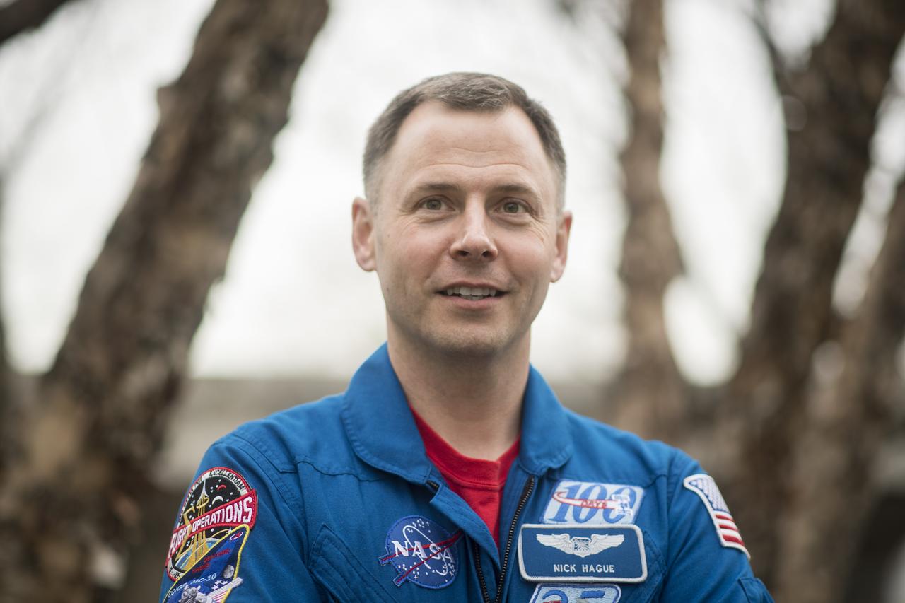
NASA Astronaut Nick Hague Retires
NASA astronaut Brig. Gen. Nick Hague has retired from the agency, concluding a distinguished career that included two spaceflight missions, 374 days in space, and multiple spacewalks in support of the International Space Station. Hague continues service in the U.S. Space Force.
Hague launched aboard the Soyuz MS-12 spacecraft in March 2019 from the Baikonur Cosmodrome in Kazakhstan for his first long-duration mission, serving as a flight engineer during Expeditions 59/60. During this 203-day mission, he conducted three spacewalks to upgrade the station’s power systems and support ongoing maintenance of the orbiting laboratory. Hague also contributed to a wide range of scientific investigations, spanning biology, human physiology, materials science, and technology demonstrations.
Hague originally was assigned to fly in 2018 as part of the Soyuz MS-10 crew. The mission experienced a launch anomaly shortly after liftoff, and Hague and his crewmate executed a high-G ballistic abort. The two landed safely and Hague returned to flight status within months, ultimately completing his 2019 mission.
He flew again during NASA’s SpaceX Crew-9 mission, launching in September 2024 alongside Roscosmos cosmonaut Aleksandr Gorbunov. It was the first human spaceflight mission launched from Space Launch Complex 40 at Cape Canaveral Space Force Station in Florida, and it also marked the first time a Space Force Guardian launched to space. Hague then joined the Expedition 72 crew, spending 171 days aboard the station before returning in March 2025 along with NASA astronauts Butch Wilmore and Suni Williams. During the mission, he conducted another spacewalk, bringing his career total to 25 hours and 56 minutes across four spacewalks.
“Nick’s determination and dedication to human space exploration are truly phenomenal,” said Vanessa Wyche, director of NASA’s Johnson Space Center in Houston. “His leadership and commitment to mission excellence have supported progress aboard the International Space Station and prepared us for future missions as we continue to explore farther into the solar system.”
Beyond his flight experience, Hague served in several technical and leadership roles within NASA. He supported the development of future spacecraft operations, contributed to astronaut training, and played a key role in human spaceflight safety initiatives, drawing on his firsthand experience during the MS-10 launch abort.
“Nick brought calm, clarity, and a spirit of teamwork to every situation,” said Scott Tingle, chief of the Astronaut Office at NASA Johnson. “From his work in orbit to his support of crew operations here on Earth, he exemplified what it means to be an astronaut. His impact will continue to shape the missions and the astronauts who follow.”
A native of Hoxie, Kansas, Hague is a brigadier general in the U.S. Space Force where he is responsible for the development and implementation of policy for all U. S. Space Force global operations, sustainment, training and readiness. He earned a bachelor’s degree in astronautical engineering from the U.S. Air Force Academy in Colorado and a master’s degree in astronautical engineering from the Massachusetts Institute of Technology. Before joining NASA in 2013, he served in developmental and test engineer roles supporting advanced Air Force technologies and operations at home and abroad.
“It has been an honor to serve as a NASA astronaut,” said Hague. “Working alongside incredible teams, on the ground and in space, has been the privilege of a lifetime. The International Space Station represents the very best of what humanity can accomplish when we work together. I am grateful to have contributed to that mission, and I look forward to watching NASA, our partners, and the next generation of explorers push even farther as we return to the Moon and journey on to Mars.”
To learn more about NASA’s astronauts and their contributions to space exploration, visit:
https://www.nasa.gov/astronauts
-end-
Shaneequa Vereen
Johnson Space Center, Houston
281-483-5111
shaneequa.y.vereen@nasa.gov
The best space pictures of 2025, from supernovae to moon landings
The best space pictures of 2025, from supernovae to moon landings
NASA’s Hubble Reveals Largest Found Chaotic Birthplace of Planets
- Hubble Home
- Overview
- Impact & Benefits
- Science
- Observatory
- Team
- Multimedia
- News
- More
Astronomers using NASA’s Hubble Space Telescope have imaged the largest protoplanetary disk ever observed circling a young star. For the first time in visible light, Hubble has revealed the disk is unexpectedly chaotic and turbulent, with wisps of material stretching much farther above and below the disk than astronomers have seen in any similar system. Strangely, more extended filaments are only visible on one side of the disk. The findings, which published Tuesday in The Astrophysical Journal, mark a new milestone for Hubble and shed light on how planets may form in extreme environments, as NASA’s missions lead humanity’s exploration of the universe and our place in it.
Located roughly 1,000 light-years from Earth, IRAS 23077+6707, nicknamed “Dracula’s Chivito,” spans nearly 400 billion miles — 40 times the diameter of our solar system to the outer edge of the Kuiper Belt of cometary bodies. The disk obscures the young star within it, which scientists believe may be either a hot, massive star, or a pair of stars. And the enormous disk is not only the largest known planet-forming disk; it’s also shaping up to be one of the most unusual.
“The level of detail we’re seeing is rare in protoplanetary disk imaging, and these new Hubble images show that planet nurseries can be much more active and chaotic than we expected,” said lead author Kristina Monsch of the Center for Astrophysics | Harvard & Smithsonian (CfA). “We’re seeing this disk nearly edge-on and its wispy upper layers and asymmetric features are especially striking. Both Hubble and NASA’s James Webb Space Telescope have glimpsed similar structures in other disks, but IRAS 23077+6707 provides us with an exceptional perspective — allowing us to trace its substructures in visible light at an unprecedented level of detail. This makes the system a unique, new laboratory for studying planet formation and the environments where it happens.”
The nickname “Dracula’s Chivito” playfully reflects the heritage of its researchers—one from Transylvania and another from Uruguay, where the national dish is a sandwich called a chivito. The edge-on disk resembles a hamburger, with a dark central lane flanked by glowing top and bottom layers of dust and gas.
This Hubble Space Telescope image shows the largest planet-forming disk ever observed around a young star. It spans nearly 400 billion miles — 40 times the diameter of our solar system. Image: NASA, ESA, STScI, Kristina Monsch (CfA); Image Processing: Joseph DePasquale (STScI) Puzzling asymmetry
The impressive height of these features wasn’t the only thing that captured the attention of scientists. The new images revealed that vertically imposing filament-like features appear on just one side of the disk, while the other side appears to have a sharp edge and no visible filaments. This peculiar, lopsided structure suggests that dynamic processes, like the recent infall of dust and gas, or interactions with its surroundings, are shaping the disk.
“We were stunned to see how asymmetric this disk is,” said co-investigator Joshua Bennett Lovell, also an astronomer at the CfA. “Hubble has given us a front row seat to the chaotic processes that are shaping disks as they build new planets — processes that we don’t yet fully understand but can now study in a whole new way.”
All planetary systems form from disks of gas and dust encircling young stars. Over time, the gas accretes onto the star, and planets emerge from the remaining material. IRAS 23077+6707 may represent a scaled-up version of our early solar system, with a disk mass estimated at 10 to 30 times that of Jupiter — ample material for forming multiple gas giants. This, plus the new findings, makes it an exceptional case for studying the birth of planetary systems.
“In theory, IRAS 23077+6707 could host a vast planetary system,” said Monsch. “While planet formation may differ in such massive environments, the underlying processes are likely similar. Right now, we have more questions than answers, but these new images are a starting point for understanding how planets form over time and in different environments.”
Credit: NASA’s Goddard Space Flight Center; Lead Producer: Paul MorrisThe Hubble Space Telescope has been operating for over three decades and continues to make ground-breaking discoveries that shape our fundamental understanding of the universe. Hubble is a project of international cooperation between NASA and ESA (European Space Agency). NASA’s Goddard Space Flight Center in Greenbelt, Maryland, manages the telescope and mission operations. Lockheed Martin Space, based in Denver, also supports mission operations at Goddard. The Space Telescope Science Institute in Baltimore, which is operated by the Association of Universities for Research in Astronomy, conducts Hubble science operations for NASA.
Facebook logo @NASAHubble @NASAHubble Instagram logo @NASAHubble Related Images & Videos Dracula’s Chivito (IRAS 23077+6707)This Hubble Space Telescope image shows the largest planet-forming disk ever observed around a young star. It spans nearly 400 billion miles — 40 times the diameter of our solar system.
Dracula’s Chivito (IRAS 23077+6707) Compass Image
Image of Dracula’s Chivito captured by Hubble’s WFC3 instrument, with compass arrows, scale bar, and color key for reference.
Hubble Spots Giant Vampire Sandwich? Video
Dracula’s Chivito isn’t just the largest protoplanetary disk ever imaged, it’s also a window into how planets are born and how systems like our solar system may have formed.
Claire Andreoli
NASA’s Goddard Space Flight Center
Greenbelt, Maryland
claire.andreoli@nasa.gov
Christine Pulliam
Space Telescope Science Institute
Baltimore, Maryland
Amy Oliver
Center for Astrophysics | Harvard & Smithsonian
Cambridge, Massachusetts
- Science Paper: Hubble reveals complex multi-scale structure in the edge-on protoplanetary disk IRAS 23077+6707 by K. Monsch et al.
Keep Exploring Discover More Topics From Hubble Hubble Space Telescope
Since its 1990 launch, the Hubble Space Telescope has changed our fundamental understanding of the universe.
Hubble Science Highlights
Hubble Images
Hubble News
NASA’s Hubble Reveals Largest Found Chaotic Birthplace of Planets
- Hubble Home
- Overview
- Impact & Benefits
- Science
- Observatory
- Team
- Multimedia
- News
- More
Astronomers using NASA’s Hubble Space Telescope have imaged the largest protoplanetary disk ever observed circling a young star. For the first time in visible light, Hubble has revealed the disk is unexpectedly chaotic and turbulent, with wisps of material stretching much farther above and below the disk than astronomers have seen in any similar system. Strangely, more extended filaments are only visible on one side of the disk. The findings, which published Tuesday in The Astrophysical Journal, mark a new milestone for Hubble and shed light on how planets may form in extreme environments, as NASA’s missions lead humanity’s exploration of the universe and our place in it.
Located roughly 1,000 light-years from Earth, IRAS 23077+6707, nicknamed “Dracula’s Chivito,” spans nearly 400 billion miles — 40 times the diameter of our solar system to the outer edge of the Kuiper Belt of cometary bodies. The disk obscures the young star within it, which scientists believe may be either a hot, massive star, or a pair of stars. And the enormous disk is not only the largest known planet-forming disk; it’s also shaping up to be one of the most unusual.
“The level of detail we’re seeing is rare in protoplanetary disk imaging, and these new Hubble images show that planet nurseries can be much more active and chaotic than we expected,” said lead author Kristina Monsch of the Center for Astrophysics | Harvard & Smithsonian (CfA). “We’re seeing this disk nearly edge-on and its wispy upper layers and asymmetric features are especially striking. Both Hubble and NASA’s James Webb Space Telescope have glimpsed similar structures in other disks, but IRAS 23077+6707 provides us with an exceptional perspective — allowing us to trace its substructures in visible light at an unprecedented level of detail. This makes the system a unique, new laboratory for studying planet formation and the environments where it happens.”
The nickname “Dracula’s Chivito” playfully reflects the heritage of its researchers—one from Transylvania and another from Uruguay, where the national dish is a sandwich called a chivito. The edge-on disk resembles a hamburger, with a dark central lane flanked by glowing top and bottom layers of dust and gas.
This Hubble Space Telescope image shows the largest planet-forming disk ever observed around a young star. It spans nearly 400 billion miles — 40 times the diameter of our solar system. Image: NASA, ESA, STScI, Kristina Monsch (CfA); Image Processing: Joseph DePasquale (STScI) Puzzling asymmetryThe impressive height of these features wasn’t the only thing that captured the attention of scientists. The new images revealed that vertically imposing filament-like features appear on just one side of the disk, while the other side appears to have a sharp edge and no visible filaments. This peculiar, lopsided structure suggests that dynamic processes, like the recent infall of dust and gas, or interactions with its surroundings, are shaping the disk.
“We were stunned to see how asymmetric this disk is,” said co-investigator Joshua Bennett Lovell, also an astronomer at the CfA. “Hubble has given us a front row seat to the chaotic processes that are shaping disks as they build new planets — processes that we don’t yet fully understand but can now study in a whole new way.”
All planetary systems form from disks of gas and dust encircling young stars. Over time, the gas accretes onto the star, and planets emerge from the remaining material. IRAS 23077+6707 may represent a scaled-up version of our early solar system, with a disk mass estimated at 10 to 30 times that of Jupiter — ample material for forming multiple gas giants. This, plus the new findings, makes it an exceptional case for studying the birth of planetary systems.
“In theory, IRAS 23077+6707 could host a vast planetary system,” said Monsch. “While planet formation may differ in such massive environments, the underlying processes are likely similar. Right now, we have more questions than answers, but these new images are a starting point for understanding how planets form over time and in different environments.”
Credit: NASA’s Goddard Space Flight Center; Lead Producer: Paul MorrisThe Hubble Space Telescope has been operating for over three decades and continues to make ground-breaking discoveries that shape our fundamental understanding of the universe. Hubble is a project of international cooperation between NASA and ESA (European Space Agency). NASA’s Goddard Space Flight Center in Greenbelt, Maryland, manages the telescope and mission operations. Lockheed Martin Space, based in Denver, also supports mission operations at Goddard. The Space Telescope Science Institute in Baltimore, which is operated by the Association of Universities for Research in Astronomy, conducts Hubble science operations for NASA.
Facebook logo @NASAHubble @NASAHubble Instagram logo @NASAHubble Related Images & Videos Dracula’s Chivito (IRAS 23077+6707)This Hubble Space Telescope image shows the largest planet-forming disk ever observed around a young star. It spans nearly 400 billion miles — 40 times the diameter of our solar system.
Dracula’s Chivito (IRAS 23077+6707) Compass Image
Image of Dracula’s Chivito captured by Hubble’s WFC3 instrument, with compass arrows, scale bar, and color key for reference.
Hubble Spots Giant Vampire Sandwich? Video
Dracula’s Chivito isn’t just the largest protoplanetary disk ever imaged, it’s also a window into how planets are born and how systems like our solar system may have formed.
Claire Andreoli
NASA’s Goddard Space Flight Center
Greenbelt, Maryland
claire.andreoli@nasa.gov
Christine Pulliam
Space Telescope Science Institute
Baltimore, Maryland
Amy Oliver
Center for Astrophysics | Harvard & Smithsonian
Cambridge, Massachusetts
- Science Paper: Hubble reveals complex multi-scale structure in the edge-on protoplanetary disk IRAS 23077+6707 by K. Monsch et al.
Keep Exploring Discover More Topics From Hubble Hubble Space Telescope
Since its 1990 launch, the Hubble Space Telescope has changed our fundamental understanding of the universe.
Hubble Science Highlights
Hubble Images
Hubble News
I Am Artemis: Grace Lauderdale
Listen to this audio excerpt from Grace Lauderdale, exploration project manager for the Training Systems Office at NASA Johnson:
0:00 / 0:00
Your browser does not support the audio element.In preparation for their mission around the Moon inside NASA’s Orion spacecraft, the Artemis II crew will spend countless hours training inside the Orion Mission Simulator. The simulator replicates what the crew will experience inside the spacecraft and allows the astronauts and flight controllers to rehearse every phase of the mission.
As the exploration project manager for the Training Systems Office at Johnson, Grace Lauderdale leads the team that develops and operates the Orion Mission Simulator at NASA’s Johnson Space Center in Houston, playing a key role in making sure astronauts and flight control teams are ready for the first crewed mission of the Artemis campaign.
"This simulator trains the flight control team and the crew all the way from launch to splashdown. Every button, every display, every view out the window is as lifelike as possible.”Grace Lauderdale
Exploration Project Manager for the Training Systems Office at NASA Johnson
The simulator is more than a mock-up. It connects directly to Johnson’s Mission Control Center, sending real-time data, audio, and video — just like the spacecraft will during flight. That means the flight control team trains in parallel, seeing and hearing exactly what they would throughout the mission.
“One of our major goals is to make the data they see on their displays look like the real vehicle,” Lauderdale said. “We also simulate the near space and deep space networks, including all the communication delays. It’s all about realism.”
That realism is powered by a complex software system developed in collaboration with partners like Lockheed Martin. Lauderdale’s team works behind the scenes to ensure the simulator runs smoothly — writing code, troubleshooting issues, and even creating custom malfunctions to challenge the crew during training.
Grace Lauderdale, exploration project manager for the Training Systems Office at NASA’s Johnson Space Center in Houston, sits inside the Orion Mission Simulator used for training the Artemis II crew and flight control team.Credits: NASA/Rad Sinyak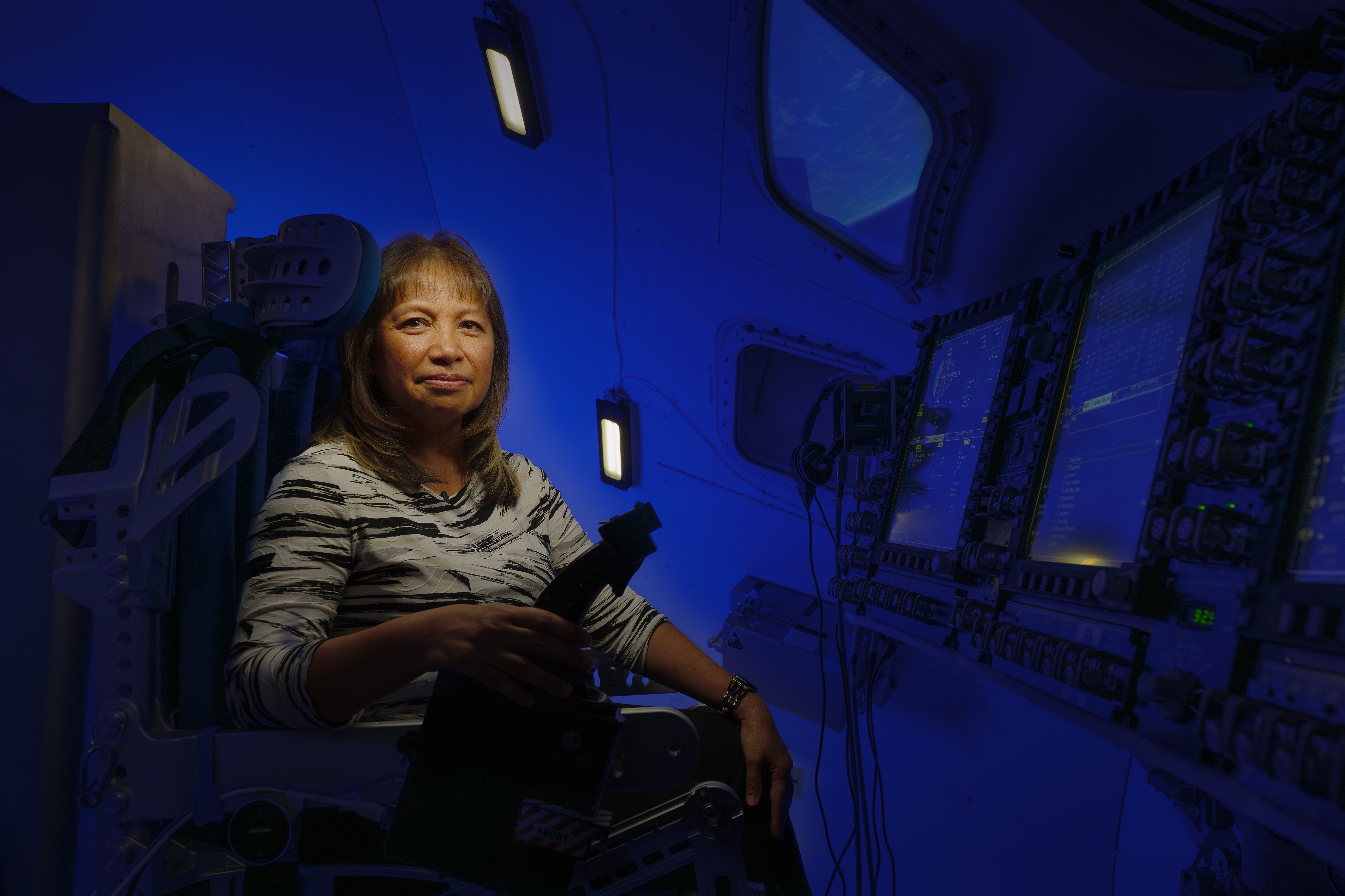
To prepare astronauts for the unexpected, instructors work with Lauderdale’s team to simulate problems that could occur during the mission, some of which require creative solutions.
“There are times when the instructors will ask for malfunctions or capabilities that the sim doesn’t automatically do,” she said. “Part of our role is to come up with ways to make that happen.”
Her team plans, develops, and executes training scenarios in the Orion Mission Simulator across multiple Artemis missions, often simultaneously. “Currently, we’re planning for future crewed missions, developing Artemis III, and executing Artemis II,” she said.
The work is demanding, but deeply personal, according to Lauderdale.
“I’ve known I wanted to work at NASA since the seventh grade. Every class I took, the degree I earned — it was all to get here.”Grace Lauderdale
Exploration Project Manager for the Training Systems Office at NASA Johnson
That passion shows in her leadership. Her team often works nights, weekends, and holidays to ensure the simulator is ready. During a recent 30-hour simulation, they spent days preparing, fixing memory issues, and ensuring the system wouldn’t crash. It didn’t.
“I’m very proud of my team,” she said. “They’ve put in countless hours of work to make sure this simulator reacts exactly as it would in the real mission.”
For Lauderdale, helping send astronauts around the Moon isn’t just a job—it’s a dream realized.
“Being part of getting us back to the Moon is very personal to me,” she said. “And I’m proud to be part of the team that will help get our astronauts there.”
Reid Wiseman and Victor Glover train for the Artemis II mission inside the Orion Mission Simulator at NASA’s Johnson Space Center in Houston. NASA/Bill Stafford About the AuthorErika Peters Share Details Last Updated Dec 22, 2025 Related Terms Explore More 3 min read Get In, We’re Going Moonbound: Meet NASA’s Artemis Closeout Crew Article 6 days ago 4 min read Artemis II Flight Crew, Teams Conduct Demonstration Ahead of Launch Article 6 days ago 6 min read NASA Kennedy Top 20 Stories of 2025 Article 7 days ago Keep Exploring Discover More Topics From NASA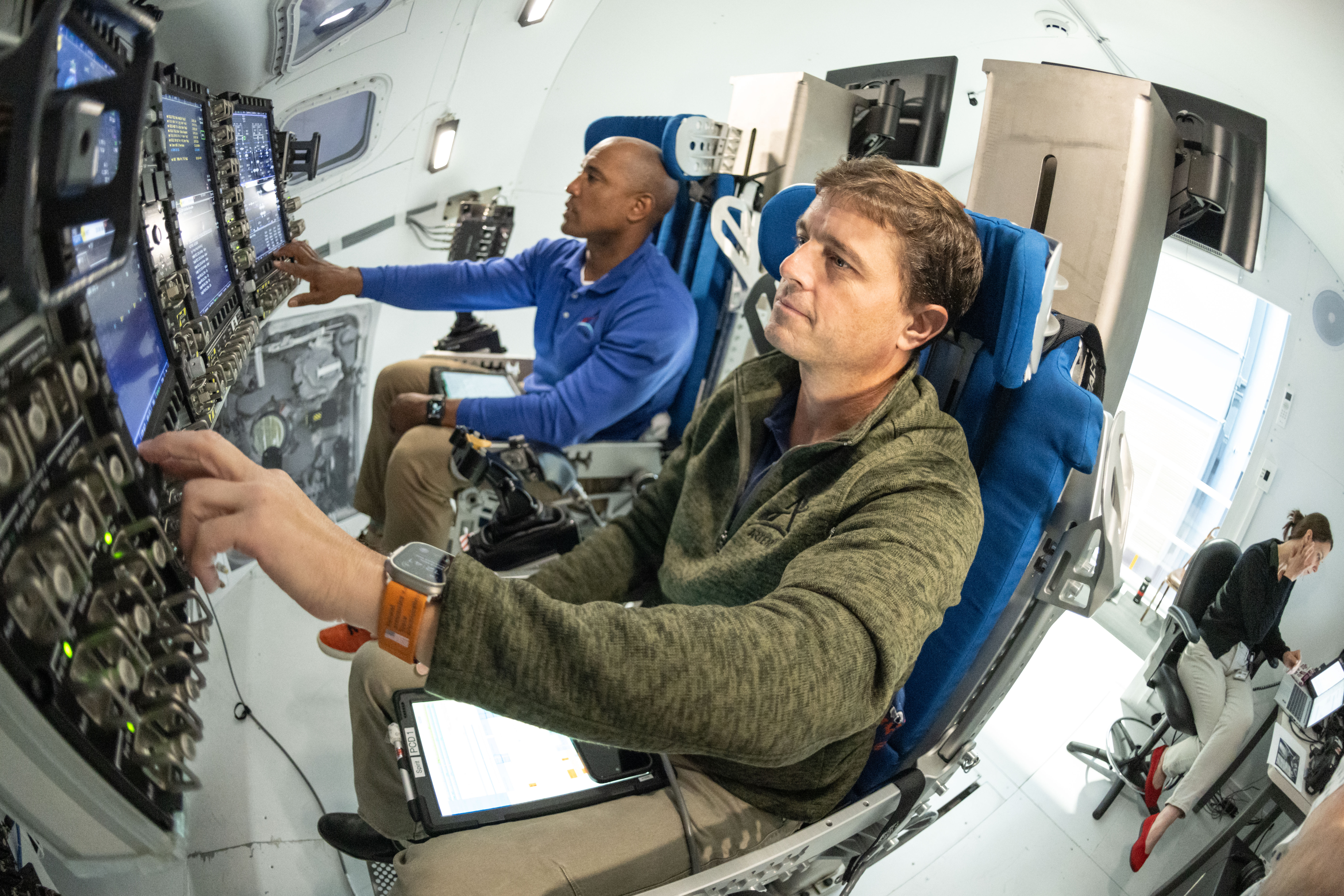
Missions
Humans in Space
Climate Change
Solar System
I Am Artemis: Grace Lauderdale
Listen to this audio excerpt from Grace Lauderdale, exploration project manager for the Training Systems Office at NASA Johnson:
0:00 / 0:00
Your browser does not support the audio element.In preparation for their mission around the Moon inside NASA’s Orion spacecraft, the Artemis II crew will spend countless hours training inside the Orion Mission Simulator. The simulator replicates what the crew will experience inside the spacecraft and allows the astronauts and flight controllers to rehearse every phase of the mission.
As the exploration project manager for the Training Systems Office at Johnson, Grace Lauderdale leads the team that develops and operates the Orion Mission Simulator at NASA’s Johnson Space Center in Houston, playing a key role in making sure astronauts and flight control teams are ready for the first crewed mission of the Artemis campaign.
"This simulator trains the flight control team and the crew all the way from launch to splashdown. Every button, every display, every view out the window is as lifelike as possible.”Grace Lauderdale
Exploration Project Manager for the Training Systems Office at NASA Johnson
The simulator is more than a mock-up. It connects directly to Johnson’s Mission Control Center, sending real-time data, audio, and video — just like the spacecraft will during flight. That means the flight control team trains in parallel, seeing and hearing exactly what they would throughout the mission.
“One of our major goals is to make the data they see on their displays look like the real vehicle,” Lauderdale said. “We also simulate the near space and deep space networks, including all the communication delays. It’s all about realism.”
That realism is powered by a complex software system developed in collaboration with partners like Lockheed Martin. Lauderdale’s team works behind the scenes to ensure the simulator runs smoothly — writing code, troubleshooting issues, and even creating custom malfunctions to challenge the crew during training.
Grace Lauderdale, exploration project manager for the Training Systems Office at NASA’s Johnson Space Center in Houston, sits inside the Orion Mission Simulator used for training the Artemis II crew and flight control team.Credits: NASA/Rad SinyakTo prepare astronauts for the unexpected, instructors work with Lauderdale’s team to simulate problems that could occur during the mission, some of which require creative solutions.
“There are times when the instructors will ask for malfunctions or capabilities that the sim doesn’t automatically do,” she said. “Part of our role is to come up with ways to make that happen.”
Her team plans, develops, and executes training scenarios in the Orion Mission Simulator across multiple Artemis missions, often simultaneously. “Currently, we’re planning for future crewed missions, developing Artemis III, and executing Artemis II,” she said.
The work is demanding, but deeply personal, according to Lauderdale.
“I’ve known I wanted to work at NASA since the seventh grade. Every class I took, the degree I earned — it was all to get here.”Grace Lauderdale
Exploration Project Manager for the Training Systems Office at NASA Johnson
That passion shows in her leadership. Her team often works nights, weekends, and holidays to ensure the simulator is ready. During a recent 30-hour simulation, they spent days preparing, fixing memory issues, and ensuring the system wouldn’t crash. It didn’t.
“I’m very proud of my team,” she said. “They’ve put in countless hours of work to make sure this simulator reacts exactly as it would in the real mission.”
For Lauderdale, helping send astronauts around the Moon isn’t just a job—it’s a dream realized.
“Being part of getting us back to the Moon is very personal to me,” she said. “And I’m proud to be part of the team that will help get our astronauts there.”
Reid Wiseman and Victor Glover train for the Artemis II mission inside the Orion Mission Simulator at NASA’s Johnson Space Center in Houston. NASA/Bill Stafford About the AuthorErika Peters Share Details Last Updated Dec 22, 2025 Related Terms Explore More 3 min read Get In, We’re Going Moonbound: Meet NASA’s Artemis Closeout Crew Article 6 days ago 4 min read Artemis II Flight Crew, Teams Conduct Demonstration Ahead of Launch Article 6 days ago 6 min read NASA Kennedy Top 20 Stories of 2025 Article 7 days ago Keep Exploring Discover More Topics From NASAMissions
Humans in Space
Climate Change
Solar System
Webb Spots the 'Smoke' from Crashing Exocomets Around a Nearby Star
The James Webb Space Telescope (JWST) was involved in yet another first discovery recently available in pre-print form on arXiv from Cicero Lu at the Gemini Observatory and his co-authors. This time, humanity’s most advanced space telescope found UV-fluorescent carbon monoxide in a protoplanetary debris disc for the first time ever. It also discovered some features of that disc that have considerable implications for planetary formation theory.
How lab-grown lichen could help us to build habitations on Mars
How lab-grown lichen could help us to build habitations on Mars
Spectacular Cosmic Collision Captured in New Hubble Image
NASA’s Hubble Space Telescope captured asteroids crashing into one another in a nearby planetary system around a star some 25 light-years away