
Feed aggregator
To See the World in a Grain of Sand: Investigating Megaripples at ‘Kerrlaguna’
- Perseverance Home
- Science
- News and Features
- Multimedia
- Mars Missions
- Mars Home
3 min read
To See the World in a Grain of Sand: Investigating Megaripples at ‘Kerrlaguna’ NASA’s Mars Perseverance rover acquired this image of inactive megaripples at “Kerrlaguna,” Perseverance’s latest target of exploration, on Aug. 13, 2025. The rover acquired the image using its Right Mastcam-Z camera, one of a pair of cameras located high on the rover’s mast, on Sol 1593 — or, Martian day 1,593 of the Mars 2020 mission — at the local mean solar time of 12:05:13.NASA/JPL-Caltech/ASU
Written by Athanasios Klidaras, Ph.D. candidate at Purdue University
On Mars, the past is written in stone — but the present is written in sand. Last week, Perseverance explored inactive megaripples to learn more about the wind-driven processes that are reshaping the Martian landscape every day.
After wrapping up its investigation at the contact between clay and olivine-bearing rocks at “Westport,” Perseverance is journeying south once more. Previously, attempts were made to drive uphill to visit a new rock exposure called “Midtoya.” However, a combination of the steep slope and rubbly, rock-strewn soil made drive progress difficult, and after several attempts, the decision was made to return to smoother terrain. Thankfully, the effort wasn’t fruitless, as the rover was able to gather data on new spherule-rich rocks thought to have rolled downhill from “Midtoya,” including the witch hat or helmet-shaped rock “Horneflya,” which has attracted much online interest.
More recently, Perseverance explored a site called “Kerrlaguna” where the steep slopes give way to a field of megaripples: large windblown sand formations up to 1 meter (about 3 feet) tall. The science team chose to perform a mini-campaign to make a detailed study of these features. Why such interest? While often the rover’s attention is focused on studying processes in Mars’ distant past that are recorded in ancient rocks, we still have much to learn about the modern Martian environment.
Almost a decade ago, Perseverance’s forerunner Curiosity studied an active sand dune at “Namib Dune” on the floor of Gale crater, where it took a memorable selfie. However the smaller megaripples — and especially dusty, apparently no longer active ones like at “Kerrlaguna” — are also common across the surface of Mars. These older immobile features could teach us new insights about the role that wind and water play on the modern Martian surface.
After arriving near several of these inactive megaripples, Perseverance performed a series of measurements using its SuperCam, Mastcam-Z, and MEDA science instruments in order to characterize the surrounding environment, the size and chemistry of the sand grains, and any salty crusts that may have developed over time.
Besides furthering our understanding of the Martian environment, documenting these potential resources could help us prepare for the day when astronauts explore the Red Planet and need resources held within Martian soils to help them survive. It is hoped that this investigation at “Kerrlaguna” can provide a practice run for a more comprehensive campaign located at a more extensive field of larger bedforms at “Lac de Charmes,” further along the rover traverse.
-
Want to read more posts from the Perseverance team?
-
Want to learn more about Perseverance’s science instruments?
Mars is the fourth planet from the Sun, and the seventh largest. It’s the only planet we know of inhabited…
All Mars ResourcesExplore this collection of Mars images, videos, resources, PDFs, and toolkits. Discover valuable content designed to inform, educate, and inspire,…
Rover BasicsEach robotic explorer sent to the Red Planet has its own unique capabilities driven by science. Many attributes of a…
Mars Exploration: Science GoalsThe key to understanding the past, present or future potential for life on Mars can be found in NASA’s four…
To See the World in a Grain of Sand: Investigating Megaripples at ‘Kerrlaguna’
- Perseverance Home
- Science
- News and Features
- Multimedia
- Mars Missions
- Mars Home
3 min read
To See the World in a Grain of Sand: Investigating Megaripples at ‘Kerrlaguna’ NASA’s Mars Perseverance rover acquired this image of inactive megaripples at “Kerrlaguna,” Perseverance’s latest target of exploration, on Aug. 13, 2025. The rover acquired the image using its Right Mastcam-Z camera, one of a pair of cameras located high on the rover’s mast, on Sol 1593 — or, Martian day 1,593 of the Mars 2020 mission — at the local mean solar time of 12:05:13.NASA/JPL-Caltech/ASUWritten by Athanasios Klidaras, Ph.D. candidate at Purdue University
On Mars, the past is written in stone — but the present is written in sand. Last week, Perseverance explored inactive megaripples to learn more about the wind-driven processes that are reshaping the Martian landscape every day.
After wrapping up its investigation at the contact between clay and olivine-bearing rocks at “Westport,” Perseverance is journeying south once more. Previously, attempts were made to drive uphill to visit a new rock exposure called “Midtoya.” However, a combination of the steep slope and rubbly, rock-strewn soil made drive progress difficult, and after several attempts, the decision was made to return to smoother terrain. Thankfully, the effort wasn’t fruitless, as the rover was able to gather data on new spherule-rich rocks thought to have rolled downhill from “Midtoya,” including the witch hat or helmet-shaped rock “Horneflya,” which has attracted much online interest.
More recently, Perseverance explored a site called “Kerrlaguna” where the steep slopes give way to a field of megaripples: large windblown sand formations up to 1 meter (about 3 feet) tall. The science team chose to perform a mini-campaign to make a detailed study of these features. Why such interest? While often the rover’s attention is focused on studying processes in Mars’ distant past that are recorded in ancient rocks, we still have much to learn about the modern Martian environment.
Almost a decade ago, Perseverance’s forerunner Curiosity studied an active sand dune at “Namib Dune” on the floor of Gale crater, where it took a memorable selfie. However the smaller megaripples — and especially dusty, apparently no longer active ones like at “Kerrlaguna” — are also common across the surface of Mars. These older immobile features could teach us new insights about the role that wind and water play on the modern Martian surface.
After arriving near several of these inactive megaripples, Perseverance performed a series of measurements using its SuperCam, Mastcam-Z, and MEDA science instruments in order to characterize the surrounding environment, the size and chemistry of the sand grains, and any salty crusts that may have developed over time.
Besides furthering our understanding of the Martian environment, documenting these potential resources could help us prepare for the day when astronauts explore the Red Planet and need resources held within Martian soils to help them survive. It is hoped that this investigation at “Kerrlaguna” can provide a practice run for a more comprehensive campaign located at a more extensive field of larger bedforms at “Lac de Charmes,” further along the rover traverse.
-
Want to read more posts from the Perseverance team?
-
Want to learn more about Perseverance’s science instruments?
Mars is the fourth planet from the Sun, and the seventh largest. It’s the only planet we know of inhabited…
All Mars ResourcesExplore this collection of Mars images, videos, resources, PDFs, and toolkits. Discover valuable content designed to inform, educate, and inspire,…
Rover BasicsEach robotic explorer sent to the Red Planet has its own unique capabilities driven by science. Many attributes of a…
Mars Exploration: Science GoalsThe key to understanding the past, present or future potential for life on Mars can be found in NASA’s four…
Astronomers discover strange new type of supernova: 'This is the first time we have seen a star that was essentially stripped to the bone'
We could get most metals for clean energy without opening new mines
We could get most metals for clean energy without opening new mines
The colour of your car has a big impact on urban heat
The colour of your car has a big impact on urban heat
How do the biggest stars in the universe grow so large?
If aliens explore space like humans do, NASA scientists know where to look for their signals
NASA Astronauts to Answer Questions from Students in Ohio
NASA astronauts Michael Fincke and Zena Cardman will connect with students in Ohio as they answer prerecorded science, technology, engineering, and mathematics (STEM) questions aboard the International Space Station.
The Earth-to-space call will begin at 10:15 a.m. EDT on Wednesday, Aug. 27, and will stream live on the agency’s Learn With NASA YouTube channel.
Media interested in covering the event must RSVP by 5 p.m., Monday, Aug. 25, to Mary Beddell at: 330-492-3500 or at beddellm@plainlocal.org.
The STEM Academy at Glen Oak High School will host this event in Canton, Ohio for high school students. The goal of this event is to expose learners to the excitement and challenges of engineering and technology, while bringing space exploration to life through cross-curricular instruction and language arts.
For nearly 25 years, astronauts have continuously lived and worked aboard the space station, testing technologies, performing science, and developing skills needed to explore farther from Earth. Astronauts communicate with NASA’s Mission Control Center in Houston 24 hours a day through SCaN’s (Space Communications and Navigation) Near Space Network.
Research and technology investigations taking place aboard the space station benefit people on Earth and lay the groundwork for other agency deep space missions. As part of NASA’s Artemis campaign, the agency will send astronauts to the Moon to prepare for future human exploration of Mars, inspiring the world through discovery in a new Golden Age of innovation and exploration.
See more information on NASA in-flight calls at:
https://www.nasa.gov/stemonstation
-end-
Gerelle Dodson
Headquarters, Washington
202-358-1600
gerelle.q.dodson@nasa.gov
Sandra Jones
Johnson Space Center, Houston
281-483-5111
sandra.p.jones@nasa.gov
How to tackle environmental issues when the world can't agree
How to tackle environmental issues when the world can't agree
Controversial Quantum-Computing Paper Gets a Hefty Correction
The journal Science has lifted an expression of concern on a paper claiming evidence of Majorana quasiparticles, but concerns linger
'It's not over!' — 'Invasion' Season 3 clip carries an ominous warning from Trevante (exclusive)
NASA’s Artemis II Lunar Science Operations to Inform Future Missions
4 min read
NASA’s Artemis II Lunar Science Operations to Inform Future Missions An image of the eastern hemisphere of the Moon as the Artemis II astronauts would see it from an altitude of about 7,000 kilometers. The Moon’s far side is mostly dark in this image, which is based on a simulated trajectory. The dark patches near the center of the sunlit portion are plains of ancient lava: Mare Marginis to the north and Mare Smythii to the south. NASA Goddard/Ernie Wright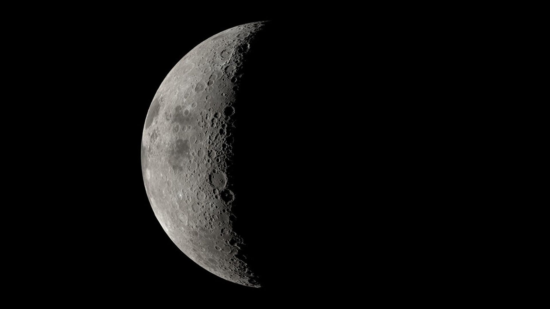
NASA’s Artemis II mission, set to send four astronauts on a nearly 10-day mission around the Moon and back, will advance the agency’s goal to land astronauts at the Moon’s south polar region and will help set the stage for future crewed Mars missions.
While the Artemis II crew will be the first humans to test NASA’s Orion spacecraft in space, they will also conduct science investigations that will inform future deep space missions, including a lunar science investigation as Orion flies about 4,000 to 6,000 miles from the Moon’s surface. From this distance, the Moon will appear to be the size of a basketball held at arm’s length and will provide a unique opportunity for scientific observations.
Artemis II is a chance for astronauts to implement the lunar science skills they’ve developed in training. It’s also an opportunity for scientists and the engineers in mission control to collaborate during real-time operations …Kelsey Young
Artemis II lunar science lead at NASA’s Goddard Space Flight Center in Greenbelt, Maryland.
As Orion passes on the far side of the Moon — the side that always faces away from Earth — the crew will analyze and photograph geologic features on the surface, such as impact craters and ancient lava flows, relying on their extensive geology training in the classroom and in Moon-like places on Earth. The astronauts will also practice describing nuances in shapes, textures, and colors of surface features. This type of information reveals the geologic history of an area and will be critical to collect when Artemis III astronauts explore the surface.
“Artemis II is a chance for astronauts to implement the lunar science skills they’ve developed in training,” said Kelsey Young, Artemis II lunar science lead at NASA’s Goddard Space Flight Center in Greenbelt, Maryland. “It’s also an opportunity for scientists and the engineers in mission control to collaborate during real-time operations, building on the years of testing and simulations that our teams have done together.”
In this May 2024 photo, lunar scientists are working in a mock Science Evaluation Room on the upper floor of the Mission Control Center building at NASA’s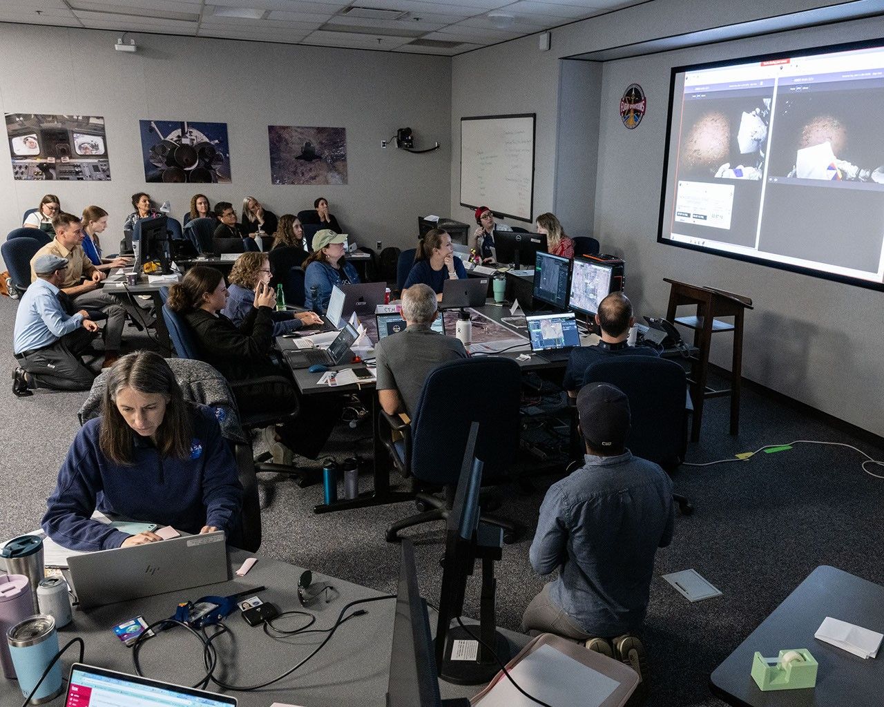
Johnson Space Center in Houston. On the large screens in the background, they are following live as NASA astronauts Kate Rubins and Andre Douglas simulate a moonwalk, in the dark, in northern Arizona’s San Francisco Volcanic Field to help NASA prepare for its Artemis III mission. Scheduled to launch in 2027, Artemis III will land two astronauts at the Moon’s South Pole region. As they did during the 2024 moonwalk simulation, scientists will develop detailed science plans for South Pole moonwalks and provide geology expertise to mission control. NASA/Robert Markowitz
The four Artemis II astronauts, NASA’s Reid Wiseman, Victor Glover, and Christina Koch, and CSA’s (Canadian Space Agency) Jeremy Hansen, could be the first humans to see some parts of the Moon’s far side with the naked eye, depending on the spacecraft’s final trajectory as determined upon launch. During the nine Apollo missions that left Earth’s orbit, astronauts saw parts of the Moon’s far side, but not all of it, as they were limited by which sections were lit during their orbits.
One previously unlit region they may see is the Orientale Basin, a 600-mile-wide crater that serves as a transition point between the near and far side and is sometimes partly visible along the Moon’s western edge.
The astronauts may also get to observe flashes of light from space rocks striking the surface—clues that help reveal how often the Moon gets hit—or dust floating above the edge of the Moon, a mysterious phenomenon scientists want to understand.
To view this video please enable JavaScript, and consider upgrading to a web browser that
supports HTML5 video
The crew’s observations will help pave the way for lunar science activities on future Artemis missions to the Moon’s surface, including Artemis III. Artemis III astronauts will investigate the land forms, rocks, and other features around their landing site. They will also collect rock samples for generations of analyses in Earth labs and set up several instruments to investigate lunar properties and resources — information critical to future human exploration efforts.
“Whether they’re looking out the spacecraft’s windows or walking the surface, Artemis astronauts will be working on behalf of all scientists to collect clues to the ancient geologic processes that shaped the Moon and our solar system,” said Cindy Evans, NASA’s Artemis geology training and strategic integration lead, based at NASA Johnson.
In addition to lunar science observations, the crew will gather data on the effects of the space environment on the crew’s health and performance. These experiments will be managed through the Payload Mission Operations Directorate at NASA’s Marshall Space Flight Center, in Huntsville, Alabama, in tight coordination with mission control. This data could inform long-term lunar exploration and future human missions to Mars.
For more information on Artemis II, visit:
https://www.nasa.gov/mission/artemis-ii/
Related: NASA to Announce New Astronaut Class, Preview Artemis II Moon Mission
Karen Fox / Molly Wasser
Headquarters, Washington
202-358-1600
karen.c.fox@nasa.gov / molly.l.wasser@nasa.gov
Lonnie Shekhtman
NASA’s Goddard Space Flight Center, Greenbelt, Md.
About the Author Lonnie ShekhtmanShare
Details Last Updated Aug 21, 2025 Related Terms Explore More 5 min read Close-Up Views of NASA’s DART Impact to Inform Planetary DefenseArticle
4 hours ago
6 min read Steve Platnick Steps Down from NASA After 34 Years of Service
Article
1 day ago
6 min read NASA, IBM’s ‘Hot’ New AI Model Unlocks Secrets of Sun
Article
1 day ago
Keep Exploring Discover More Topics From NASA
Missions
Humans in Space
Climate Change
Solar System
NASA’s Artemis II Lunar Science Operations to Inform Future Missions
4 min read
NASA’s Artemis II Lunar Science Operations to Inform Future Missions An image of the eastern hemisphere of the Moon as the Artemis II astronauts would see it from an altitude of about 7,000 kilometers. The Moon’s far side is mostly dark in this image, which is based on a simulated trajectory. The dark patches near the center of the sunlit portion are plains of ancient lava: Mare Marginis to the north and Mare Smythii to the south. NASA Goddard/Ernie WrightNASA’s Artemis II mission, set to send four astronauts on a nearly 10-day mission around the Moon and back, will advance the agency’s goal to land astronauts at the Moon’s south polar region and will help set the stage for future crewed Mars missions.
While the Artemis II crew will be the first humans to test NASA’s Orion spacecraft in space, they will also conduct science investigations that will inform future deep space missions, including a lunar science investigation as Orion flies about 4,000 to 6,000 miles from the Moon’s surface. From this distance, the Moon will appear to be the size of a basketball held at arm’s length and will provide a unique opportunity for scientific observations.
Artemis II is a chance for astronauts to implement the lunar science skills they’ve developed in training. It’s also an opportunity for scientists and the engineers in mission control to collaborate during real-time operations …Kelsey Young
Artemis II lunar science lead at NASA’s Goddard Space Flight Center in Greenbelt, Maryland.
As Orion passes on the far side of the Moon — the side that always faces away from Earth — the crew will analyze and photograph geologic features on the surface, such as impact craters and ancient lava flows, relying on their extensive geology training in the classroom and in Moon-like places on Earth. The astronauts will also practice describing nuances in shapes, textures, and colors of surface features. This type of information reveals the geologic history of an area and will be critical to collect when Artemis III astronauts explore the surface.
“Artemis II is a chance for astronauts to implement the lunar science skills they’ve developed in training,” said Kelsey Young, Artemis II lunar science lead at NASA’s Goddard Space Flight Center in Greenbelt, Maryland. “It’s also an opportunity for scientists and the engineers in mission control to collaborate during real-time operations, building on the years of testing and simulations that our teams have done together.”
In this May 2024 photo, lunar scientists are working in a mock Science Evaluation Room on the upper floor of the Mission Control Center building at NASA’sJohnson Space Center in Houston. On the large screens in the background, they are following live as NASA astronauts Kate Rubins and Andre Douglas simulate a moonwalk, in the dark, in northern Arizona’s San Francisco Volcanic Field to help NASA prepare for its Artemis III mission. Scheduled to launch in 2027, Artemis III will land two astronauts at the Moon’s South Pole region. As they did during the 2024 moonwalk simulation, scientists will develop detailed science plans for South Pole moonwalks and provide geology expertise to mission control. NASA/Robert Markowitz
The four Artemis II astronauts, NASA’s Reid Wiseman, Victor Glover, and Christina Koch, and CSA’s (Canadian Space Agency) Jeremy Hansen, could be the first humans to see some parts of the Moon’s far side with the naked eye, depending on the spacecraft’s final trajectory as determined upon launch. During the nine Apollo missions that left Earth’s orbit, astronauts saw parts of the Moon’s far side, but not all of it, as they were limited by which sections were lit during their orbits.
One previously unlit region they may see is the Orientale Basin, a 600-mile-wide crater that serves as a transition point between the near and far side and is sometimes partly visible along the Moon’s western edge.
The astronauts may also get to observe flashes of light from space rocks striking the surface—clues that help reveal how often the Moon gets hit—or dust floating above the edge of the Moon, a mysterious phenomenon scientists want to understand.
To view this video please enable JavaScript, and consider upgrading to a web browser that
supports HTML5 video
The crew’s observations will help pave the way for lunar science activities on future Artemis missions to the Moon’s surface, including Artemis III. Artemis III astronauts will investigate the land forms, rocks, and other features around their landing site. They will also collect rock samples for generations of analyses in Earth labs and set up several instruments to investigate lunar properties and resources — information critical to future human exploration efforts.
“Whether they’re looking out the spacecraft’s windows or walking the surface, Artemis astronauts will be working on behalf of all scientists to collect clues to the ancient geologic processes that shaped the Moon and our solar system,” said Cindy Evans, NASA’s Artemis geology training and strategic integration lead, based at NASA Johnson.
In addition to lunar science observations, the crew will gather data on the effects of the space environment on the crew’s health and performance. These experiments will be managed through the Payload Mission Operations Directorate at NASA’s Marshall Space Flight Center, in Huntsville, Alabama, in tight coordination with mission control. This data could inform long-term lunar exploration and future human missions to Mars.
For more information on Artemis II, visit:
https://www.nasa.gov/mission/artemis-ii/
Related: NASA to Announce New Astronaut Class, Preview Artemis II Moon Mission
Karen Fox / Molly Wasser
Headquarters, Washington
202-358-1600
karen.c.fox@nasa.gov / molly.l.wasser@nasa.gov
Lonnie Shekhtman
NASA’s Goddard Space Flight Center, Greenbelt, Md.
About the Author Lonnie ShekhtmanShare
Details Last Updated Aug 21, 2025 Related Terms Explore More 5 min read Close-Up Views of NASA’s DART Impact to Inform Planetary DefenseArticle
4 hours ago
6 min read Steve Platnick Steps Down from NASA After 34 Years of Service
Article
1 day ago
6 min read NASA, IBM’s ‘Hot’ New AI Model Unlocks Secrets of Sun
Article
1 day ago
Keep Exploring Discover More Topics From NASA
Missions
Humans in Space
Climate Change
Solar System
La NASA invita a los medios al lanzamiento conjunto de misiones sobre el Sol y la meteorología espacial
Read this release in English here.
La NASA ha abierto el plazo para la acreditación de los medios para el lanzamiento de tres observatorios que estudiarán el Sol y mejorarán nuestra capacidad de hacer pronósticos precisos de meteorología espacial, ayudando a proteger los sistemas tecnológicos que impactan la vida en la Tierra.
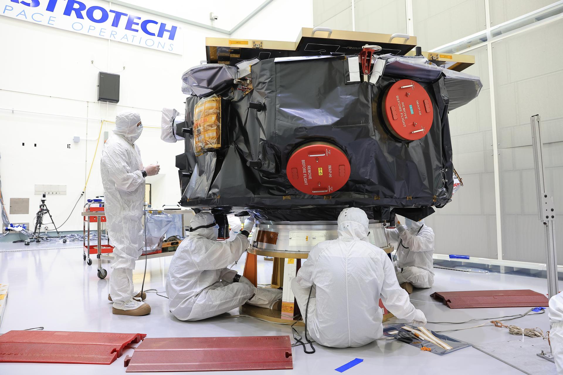
La NASA tiene previsto lanzar, no antes del martes 23 de septiembre, la sonda IMAP (por las siglas en inglés de Sonda de Cartografía y Aceleración Interestelar) de la agencia, el Observatorio Carruthers de la Geocorona y el observatorio Seguimiento de la Meteorología Espacial–Lagrange 1 (SWFO-L1, por su acrónimo en inglés) de la Administración Nacional Oceánica y Atmosférica (NOAA, por sus siglas en inglés). Los observatorios se lanzarán a bordo de un cohete SpaceX Falcon 9 desde el Complejo de Lanzamiento 39A del Centro Espacial Kennedy de la NASA en Florida.
Los medios acreditados tendrán la oportunidad de participar en sesiones informativas previas al lanzamiento y entrevistas con miembros clave de la misión antes del lanzamiento, así como de cubrir el lanzamiento. La NASA comunicará más detalles sobre el calendario de eventos para los medios de comunicación a medida que se acerque la fecha del lanzamiento.
Las fechas límites de acreditación de medios para el lanzamiento son:
- Los miembros de medios de comunicación sin ciudadanía estadounidense deben enviar su solicitud a más tardar a las 11:59 p.m. EDT del domingo, 31 de agosto.
- Los miembros de medios de comunicación con ciudadanía estadounidense deben enviar su solicitud a más tardar a las 11:59 p.m. EDT del jueves, 4 de septiembre.
Todas las solicitudes de acreditación deben enviarse en línea en:
La política de acreditación de medios de la NASA está disponible en línea. Si tiene preguntas sobre el proceso de acreditación, por favor envíelas a: ksc-media-accreditat@mail.nasa.gov. Para otras preguntas, por favor póngase en contacto con el centro de prensa del centro Kennedy de la NASA: +1 321-867-2468.
Para obtener información en español en sobre el Centro Espacial Kennedy, comuníquese con Antonia Jaramillo: 321-501-8425. Si desea solicitar entrevistas en español sobre IMAP, póngase en contacto con María-José Viñas: maria-jose.vinasgarcia@nasa.gov.
La sonda IMAP de la NASA utilizará diez instrumentos científicos para estudiar y mapear la heliosfera, una vasta burbuja magnética que rodea al Sol y protege nuestro sistema solar de la radiación proveniente del espacio interestelar. Esta misión y sus dos compañeros de viaje orbitarán el Sol cerca del punto de Lagrange 1, a aproximadamente 1,6 millones de kilómetros (un millón de millas) de la Tierra, donde escaneará la heliosfera, analizará la composición de partículas cargadas e investigará cómo esas partículas se mueven a través del sistema solar. Esto proporcionará información sobre cómo el Sol acelera las partículas cargadas, aportando información esencial para comprender el entorno meteorológico espacial en todo el sistema solar. IMAP también monitoreará continuamente el viento solar y la radiación cósmica. La comunidad científica podrá usar estos datos para evaluar capacidades nuevas y mejoradas para herramientas y modelos de predicción de la meteorología espacial, que son vitales para la salud de los humanos que exploran el espacio y la longevidad de sistemas tecnológicos, como satélites y redes eléctricas, que pueden afectar la vida en la Tierra.
El Observatorio Carruthers de la Geocorona de la agencia es un pequeño satélite concebido para estudiar la exosfera, la parte más externa de la atmósfera de la Tierra. Utilizando cámaras ultravioletas, monitoreará cómo la meteorología espacial del Sol impacta la exosfera, la cual juega un papel crucial en la protección de la Tierra contra eventos de meteorología espacial que pueden afectar satélites, comunicaciones y líneas eléctricas. La exosfera, una nube de hidrógeno neutro que se extiende hasta la Luna y posiblemente más allá, se crea por la descomposición del agua y el metano por la luz ultravioleta del Sol, y su brillo, conocido como la geocorona, solo se ha observado a nivel mundial cuatro veces antes de esta misión.
La misión SWFO-L1, gestionada por la NOAA y desarrollada con el Centro de Vuelo Espacial Goddard de NASA en Greenbelt, Maryland, y socios comerciales, utilizará un conjunto de instrumentos para proporcionar mediciones en tiempo real del viento solar, junto con un coronógrafo compacto para detectar eyecciones de masa coronal del Sol. El observatorio, que sirve como baliza de alerta temprana para fenómenos meteorológicos espaciales potencialmente destructivos, permitirá pronósticos más rápidos y precisos. Sus datos, disponibles las 24 horas del día, los 7 días de la semana, ayudarán al Centro de Predicción Meteorológica Espacial de la NOAA a proteger infraestructuras vitales, intereses económicos y la seguridad nacional, tanto en la Tierra como en el espacio.
David McComas, profesor de la Universidad de Princeton, lidera la misión IMAP con un equipo internacional de 25 instituciones asociadas. El Laboratorio de Física Aplicada Johns Hopkins en Laurel, Maryland, construyó la nave espacial y opera la misión. IMAP de la NASA es la quinta misión en el portafolio del programa de Sondas Solares Terrestres de la NASA. La División de Exploradores y Proyectos de Heliofísica en el centro Goddard de la NASA gestiona el programa para la División de Heliofísica de la Dirección de Misiones Científicas de la NASA.
Para más detalles (en inglés) sobre la misión IMAP y actualizaciones sobre los preparativos de lanzamiento, visite:
https://science.nasa.gov/mission/imap/
-fin-
Abbey Interrante / María José Viñas
Sede central de la NASA, Washington
301-201-0124
abbey.a.interrante@nasa.gov / maria-jose.vinasgarcia@nasa.gov
Sarah Frazier
Centro de Vuelo Espacial Goddard, Greenbelt, Md.
202-853-7191
sarah.frazier@nasa.gov
Leejay Lockhart
Centro Espacial Kennedy, Fla.
321-747-8310
leejay.lockhart@nasa.gov
John Jones-Bateman
Servicio de Satélites e Información de la NOAA, Silver Spring, Md.
202-242-0929
john.jones-bateman@noaa.gov
La NASA invita a los medios al lanzamiento conjunto de misiones sobre el Sol y la meteorología espacial
Read this release in English here.
La NASA ha abierto el plazo para la acreditación de los medios para el lanzamiento de tres observatorios que estudiarán el Sol y mejorarán nuestra capacidad de hacer pronósticos precisos de meteorología espacial, ayudando a proteger los sistemas tecnológicos que impactan la vida en la Tierra.
La NASA tiene previsto lanzar, no antes del martes 23 de septiembre, la sonda IMAP (por las siglas en inglés de Sonda de Cartografía y Aceleración Interestelar) de la agencia, el Observatorio Carruthers de la Geocorona y el observatorio Seguimiento de la Meteorología Espacial–Lagrange 1 (SWFO-L1, por su acrónimo en inglés) de la Administración Nacional Oceánica y Atmosférica (NOAA, por sus siglas en inglés). Los observatorios se lanzarán a bordo de un cohete SpaceX Falcon 9 desde el Complejo de Lanzamiento 39A del Centro Espacial Kennedy de la NASA en Florida.
Los medios acreditados tendrán la oportunidad de participar en sesiones informativas previas al lanzamiento y entrevistas con miembros clave de la misión antes del lanzamiento, así como de cubrir el lanzamiento. La NASA comunicará más detalles sobre el calendario de eventos para los medios de comunicación a medida que se acerque la fecha del lanzamiento.
Las fechas límites de acreditación de medios para el lanzamiento son:
- Los miembros de medios de comunicación sin ciudadanía estadounidense deben enviar su solicitud a más tardar a las 11:59 p.m. EDT del domingo, 31 de agosto.
- Los miembros de medios de comunicación con ciudadanía estadounidense deben enviar su solicitud a más tardar a las 11:59 p.m. EDT del jueves, 4 de septiembre.
Todas las solicitudes de acreditación deben enviarse en línea en:
La política de acreditación de medios de la NASA está disponible en línea. Si tiene preguntas sobre el proceso de acreditación, por favor envíelas a: ksc-media-accreditat@mail.nasa.gov. Para otras preguntas, por favor póngase en contacto con el centro de prensa del centro Kennedy de la NASA: +1 321-867-2468.
Para obtener información en español en sobre el Centro Espacial Kennedy, comuníquese con Antonia Jaramillo: 321-501-8425. Si desea solicitar entrevistas en español sobre IMAP, póngase en contacto con María-José Viñas: maria-jose.vinasgarcia@nasa.gov.
La sonda IMAP de la NASA utilizará diez instrumentos científicos para estudiar y mapear la heliosfera, una vasta burbuja magnética que rodea al Sol y protege nuestro sistema solar de la radiación proveniente del espacio interestelar. Esta misión y sus dos compañeros de viaje orbitarán el Sol cerca del punto de Lagrange 1, a aproximadamente 1,6 millones de kilómetros (un millón de millas) de la Tierra, donde escaneará la heliosfera, analizará la composición de partículas cargadas e investigará cómo esas partículas se mueven a través del sistema solar. Esto proporcionará información sobre cómo el Sol acelera las partículas cargadas, aportando información esencial para comprender el entorno meteorológico espacial en todo el sistema solar. IMAP también monitoreará continuamente el viento solar y la radiación cósmica. La comunidad científica podrá usar estos datos para evaluar capacidades nuevas y mejoradas para herramientas y modelos de predicción de la meteorología espacial, que son vitales para la salud de los humanos que exploran el espacio y la longevidad de sistemas tecnológicos, como satélites y redes eléctricas, que pueden afectar la vida en la Tierra.
El Observatorio Carruthers de la Geocorona de la agencia es un pequeño satélite concebido para estudiar la exosfera, la parte más externa de la atmósfera de la Tierra. Utilizando cámaras ultravioletas, monitoreará cómo la meteorología espacial del Sol impacta la exosfera, la cual juega un papel crucial en la protección de la Tierra contra eventos de meteorología espacial que pueden afectar satélites, comunicaciones y líneas eléctricas. La exosfera, una nube de hidrógeno neutro que se extiende hasta la Luna y posiblemente más allá, se crea por la descomposición del agua y el metano por la luz ultravioleta del Sol, y su brillo, conocido como la geocorona, solo se ha observado a nivel mundial cuatro veces antes de esta misión.
La misión SWFO-L1, gestionada por la NOAA y desarrollada con el Centro de Vuelo Espacial Goddard de NASA en Greenbelt, Maryland, y socios comerciales, utilizará un conjunto de instrumentos para proporcionar mediciones en tiempo real del viento solar, junto con un coronógrafo compacto para detectar eyecciones de masa coronal del Sol. El observatorio, que sirve como baliza de alerta temprana para fenómenos meteorológicos espaciales potencialmente destructivos, permitirá pronósticos más rápidos y precisos. Sus datos, disponibles las 24 horas del día, los 7 días de la semana, ayudarán al Centro de Predicción Meteorológica Espacial de la NOAA a proteger infraestructuras vitales, intereses económicos y la seguridad nacional, tanto en la Tierra como en el espacio.
David McComas, profesor de la Universidad de Princeton, lidera la misión IMAP con un equipo internacional de 25 instituciones asociadas. El Laboratorio de Física Aplicada Johns Hopkins en Laurel, Maryland, construyó la nave espacial y opera la misión. IMAP de la NASA es la quinta misión en el portafolio del programa de Sondas Solares Terrestres de la NASA. La División de Exploradores y Proyectos de Heliofísica en el centro Goddard de la NASA gestiona el programa para la División de Heliofísica de la Dirección de Misiones Científicas de la NASA.
Para más detalles (en inglés) sobre la misión IMAP y actualizaciones sobre los preparativos de lanzamiento, visite:
https://science.nasa.gov/mission/imap/
-fin-
Abbey Interrante / María José Viñas
Sede central de la NASA, Washington
301-201-0124
abbey.a.interrante@nasa.gov / maria-jose.vinasgarcia@nasa.gov
Sarah Frazier
Centro de Vuelo Espacial Goddard, Greenbelt, Md.
202-853-7191
sarah.frazier@nasa.gov
Leejay Lockhart
Centro Espacial Kennedy, Fla.
321-747-8310
leejay.lockhart@nasa.gov
John Jones-Bateman
Servicio de Satélites e Información de la NOAA, Silver Spring, Md.
202-242-0929
john.jones-bateman@noaa.gov