NASA News

Curiosity Blog, Sols 4852–4858: When Data Take Their Time…
- Curiosity Home
- Science
- News and Features
- Multimedia
- Mars Missions
- Mars Home
4 min read
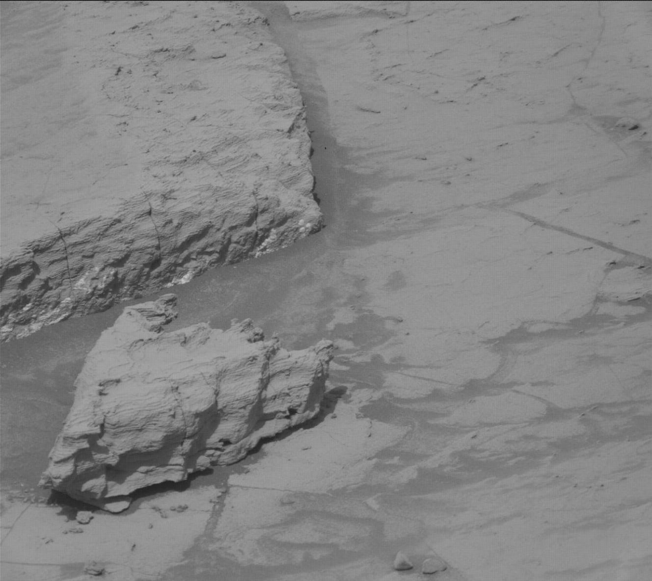
Curiosity Blog, Sols 4852–4858: When Data Take Their Time… NASA’s Mars rover Curiosity acquired this image using its Mast Camera (Mastcam), showing polygons and other interesting textures that characterize the terrain beyond the boxwork area. Curiosity captured the image on April 3, 2026 — Sol 4855, or Martian day 4,85 of the Mars Science Laboratory mission — at 12:26:28 UTC. NASA/JPL-Caltech/MSSSWritten by Susanne P. Schwenzer, Professor of Planetary Mineralogy at The Open University, UK
Earth planning date: Friday, April 3, 2026
I was the geology science team lead on Monday for planning Sols 4852-4853, when our data did not arrive on time for planning. Thus, we got creative as a team thinking what we could do, not knowing where exactly our rover might be. And for that we first thought about AEGIS, the capability of the rover to find a target for ChemCam LIBS measurements on its own.
We normally use this capability after drives, before we have seen the data here on Earth, to get an extra LIBS measurement. This time, we put two of those observations into the plan, and added many atmospheric and environmental observations, such as dust-devil movies, too. It’s an interesting planning session that always makes the team talk more than normal, because there are no routines for those days! I find it both tense and rewarding at the same time. Anything that isn’t quite as expected adds levels of complexity that require more focus and more thinking, hence making me tense. But it is also really nice when we’ve succeeded in making the best of those days. My colleagues also seem to have lots of energy and are especially supportive of each other. That said, like everyone else I prefer the routine days where everything goes right and we focus on the science.
All our data arrived perfectly fine in time for planning on Wednesday and we found ourselves in a terrain with many blocks that have polygons on their top surface. Do check out the images, it’s a wild terrain that reminded me of some boulder-rich terrains we have seen back on the margins of the Gediz Vallis Channel. It is interesting to see the distribution of the blocks, and I am curious how they might change along the traverse up Mount Sharp. For now, we have an activity that we call “MARDI sidewalk” in the plan. This means the MARDI camera takes images while the rover is driving, on Sol 4855. Those image sequences give great insights into changing terrains, and we are looking forward to the data reaching us!
Over the course of the week, ChemCam did three AEGIS observations and four human-pointed observations on the targets “Las Petas,” “Punta Negra,” “Pampa del Molle,” and “Los Condores.” We were trying to measure the normal-looking bedrock and all the different features, some of which you can see in the image above. We want to find out what the higher-standing materials are that form those prominent polygons. APXS is getting four targets in the plan, also looking at the diversity of rocks. These are called “Rio Espiritu Santo,” “La Escalera,” “Los Condores,” and “Tropico de Capricornio.” It’s all focused on understanding what forms the polygons, because any differences in chemistry could tell us a lot about what happened and how the polygons came to be. By extension, this will then allow the team to deduce the environmental conditions at the time the polygons formed.
As you may guess, imaging is very important in a landscape as varied as this! Mastcam is looking in many directions in the near-field and further up the road — our projected drive path. In addition, ChemCam is taking long-distance images with its Remote Micro Imager (RMI) to get a closer look at the walls around us. The butte called “Mishe Mokwa” is still one of the RMI and Mastcam favorites because it gives us many insights into its structure as we are driving past and also somewhat around it.
Atmospheric and environmental observations occur all across the plans and include atmospheric opacity measurements, dust-devil searches and, in Friday’s plan, also an APXS atmospheric measurement. The DAN instrument is monitoring water in the subsurface across all plans. So, it’s three full plans, despite the little extra wait on the data!
And while I am writing this, four astronauts in the Orion capsule are on the way around the Moon. I am very excited! When Apollo 8 was the very first mission to ever fly around the Moon in December 1968, I wasn’t born yet. In fact, I arrived a few months after Apollo 11 had landed on the Moon for the first time. Now being able to witness these lunar missions myself, to hear the voices between the Integrity spacecraft and the control room in Houston, and to see the pictures as they arrive … magnificent! Go, Artemis II!
-
Want to read more posts from the Curiosity team?
-
Want to learn more about Curiosity’s science instruments?
Article
28 minutes ago
4 min read Curiosity Blog, Sols 4838-4844: Wrapping Up the Boxwork Terrain
Article
3 weeks ago
3 min read Curiosity Blog, Sols 4832–4837: Driving the (Contact) Line!
Article
4 weeks ago
Keep Exploring Discover More Topics From NASA Mars
Mars is the fourth planet from the Sun, and the seventh largest. It’s the only planet we know of inhabited…
All Mars Resources
Explore this collection of Mars images, videos, resources, PDFs, and toolkits. Discover valuable content designed to inform, educate, and inspire,…
Rover Basics
Each robotic explorer sent to the Red Planet has its own unique capabilities driven by science. Many attributes of a…
Mars Exploration: Science Goals
The key to understanding the past, present or future potential for life on Mars can be found in NASA’s four…
Curiosity Blog, Sols 4845-4851: Bye-Bye Boxwork, Bye-Bye
- Curiosity Home
- Science
- News and Features
- Multimedia
- Mars Missions
- Mars Home
3 min read
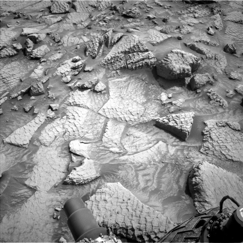
Curiosity Blog, Sols 4845-4851: Bye-Bye Boxwork, Bye-Bye NASA’s Mars rover Curiosity acquired this image, showing the polygonal sulfate unit currently being investigated by the rover after leaving the boxwork terrain. Curiosity captured the image using its Left Navigation Camera on March 27, 2026 — Sol 4848, or Martian day 4,848 of the Mars Science Laboratory mission — at 10:43:16 UTC. NASA/JPL-CaltechWritten by Lucy Thompson, APXS Strategic Planner and Planetary Geologist at the University of New Brunswick, Canada
Earth planning date: Friday, March 27, 2026
Last weekend’s drive took us just over the southernmost contact of the boxwork terrain with the surrounding layered sulfate unit. This was our third time crossing this contact, providing an excellent opportunity to look for any changes across it. We have acquired multiple observations (chemistry and imaging for textures) of the boxwork-bearing bedrock close to the contact. We are also interested in determining whether the layered sulfate unit to the south of the boxwork terrain has the same depositional setting as that encountered to the north. Is the composition the same as the typical layered sulfate unit we encountered prior to the boxwork, or could there be a change associated with a different depositional environment, source sediment, or potential alteration along the contact with the boxwork?
Unfortunately, although the weekend drive was successful, Curiosity was not on stable enough ground coming into planning Monday to brush the dusty bedrock, although we were able to get MAHLI imaging of a block within the workspace. The rover engineers repositioned the rover so that we could safely unstow the arm, brush, image with MAHLI, and analyze with APXS the layered sulfate unit bedrock just across the contact (“Santa Rosa”) in Wednesday’s plan. We also looked at a concentration of granules with APXS and MAHLI (“Piedra Colgada”). They appear to be a collection of fine nodules that eroded from the bedrock, thereby allowing us to obtain chemical and textural data on these nodules.
The drive planned on Wednesday took us another 50 meters (about 164 feet) away from the boxwork, to a stunning sulfate unit workspace. The bedrock contained abundant resistant ridges forming a polygonal pattern. We wanted to compare these current exposures with polygonal textures observed previously, for example, within the boxwork, the sulfate unit before the boxwork, and the clay-sulfate transition. We are brushing two spots on the bedrock in front of us (“Ocharaza” and “Nevado Tres Cruces”) and analyzing them both with APXS and MAHLI for chemistry and texture.
Across the three plans, Mastcam imaging was acquired of the boxwork terrain behind, the sulfate unit ahead, and the rocks immediately in front of us. In particular, this weekend’s plan was jam-packed full of mosaics to capture the amazing polygonal textures surrounding the rover. The planned 30-meter drive (about 98 feet) should keep us in this same terrain.
The environmental group has also been busy planning multiple observations to monitor atmospheric opacity, optical depth and aerosol scattering properties, clouds, wind direction, and potential dust-devil activity. Navcam and Mastcam are utilized to make these observations. As usual, our plans this week included the standard DAN, REMS and RAD activities.
-
Want to read more posts from the Curiosity team?
-
Want to learn more about Curiosity’s science instruments?
Article
36 seconds ago
4 min read Curiosity Blog, Sols 4838-4844: Wrapping Up the Boxwork Terrain
Article
3 weeks ago
3 min read Curiosity Blog, Sols 4832–4837: Driving the (Contact) Line!
Article
4 weeks ago
Keep Exploring Discover More Topics From NASA Mars
Mars is the fourth planet from the Sun, and the seventh largest. It’s the only planet we know of inhabited…
All Mars Resources
Explore this collection of Mars images, videos, resources, PDFs, and toolkits. Discover valuable content designed to inform, educate, and inspire,…
Rover Basics
Each robotic explorer sent to the Red Planet has its own unique capabilities driven by science. Many attributes of a…
Mars Exploration: Science Goals
The key to understanding the past, present or future potential for life on Mars can be found in NASA’s four…
NASA to Host Artemis II Crew Postflight News Conference
Fresh off their return to Earth, the Artemis II astronauts will hold a news conference at 2:30 p.m. EDT Thursday, April 16, at NASA’s Johnson Space Center in Houston to discuss their historic mission around the Moon.
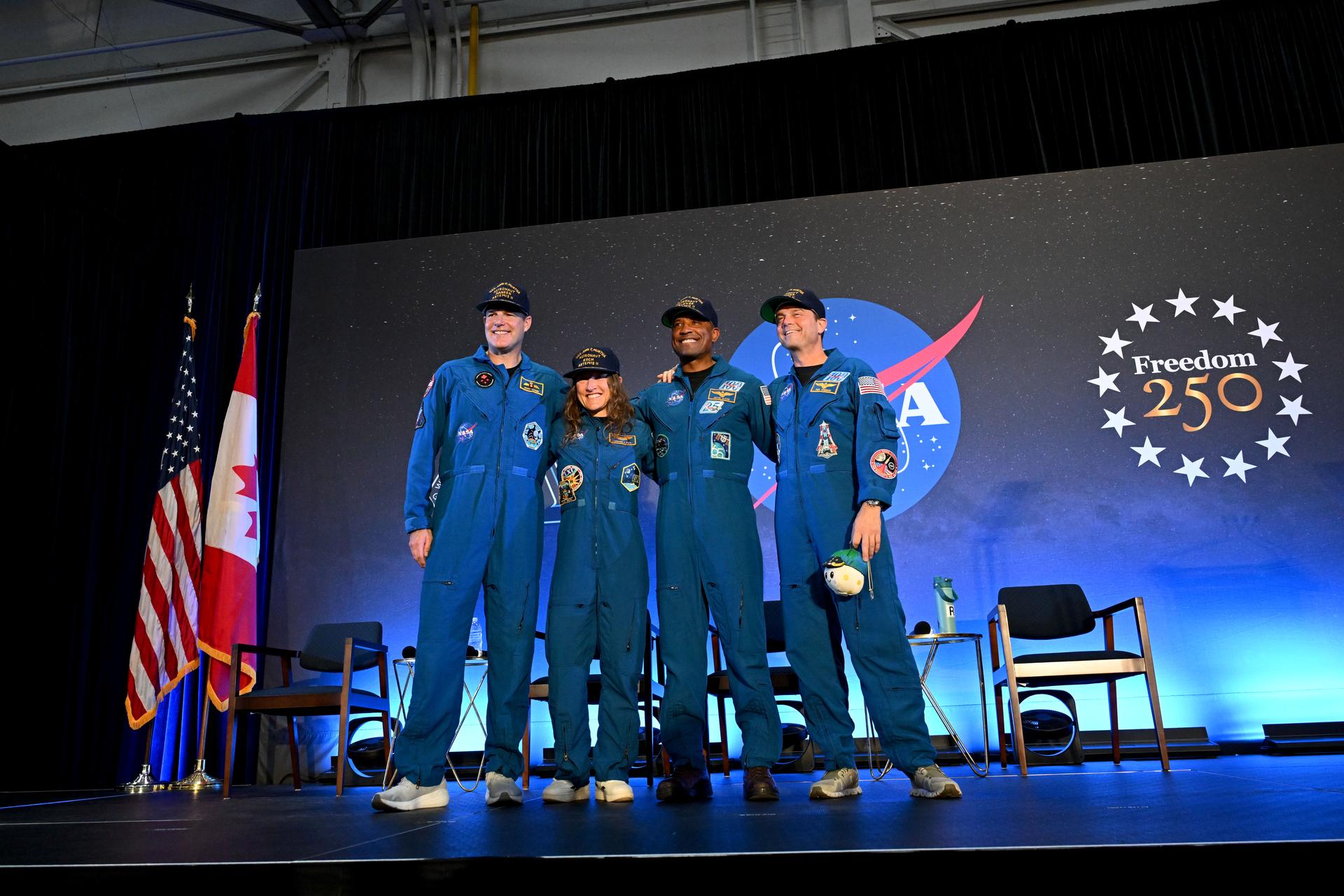
NASA astronauts Reid Wiseman, Victor Glover, and Christina Koch, along with CSA (Canadian Space Agency) astronaut Jeremy Hansen, will answer questions about their mission. The crew returned to Earth on April 10, splashing down off the coast of San Diego, and arrived in Houston on April 11, where they are undergoing standard postflight reconditioning, evaluations, and lunar science debriefs.
NASA will provide live coverage of the news conference on the agency’s YouTube channel. Learn how to watch NASA content through a variety of additional online platforms, including social media.
Media are invited to attend in person or by phone.
In-person attendance is limited to media previously credentialed by NASA Johnson for the Artemis II mission. To attend in person, contact the NASA Johnson newsroom by 5 p.m. CDT Tuesday, April 14, at jsccommu@mail.nasa.gov.
Media joining by phone must RSVP to the NASA Johnson newsroom via email by 5 p.m. CDT Wednesday, April 15. Those participating by phone must dial in no later than 10 minutes before the start of the event.
NASA’s media accreditation policy is available on the agency’s website.
The Artemis II mission launched April 1 on NASA’s SLS (Space Launch System) rocket from the agency’s Kennedy Space Center in Florida. During the nearly 10‑day test flight, the crew achieved the mission’s primary objectives, including testing its life support systems; manually piloting the Orion spacecraft; performing maneuvers to propel Orion to the Moon and adjust its course; conducting a lunar flyby with unprecedented views of the Moon’s far side; and completing a safe re-entry and recovery. The astronauts also set a record for the farthest distance traveled by humans away from Earth.
As part of a Golden Age of innovation and exploration, NASA will send Artemis astronauts on increasingly challenging missions to explore more of the Moon for scientific discovery, economic benefits, establish an enduring human presence on the lunar surface, and lay the groundwork for sending the first astronauts – American astronauts – to Mars.
Learn more about the mission by visiting:
https://www.nasa.gov/artemis-ii
-end-
Rachel Kraft / Lauren Low
Headquarters, Washington
202-358-1600
rachel.h.kraft@nasa.gov / lauren.e.low@nasa.gov
Courtney Beasley
Johnson Space Center, Houston
281-483-5111
courtney.m.beasley@nasa.gov
Artemis II Astronauts Aboard USS John P. Murtha
The first astronauts to travel to the Moon in more than half a century are back on Earth after a record-setting mission aboard NASA’s Artemis II test flight.
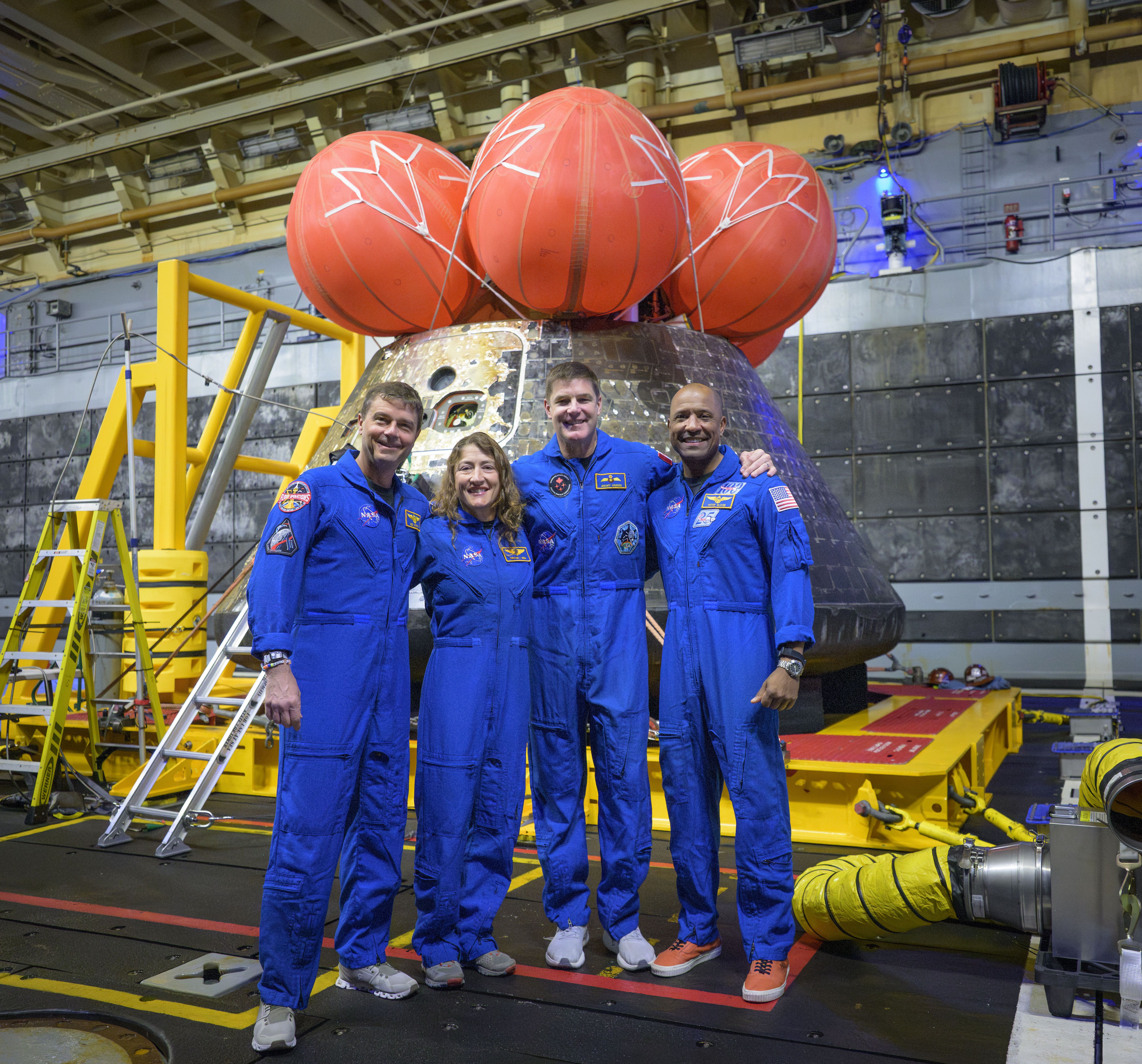
NASA astronauts Reid Wiseman (commander), Christina Koch (mission specialist), Victor Glover (pilot), and CSA astronaut Jeremy Hansen (mission specialist) pose for a group photo in the well deck of the USS John P. Murtha after inspecting the Orion spacecraft on Saturday, April 11, 2026.
The crew splashed down in the Pacific Ocean off the coast of California on Friday, April 10, at 5:07 p.m. PDT (8:07 p.m. EDT), marking the completion of their Artemis II mission.
After splashdown in the Pacific Ocean, the astronauts were met by a combined NASA and U.S. military team that assisted them out of the spacecraft in open water and transported them via helicopter to the USS John P. Murtha for initial medical checkouts.
Artemis II is the first crewed flight aboard NASA’s human deep space capabilities, paving the way for future lunar surface missions.
NASA Night-light Imagery Tracks US Energy Transition, Global Volatility
- Earth
- Explore
- Science at Work
- Multimedia
- Data
- For Researchers
- About Us
Kel Elkins/NASA’s Scientific Visualization Studio
New nighttime maps based on NASA satellite imagery are upending assumptions, revealing a world where artificial brightening and dimming have intensified over the past decade. The findings show intense flaring over major oil and gas fields in the United States, while factors such as rural electrification and energy conservation are changing how billions around the world experience the night.
Scientists analyzed 1.6 million satellite images collected every night for nine years to picture Earth in a new light. Their findings reveal a world flickering with change. Data image by Michala Garrison/ NASA Earth Observatory“Unlocking energy sector insights is just one way NASA data is advancing national security interests at a critical time,” said Miguel Román, deputy director for atmospheres and data systems at NASA’s Goddard Space Flight Center in Greenbelt, Maryland. “Earth at night has so much to teach us.”
The study team, led by Tian Li and Zhe Zhu at the University of Connecticut, used a new algorithm to analyze 1.16 million satellite images collected at approximately 1:30 a.m. local time every day for nine years by the Visible Infrared Imaging Radiometer Suite (VIIRS). The refrigerator-size sensors, orbiting Earth at over 16,000 mph, can resolve light sources down to the scale of a toll booth on a dark highway. They fly aboard Earth science satellites that were launched and operated by NASA and the National Oceanic and Atmospheric Administration (NOAA).
The analysis, reported April 8 in Nature, covered most of the inhabited world, from latitudes between 60 degrees south and 70 degrees north. During the time frame analyzed—2014 to 2022—domestic production of oil and natural gas reached record levels, driven by technological developments and horizontal drilling. Satellite imagery revealed cycles of intense gas flaring over central U.S. regions, particularly the Permian Basin in Texas and North Dakota’s Bakken Formation. Flaring occurs at oil wellheads when excess gas—mostly methane—is burned off. The process releases carbon dioxide and soot, among other byproducts.
Flared gas is money burned, said Deborah Gordon, a methane expert at the non-profit Rocky Mountain Institute (RMI) who was not involved in the study. “Letting operators, investors, and insurers know that this is happening is a huge value proposition, both privately and publicly to the world. And it all starts with taxpayer dollars and NASA.”
Scientists, such as Gordon, and analysts across industries, use NASA night-light data to understand how energy moves through grids, pipelines, and supply chains in near real time. The data is free to access via the agency’s Black Marble product suite.
“Understanding where gas is being wasted around the globe and to have this data be public is huge for energy, and economic and environmental security,” Gordon said. “The Black Marble product provides free, openly validated flaring data that are critical inputs into RMI’s suite of public tools.”
City of Light saves energy, global shocks revealedThe latest nighttime maps also challenge some long-held assumptions.
Instead of a planet that simply glows brighter over time due to development—the prevailing view among researchers for decades—the new analysis portrays a world flickering with industrial booms and busts, construction, and blackouts, as well as more gradual shifts, such as policy-driven retrofits.
The study team was able to detect changes in night lights continuously, pixel by pixel, using methods that filter out interference from moonlight, clouds, and atmospheric effects. Their approach acts like giving satellites “smart glasses,” allowing them to focus on real changes.
Overall, the researchers found that global radiance increased by 34% during the study period, but that surge masks large areas of dimming. Such “bidirectional changes” often happen side by side. In the U.S., for example, West Coast cities grew brighter as their populations increased, while much of the East Coast showed dimming, which the team attributed to the use of energy-efficient LEDs and broader economic restructuring.
The authors concluded that internationally, nighttime light surged in China and northern India along with urban development, while LEDs and energy conservation measures coincided with reduced light pollution in Paris and throughout France (a 33% dimming), the UK (22% dimming), and the Netherlands (21% dimming). European nights dimmed sharply in 2022 during a regional energy crisis that followed the outbreak of the Russia-Ukraine conflict.
Tracking such dips and flares night after night “is like watching the heartbeat of the planet,” said coauthor Zhe Zhu, director of the Global Environmental Remote Sensing Laboratory at the University of Connecticut.
Flying since 2011, VIIRS sensors now are carried aboard three satellite platforms: Suomi NPP, NOAA-20, and NOAA-21. The instruments can sense light spanning visible to thermal infrared wavelengths. Their unique day-night band is ultrasensitive in low-light conditions, achieving finer resolution compared to previous night-light imagery provided by the Defense Meteorological Satellite Program.
Learn More
By Sally Younger
NASA’s Earth Science News Team
Share Details Last Updated Apr 13, 2026 Related Terms Explore More 3 min read Hubble Spies an Active SpiralArticle
4 hours ago
5 min read Megaberg Ends Its Long Odyssey at Sea
Antarctic Iceberg A-23A’s journey ends in fragmentation in the South Atlantic Ocean, after a 40-year…
Article
12 hours ago
2 min read Earthset From the Lunar Far Side
The crew of NASA’s Artemis II mission captured extraordinary images of our home planet during…
Article
4 days ago
Keep Exploring Discover More Topics From NASA
Missions
Humans in Space
Climate Change
Solar System
Hubble Spies an Active Spiral
- Hubble Home
- Overview
- Impact & Benefits
- Science
- Observatory
- Team
- Multimedia
- News
- More
ESA/Hubble & NASA, M. J. Koss, A. J. Barth
A luminous swirl set against the deep black of space, the barred spiral galaxy IC 486 glows with a soft, ethereal light in this new NASA Hubble Space Telescope image.
IC 486 lies right on the edge of the constellation Gemini (the Twins), around 380 million light-years from Earth. Classified as a barred spiral galaxy, it features a bright central bar-shaped structure from which its spiral arms unfurl, wrapping around the core in a smooth, almost ring-like pattern.
Hubble’s keen eye reveals subtle variations in color across the galaxy. The pale, luminous center is dominated by older stars, while faint bluish regions in the surrounding disk trace pockets of more recent star formation. Wisps of dust thread through the galaxy’s structure, gently obscuring light and tracing regions of increased molecular gas where new stars are likely to form.
The barred spiral galaxy IC 486 glows with a soft, ethereal light in this new NASA Hubble Space Telescope image. ESA/Hubble & NASA, M. J. Koss, A. J. BarthAt the galaxy’s center a noticeable white glow outshines the starlight around it. This is light from IC 486’s active galactic nucleus (AGN), which is powered by a supermassive black hole more than 100 million times the mass of the Sun. Every sufficiently large galaxy hosts a supermassive black hole at its center, but some of these black holes are particularly ravenous, assembling vast amounts of gas and dust into swirling accretion disks from which they feed. The intense heat generated by the orbiting disk of material generates intense radiation, including X-rays, which can outshine the entire rest of the galaxy. In these cases, the galaxy is known as an active galaxy, with an AGN at its center.
The data used to make this image comes from two separate observing programs — #17310 (PI: M. J. Koss) and #15444 (PI: A. J. Barth) — with similar aims: to survey nearby active galaxies like IC 486 and record detailed, high-quality images of their central black holes and the stars near the core of the galaxy. By combining Hubble’s sharp imaging capabilities with large comprehensive samples, these programs enable detailed comparisons of how stars, gas, dust, and black holes interact in galaxy centers.
This wide-field view of the spiral galaxy IC 486 from NASA’s Hubble Space Telescope features a vibrant scene of distant background galaxies and foreground stars. Some stars appear with characteristic diffraction spikes. However, much of the field is dominated by the more diffuse, orange-red smudges of far more distant galaxies. ESA/Hubble & NASA, M. J. Koss, A. J. BarthA key goal of this work is to understand how galaxies grow by linking their large-scale structures, such as bars and spiral arms, to activity in their nuclei. To achieve this, the research teams leverage both expert classifications and citizen science through Galaxy Zoo, with datasets they will ultimately release to the public. In parallel, researchers are using the same images to test how well large language models and other machine learning techniques can reproduce or extend human classifications, offering a new way to scale galaxy morphology studies to the largest surveys that telescopes like Euclid and the Vera Rubin Observatory are preforming, and NASA’s Roman Space Telescope will perform.
Beyond IC 486, distant background galaxies and foreground stars pepper the image. Some stars appear with characteristic diffraction spikes, while the more diffuse, reddish smudges are far more distant galaxies scattered across the cosmos.
Though it may appear calm and orderly, IC 486 is a dynamic system shaped by gravity and stellar evolution. Over millions of years, its structure will continue to evolve as stars are born, age, and fade, contributing to the ongoing story of galactic life in the universe.
Facebook logo @NASAHubble @NASAHubble Instagram logo @NASAHubbleMedia Contact:
Claire Andreoli
NASA’s Goddard Space Flight Center, Greenbelt, MD
claire.andreoli@nasa.gov
Since its 1990 launch, the Hubble Space Telescope has changed our fundamental understanding of the universe.
Hubble Images
Hubble’s Galaxies
Hubble News
La NASA da la bienvenida a la Tierra a los exploradores lunares de Artemis II, quienes batieron récords
Los primeros astronautas en viajar a la Luna en más de medio siglo han regresado a la Tierra tras una misión que ha establecido nuevos récords a bordo del vuelo de prueba Artemis II de la NASA.
Los astronautas de la NASA Reid Wiseman, Victor Glover y Christina Koch, y el astronauta Jeremy Hansen de la CSA (Agencia Espacial Canadiense) amerizaron a las 5:07 p.m. PDT (hora del Pacífico) de este viernes frente a la costa de San Diego, completando un viaje de casi 10 días que los llevó a una distancia máxima de 406.771 kilómetros (252.756 millas) de la Tierra.
“Reid, Victor, Christina y Jeremy: bienvenidos a casa y felicitaciones por un logro verdaderamente histórico. La NASA agradece al presidente Donald Trump y a sus aliados en el Congreso por proporcionar el mandato y los recursos que hicieron posible esta misión y el futuro de Artemis”, dijo el administrador de la NASA, Jared Isaacman. “Artemis II demostró una habilidad, valentía y dedicación extraordinarias a medida que la tripulación llevaba a Orion, al Sistema de Lanzamiento Espacial [SLS, por sus siglas en inglés] y a la exploración humana más lejos que nunca. Al ser los primeros astronautas en volar en este cohete y en esta nave espacial, la tripulación aceptó un riesgo considerable al servicio del conocimiento adquirido y el futuro que estamos decididos a construir. La NASA también reconoce las contribuciones de toda la fuerza laboral de esta agencia, así como la de nuestros socios internacionales, cuya pericia y compromiso fueron esenciales para el éxito de esta misión. Con la misión Artemis II completada, la atención se centra ahora con confianza en el ensamblaje de Artemis III y en los preparativos para regresar a la superficie lunar, establecer una base y no volver a abandonar la Luna jamás”.
Después de su amerizaje en el océano Pacífico, los astronautas fueron recibidos por un equipo combinado de la NASA y el ejército de Estados Unidos, que los asistió para salir de la nave espacial en mar abierto y los transportó en helicóptero hasta el buque USS John P. Murtha para someterse a exámenes médicos iniciales. Se espera que los miembros de la tripulación regresen al Centro Espacial Johnson de la NASA en Houston el sábado 11 de abril.
Durante su misión, Wiseman, Glover, Koch y Hansen recorrieron un total de 1.117.659 kilómetros (694.481 millas). Su sobrevuelo lunar los llevó más lejos de lo que jamás han viajado antes los seres humanos, superando el récord de la distancia anterior establecido por los astronautas del Apolo 13 en 1970.
La primera tripulación de Artemis despegó a bordo del cohete SLS de la NASA a las 6:35 p.m. del 1 de abril, desde la plataforma de lanzamiento 39B en el Centro Espacial Kennedy de la agencia en Florida. Con casi cuatro millones de kilogramos (8,8 millones de libras) de empuje en el momento del despegue, el cohete de fabricación estadounidense impulsó hacia el espacio a la tripulación ubicada dentro de la nave espacial Orion, situándola en órbita con una precisión milimétrica después de una cuenta regresiva sin contratiempos, dirigida por el equipo de control de lanzamiento de Artemis de la agencia.
Durante el primer día en el espacio, los astronautas y los equipos en tierra inspeccionaron la nave espacial —a la que la tripulación ha dado el nombre de Integrity (Integridad en español)— para confirmar que todos los sistemas funcionaban correctamente antes de hacer el tránsito hacia la Luna. La NASA también desplegó en la órbita terrestre cuatro pequeños satélites CubeSat de sus socios internacionales.
En el segundo día del vuelo de prueba, con todos los sistemas listos (“Go” en el argot astronáutico), el módulo de servicio de Orion encendió su motor principal, situando a los astronautas en una trayectoria que los llevó a 6.545 kilómetros (4.067 millas) por encima de la superficie lunar en su aproximación más cercana.
“La tripulación de Artemis II ya está en casa. Los sistemas de reentrada, descenso y aterrizaje funcionaron tal como fueron diseñados, y la prueba final se completó según lo previsto. Este momento pertenece a las miles de personas, de catorce países distintos, que construyeron este vehículo, lo sometieron a pruebas y depositaron su confianza en él. Su trabajo protegió cuatro vidas humanas que viajaban a 40.233 kilómetros (25.000 millas) por hora, y las trajo de regreso a la Tierra sanas y salvas”, dijo Amit Kshatriya, administrador asociado de la NASA. “Artemis II ha validado el vehículo, los equipos, la arquitectura y la colaboración internacional que llevarán de nuevo a la humanidad a la superficie lunar. Reid, Victor, Christina y Jeremy llevaron las esperanzas de este mundo más lejos de lo que los seres humanos han viajado en más de medio siglo. Hace 53 años, la humanidad dejó la Luna. Esta vez, hemos regresado para quedarnos. El futuro es nuestro para conquistarlo”.
Con astronautas a bordo por primera vez, los ingenieros sometieron a Orion a una evaluación completa durante el vuelo. La tripulación puso a prueba los sistemas de soporte vital de la nave espacial, confirmando que Orion es capaz de dar sustento a seres humanos en el espacio profundo. Durante varias demostraciones de pilotaje, los miembros de la tripulación tomaron el control manual de la astronave, pilotando a Orion para validar su maniobrabilidad y recopilar datos que servirán de guía para futuras operaciones de encuentro y acoplamiento con módulos de aterrizaje aptos para llevar tripulación durante la misión Artemis III y otras misiones futuras.
La tripulación completó una serie de pruebas que servirán de orientación para la forma en que la NASA llevará a cabo futuras misiones a la Luna. Entre estas pruebas se incluyeron evaluaciones sobre el funcionamiento de la nave espacial durante los ejercicios de la tripulación, el equipo y los procedimientos de emergencia, los trajes espaciales del sistema de supervivencia de la tripulación de Orion y otros sistemas críticos de la nave.
Wiseman, Glover, Koch y Hansen también respaldaron investigaciones científicas destinadas a ayudar a la NASA a preparar a los astronautas para vivir y trabajar en la Luna, a medida que la agencia construye una base lunar y fija su mirada en Marte. Estos experimentos —entre los que se incluye la investigación AVATAR, la cual estudia cómo responde el tejido humano a la microgravedad y al entorno de radiación del espacio profundo, así como otros estudios de investigación sobre los seres humanos y su desempeño—recopilan datos esenciales sobre la salud para misiones de larga duración.
Durante su sobrevuelo lunar del 6 de abril, los astronautas capturaron más de 7.000 imágenes de la superficie lunar y de un eclipse solar, durante el cual la Luna ocultó al Sol desde el punto de observación de Orion. Las imágenes incluyen vistas impresionantes de la puesta y la salida de la Tierra, cráteres de impacto, antiguos flujos de lava, nuestra galaxia, la Vía Láctea, así como de fracturas en la superficie y variaciones de color a lo largo del terreno lunar.
La tripulación documentó la topografía a lo largo del terminador —el límite entre el día y la noche lunares—, donde la luz solar rasante (de ángulo cerrado) proyecta largas sombras sobre la superficie, creando condiciones de iluminación similares a las de la región del Polo Sur, donde está previsto que alunicen los astronautas en 2028. Los astronautas también propusieron posibles nombres para dos cráteres lunares, e informaron sobre destellos de impactos de meteoroides en el lado de la Luna a oscuras.
Las investigaciones científicas de Artemis II allanarán el camino para futuras misiones a la superficie de la Luna, al contribuir al avance de las operaciones de misiones y capacitar a los astronautas para ejercer un juicio fundamentado a fin de identificar áreas de gran interés para la ciencia y la exploración.
Con la tripulación a salvo en la Tierra, la NASA y sus socios ahora centrarán su atención en los preparativos para la misión Artemis III del próximo año, en la que una nueva tripulación a bordo de Orion pondrá a prueba las operaciones integradas con módulos de aterrizaje lunar de fabricación comercial en la órbita terrestre baja.
Como parte de una edad de oro de innovación y exploración, la NASA enviará a los astronautas del programa Artemis en misiones cada vez más desafiantes para explorar más regiones de la Luna para lograr descubrimientos científicos y beneficios económicos, establecer una presencia humana duradera en la superficie lunar y sentar las bases para enviar a los primeros astronautas —astronautas estadounidenses— a Marte.
Para obtener más información sobre el programa Artemis, visita :
https://www.nasa.gov/artemis (en inglés)
https://ciencia.nasa.gov/artemis (en español)
-fin-
Bethany Stevens / Rachel Kraft / María José Viñas
Sede central de la NASA, Washington
202-358-1600
bethany.c.stevens@nasa.gov / rachel.h.kraft@nasa.gov / maria-jose.vinasgarcia@nasa.gov
NASA Science, Cargo Launch Aboard Northrop Grumman CRS-24
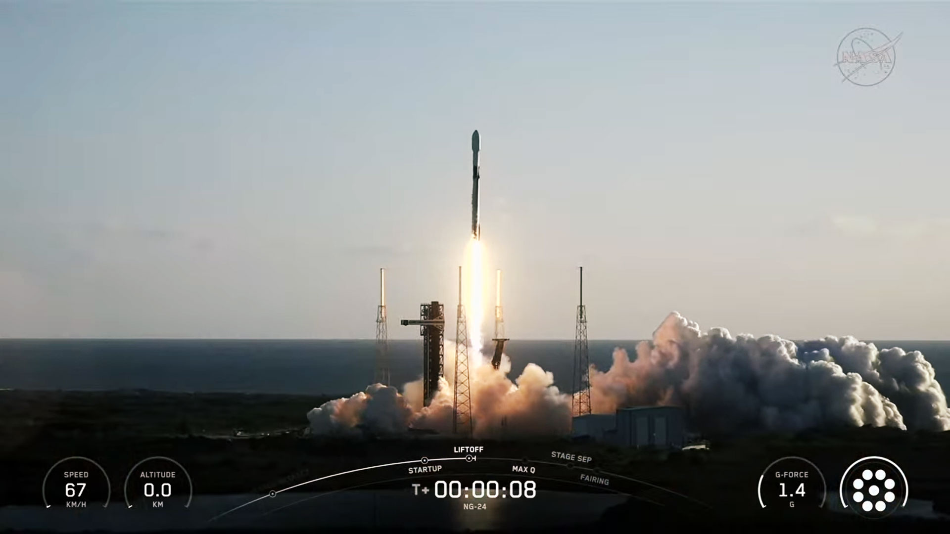
NASA is sending more science, technology demonstrations, and crew supplies to the International Space Station following the successful launch of the agency’s Northrop Grumman Commercial Resupply Services 24 mission, or Northrop Grumman CRS-24.
Northrop Grumman’s Cygnus XL spacecraft, carrying approximately 11,000 pounds of cargo to the orbiting laboratory, lifted off at 7:41 a.m. EDT Saturday on a SpaceX Falcon 9 rocket from Space Launch Complex 40 at Cape Canaveral Space Force Station in Florida.
Watch live coverage of the spacecraft’s arrival to the space station beginning at 12 p.m. on Monday, April 13, on NASA+, Amazon Prime, and the agency’s YouTube channel. Learn how to watch NASA content through a variety of online platforms, including social media.
Cygnus XL is scheduled to be captured at 12:50 p.m. by the station’s Canadarm2 robotic arm, operated by NASA astronauts Jack Hathaway and Chris Williams. After capture, the spacecraft will be installed on the Unity module’s Earth-facing port for cargo unloading.
NASA’s arrival and capture coverage is as follows (all times Eastern and subject to change based on real-time operations):
Monday, April 13
12 p.m. – Arrival coverage begins on NASA+, Amazon Prime, and the agency’s YouTube channel.
12:50 p.m. – Capture of Cygnus XL with the space station’s robotic arm.
The resupply mission is carrying dozens of research experiments that will be conducted during Expedition 74/75, including a new module to advance quantum science that could improve computing technology and aid in the search for dark matter, and hardware to produce a greater number of therapeutic stem cells for blood diseases and cancer. Cygnus also carries model organisms to study the gut microbiome and a receiver that could enhance space weather models to protect critical space infrastructure, such as GPS and radar.
These experiments are just some of the hundreds of scientific investigations conducted aboard the orbiting laboratory in the areas of biology and biotechnology, Earth and space science, physical sciences, and technology development and demonstrations.
Cygnus XL is scheduled to remain at the orbiting laboratory until October, before it departs and disposes of thousands of pounds of trash through its re-entry into Earth’s atmosphere, where it will harmlessly burn up.
Northrop Grumman named the spacecraft the S.S. Steven R. Nagel in honor of the former NASA astronaut who flew four space shuttle missions, commanded the Gamma Ray Observatory deployment, and logged 723 hours in space.
Learn more about this NASA commercial resupply mission at:
https://www.nasa.gov/mission/nasas-northrop-grumman-crs-24/
-end-
Josh Finch
Headquarters, Washington
202-358-1100
joshua.a.finch@nasa.gov
Amanda Griffin
Kennedy Space Center, Fla.
321-876-2468
amanda.a.griffin@nasa.gov
Sandra Jones
Johnson Space Center, Houston
281-483-5111
sandra.p.jones@nasa.gov
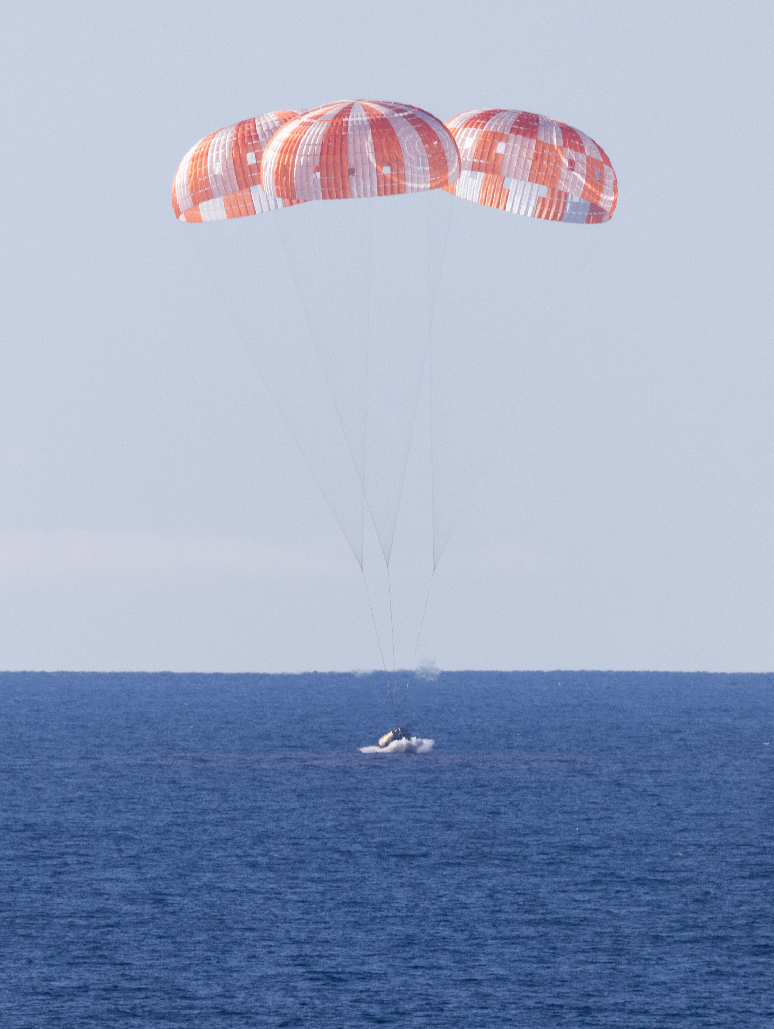
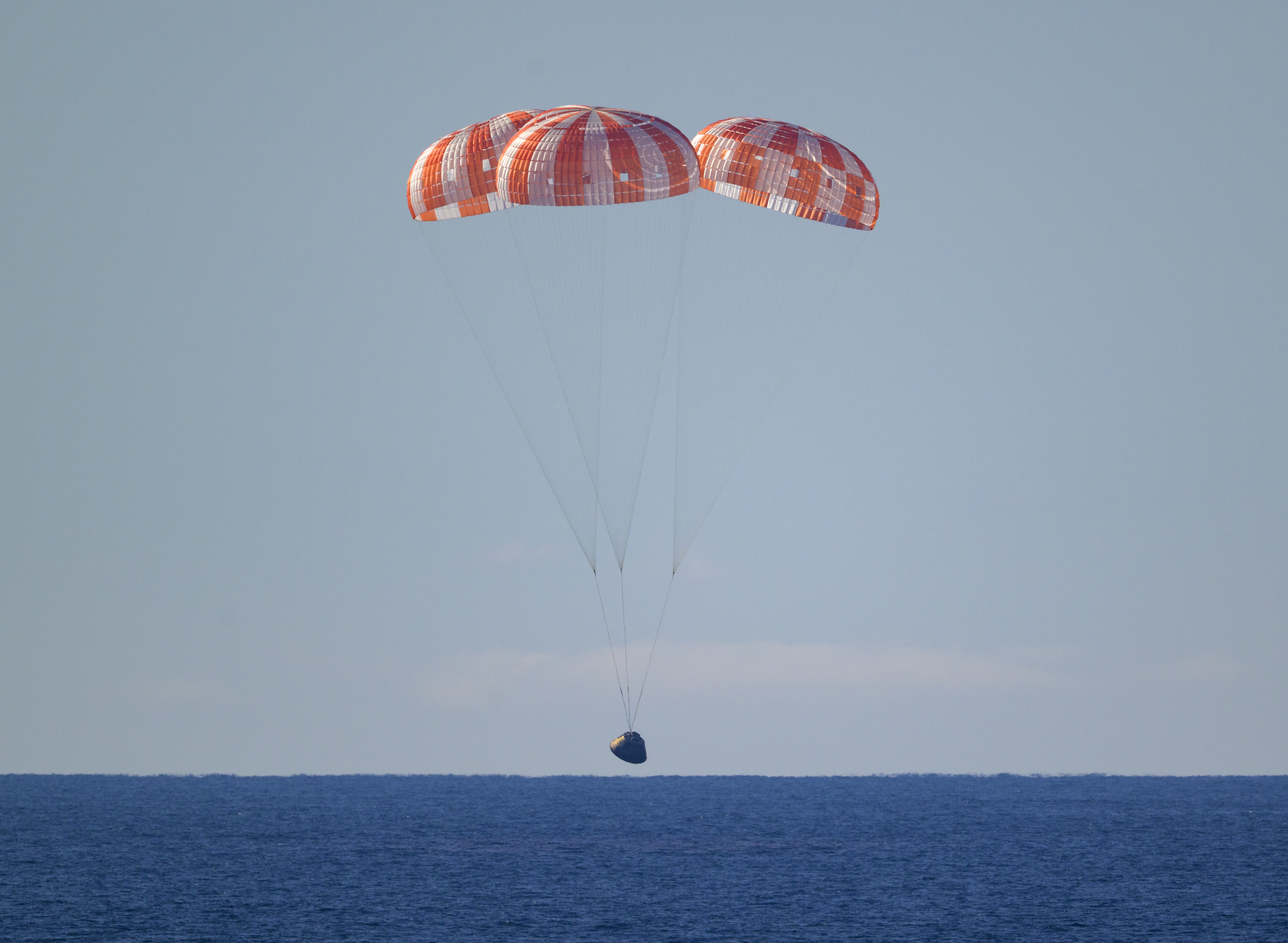
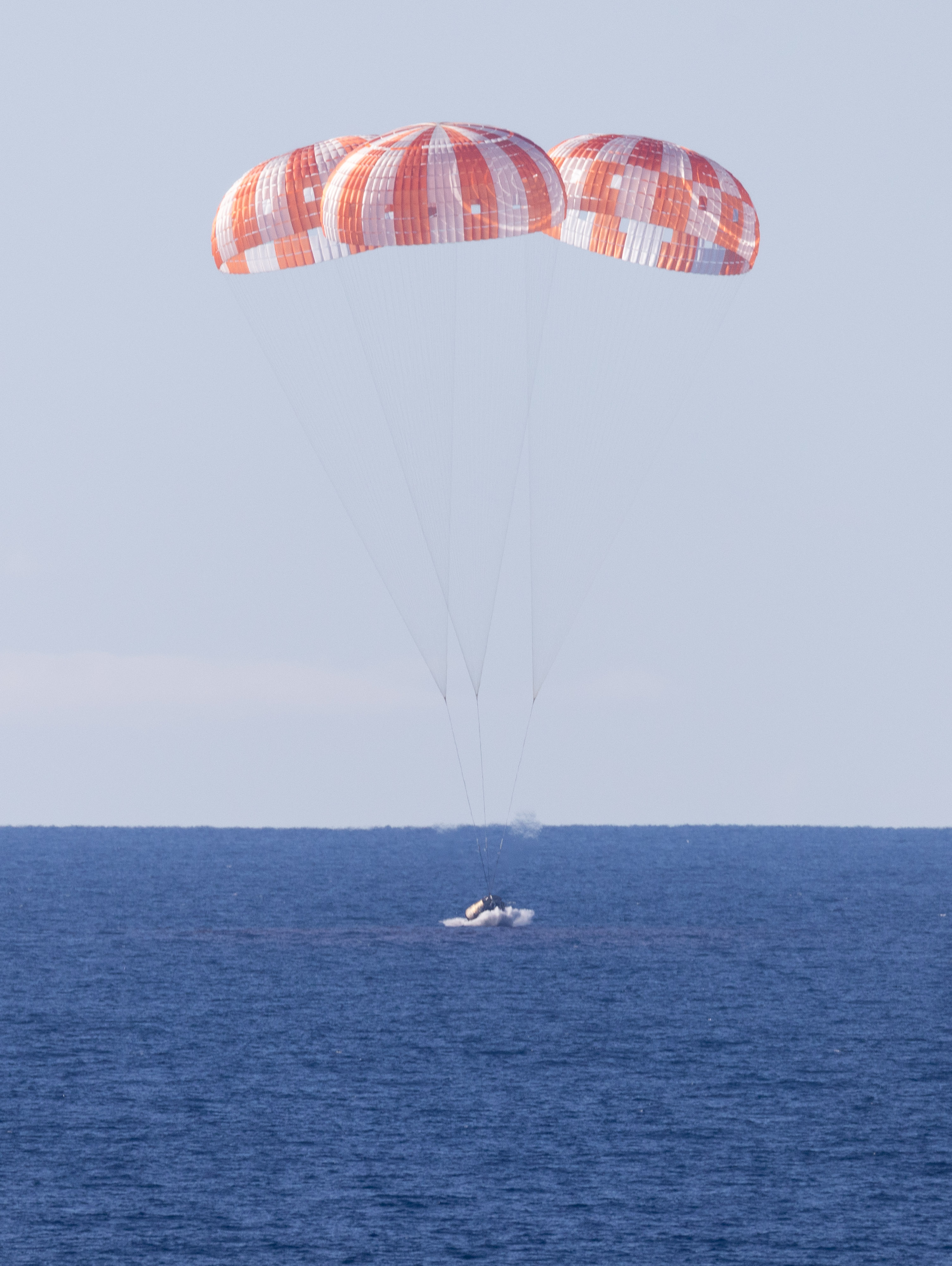
Artemis II Splashes Down
This image from April 10, 2026, captures NASA’s Orion spacecraft, with its parachutes deployed, seconds before splashdown in the Pacific Ocean. The Artemis II crew accomplished many milestones on their nearly 10-day mission, surpassing the Apollo 13 record for farthest crewed spaceflight and capturing views of the far side of the Moon.
Under Artemis, NASA will send astronauts on increasingly difficult missions to explore more of the Moon for scientific discovery, economic benefits, and to build on our foundation for the first crewed missions to Mars.
See more photos from the mission. (Link to https://www.nasa.gov/artemis-ii-multimedia/)
NASA Welcomes Record-Setting Artemis II Moonfarers Back to Earth
The first astronauts to travel to the Moon in more than half a century are back on Earth after a record-setting mission aboard NASA’s Artemis II test flight.
NASA astronauts Reid Wiseman, Victor Glover, and Christina Koch, and CSA (Canadian Space Agency) astronaut Jeremy Hansen splashed down at 5:07 p.m. PDT Friday off the coast of San Diego, completing a nearly 10-day journey that took them 252,756 miles from home at their farthest distance from Earth.
“Reid, Victor, Christina, and Jeremy, welcome home, and congratulations on a truly historic achievement. NASA is grateful to President Donald Trump and partners in Congress for providing the mandate and resources that made this mission and the future of Artemis possible,” said NASA Administrator Jared Isaacman. “Artemis II demonstrated extraordinary skill, courage, and dedication as the crew pushed Orion, SLS (Space Launch System), and human exploration farther than ever before. As the first astronauts to fly this rocket and spacecraft, the crew accepted significant risk in service of the knowledge gained and the future we are determined to build. NASA also acknowledges the contributions of the entire NASA workforce, along with our international partners, whose expertise and commitment were essential to this mission’s success. With Artemis II complete, focus now turns confidently toward assembling Artemis III and preparing to return to the lunar surface, build the base, and never give up the Moon again.”
After splashdown in the Pacific Ocean, the astronauts were met by a combined NASA and U.S. military team that assisted them out of the spacecraft in open water and transported them via helicopter to the USS John P. Murtha for initial medical checkouts. The crew members are expected to return to NASA’s Johnson Space Center in Houston on Saturday, April 11.
During their mission, Wiseman, Glover, Koch, and Hansen flew 694,481 miles in total. Their lunar flyby took them farther than any humans have ever traveled before, surpassing the previous distance record set by Apollo 13 astronauts in 1970.
The first Artemis crew launched on NASA’s SLS rocket at 6:35 p.m. April 1, from Launch Pad 39B at the agency’s Kennedy Space Center in Florida. With 8.8 million pounds of thrust at liftoff, the American-built rocket propelled the crew inside the Orion spacecraft to space, delivering it to orbit with pinpoint accuracy after a smooth countdown conducted by the agency’s Artemis launch control team.
During the first day in space, the astronauts and teams on the ground checked out the spacecraft — named Integrity by the crew — to confirm all systems were healthy ahead of the transit to the Moon. NASA also deployed four CubeSats from international partners to Earth orbit.
On the second day of the test flight, with all systems Go, Orion’s service module fired its main engine, placing the astronauts on a trajectory that brought them 4,067 miles above the lunar surface at their closest approach.
“The Artemis II crew is home. The entry, descent, and landing systems performed as designed and the final test was completed as intended. This moment belongs to the thousands of people across fourteen countries who built, tested, and trusted this vehicle. Their work protected four human lives traveling at 25,000 miles per hour and brought them safely back to Earth,” said NASA Associate Administrator Amit Kshatriya. “Artemis II proved the vehicle, the teams, the architecture, and the international partnership that will return humanity to the lunar surface. Reid, Victor, Christina, and Jeremy carried the hopes of this world farther than humans have traveled in more than half a century. Fifty‑three years ago, humanity left the Moon. This time, we returned to stay. The future is ours to win.”
With astronauts aboard for the first time, engineers put Orion through a full in‑flight evaluation. The crew tested the spacecraft’s life support systems, confirming Orion can sustain humans in deep space. During several piloting demonstrations, crew members took manual control of the spacecraft, flying Orion to validate its handling and collect data that will guide future rendezvous and docking operations with human-rated landers during Artemis III and beyond.
The crew completed a series of tests to inform how NASA will fly future missions to the Moon, including evaluations of how the spacecraft operates during crew exercise, emergency equipment and procedures, the Orion crew survival system spacesuits, and other critical spacecraft systems.
Wiseman, Glover, Koch, and Hansen also supported scientific investigations to help NASA prepare astronauts to live and work on the Moon as the agency builds a Moon Base and looks toward Mars. These experiments — including the AVATAR investigation, which studies how human tissue responds to microgravity and the deep space radiation environment, and other human research performance studies — are gathering essential health data for long-duration missions.
During their April 6 lunar flyby, the astronauts captured more than 7,000 images of the lunar surface and a solar eclipse, during which the Moon blocked the Sun from Orion’s vantage point. The imagery includes striking views of earthset and earthrise, impact craters, ancient lava flows, our Milky Way galaxy, and surface fractures and color variations across the lunar terrain.
They documented the topography along the terminator — the boundary between lunar day and night — where low-angle sunlight casts long shadows across the surface, creating illumination conditions similar to those in the South Pole region where astronauts are scheduled to land in 2028. The crew also proposed potential names for two lunar craters and reported meteoroid impact flashes on the night side of the Moon.
Artemis II science will pave the way for future missions to the Moon’s surface by helping advance mission operations and training astronauts to use well-informed judgment to identify areas of high interest for science and exploration.
With the crew safely on Earth, NASA and its partners now will turn attention to preparing for next year’s Artemis III mission, when a new Orion crew will test integrated operations with commercially built Moon landers in low Earth orbit.
As part of a Golden Age of innovation and exploration, NASA will send Artemis astronauts on increasingly challenging missions to explore more of the Moon for scientific discovery, economic benefits, establish an enduring human presence on the lunar surface, and lay the groundwork for sending the first astronauts – American astronauts – to Mars.
To learn more about the Artemis program, visit:
-end-
Bethany Stevens / Rachel Kraft
Headquarters, Washington
202-358-1600
bethany.c.stevens@nasa.gov / rachel.h.kraft@nasa.gov
New Perspective of Home
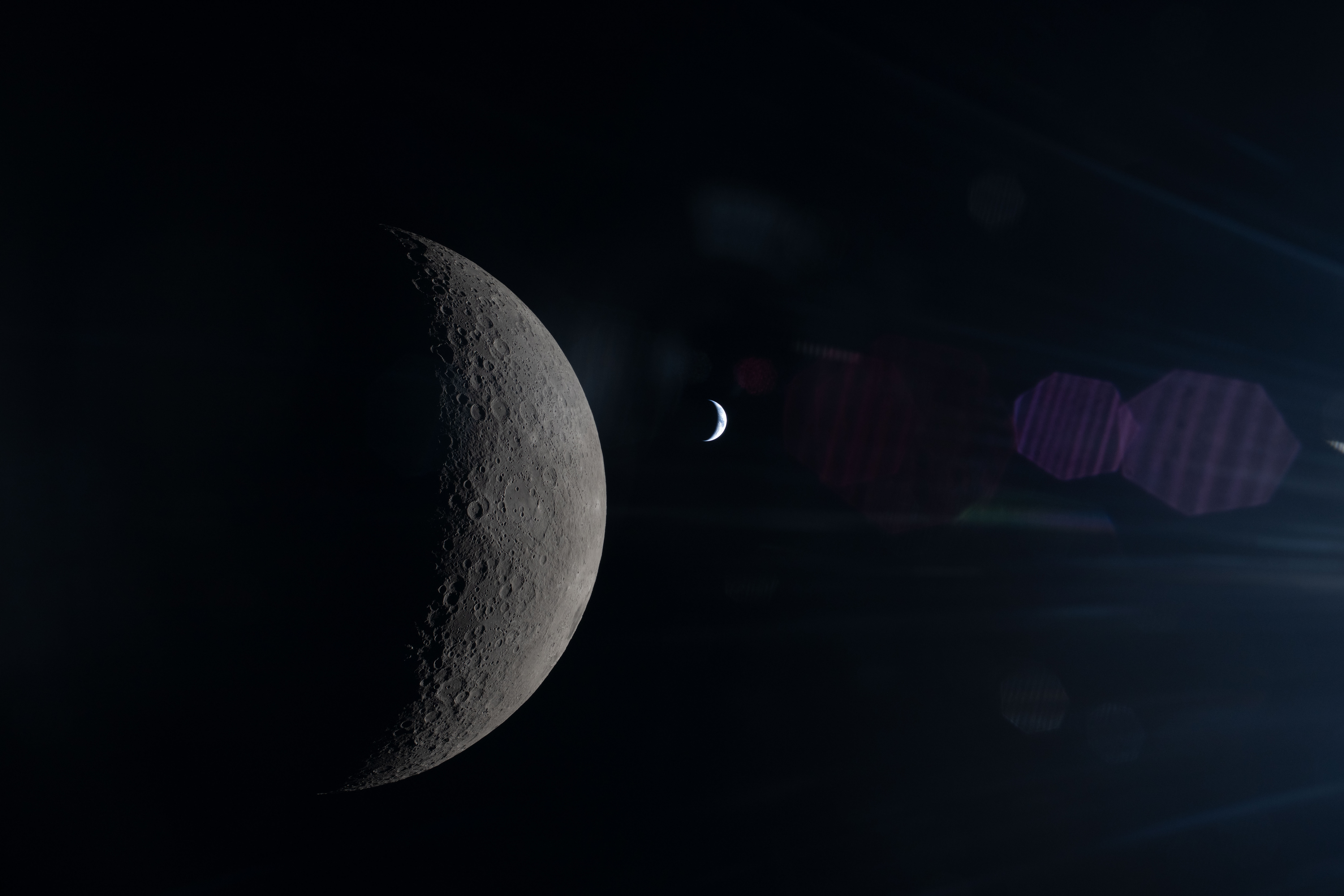
Seen during Artemis II’s lunar flyby on April 6, 2026, the Moon and Earth align in the same frame, each partially illuminated by the Sun. The Moon’s surface appears in sharp detail in the foreground, while Earth sits much farther away, smaller and softly lit in the background. A faint reflection in the spacecraft window is also visible, subtly overlaying the scene. Though their phases differ, both are shaped by the same sunlight, revealing the geometry of the Sun–Earth–Moon system from deep space.
NASA astronauts Reid Wiseman, Christina Koch, and Victor Glover, and CSA (Canadian Space Agency) astronaut Jeremy Hansen are set to return to Earth, splashing down in the Pacific Ocean around 8:07 p.m. EDT. Watch their return with NASA.
Image credit: NASA
Earthset From the Lunar Far Side
- Earth
- Earth Observatory
- Image of the Day
- EO Explorer
- Topics
- More Content
- About
Indoor Testing Facilities available at the NASA Unmanned Autonomy Research Complex (NUARC)
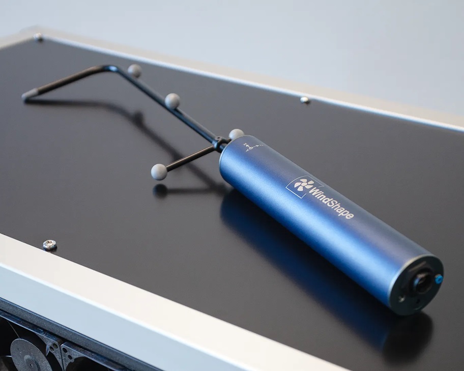
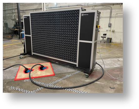
A large WindShaper fan array is available for dynamic low-speed and hovering flight research. The WindShaper is ideal for generating arbitrary wind gradients and wind gusts via a simple Python API. A companion WindProbe is also available for quick surveys of flows. The WindProbe utilizes the lab’s OptiTrack motion capture system to extract the position and orientation of the 5-hole cone probe located on the probe tip.
- Large dynamic fan array: 9’x7’, 1134 fans arranged as 567 ‘wind pixels’
- Wind speeds: 0 to 16 m/s (0 to 36 mph/31 kts)
- Acceleration: 4 m/s2, Deceleration: 2.5 m/s2
- Each fan is programmable via Python scripting
- Replicates steady winds, gusts, and wind gradients
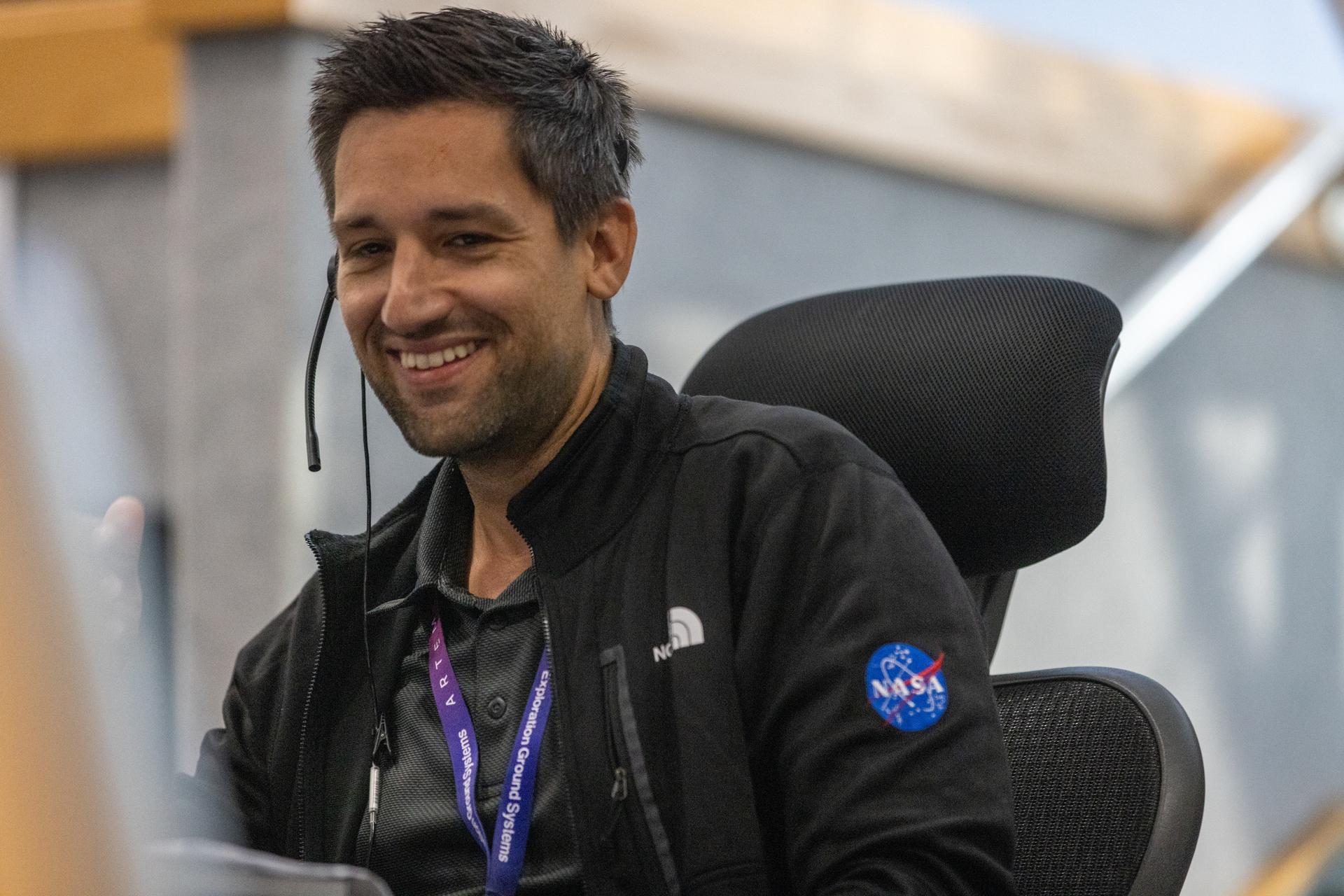
I Am Artemis: Dan Florez
Listen to this audio excerpt from Dan Florez, test director for NASA’s Exploration Ground Systems Program:
0:00 / 0:00
Your browser does not support the audio element.At 1:47 a.m. EST November 16, 2022, as the Artemis I engines ignited, NASA astronaut Reid Wiseman and Dan Florez, NASA test director for the agency’s Exploration Ground Systems, watched from Kennedy’s Launch Control Center roof as the midnight sky turned bright as daylight, the crackle and roar of launch vibrating through them. Little did they know, one of them soon would be the Artemis II commander, and the other would be an important figure in bringing the mission home safely.
Florez is one of the NASA test directors for the Exploration Ground Systems Program. The test directors are a group of 20 engineers at the agency’s Kennedy Space Center in Florida who plan and execute integrated testing for Artemis missions. Their work includes developing timelines and procedures for launch countdown, propellant loading, emergency egress, pad and launch abort scenarios, recovery operations, and more. They help lead the ground systems team in all areas of testing.
Members of the Artemis launch team participate in an Artemis II launch countdown simulation inside Firing Room 1 in the Launch Control Center at NASA’s Kennedy Space Center in Florida on Thursday, May 8, 2025. NASA/Frank MichauxAt the time of Artemis I launch, Florez and his fellow test directors had already developed the launch countdown timelines for Artemis II.
“We were really focused on loading that spacecraft with cryogenic propellants and successfully launching it. With Artemis II, we’re going to have to do all that again, but in the middle of that, we’re going to have to embed the crew timeline to get the crew safely inside the spacecraft, get all the systems checked out, and launch them into space,” Florez said. “And we have to do the same thing on the tail end through recovery. So, there’s a lot of complexities when you have the human element thrown into the operation.”
Since Artemis I, Florez has focused his work even more heavily on the human element, taking on rescue and recovery operations.
A wave breaks inside the well deck of USS Somerset as teams work to recover the Crew Module Test Article (CMTA), a full scale replica of the Orion spacecraft, as they practice Artemis recovery operations during Underway Recovery Test-12 off the coast of California, Thursday, March 27, 2025. NASA/Joel Kowsky“We have to have a plan to go get to the crew if we have an abort, if we land anywhere in the world within 24 hours,” said Florez. “My role right now is to do a lot of that coordination to make sure we have all the assets and all the resources in place to get to the crew.”
When the Artemis II crew returns to Earth aboard the Orion spacecraft, Florez will be there, prepared and ready with NASA’s Landing and Recovery Team and the U.S. military.
We have a great partnership with the military. We have the Human Spaceflight Support Office within the Air Force that support us directly for not just for recovery operations, but also for any of the rescue operations.Dan Florez
NASA Test Director, Exploration Ground Systems Program
Recovery operations are routinely verified and validated in what is called an underway recovery test. NASA and Navy teams board a U.S. Navy ship and travel off the coast of San Diego to test retrieving the capsule and getting the crew safely on the ship. In late February 2024, the Artemis II crew joined the recovery team’s eleventh iteration of testing called, URT-11.
“It was really great to have that perspective of having astronauts in the loop during our test operations,” said Florez. “Everywhere along the way, we got feedback from them.”
Artemis II launched at 6:35 p.m. EDT April 1, from Launch Complex 39B, sending NASA astronauts Reid Wiseman, Victor Glover, and Christina Koch, and CSA (Canadian Space Agency) astronaut Jeremy Hansen, on their approximately 10-day mission around the Moon.
Florez and his colleagues are prepared and ready to apply everything they tested to recover the crew.
Watching them launch is going to be great. I'm going to be happier when they land.Dan Florez
NASA Test Director, Exploration Ground Systems Program
About the AuthorAdeline Morgan RoeschStrategic Communications Specialist Share Details Last Updated Apr 10, 2026 Related Terms Explore More 1 min read Watching the Artemis II Mission Unfold at JPL’s Space Flight Operations FacilityDescription Staff at NASA’s Jet Propulsion Laboratory in Southern California watch the agency’s Artemis II…
Article 3 days ago 2 min read The Deep Space Network Acquires Artemis II SignalDescription A graphical representation of the Deep Space Network’s radio frequency antennas indicate signal acquisition…
Article 3 days ago 2 min read The Deep Space Network Acquires Artemis II SignalDescription The acquisition of the radio frequency signal from the Artemis II crewed mission to…
Article 3 days ago Keep Exploring Discover More Topics From NASAMissions
Humans in Space
Climate Change
Solar System
Indoor Testing Facilities available at the NASA Unmanned Autonomy Research Complex (NUARC)
A large WindShaper fan array is available for dynamic low-speed and hovering flight research. The WindShaper is ideal for generating arbitrary wind gradients and wind gusts via a simple Python API. A companion WindProbe is also available for quick surveys of flows. The WindProbe utilizes the lab’s OptiTrack motion capture system to extract the position and orientation of the 5-hole cone probe located on the probe tip.
Windshaper fan array for dynamic low-speed and hovering flight research at NASA Ames Research Center.NASA/John Melton•Large dynamic fan array: 9’x7’, 1134 fans arranged as 567 ‘wind pixels’
•Wind speeds: 0 to 16 m/s (0 to 36 mph/31 kts)
•Acceleration: 4 m/s2, Deceleration: 2.5 m/s2
•Each fan is programmable via Python scripting
•Replicates steady winds, gusts, and wind gradients
WindProbe for handheld mobile wind data collection. WindShaperStarstruck
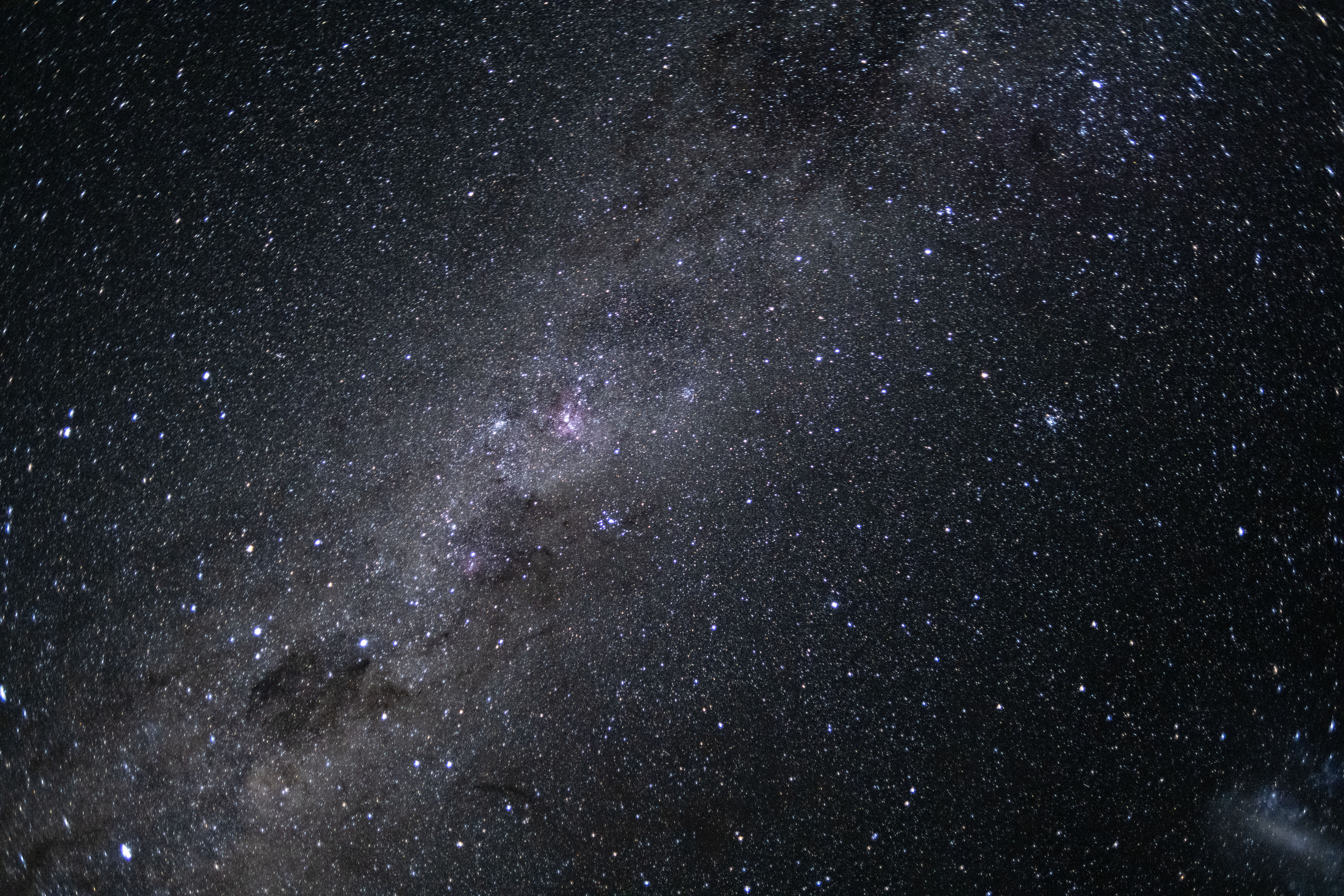
The Artemis II crew captured this photo of our galaxy, the Milky Way, on April 7, 2026. The Milky Way’s elegant spiral structure is dominated by just two arms wrapping off the ends of a central bar of stars. Spanning more than 100,000 light-years, Earth is located along one of the galaxy’s spiral arms, about halfway from the center.
See more photos from the mission.
Image credit: NASA
Watching the Artemis II Mission Unfold at JPL’s Space Flight Operations Facility
NASA/JPL-Caltech Photojournal Navigation Downloads Watching the Artemis II Mission Unfold at JPL’s Space Flight Operations Facility
JPEG (66.13 MB)
Description
Staff at NASA’s Jet Propulsion Laboratory in Southern California watch the agency’s Artemis II mission unfold soon after launch on April 1, 2026, at the Space Flight Operations Facility, which operates the Deep Space Network (DSN).
The DSN comprises of three complexes in Goldstone, California; Madrid, Spain; and Canberra, Australia. Each complex has several radio frequency antennas that communicate with dozens of spacecraft exploring the solar system in addition to the crewed Artemis II mission.
The DSN is managed by JPL for the agency’s Space Communications and Navigation program, which is located at NASA Headquarters within the Space Operations Mission Directorate. The DSN allows missions to track, send commands to, and receive scientific data from faraway spacecraft. JPL is managed by Caltech in Pasadena, California, for NASA.
For more information about Artemis II, visit: https://www.nasa.gov/mission/artemis-ii/
Keep Exploring Discover More Topics From Photojournal
Photojournal
Search Photojournal
Photojournal’s Latest Content
Feedback
The Deep Space Network Acquires Artemis II Signal
NASA/JPL-Caltech Photojournal Navigation Downloads The Deep Space Network Acquires Artemis II Signal
JPEG (62.03 MB)
Description
A graphical representation of the Deep Space Network’s radio frequency antennas indicate signal acquisition from NASA’s Artemis II mission to the Moon on April 1, 2026, inside the Space Flight Operations Facility at NASA’s Jet Propulsion Laboratory in Southern California. Two antennas at the Madrid Deep Space Communications Complex, Deep Space Station 54 and 56, can be seen communicating with Artemis II (the signals are labelled “EM2”, short for “Exploration Mission 2”; elsewhere they are labelled “ART2” for “Artemis II”).
A similar visualization can be found at DSN Now, which details all the missions that the network is communicating with 24 hours a day, seven days a week.
The Space Flight Operations Facility operates the DSN, which comprises of three complexes in Goldstone, California; Madrid, Spain; and Canberra, Australia. Each complex consists of several radio frequency antennas that communicate with dozens of spacecraft exploring the solar system in addition to the Artemis II mission.
The DSN is managed by JPL for the agency’s Space Communications and Navigation program, which is located at NASA Headquarters within the Space Operations Mission Directorate. The DSN allows missions to track, send commands to, and receive scientific data from faraway spacecraft. JPL is managed by Caltech in Pasadena, California, for NASA.
For more information about Artemis II, visit: https://www.nasa.gov/mission/artemis-ii/
Keep Exploring Discover More Topics From Photojournal
Photojournal
Search Photojournal
Photojournal’s Latest Content
Feedback
The Deep Space Network Acquires Artemis II Signal
NASA/JPL-Caltech Photojournal Navigation Downloads The Deep Space Network Acquires Artemis II Signal
JPEG (66.25 MB)
Description
The acquisition of the radio frequency signal from the Artemis II crewed mission to the Moon by NASA’s Deep Space Network (DSN) is indicated by the peak in the data signal shown on the top computer screen.
Soon after the mission’s launch on April 1, 2026, at 6:35 p.m. EDT, NASA’s Near Space Network led communications with the Orion capsule. Then, communications were handed off to the DSN, marking the first time in over 50 years that the network would be communicating with a crewed spacecraft traveling through deep space.
The Space Flight Operations Facility at NASA’s Jet Propulsion Laboratory in Southern California (where this photo was taken) operates the DSN, which comprises three complexes in Goldstone, California; Madrid, Spain; and Canberra, Australia. Each complex consists of several radio frequency antennas that communicate with dozens of robotic spacecraft exploring the solar system in addition to the Artemis II mission.
The DSN is managed by JPL for the agency’s Space Communications and Navigation program, which is located at NASA Headquarters within the Space Operations Mission Directorate. The DSN allows missions to track, send commands to, and receive scientific data from faraway spacecraft. JPL is managed by Caltech in Pasadena, California, for NASA.
For more information about Artemis II, visit: https://www.nasa.gov/mission/artemis-ii/
Keep Exploring Discover More Topics From Photojournal
Photojournal
Search Photojournal
Photojournal’s Latest Content
Feedback
Watching Over the Deep Space Network Before Artemis II Signal Acquisition
NASA/JPL-Caltech Photojournal Navigation Downloads Watching Over the Deep Space Network Before Artemis II Signal Acquisition
JPEG (63.52 MB)
Description
Blanca Renteria, Artemis Deep Space Network (DSN) operations chief, monitors data at the Space Flight Operations Facility at NASA’s Jet Propulsion Laboratory in Southern California shortly after Artemis II launched from the agency’s Kennedy Space Flight Center in Florida on April 1, 2026, at 6:35 p.m. EDT.
The Space Flight Operations Facility operates the DSN, which comprises three complexes in Goldstone, California; Madrid, Spain; and Canberra, Australia. Each complex consists of several radio frequency antennas that communicate with dozens of robotic spacecraft exploring the solar system in addition to the crewed Artemis II mission.
The DSN is managed by JPL for the agency’s Space Communications and Navigation program, which is located at NASA Headquarters within the Space Operations Mission Directorate. The DSN allows missions to track, send commands to, and receive scientific data from faraway spacecraft. JPL is managed by Caltech in Pasadena, California, for NASA.
For more information about Artemis II, visit: https://www.nasa.gov/mission/artemis-ii/
Keep Exploring Discover More Topics From Photojournal
Photojournal
Search Photojournal
Photojournal’s Latest Content
Feedback