
NASA News
Helio Highlights: July 2025
- Home
- Framework for Heliophysics Education
- Resource Database
- About NASA HEAT
- More
5 min read
Helio Highlights: July 2025 5 Min Read Helio Highlights: July 2025 When astronauts return to the Moon, they will need to know what the Sun is doing in order to keep themselves safe and healthy. Credits:NASA A Trip to the Moon
In July 1969, astronauts Neil Armstrong and Buzz Aldrin became the first humans to walk on the Moon. Now, NASA and its international partners in the Artemis accords are working to send humans back there, this time to stay. The trip will be challenging, especially since space is a very uninviting place for humans! One unexpected source of danger will be the Sun.
The Sun: Friend and FoeThe energy the Sun provides allows life on Earth to thrive. But this energy can also be dangerous to us. This danger can be as simple as getting a sunburn if you are out in the sunlight for too long, or as complex as a geomagnetic storm causing chaos in our satellite network.
This animation demonstrates a simulation by the MAGE model of Earth’s magnetosphere being hit by a geospace storm in May 2024, the strongest in nearly 20 years. Storms like this are caused by solar weather that could endanger astronauts en route to the Moon or active on its surface during future missions. NASA’s Scientific Visualization Studio and CGS TeamThings get more complicated in space. On Earth, the atmosphere and magnetosphere protect us from most solar energy. But spacecraft and astronauts in space don’t have this protection. For astronauts on upcoming Artemis missions to the Moon, the Sun’s radiation could cause anything from ruined electronics to a greater long-term risk of cancer.
The Real RisksOn August 2, 1972, a massive solar storm began with the eruption of sunspot MR11976. One of the Coronal Mass Ejections (CMEs) it produced raced from the Sun to Earth in less than 15 hours. That’s a record that still stands today! This led to power grid fluctuations and caused havoc with spacecraft in flight. Recently declassified U.S. military records show that the storm caused sea mines off the Vietnamese coast to explode, as well.
Importantly, the August 1972 solar storm happened in between the Apollo 16 and 17 missions to the Moon. Studies show that astronauts en route to the Moon, and especially astronauts on the surface, could have been badly sickened by the radiation that came with it. This threat remains real if a solar storm of similar severity were to occur during future Lunar missions.
Watchful ProtectorsOrganizations like NASA and NOAA keep an eye on the Sun, to forecast potential sources of danger. If a solar flare or Coronal Mass Ejection (CME) is on the way, scientists should be able to spot the danger ahead of time so that steps can be taken to reduce the damage. For astronauts going to the Moon, this may be as simple as taking shelter in a special part of their spacecraft.
An animated gif of a Coronal Mass Ejection (CME) erupting from the surface of the Sun in September 2024. If a CME like this was aimed at the Moon, the intense energy it carried could damage spacecraft electronics and even cause severe radiation sickness in astronauts. NOAA/NASANOAA’s Space Weather Follow-On (SWFO) program sustains their space weather observations and measurements. NOAA’s CCOR-1 flew on the GOES-19 spacecraft and provides crucial near-real-time CME data. The CCOR-2 instrument will fly on SWFO-L1. Other missions include SOHO, a long-running collaboration between NASA and the European Space Agency, and HERMES, a NASA heliophysics instrument intended for the Lunar Gateway that will orbit the Moon.
NASA’s Moon to Mars Space Weather Analysis Office (M2M SWAO) also conducts real-time space weather assessments. These support new capabilities for understanding space weather impacts on NASA exploration activities, including on the Moon.
The Moon as a LaboratoryA big part of the reason we want to go back to the Moon is the amazing level of information we can learn about the history of the Solar System. “Any object in our solar system doesn’t just exist in isolation,” explains Prabal Saxena, a Research Space Scientist in the Planetary Geology, Geophysics & Geochemistry Lab at NASA’s Goddard Space Flight Center. “It is constantly interacting with meteorites and meteors. That’s why you see a lot of the impact creators on the Moon. But it is also constantly interacting with the Sun.” This can come from the solar wind, CMEs, and other forms of solar energy hitting the Moon’s barren surface.
Pictured is the Lunar Swirl Reiner Gamma, a geological feature on the surface of the moon. In areas that are magnetically protected, the ground stays relatively bright. Just outside of the shielded regions, radiation-induced chemical reactions darken the landscape, effectively “sunburning” the lunar surface. NASA/GSFC/Arizona State UniversitySaxena points out that the Moon’s relative lack of a magnetosphere means that Lunar surface material effectively traps evidence of the past habits of the Sun. “A lot of the energetic particles that we would otherwise see deflected by Earth’s magnetosphere and atmosphere are impacting the surface of the Moon. So you can actually trace back what the history of the Sun might be.”
He compares this to scientists taking ice cores to get a glimpse into Earth’s atmospheric history. With everything from evidence of the prehistoric solar atmosphere to information on how the Sun affects water on the lunar surface locked in rocks left largely untouched for millions of years, it is clear why NASA wants to go back and have another look around.
Going BackBut it is still important to keep an eye on the potential dangers to explorers both metallic and organic. In an interview, Lennard Fisk, former NASA Associate Administrator for Space Science and Applications, described a conversation he had with Neil Armstrong. More than anything else during Apollo 11, Armstrong was afraid of a solar flare. He knew he could depend on his spacecraft and crewmates. But space weather was an uncontrollable variable.
We had a different understanding of space weather in 1969. Space radiation, including the solar wind, was a new discovery back then. But research done in those early days helped make breakthroughs still paying off today, and we are building upon these discoveries with new missions that continue to advance our knowledge of the Sun and the rest of our solar system.
Additional Resources Lesson Plans & Educator Guides NASA Helio ClubStudy Unit
Six lessons created for a middle-school audience to introduce basic heliophysics concepts to learners.
Space Weather Math
Hands-on activities with embedded math problems that explore the causes and effects of space weather.
“Solar Storms and You” Educator Guide
A downloadable educator guide with a variety of activities on the science of solar storms for learners grades 5-8.
Interactive Resources Magnetic Earth
Interactive Resource
An animation with information on Earth’s magnetic field and its role in creating northern lights, and an interactive activity allowing students to experiment with magnetism.
Student HelioViewer:
Solar Data Interactive
A student-friendly interactive with accessible NASA data about the Sun and its features, including solar flares, magnetic fields, sunspots, and Coronal Mass Ejections (CMEs).
Webinars & Slide Decks What is Space
Weather Video
This approximately 3-minute video summarizes space weather and explains its effects on the rest of the Solar System.
Science Update: Space Weather on Our
Approach to Solar Max
A webinar about the solar storm on May 10th, 2024, which led to auroras being visible across North America.
Astronaut Dr. John
Phillips Discusses
Space Radiation
Dr. John Phillips, NASA astronaut and space plasma physicist, talks about his work and personal experience with space radiation on the Space Weather Living History podcast.
Dr. Lennard Fisk
Discusses Heliophysics History at NASA
Former Associate Administrator Dr. Lennard Fisk recounts the evolution of the Heliophysics Division at NASA.
NUBE: New Card Game Helps Learners Identify Cloud Types Through Play
4 min read
NUBE: New Card Game Helps Learners Identify Cloud Types Through PlayDifferent clouds types can have different effects on our weather and climate, which makes identifying cloud types important – but learning to identify cloud types can be tricky! Educational games make the learning process easier and more enjoyable for learners of all ages and create an opportunity for families and friends to spend quality time together.
The NASA Science Activation Program’s NASA Earth Science Education Collaborative (NESEC) and the Queens Public Library co-developed a new Global Learning & Observations to Benefit the Environment (GLOBE) card game called NUBE (pronounced noo-beh) – the Spanish word for cloud. During this fun, interactive game, players match cards by cloud type or sky color – with 11 cloud types and 5 shades of blue (in real life, sky color can be an indication of how many aerosols are in the atmosphere). There are also special cards in the deck, such as Rainmakers, which change the order of play; Obscurations, which require the next player to draw two cards; and Mystery cards, which require players to give hints while other players guess the cloud type. By playing the game, participants practice learning the names of clouds while they begin to appreciate the differences in cloud type and sky color.
NESEC is collaborating with another NASA Science Activation project team – NASA@ My Library (NAML, led by the Space Science Institute, SSI – to get the game into library programs. NAML recruited and is distributing sets of two or four card decks to 292 U.S. libraries. Participating libraries are located in 45 states, with a large number (>50%) serving rural communities. SSI also promoted the opportunity to its network of libraries and co-presented a webinar with NESEC for interested libraries. Library applications described how they plan to use the game with their patrons, including programs for audiences ranging from kids to seniors related to weather and safety programs, citizen science clubs, home school groups, summer reading, game nights, circulating kits and more. Libraries that receive NUBE commit to use the game in at least one program and complete a short evaluation survey.
NUBE evolved through several iterations as staff from several Queens Public Library branches tested the game with different age groups, from young kids to teens and adults. The game was also tested at the Challenger Center and the Center for Science, Technology, Education, & Mathematics (STEM) Teaching and Learning at Northern Arizona University. Alex Hernandez Bonifacio, an early Learning Educator at Queens Public Library reported, “It was amazing to see what kids reflected on as they were playing NUBE. For example, there was this third grader who was surprised to realize something could obscure our view of the clouds. She used to think clouds were too high in the sky for anything to block our view of them. While playing NUBE, she became very intrigued about the obscuration cards, and she realized that things closer to the ground like heavy snow could in fact block our view of the clouds!” After incorporating feedback from testers and counting the votes for different graphic design options, NUBE is now ready to be downloaded and enjoyed by all!
If you’re excited to play this awesome GLOBE Clouds card game and want to learn even more about clouds, you can download the GLOBE Observer app on your smartphone to participate in hands-on NASA scientific research – sharing observations of your environment as a citizen scientist (no citizenship required)! Learn more and discover additional resources for engaging in clouds activities with the GLOBE Observer Clouds Toolkit.
NESEC, led by the Institute for Global Environmental Strategies (IGES) and supported by NASA under cooperative agreement award number NNX16AE28A, is part of NASA’s Science Activation Portfolio. Learn more about how Science Activation connects NASA science experts, real content, and experiences with community leaders to do science in ways that activate minds and promote deeper understanding of our world and beyond: https://science.nasa.gov/learn
NUBE, a GLOBE Clouds card game Share Details Last Updated Aug 01, 2025 Editor NASA Science Editorial Team Related Terms Explore More 3 min read NASA eClips STEM Student Ambassadors Light Up CNU’s 2025 STEM Community DayArticle
1 week ago
2 min read GLOBE-Trotting Science Lands in Chesapeake with NASA eClips
Article
2 weeks ago
3 min read NASA Citizen Science and Your Career: Stories of Exoplanet Watch Volunteers
Doing NASA Science brings many rewards. But can taking part in NASA citizen science help…
Article
2 weeks ago
Keep Exploring Discover More Topics From NASA James Webb Space Telescope
Webb is the premier observatory of the next decade, serving thousands of astronomers worldwide. It studies every phase in the…
Perseverance Rover
This rover and its aerial sidekick were assigned to study the geology of Mars and seek signs of ancient microbial…
Parker Solar Probe
On a mission to “touch the Sun,” NASA’s Parker Solar Probe became the first spacecraft to fly through the corona…
Juno
NASA’s Juno spacecraft entered orbit around Jupiter in 2016, the first explorer to peer below the planet’s dense clouds to…
Crew-11 Launches to International Space Station
A SpaceX Falcon 9 rocket carrying the SpaceX Dragon spacecraft Endeavour lifts off from Launch Complex 39A at NASA’s Kennedy Space Center in Florida on Aug. 1, 2025. NASA astronauts Zena Cardman and Mike Fincke, JAXA (Japan Aerospace Exploration Agency) astronaut Kimiya Yui, and Roscosmos cosmonaut Oleg Platonov are aboard the spacecraft. After the crew arrives at the International Space Station, they will perform research, technology demonstrations, and maintenance activities aboard the orbiting laboratory. Crew-11 will also contribute to NASA’s Artemis campaign by simulating Moon landing scenarios that astronauts may encounter near the lunar South Pole, showing how the space station helps prepare crews for deep space human exploration.
The flight is the 11th crew rotation mission with SpaceX to the space station as part of NASA’s Commercial Crew Program.
Image credit: NASA/Aubrey Gemignani
NASA’s Europa Clipper Radar Instrument Proves Itself at Mars
5 min read
Preparations for Next Moonwalk Simulations Underway (and Underwater) Europa Clipper’s radar instrument received echoes of its very-high-frequency radar signals that bounced off Mars and were processed to develop this radargram. What looks like a skyline is the outline of the topography beneath the spacecraft.NASA/JPL-Caltech/UT-AustinThe agency’s largest interplanetary probe tested its radar during a Mars flyby. The results include a detailed image and bode well for the mission at Jupiter’s moon Europa.
As it soared past Mars in March, NASA’s Europa Clipper conducted a critical radar test that had been impossible to accomplish on Earth. Now that mission scientists have studied the full stream of data, they can declare success: The radar performed just as expected, bouncing and receiving signals off the region around Mars’ equator without a hitch.
Read more about Europa Clipper's radargram at MarsCalled REASON (Radar for Europa Assessment and Sounding: Ocean to Near-surface), the radar instrument will “see” into Europa’s icy shell, which may have pockets of water inside. The radar may even be able to detect the ocean beneath the shell of Jupiter’s fourth-largest moon.
“We got everything out of the flyby that we dreamed,” said Don Blankenship, principal investigator of the radar instrument, of the University of Texas at Austin. “The goal was to determine the radar’s readiness for the Europa mission, and it worked. Every part of the instrument proved itself to do exactly what we intended.”
In this artist’s concept, Europa Clipper’s radar antennas — seen at the lower edge of the solar panels — are fully deployed. The antennas are key components of the spacecraft’s radar instrument, called REASON.NASA/JPL-CaltechThe radar will help scientists understand how the ice may capture materials from the ocean and transfer them to the surface of the moon. Above ground, the instrument will help to study elements of Europa’s topography, such as ridges, so scientists can examine how they relate to features that REASON images beneath the surface.
Limits of EarthEuropa Clipper has an unusual radar setup for an interplanetary spacecraft: REASON uses two pairs of slender antennas that jut out from the solar arrays, spanning a distance of about 58 feet (17.6 meters). Those arrays themselves are huge — from tip to tip, the size of a basketball court — so they can catch as much light as possible at Europa, which gets about 1/25th the sunlight as Earth.
The instrument team conducted all the testing that was possible prior to the spacecraft’s launch from NASA’s Kennedy Space Center in Florida on Oct. 14, 2024. During development, engineers at the agency’s Jet Propulsion Laboratory in Southern California even took the work outdoors, using open-air towers on a plateau above JPL to stretch out and test engineering models of the instrument’s spindly high-frequency and more compact very-high-frequency antennas.
But once the actual flight hardware was built, it needed to be kept sterile and could be tested only in an enclosed area. Engineers used the giant High Bay 1 clean room at JPL, where the spacecraft was assembled, to test the instrument piece by piece. To test the “echo,” or the bounceback of REASON’s signals, however, they’d have needed a chamber about 250 feet (76 meters) long — nearly three-quarters the length of a football field.
Enter MarsThe mission’s primary goal in flying by Mars on March 1, less than five months after launch, was to use the planet’s gravitational pull to reshape the spacecraft’s trajectory. But it also presented opportunities to calibrate the spacecraft’s infrared camera and perform a dry run of the radar instrument over terrain NASA scientists have been studying for decades.
As Europa Clipper zipped by the volcanic plains of the Red Planet — starting at 3,100 miles (5,000 kilometers) down to 550 miles (884 kilometers) above the surface — REASON sent and received radio waves for about 40 minutes. In comparison, at Europa the instrument will operate as close as 16 miles (25 kilometers) from the moon’s surface.
All told, engineers were able to collect 60 gigabytes of rich data from the instrument. Almost immediately, they could tell REASON was working well. The flight team scheduled the full dataset to download, starting in mid-May. Scientists relished the opportunity over the next couple of months to examine the information in detail and compare notes.
“The engineers were excited that their test worked so perfectly,” said JPL’s Trina Ray, Europa Clipper deputy science manager. “All of us who had worked so hard to make this test happen — and the scientists seeing the data for the first time — were ecstatic, saying, ‘Oh, look at this! Oh, look at that!’ Now, the science team is getting a head start on learning how to process the data and understand the instrument’s behavior compared to models. They are exercising those muscles just like they will out at Europa.”
Europa Clipper’s total journey to reach the icy moon will be about 1.8 billion miles (2.9 billion kilometers) and includes one more gravity assist — using Earth — in 2026. The spacecraft is currently about 280 million miles (450 million kilometers) from Earth.
More About Europa ClipperEuropa Clipper’s three main science objectives are to determine the thickness of the moon’s icy shell and its interactions with the ocean below, to investigate its composition, and to characterize its geology. The mission’s detailed exploration of Europa will help scientists better understand the astrobiological potential for habitable worlds beyond our planet.
Managed by Caltech in Pasadena, California, NASA’s Jet Propulsion Laboratory in Southern California leads the development of the Europa Clipper mission in partnership with the Johns Hopkins Applied Physics Laboratory in Laurel, Maryland, for NASA’s Science Mission Directorate in Washington. APL designed the main spacecraft body in collaboration with JPL and NASA’s Goddard Space Flight Center in Greenbelt, Maryland, NASA’s Marshall Space Flight Center in Huntsville, Alabama, and Langley Research Center in Hampton, Virginia. The Planetary Missions Program Office at NASA Marshall executes program management of the Europa Clipper mission. NASA’s Launch Services Program, based at NASA Kennedy, managed the launch service for the Europa Clipper spacecraft. The REASON radar investigation is led by the University of Texas at Austin.
Find more information about Europa Clipper here:
https://science.nasa.gov/mission/europa-clipper/
Check out Europa Clipper's Mars flyby in 3D News Media ContactsGretchen McCartney
Jet Propulsion Laboratory, Pasadena, Calif.
818-287-4115
gretchen.p.mccartney@jpl.nasa.gov
Karen Fox / Molly Wasser
NASA Headquarters, Washington
202-358-1600
karen.c.fox@nasa.gov / molly.l.wasser@nasa.govt
2025-097
Share Details Last Updated Aug 01, 2025 Related Terms Explore More 6 min read How Joint NASA-ESA Sea Level Mission Will Help Hurricane Forecasts Article 12 hours ago 5 min read How NASA Is Testing AI to Make Earth-Observing Satellites Smarter Article 1 week ago 5 min read NASA Shares How to Save Camera 370-Million-Miles Away Near Jupiter Article 2 weeks ago Keep Exploring Discover Related TopicsMissions
Humans in Space
Climate Change
Solar System
What’s Up: August 2025 Skywatching Tips from NASA
Jupiter and Venus shine brightly in the mornings as they appear to graze each other in the sky on the 11th and 12th. The Perseids are washed out by the Moon.
Skywatching HighlightsAll Month – Planet Visibility:
- Mercury: Pops up above the horizon during the second half of August. Appears very low, below 10 degrees altitude.
- Venus: Shines very brightly in the east each morning before sunrise, about 20 to 30 degrees above the horizon.
- Mars: Can be observed low in the west during the hour after sunset, appearing about as bright as the brightest stars in the Big Dipper.
- Jupiter: Appears in the east each morning, together with Venus, but much less bright.
- Saturn: Observable late night to dawn. Rises around 10:30 p.m. early in the month, and around 8:30 p.m. by the end of the month. Find it high in the south as sunrise approaches.
Skywatching Highlights:
August 11 & 12 – Venus-Jupiter Conjunction – The two brightest planets have a close meetup over several days, appearing closest over two days on the 11th and 12th, at just a degree apart.
August 19 & 20 – Moon with Jupiter & Venus – A slim lunar crescent joins Jupiter and Venus — still relatively close in the sky after their conjunction. They appear in the east in the several hours preceding sunrise.
August 12th-13th – Perseids Peak – The celebrated annual meteor shower will be hampered by an 84%-full Moon on the peak night. A few bright meteors may still be seen in the pre-dawn hours, but viewing conditions are not ideal this year.
All month – The Dumbbell Nebula (M27) – One of the easiest planetary nebulas to observe, M27 appears within the Summer Triangle star pattern, high overhead in the first half of the night.
TranscriptWhat’s Up for August? Jupiter and Venus have a morning meetup, we check out this year’s Perseid meteor shower, and peek into the future of our own Sun.
Mars is the lone planet in the early evening sky this month, visible low in the west for about an hour after the sky starts to darken. It’s now only about 60% as bright as it appeared back in May.
Saturn is rising by about 10 pm, and you’ll see it showing up a bit earlier each evening as the month goes on. You’ll find it in the east after dark with the constellations Cassiopeia and Andromeda. The Ringed Planet makes its way over to the western part of the sky by dawn, where early risers will find it on August mornings.
The real highlight of August is the close approach of Jupiter and Venus. They shine brightly in the east before sunrise throughout the month. The pair begin the month farther apart, but quickly approach each other in the sky. They appear at their closest on the 11th and 12th — only about a degree apart. Their rendezvous happens against a backdrop of bright stars including Orion, Taurus, Gemini, and Sirius. A slim crescent Moon joins the pair of planets after they separate again, on the mornings of the 19th and 20th.
Sky chart showing the eastern sky before sunrise on August 11th, with Venus and Jupiter only a degree apart. NASA/JPL-CaltechOne of the best annual meteor showers, the Perseids, peaks overnight on August 12th and into the 13th. Unfortunately, this year the Moon is nearly full on the peak night, and its glare will wash out all but the brightest meteors. While that’s not so great for Perseid watchers, the good news is that another favorite annual meteor shower, the Geminids, is poised for Moon-free viewing in December.
August is a great time to see one of the easiest-to-observe nebulas in the sky.
The Dumbbell Nebula, also known as M27, is high overhead on August nights. It’s a type of nebula called a “planetary nebula.”
A nebula is a giant cloud of gas and dust in space, and planetary nebulas are produced by stars like our Sun when they become old and nuclear fusion ceases inside them. They blow off their outer layers, leaving behind a small, hot remnant called a white dwarf. The white dwarf produces lots of bright ultraviolet light that illuminates the nebula from the inside, as the expanding shell of gas absorbs the UV light and re-radiates it as visible light.
The Dumbbell Nebula, nicknamed for its dumbbell-like shape, appears as a small, faint patch of light about a quarter of the width of the full moon in binoculars or a small telescope. It lies within the Summer Triangle, a pattern of stars that’s easy to find overhead in the August sky. You’ll find the nebula about a third of the way between its bright stars Altair and Deneb.
Sky chart showing the Summer Triangle asterism, with the location of the Dumbbell Nebula (M27) indicated. NASA/JPL-CaltechHere’s hoping you get a chance to observe this glimpse into the future that awaits our Sun about 5 billion years from now. It’s part of a cycle that seeds the galaxy with the ingredients for new generations of stars and planets — perhaps even some not too different from our own.
Here are the phases of the Moon for August.
The phases of the Moon for August 2025. NASA/JPL-CaltechYou can stay up to date on all of NASA’s missions exploring the solar system and beyond at science.nasa.gov. I’m Chelsea Gohd from NASA’s Jet Propulsion Laboratory, and that’s What’s Up for this month.
Keep Exploring Discover More Topics From NASA
Missions
Humans in Space
Climate Change
Solar System
NASA’s SpaceX Crew-11 Launches to International Space Station
Four crew members of NASA’s SpaceX Crew-11 mission launched at 11:43 a.m. EDT Friday from Launch Complex 39A at the agency’s Kennedy Space Center in Florida for a science expedition aboard the International Space Station.
A SpaceX Falcon 9 rocket propelled the Dragon spacecraft into orbit carrying NASA astronauts Zena Cardman and Mike Fincke, JAXA (Japan Aerospace Exploration Agency) astronaut Kimiya Yui, and Roscosmos cosmonaut Oleg Platonov. The spacecraft will dock autonomously to the space-facing port of the station’s Harmony module at approximately 3 a.m. on Saturday, Aug. 2.
“Thanks to the bold leadership of President Donald J. Trump, NASA is back! The agency’s SpaceX Crew-11 mission to the space station is the first step toward our permanent presence on the Moon. NASA, in conjunction with great American companies, continues the mission with Artemis in 2026. This Moon mission will ensure America wins the space race – critical to national security – and leads in the emerging, exciting and highly profitable private sector commercial space business,” said acting NASA Administrator Sean Duffy. “The Commercial Crew Program and Artemis missions prove what American ingenuity, and cutting-edge American manufacturing can achieve. We’re going to the Moon…to stay! After that, we go to Mars! Welcome to the Golden Age of exploration!”
During Dragon’s flight, SpaceX will monitor a series of automatic spacecraft maneuvers from its mission control center in Hawthorne, California. NASA will monitor space station operations throughout the flight from the Mission Control Center at the agency’s Johnson Space Center in Houston.
NASA’s live coverage resumes at 1 a.m., Aug. 2, on NASA+ with rendezvous, docking, and hatch opening. After docking, the crew will change out of their spacesuits and prepare cargo for offload before opening the hatch between Dragon and the space station’s Harmony module around 4:45 a.m. Once the new crew is aboard the orbital outpost, NASA will provide coverage of the welcome ceremony beginning at approximately 5:45 a.m.
Learn how to watch NASA content through a variety of platforms, including social media.
The number of crew aboard the space station will increase to 11 for a short time as Crew-11 joins NASA astronauts Anne McClain, Nichole Ayers, and Jonny Kim, JAXA astronaut Takuya Onishi, and Roscosmos cosmonauts Kirill Peskov, Sergey Ryzhikov, and Alexey Zubritsky.
NASA’s SpaceX Crew-10 will depart the space station after the arrival of Crew-11 and a handover period. Ahead of Crew-10’s return, mission teams will review weather conditions at the splashdown sites off the coast of California prior to departure from station.
During their mission, Crew-11 will conduct scientific research to prepare for human exploration beyond low Earth orbit and benefit humanity on Earth. Participating crew members will simulate lunar landings, test strategies to safeguard vision, and advance other human spaceflight studies led by NASA’s Human Research Program. The crew also will study plant cell division and microgravity’s effects on bacteria-killing viruses, as well as perform experiments to produce a higher volume of human stem cells and generate on-demand nutrients.
The mission is part of NASA’s Commercial Crew Program, which provides reliable access to space, maximizing the use of the station for research and development and supporting future missions beyond low Earth orbit by partnering with private companies to transport astronauts to and from the space station.
Learn more about the agency’s Commercial Crew Program at:
https://www.nasa.gov/commercialcrew
-end-
Josh Finch / Claire O’Shea
Headquarters, Washington
202-358-1100
joshua.a.finch@nasa.gov / claire.a.o’shea@nasa.gov
Steven Siceloff
Kennedy Space Center, Florida
321-867-2468
steven.p.siceloff@nasa.gov
Sandra Jones
Johnson Space Center, Houston
281-483-5111
sandra.p.jones@nasa.gov
How Joint NASA-ESA Sea Level Mission Will Help Hurricane Forecasts
6 min read
Preparations for Next Moonwalk Simulations Underway (and Underwater) Sea surface height can tell meteorologists a lot about extreme storms like hurricanes, including whether they will intensify within a day. This kind of information can help communities better prepare if a hurricane is headed their way. Hurricane Elena is seen here from the space shuttle Discovery in 1985.NASASentinel-6B will measure sea surface height for nearly all of the world’s ocean, providing important data for information products, including weather and hurricane forecasts.
NASA has a long record of monitoring Earth’s sea surface height, information critical not only for tracking how the ocean changes over time but also for hurricane forecasting. These extreme storms can cost the United States billions of dollars each year, wreaking havoc on lives and property. Meteorologists have worked to improve forecasts for a hurricane’s path, or track, as well as its intensity, measured as surface wind speed. Sentinel-6B, the U.S.-European satellite launching later this year, will help in that effort.
The satellite is the second of two spacecraft that constitute the Sentinel-6/Jason-CS (Continuity of Service) mission, a collaboration between NASA, ESA (European Space Agency), EUMETSAT (the European Organisation for the Exploitation of Meteorological Satellites), and the U.S. National Oceanic and Atmospheric Administration (NOAA). With its launch planned for no earlier than Nov. 16, 2025, Sentinel-6B will take over from its twin, Sentinel-6 Michael Freilich, which launched in November 2020 as part of a long line of U.S.-European missions that have monitored sea levels since 1992.
“Sentinel-6 will track global changes in Earth’s ocean — height, heat, and movement — and will improve forecasts of local extremes like floods and hurricanes, linking planetary trends to real-world risks for communities,” said Nadya Vinogradova Shiffer, Sentinel-6 program scientist at NASA Headquarters in Washington.
before after beforeafter before afterBefore and After
Hurricane Milton CurtainToggle2-Up Image Details These illustrations show ocean heat on Oct. 7, 2024, left, and Oct. 9, right, as Hurricane Milton passed over very warm seawater and rapidly grew. Red and yellow indicate more heat; blue and green are cooler. A satellite image of the hurricane shows the storm’s position as it moves toward Florida’s west coast. Credit: NOAAThe decades-long, U.S.-European ocean dataset has been key to helping researchers advance hurricane intensity forecasting. Warm water fuels hurricanes. And since water expands as it warms, sea surface height can tell researchers which regions of the ocean are warm enough to supercharge a hurricane.
“A deep layer of warm seawater is literally taller than a shallow layer of warm water,” said Josh Willis, Sentinel-6B project scientist at NASA’s Jet Propulsion Laboratory in Southern California. So sea surface height can be used as a proxy for the amount of heat in the ocean.
Fueling HurricanesThere are two main ways that forecasters use sea level measurements, said Mark DeMaria, a senior research scientist at Colorado State University in Fort Collins. One way is to help set the proper ocean conditions in ocean-atmosphere hurricane forecast models utilized by the National Hurricane Center.
The second way is by feeding sea level data into machine learning models that forecasters use to predict whether a hurricane will undergo rapid intensification, where its wind speeds increase by 35 mph (56 kph) or more within 24 hours. Meteorologists include both water temperature measurements from sensors drifting in the ocean and sea surface height data collected by Sentinel-6 Michael Freilich as well as other satellites.
Hurricanes churn the ocean as they pass overhead, mixing the top layers of seawater. If the storm encounters a shallow pool of warm seawater, its winds can stir things up, pulling cooler waters from the depths to the surface. This can hinder rapid intensification. But if the warm pool of seawater extends deep into the ocean, those winds will only stir up more warm water, potentially resulting in the hurricane’s rapid intensification.
“Hurricane Milton is a perfect example of this,” said DeMaria, who was previously a branch chief at the National Hurricane Center in Miami and helped to develop hurricane intensity forecast models. Milton experienced an intense period of rapid intensification — an event that was forecast using a model fed partly with data from Sentinel-6 Michael Freilich. From Oct. 6 to Oct. 7, 2024, Milton exploded from a Category 1 hurricane to a Category 5, producing wind speeds as high as 180 mph (289 kph). The storm weakened to a Category 3 — still a major hurricane — by the time it made landfall near Sarasota, Florida, on Oct. 9.
Forecast ImprovementsWhile the U.S.-European series of sea level satellites began collecting measurements in 1992, it wasn’t until the early 2000s that meteorologists started working with data from satellites in operational hurricane intensity forecasts such as the ones used by the National Hurricane Center. Before then, forecasts relied on models and ocean surface temperature measurements that weren’t always able to identify warm, deep pools of seawater that could induce rapid intensification in a hurricane.
Improvement efforts got a boost when the U.S. federal government started a program in 2007 aimed at advancing these types of forecasts. Since then, the program has helped move improvements made in the research realm — such as in hurricane forecast reliability and accuracy, extensions in the lead time for predictions, and reduced forecast uncertainty — into operational use.
The investment has been money well spent, said Renato Molina, an economist at the University of Miami who has analyzed the economic impact of improving hurricane forecasts. An accurate, timely forecast can give communities time to prepare, such as by boarding up homes and businesses or evacuating an area. The monetary savings can reach into the billions, he added.
While a host of atmospheric and oceanic characteristics go into hurricane forecasts, the inclusion of sea level data from satellites like Sentinel-6 Michael Freilich and, soon, Sentinel-6B has been an important addition. “We need data from sensors in the ocean as well as satellite data — they go hand-in-hand,” said DeMaria. “It would be impossible to do what we do without the satellites.”
More About Sentinel-6BSentinel-6/Jason-CS was jointly developed by ESA, EUMETSAT, NASA, and NOAA, with funding support from the European Commission and technical support from France’s space agency CNES (Centre National d’Études Spatiales).
NASA JPL, a division of Caltech in Pasadena, contributed three science instruments for each Sentinel-6 satellite: the Advanced Microwave Radiometer, the Global Navigation Satellite System – Radio Occultation, and the Laser Retroreflector Array. NASA is also contributing launch services, ground systems supporting operation of the NASA science instruments, the science data processors for two of these instruments, and support for the U.S. members of the international Ocean Surface Topography Science Team.
For more about Sentinel-6/Jason-CS, visit:
https://sealevel.jpl.nasa.gov/missions/jason-cs-sentinel-6
News Media ContactsJane J. Lee / Andrew Wang
Jet Propulsion Laboratory, Pasadena, Calif.
626-491-1943 / 626-379-6874
jane.j.lee@jpl.nasa.gov / andrew.wang@jpl.nasa.gov
2025-096
Share Details Last Updated Aug 01, 2025 Related Terms Explore More 5 min read NASA’s Europa Clipper Radar Instrument Proves Itself at Mars Article 11 hours ago 5 min read How NASA Is Testing AI to Make Earth-Observing Satellites Smarter Article 1 week ago 5 min read NASA Shares How to Save Camera 370-Million-Miles Away Near Jupiter Article 2 weeks ago Keep Exploring Discover Related TopicsMissions
Humans in Space
Climate Change
Solar System
Hubble Surveys Supernova-Rich Spiral
- Hubble Home
- Overview
- Impact & Benefits
- Science
- Observatory
- Team
- Multimedia
- News
- More
2 min read
Hubble Surveys Supernova-Rich Spiral This NASA/ESA Hubble Space Telescope image features the face-on spiral galaxy NGC 1309. ESA/Hubble & NASA, L. Galbany, S. Jha, K. Noll, A. RiessRich with detail, the spiral galaxy NGC 1309 shines in this NASA/ESA Hubble Space Telescope image. NGC 1309 is about 100 million light-years away in the constellation Eridanus.
This stunning Hubble image encompasses NGC 1309’s bluish stars, dark brown gas clouds, and pearly-white core, as well as hundreds of distant background galaxies. Nearly every smudge, streak, and blob of light in this image is an individual galaxy, some shining through less dense regions of NGC 1309 itself. The only exception to this extragalactic ensemble is a star near the top of the frame identified by its diffraction spikes. The star is positively neighborly at just a few thousand light-years away in the Milky Way galaxy.
Hubble turned its attention toward NGC 1309 several times; previous Hubble images of this galaxy were released in 2006 and 2014. Much of NGC 1309’s scientific interest derives from two supernovae, SN 2002fk in 2002 and SN 2012Z in 2012. SN 2002fk was a perfect example of a Type Ia supernova, which happens when the stripped-down core of a dead star (a white dwarf) explodes.
SN 2012Z, on the other hand, was a bit of a renegade. It was classified as a Type Iax supernova: while its spectrum resembled that of a Type Ia supernova, the explosion wasn’t as bright as expected. Hubble observations showed that in this case, the supernova did not destroy the white dwarf completely, leaving behind a ‘zombie star’ that shone even brighter than it did before the explosion. Hubble observations of NGC 1309 taken across several years also made this the first time astronomers spotted a star system that later produced an unusual supernova explosion of a white dwarf.
Text Credit: ESA/Hubble
Facebook logo @NASAHubble @NASAHubble Instagram logo @NASAHubbleMedia Contact:
Claire Andreoli (claire.andreoli@nasa.gov)
NASA’s Goddard Space Flight Center, Greenbelt, MD
Since its 1990 launch, the Hubble Space Telescope has changed our fundamental understanding of the universe.
Tracing the Growth of Galaxies
Hubble e-Books
Hubble’s 35th Anniversary
Sunrise on Crew-11 Launch Attempt
The Sun rises on the morning of July 31, 2025, ahead of NASA’s SpaceX Crew-11 mission launch from NASA’s Kennedy Space Center in Florida. The launch was postponed due to an unfavorable weather forecast. Teams are now targeting 11:43 a.m. EDT Friday, Aug. 1.
NASA astronauts Zena Cardman and Mike Fincke, JAXA (Japan Aerospace Exploration Agency) astronaut Kimiya Yui, and Roscosmos cosmonaut Oleg Platonov will launch to the International Space Station, where they will perform research, technology demonstrations, and maintenance activities.
Image credit: NASA/Cory S. Huston
NASA Installs Key ‘Sunblock’ Shield on Roman Space Telescope
Technicians have successfully installed two sunshields onto NASA’s Nancy Grace Roman Space Telescope’s inner segment. Along with the observatory’s Solar Array Sun Shield and Deployable Aperture Cover, the panels (together called the Lower Instrument Sun Shade), will play a critical role in keeping Roman’s instruments cool and stable as the mission explores the infrared universe.
To view this video please enable JavaScript, and consider upgrading to a web browser that supports HTML5 video
This video shows technicians installing two sunshields onto NASA's nearly complete Nancy Grace Roman Space Telescope on July 17. The large yet lightweight panels will block sunlight, keeping Roman’s instruments cool and stable as the mission explores the infrared universe.Credit: NASA/Sophia RobertsThe team is on track to join Roman’s outer and inner assemblies this fall to complete the full observatory, which can then undergo further prelaunch testing.
“This shield is like an extremely strong sunblock for Roman’s sensitive instruments, protecting them from heat and light from the Sun that would otherwise overwhelm our ability to detect faint signals from space,” said Matthew Stephens, an aerospace engineer at NASA’s Goddard Space Flight Center in Greenbelt, Maryland.
The sunshade, which was designed and engineered at NASA Goddard, is essentially an extension of Roman’s solar panels, except without solar cells. Each sunshade flap is roughly the size of a garage door — about 7 by 7 feet (2.1 by 2.1 meters) — and 3 inches (7.6 centimeters) thick.
“They’re basically giant aluminum sandwiches, with metal sheets as thin as a credit card on the top and bottom and the central portion made up of a honeycomb structure,” said Conrad Mason, an aerospace engineer at NASA Goddard.
This design makes the panels lightweight yet stiff, and the material helps limit heat transfer from the side facing the Sun to the back—no small feat considering the front will be hot enough to boil water (up to 216 degrees Fahrenheit, or 102 degrees Celsius) while the back will be much colder than Antarctica’s harshest winter (minus 211 Fahrenheit, or minus 135 Celsius). A specialized polymer film blanket will wrap around each panel to temper the heat, with 17 layers on the Sun side and one on the shaded side.
The sunshade will be stowed and gently deploy around an hour after launch.
To view this video please enable JavaScript, and consider upgrading to a web browser that supports HTML5 video
In this time-lapse video, technicians manually deploy the Lower Instrument Sun Shield for NASA's Nancy Grace Roman Space Telescope. The test helps verify the panels will operate as designed in space.NASA/Sophia Roberts“The deploying mechanisms have dampers that work like soft-close hinges for drawers or cabinets, so the panels won’t slam open and rattle the observatory,” Stephens said. “They each take about two minutes to move into their final positions. This is the very first system that Roman will deploy in space after the spacecraft separates from the launch vehicle.”
Now completely assembled, Roman’s inner segment is slated to undergo a 70-day thermal vacuum test next. Engineers and scientists will test the full functionality of the spacecraft, telescope, and instruments under simulated space conditions. Following the test, the sunshade will be temporarily removed while the team joins Roman’s outer and inner assemblies, and then reattached to complete the observatory. The mission remains on track for launch no later than May 2027 with the team aiming for as early as fall 2026.
Click here to virtually tour an interactive version of the telescopeDownload high-resolution video and images from NASA’s Scientific Visualization Studio
The Nancy Grace Roman Space Telescope is managed at NASA’s Goddard Space Flight Center in Greenbelt, Maryland, with participation by NASA’s Jet Propulsion Laboratory in Southern California; Caltech/IPAC in Pasadena, California; the Space Telescope Science Institute in Baltimore; and a science team comprising scientists from various research institutions. The primary industrial partners are BAE Systems Inc. in Boulder, Colorado; L3Harris Technologies in Rochester, New York; and Teledyne Scientific & Imaging in Thousand Oaks, California.
By Ashley Balzer
NASA’s Goddard Space Flight Center, Greenbelt, Md.
NASA Invites Proposals to Lease Aircraft Hangar in Cleveland
NASA’s Glenn Research Center in Cleveland is seeking proposals for the use of its historic aircraft hangar, along with a parking lot, tarmac, and a small neighboring office building. Proposals are due by 1 p.m. EDT on Nov. 28.
The hangar, formally known as the Flight Research Building, is available for lease by signing a National Historic Preservation Act agreement for a 10-year base period and two optional five-year extensions.
NASA first announced plans to lease the Flight Research Building and other facilities in May 2024 under the government’s Enhanced Use Lease authority. These lease agreements allow space, aeronautics, and other related industries to use agency land and facilities, reducing NASA’s maintenance costs while fostering strategic partnerships that spur innovation.
“Glenn is making great progress as we modernize our Cleveland and Sandusky campuses to support NASA’s future missions,” said Dr. Jimmy Kenyon, Glenn’s center director. “Through Enhanced Use Leases, we’re ensuring full use of land and facilities while preserving an iconic, historic building and creating regional economic opportunities.”
The property available for lease includes up to 6.7 acres of land, which contains the heated aircraft hangar, Operations and Integration Building, parking lot, and tarmac. The hangar is 160 feet by 280 feet, and the Operations and Integration Building is 5,947 square feet. Proceeds from this lease will be used to maintain Glenn facilities and infrastructure.
Visible from Brookpark Road and Cleveland Hopkins International Airport, Glenn’s hangar was the first building completed after the center was established in 1941. It has sheltered many unique aircraft used to perform vital research. From studying ice accumulation on aircraft wings to the first use of laser communications to stream 4K video from an aircraft to the International Space Station, Glenn flight research has contributed to aviation safety, atmospheric studies, and cutting-edge technology development.
Interested parties should contact both Carlos Flores at carlos.a.flores-1@nasa.gov and Diana Munro at diana.c.munro@nasa.gov to sign up for a walk-through from Monday, Sept. 8, to Friday, Sept. 12, or the week of Oct. 6.
For a 360-degree virtual tour of the Flight Research Building, visit:
https://www3.nasa.gov/specials/hangar360/
-end-
Jan Wittry
Glenn Research Center, Cleveland
216-433-5466
jan.m.wittry-1@nasa.gov
Missions
Humans in Space
Climate Change
Solar System
NASA Releases Opportunity to Boost Commercial Space Tech Development
5 min read
Preparations for Next Moonwalk Simulations Underway (and Underwater) Credit: NASANASA has released a new proposal opportunity for industry to tap into agency know-how, resources, and expertise. The Announcement of Collaboration Opportunity (ACO), managed by the Space Technology Mission Directorate, enables valuable collaboration without financial exchanges between NASA and industry partners. Instead, companies leverage NASA subject matter experts, facilities, software, and hardware to accelerate their technologies and prepare them for future commercial and government use.
On Wednesday, NASA issued a standing ACO announcement for partnership proposals which will be available for five years and will serve as the umbrella opportunity for topic-specific appendix releases. NASA intends to issue appendices every six to 12 months to address evolving space technology needs. The 2025 ACO appendix is open for proposals until Sept. 24.
NASA will host an informational webinar about the opportunity and appendix at 2 p.m. EDT on Wednesday, Aug. 6. Interested proposers are encouraged to submit questions which will be answered during the webinar and will be available online after the webinar.
NASA teaming with industry isn’t new – decades of partnerships have resulted in ambitious missions that benefit all of humanity. But in recent years, NASA has also played a key role as a technology enabler, providing one-of-a-kind tools, resources, and infrastructure to help commercial aerospace companies achieve their goals.
Since 2015, NASA has collaborated with industry on approximately 80 ACO projects. Here are some ways the collaborations have advanced space technology:
Lunar lander systemsBlue Origin and NASA worked together on several ACOs to mature the company’s lunar lander design. NASA provided technical reports and assessments and conducted tests at multiple centers to help Blue Origin advance a stacked fuel cell system for a lander’s primary power source. Other Blue Origin ACO projects evaluated high-temperature engine materials and advanced a landing navigation and guidance system.
Blue Origin’s Blue Moon Mark 1 (MK1) lander is delivering NASA science and technology to the Moon through the agency’s Commercial Lunar Payload Services initiative. In 2023, NASA selected Blue Origin as a Human Landing System provider to develop its Blue Moon MK2 lander for future crewed lunar exploration.
Artist concept of Blue Origin’s Blue Moon Mark 1 (MK1) lander.Credit: Blue Origin Cryogenic fluid transferThroughout a year-long ACO, NASA and SpaceX engineers worked together to perform in-depth computational fluid analysis of proposed propellant transfer methods between two SpaceX Starship spacecraft in low-Earth orbit. The SpaceX-specific analysis utilized Starship flight data and data from previous NASA research and development to identify potential risks and help mitigate them during the early stages of commercial development. NASA also provided inputs as SpaceX developed an initial concept of operations for its orbital propellant transfer missions.
SpaceX used the ACO analyses to inform the design of its Starship Human Landing System, which NASA selected in 2021 to put the first Artemis astronauts on the Moon.
This artist’s concept depicts a SpaceX Starship tanker (bottom) transferring propellant to a Starship depot (top) in low Earth orbit. Before astronauts launch in Orion atop the agency’s SLS (Space Launch System) rocket, SpaceX will launch a storage depot to Earth orbit. For the Artemis III and Artemis IV missions, SpaceX plans to complete propellant loading operations in Earth orbit to send a fully fueled Starship Human Landing System (HLS) to the Moon.Credit: SpaceX Autonomous spacecraft navigation solutionAdvanced Space and NASA partnered to advance the company’s Cislunar Autonomous Positioning System – software that allows lunar spacecraft to determine their location without relying exclusively on tracking from Earth.
Dylan Schmidt, CAPSTONE assembly integration and test lead, installs solar panels onto the CAPSTONE spacecraft at Tyvak Nano-Satellite Systems, Inc., in Irvine, California.NASA/Dominic HartThe CAPSTONE (Cislunar Autonomous Positioning System Technology Operations and Navigation Experiment) spacecraft launched to the Moon in 2022 and continues to operate and collect critical data to refine the software. Under the ACO, Advanced Space was able to use NASA’s Lunar Reconnaissance Orbiter to conduct crosslink experiments with CAPSTONE, helping mature the navigation solution for future missions. The mission’s Cislunar Autonomous Positioning System technology was initially supported through the NASA Small Business Innovation Research program.
Multi-purpose laser sensing systemSensuron and NASA matured a miniature, rugged fiber optic sensing system capable of taking thermal and shape measurements for multiple applications. Throughout the ACO, Sensuron benefitted from NASA’s expertise in fiber optics and electrical, mechanical, and system testing engineering to design, fabricate, and “shake and bake” its prototype laser.
Sensuron Ruggedized Fiber Optics Sensing System.SensuronSpace missions could use the technology to monitor cryogenic propellant levels and determine a fuel tank’s structural integrity throughout an extended mission. The laser technology also has medical applications on Earth, which ultimately resulted in the Sensuron spinoff company, The Shape Sensing Company.
Flexible lunar tiresIn 2023, Venturi Astrolab began work with NASA under an ACO to test its flexible lunar tire design. The company tapped into testing capabilities unique to NASA, including heat transfer to cold lunar soil, traction, and life testing. The data validated the performance of tire prototypes, helping ready the design to support future NASA missions.
In 2024, NASA selected three companies, including Venturi Astrolab, to advance capabilities for a lunar terrain vehicle that astronauts could use to travel around the lunar surface, conducting scientific research on the Moon and preparing for human missions to Mars.
Venturi Lab designed and developed a durable, robust, and hyper-deformable lunar wheel.Venturi LabThe Announcement of Collaboration Opportunity (ACO) is one of many ways NASA enables commercial industry to develop, build, own, and eventually operate space systems. To learn more about these technology projects and more, visit: https://techport.nasa.gov/.
Facebook logo @NASATechnology @NASA_Technology Explore More 2 min read NASA Seeks Industry Concepts on Moon, Mars Communications Article 1 week ago 1 min read USBR Seal Team Fix Challenge Article 1 week ago 4 min read NASA Tests New Heat Source Fuel for Deep Space Exploration Article 1 week ago Share Details Last Updated Jul 31, 2025 EditorJennifer M. Dooren Related TermsNASA Tests Epic Solution for Supersonic Parachute Deliveries
2 min read
Preparations for Next Moonwalk Simulations Underway (and Underwater)NASA/Lori Losey
The best way to solve a mystery is by gathering evidence and building a case. That’s exactly what NASA researchers are doing with a series of research flights aimed at advancing a sensor for supersonic parachutes. The clues they find could help make these parachutes more reliable and safer for delivering scientific instruments and payloads to Mars.
These investigative research flights are led by the EPIC (Enhancing Parachutes by Instrumenting the Canopy) team at NASA’s Armstrong Fight Research Center in Edwards, California. During a June flight test, a quadrotor aircraft, or drone, air-launched a capsule that deployed a parachute equipped with a sensor. The flexible, strain-measuring sensor attached to the parachute did not interfere with the canopy material, just as the EPIC team had predicted. The sensors also provided data, a bonus for planning upcoming tests.
“Reviewing the research flights will help inform our next steps,” said Matt Kearns, project manager for EPIC at NASA Armstrong. “We are speaking with potential partners to come up with a framework to obtain the data that they are interested in pursuing. Our team members are developing methods for temperature testing the flexible sensors, data analysis, and looking into instrumentation for future tests.”
The flight tests were a first step toward filling gaps in computer models to improve supersonic parachutes. This work could also open the door to future partnerships, including with the aerospace and auto racing industries.
NASA’s Space Technology Mission Directorate (STMD) funds the EPIC work through its Entry Systems Modeling project at NASA’s Ames Research Center in California’s Silicon Valley. The capsule and parachute system were developed by NASA’s Langley Research Center in Hampton, Virginia. NASA Armstrong interns worked with Langley to build and integrate a similar system for testing at NASA Armstrong. An earlier phase of the work focused on finding commercially available flexible strain sensors and developing a bonding method as part of an STMD Early Career Initiative project.
NASA researchers Paul Bean, center, and Mark Hagiwara, right, attach the capsule with parachute system to the Enhancing Parachutes by Instrumenting the Canopy test experiment on June 4, 2025, at NASA’s Armstong Flight Research Center in Edwards, California. NASA researchers are developing technology to make supersonic parachutes safer and more reliable for delivering science instruments and payloads to Mars.NASA/Christopher LC Clark Derek Abramson, left, and Justin Link, right, attach an Alta X drone to the Enhancing Parachutes by Instrumenting the Canopy test experiment on June 4, 2025, at NASA’s Armstong Flight Research Center in Edwards, California. Abramson is NASA chief engineer at the center’s Dale Reed Subscale Flight Research Laboratory, where Link also works as a pilot for small uncrewed aircraft systems. NASA researchers are developing technology to make supersonic parachutes safer and more reliable for delivering science instruments and payloads to Mars.NASA/Christopher LC Clark An Alta X drone is positioned at altitude for an air launch of the Enhancing Parachutes by Instrumenting the Canopy test experiment on June 4, 2025, at NASA’s Armstong Flight Research Center in Edwards, California. NASA researchers are developing technology to make supersonic parachutes safer and more reliable for delivering science instruments and payloads to Mars.NASA/Christopher LC Clark The parachute of the Enhancing Parachutes by Instrumenting the Canopy test experiment deploys following an air launch from an Alta X drone on June 4, 2025, at NASA’s Armstong Flight Research Center in Edwards, California. NASA researchers are developing technology to make supersonic parachutes safer and more reliable for delivering science instruments and payloads to Mars.NASA/Christopher LC Clark The Enhancing Parachutes by Instrumenting the Canopy project team examines a capsule and parachute following an air launch from an Alta X drone on June 4, 2025, at NASA’s Armstong Flight Research Center in Edwards, California. NASA researchers are developing technology to make supersonic parachutes safer and more reliable for delivering science instruments and payloads to Mars.NASA/Christopher LC Clark Share Details Last Updated Jul 29, 2025 EditorDede DiniusContactJay Levinejay.levine-1@nasa.gov Related Terms Explore More 5 min read NASA Releases Opportunity to Boost Commercial Space Tech Development Article 1 day ago 3 min read NASA Drop Test Supports Safer Air Taxi Design and Certification Article 3 days ago 3 min read NASA Rehearses How to Measure X-59’s Noise Levels Article 6 days ago Keep Exploring Discover More Topics From NASAArmstrong Flight Research Center
Humans in Space
Climate Change
Solar System
NASA-ISRO Satellite Lifts Off to Track Earth’s Changing Surfaces
Editor’s Note: This release was edited on July 30, 2025, to correct the mission launch time in the IST time zone.
Carrying an advanced radar system that will produce a dynamic, three-dimensional view of Earth in unprecedented detail, the NISAR (NASA-ISRO Synthetic Aperture Radar) satellite has launched from Satish Dhawan Space Centre in Sriharikota, Andhra Pradesh, India.
Jointly developed by NASA and the Indian Space Research Organisation (ISRO), and a critical part of the United States – India civil-space cooperation highlighted by President Trump and Prime Minister Modi earlier this year, the satellite can detect the movement of land and ice surfaces down to the centimeter. The mission will help protect communities by providing unique, actionable information to decision-makers in a diverse range of areas, including disaster response, infrastructure monitoring, and agricultural management.
The satellite lifted off aboard an ISRO Geosynchronous Satellite Launch Vehicle (GSLV) rocket at 5:40 p.m. IST (8:10 a.m. EDT), Wednesday. The ISRO ground controllers began communicating with NISAR about 20 minutes after launch, at just after 8:29 a.m. EDT, and confirmed it is operating as expected.
“Congratulations to the entire NISAR mission team on a successful launch that spanned across multiple time zones and continents in the first-ever partnership between NASA and ISRO on a mission of this sheer magnitude,” said Nicky Fox, associate administrator, Science Mission Directorate at NASA Headquarters in Washington. “Where moments are most critical, NISAR’s data will help ensure the health and safety of those impacted on Earth, as well as the infrastructure that supports them, for the benefit of all.”
From 464 miles (747 kilometers) above Earth, NISAR will use two advanced radar instruments to track changes in Earth’s forests and wetland ecosystems, monitor deformation and motion of the planet’s frozen surfaces, and detect the movement of Earth’s crust down to fractions of an inch — a key measurement in understanding how the land surface moves before, during, and after earthquakes, volcanic eruptions, and landslides.
“ISRO’s GSLV has precisely injected NISAR satellite into the intended orbit, 747 kilometers. I am happy to inform that this is GSLV’s first mission to Sun-synchronous polar orbit. With this successful launch, we are at the threshold of fulfilling the immense scientific potential NASA and ISRO envisioned for the NISAR mission more than 10 years ago,” said ISRO Chairman V Narayanan. “The powerful capability of this radar mission will help us study Earth’s dynamic land and ice surfaces in greater detail than ever before.”
The mission’s two radars will monitor nearly all the planet’s land- and ice-covered surfaces twice every 12 days, including areas of the polar Southern Hemisphere rarely covered by other Earth-observing radar satellites. The data NISAR collects also can help researchers assess how forests, wetlands, agricultural areas, and permafrost change over time.
“Observations from NISAR will provide new knowledge and tangible benefits for communities both in the U.S. and around the world,” said Karen St. Germain, director, Earth Science division at NASA Headquarters. “This launch marks the beginning of a new way of seeing the surface of our planet so that we can understand and foresee natural disasters and other changes in our Earth system that affect lives and property.”
The NISAR satellite is the first free-flying space mission to feature two radar instruments — an L-band system and an S-band system. Each system is sensitive to features of different sizes and specializes in detecting certain attributes. The L-band radar excels at measuring soil moisture, forest biomass, and motion of land and ice surfaces, while S-band radar excels at monitoring agriculture, grassland ecosystems, and infrastructure movement.
Together, the radar instruments will enhance all of the satellite’s observations, making NISAR more capable than previous synthetic aperture radar missions. Unlike optical sensors, NISAR will be able to “see” through clouds, making it possible to monitor the surface during storms, as well as in darkness and light.
NASA’s Jet Propulsion Laboratory in Southern California provided the L-band radar, and ISRO’s Space Applications Centre in Ahmedabad developed the S-band radar. The NISAR mission marks the first time the two agencies have co-developed hardware for an Earth-observing mission.
“We’re proud of the international team behind this remarkable satellite. The mission’s measurements will be global but its applications deeply local, as people everywhere will use its data to plan for a resilient future,” said Dave Gallagher, director, NASA JPL, which manages the U.S. portion of the mission for NASA. “At its core is synthetic aperture radar, a technology pioneered at NASA JPL that enables us to study Earth night and day, through all kinds of weather.”
Including L-band and S-band radars on one satellite is an evolution in SAR airborne and space-based missions that, for NASA, started in 1978 with the launch of Seasat. In 2012, ISRO began launching SAR missions starting with Radar Imaging Satellite (RISAT-1), followed by RISAT-1A in 2022, to support a wide range of applications in India.
In the coming weeks, the spacecraft will begin a roughly 90-day commissioning phase during which it will deploy its 39-foot (12-meter) radar antenna reflector. This reflector will direct and receive microwave signals from the two radars. By interpreting the differences between the two, researchers can discern characteristics about the surface below. As NISAR passes over the same locations twice every 12 days, scientists can evaluate how those characteristics have changed over time to reveal new insights about Earth’s dynamic surfaces.
The NISAR mission is an equal collaboration between NASA and ISRO. Managed for the agency by Caltech, NASA JPL leads the U.S. component of the project and is providing the mission’s L-band SAR. NASA also is providing the radar reflector antenna, the deployable boom, a high-rate communication subsystem for science data, GPS receivers, a solid-state recorder, and payload data subsystem.
Space Applications Centre Ahmedabad, ISRO’s lead center for payload development, is providing the mission’s S-band SAR instrument and is responsible for its calibration, data processing, and development of science algorithms to address the scientific goals of the mission. U R Rao Satellite Centre in Bengaluru, which leads the ISRO components of the mission, is providing the spacecraft bus. The launch vehicle is from ISRO’s Vikram Sarabhai Space Centre, launch services are through ISRO’s Satish Dhawan Space Centre, and satellite operations are by ISRO Telemetry Tracking and Command Network. National Remote Sensing Centre in Hyderabad is responsible for S-band data reception, operational products generation, and dissemination.
To learn more about NISAR, visit:
-end-
Karen Fox / Elizabeth Vlock
Headquarters, Washington
202-358-1600
karen.c.fox@nasa.gov / elizabeth.a.vlock@nasa.gov
Andrew Wang / Jane J. Lee
Jet Propulsion Laboratory, Pasadena, Calif.
626-379-6874 / 818-354-0307
andrew.wang@jpl.nasa.gov / jane.j.lee@jpl.nasa.gov
NASA’s Webb Traces Details of Complex Planetary Nebula
- Webb
- News
- Overview
- Science
- Observatory
- Multimedia
- Team
- More
NASA, ESA, CSA, STScI
Since their discovery in the late 1700s, astronomers have learned that planetary nebulae, or the expanding shell of glowing gas expelled by a low-intermediate mass star late in its life, can come in all shapes and sizes. Most planetary nebula present as circular, elliptical, or bi-polar, but some stray from the norm, as seen in new high-resolution images of planetary nebulae by NASA’s James Webb Space Telescope.
Webb’s newest look at planetary nebula NGC 6072 in the near- and mid-infrared shows what may appear as a very messy scene resembling splattered paint. However, the unusual, asymmetrical appearance hints at more complicated mechanisms underway, as the star central to the scene approaches the very final stages of its life and expels shells of material, losing up to 80 percent of its mass. Astronomers are using Webb to study planetary nebulae to learn more about the full life cycle of stars and how they impact their surrounding environments.
Image A: NGC 6072 (NIRCam Image) NASA’s James Webb Space Telescope’s view of planetary nebula NGC 6072 in the near-infrared shows a complex scene of multiple outflows expanding out at different angles from a dying star at the center of the scene. In this image, the red areas represent cool molecular gas, for example, molecular hydrogen. NASA, ESA, CSA, STScIFirst, taking a look at the image from Webb’s NIRCam (Near-Infrared Camera), it’s readily apparent that this nebula is multi-polar. This means there are several different elliptical outflows jetting out either way from the center, one from 11 o’clock to 5 o’clock, another from 1 o’clock to 7 o’clock, and possibly a third from 12 o’clock to 6 o’clock. The outflows may compress material as they go, resulting in a disk seen perpendicular to it.
Astronomers say this is evidence that there are likely at least two stars at the center of this scene. Specifically, a companion star is interacting with an aging star that had already begun to shed some of its outer layers of gas and dust.
The central region of the planetary nebula glows from the hot stellar core, seen as a light blue hue in near-infrared light. The dark orange material, which is made up of gas and dust, follows pockets or open areas that appear dark blue. This clumpiness could be created when dense molecular clouds formed while being shielded from hot radiation from the central star. There could also be a time element at play. Over thousands of years, inner fast winds could be ploughing through the halo cast off from the main star when it first started to lose mass.
Image B: NGC 6072 (MIRI Image) The mid-infrared view of planetary nebula NGC 6072 from NASA’s James Webb Space Telescope show expanding circular shells around the outflows from the dying central star. In this image, the blue represents cool molecular gas seen in red in the image from Webb’s NIRCam (Near-Infrared Camera) due to color mapping. NASA, ESA, CSA, STScIThe longer wavelengths captured by Webb’s MIRI (Mid-Infrared Instrument) are highlighting dust, revealing the star researchers suspect could be central to this scene. It appears as a small pinkish-whitish dot in this image.
Webb’s look in the mid-infrared wavelengths also reveals concentric rings expanding from the central region, the most obvious circling just past the edges of the lobes.
This may be additional evidence of a secondary star at the center of the scene hidden from our view. The secondary star, as it circles repeatedly around the original star, could have carved out rings of material in a bullseye pattern as the main star was expelling mass during an earlier stage of its life.
The rings may also hint at some kind of pulsation that resulted in gas or dust being expelled uniformly in all directions separated by say, thousands of years.
The red areas in NIRCam and blue areas in MIRI both trace cool molecular gas (likely molecular hydrogen) while central regions trace hot ionized gas.
As the star at the center of a planetary nebula cools and fades, the nebula will gradually dissipate into the interstellar medium — contributing enriched material that helps form new stars and planetary systems, now containing those heavier elements.
Webb’s imaging of NGC 6072 opens the door to studying how the planetary nebulae with more complex shapes contribute to this process.
The James Webb Space Telescope is the world’s premier space science observatory. Webb is solving mysteries in our solar system, looking beyond to distant worlds around other stars, and probing the mysterious structures and origins of our universe and our place in it. Webb is an international program led by NASA with its partners, ESA (European Space Agency) and CSA (Canadian Space Agency).
To learn more about Webb, visit:
DownloadsView/Download all image products at all resolutions for this article from the Space Telescope Science Institute.
Media ContactsLaura Betz – laura.e.betz@nasa.gov
NASA’s Goddard Space Flight Center, Greenbelt, Md.
Hannah Braun – hbraun@stsci.edu
Space Telescope Science Institute, Baltimore, Md.
View more Webb planetary nebula images
Learn more about planetary nebula
Interactive: Explore the Helix Nebula planetary nebula
Watch ViewSpace videos about planetary nebulas
Related For Kids En Español Keep Exploring Related Topics James Webb Space TelescopeWebb is the premier observatory of the next decade, serving thousands of astronomers worldwide. It studies every phase in the…
Stars
Stars Stories
Universe
Share Details Last Updated Jul 30, 2025 Editor Marty McCoy Contact Laura Betz laura.e.betz@nasa.gov Related Terms
Looking Forward to the Moon
On May 8, 2022, NASA’s Exploration Ground Systems’ Program Manager Shawn Quinn captured this crop of a full frame image of the Hadley–Apennine region of Earth’s Moon including the Apollo 15 landing site (very near the edge of the shadow of one of the lunar mountains in the area). Building upon the pioneers from the Apollo Program, Artemis crews will plan to verify capabilities for humans to explore deep space and pave the way for long-term exploration and science on the lunar surface.
Read the Artemis blog for the latest mission updates.
Image credit: NASA/Shawn Quinn
Laine Havens: Melding Science and Storytelling
Laine Havens — now a senior at Cornell University and three-time NASA intern — grew up with a deep curiosity about how the universe works and a family that encouraged her to explore it. Throughout her childhood, Laine was immersed in science and exposed to wonderful science communicators by her mother and grandfather.
Her grandfather, a retired Kodak engineer, encouraged inquisition into all matters — whether it be the inner workings of a telescope or an abandoned hornet’s nest. Laine spent summer evenings watching Mythbusters or Cosmos, and her mother’s favorite science podcast soundtracked car trips. Inspired by the likes of Carl Sagan, Laine originally intended to become a scientist.
“I fell in love with physics in high school,” she says. “I figured I would study it in college all the way through to a Ph.D.”
As a three-time NASA communications intern, Laine Havens has translated science for an audience of millions of people around the globe through science writing, social media, and video production.Credit: Kristin Rutkowski PhotographyLaine enrolled at Cornell and originally majored in physics as planned. But then she discovered an even more exciting option serendipitously while browsing an academic catalog: science and technology studies.
“I was scrolling through looking for a different class, but then I saw science and technology studies and began reading more about what it involved,” Laine says. “It was all about studying science — the philosophy of what it is, and how it interacts with social, political, ethical, and historical dimensions.”
Seeing the new program made Laine realize she could connect her love for critical analysis with her interest in science. She changed her program to a double-major in science and technology studies and astronomy, resolving to not only study and communicate science but to better understand the factors that influence it.
Laine (left) is a senior at Cornell University, where she double-majors in astronomy and science and technology studies. She served as the student newspaper’s science editor and president of the Pants Improv Comedy group. Laine channeled her comedic skills for some of her NASA projects, including a reel that used puns to discuss the agency’s upcoming Nancy Grace Roman Space Telescope.Credit: Courtesy of Laine HavensLaine began by working as a science writer at her university’s student-run newspaper, The Cornell Daily Sun, where she later became the science editor. Meanwhile, she volunteered with The Physics Bus — basically a mini science museum on wheels with experiments for kids — and the Free Science Workshop, an after school program offering kids an opportunity to build things or craft using all sorts of materials and gadgets.
“When you first hear about physics there’s a huge stigma, so we aimed to expose kids to it at a young age so they would associate it with fun,” Laine says.
Laine volunteered with The Physics Bus to introduce kids to the subject in a fun environment, helping them see the magic of how the world works before they learn to associate physics with boredom or intimidation.Credit: Courtesy of Laine HavensDuring her junior year, Laine started searching for science communication internships and found one at NASA’s Goddard Space Flight Center in Greenbelt, Maryland. She applied and was accepted to one focusing on NASA’s upcoming Nancy Grace Roman Space Telescope. Following her first internship, Laine came back for two more with the same team.
“Every day here at NASA is inspiring,” Laine says. “I’ve learned so much about both hard and soft skills involved in science communication.”
During her first internship, Laine leaned into her background as a science writer to cover engineering milestones and craft a Tumblr post that walks readers through the universe’s different stages. She also produced videos, including one about Goddard’s biggest clean room.
“Everybody let me take that and run,” Laine says. “I got to write the script, host the video, and edit it.” The video, which garnered millions of views on social media, was the first of several Laine created to engage NASA’s traditional audience while drawing in others who don’t typically follow NASA or science very closely.
In addition to her usual assigned tasks, Laine took opportunities to be involved in many different aspects of science storytelling. This photo was taken while Laine worked as a drone spotter, helping to ensure a camera-equipped drone wouldn’t damage sensitive space hardware.Credit: NASA/Sophia RobertsThroughout her internships, Laine also led tours to teach people more about Roman, helped manage a celebrity visit with John Rhys-Davies, wrote Roman team member profiles, helped gather drone footage, contributed to the release of the NASA documentary Cosmic Dawn, emceed an intern day event, and supported Live Shots — short, live TV interviews with NASA experts.
“It’s been cool to see a different side of things,” Laine says. “I ultimately want to keep doing what I’ve been doing, but also become engaged in how to make it better — the science of science communication.”
To others who are interested in interning at NASA, Laine recommends speaking up.
“Just ask people things, whether it’s for help or an opportunity,” she says. “Sometimes you don’t want to impose or risk looking dumb, but for the most part everyone wants to help you and see you succeed. I’m very grateful to the Roman team for making it feel like a safe space where I could speak up.”
In preparation for a clean room “Get Ready With Me” video, Laine shadowed NASA videographer Sophia Roberts in the clean room at the agency’s Goddard Space Flight Center, where she supported documentation of integration milestones for NASA’s Nancy Grace Roman Space Telescope. Credit: NASA/Sophia RobertsSometimes that meant pitching ideas that were ultimately rejected, but that still provided an opportunity for discussion. “Not everything works, but in talking about it you might think of something else that does work,” she says. “There’s no consequence to it, because either way you’re learning something from it — either from the process of seeing it through or figuring out why you can’t do it.”
The same advice applies to securing an internship in the first place.
“Don’t be afraid to advocate for yourself,” Laine says. “If you find something you love, you can’t wait for it to happen on its own — you have to decide to go for it and find a way to make it happen.”
By Ashley Balzer
NASA’s Goddard Space Flight Center, Greenbelt, Md.
Curiosity Blog, Sols 4614-4615: Driving Along the Boxwork
- Curiosity Home
- Science
- News and Features
- Multimedia
- Mars Missions
- Mars Home
2 min read
Curiosity Blog, Sols 4614-4615: Driving Along the Boxwork NASA’s Mars rover Curiosity acquired this image, looking out in the direction from where it came, with the rover’s tracks visible through the dust and sand covering the ground. Curiosity acquired this image using its Left Navigation Camera on July 28, 2025 — Sol 4612, or Martian day 4,612 of the Mars Science Laboratory mission — at 00:27:23 UTC. NASA/JPL-CaltechWritten by Conor Hayes, Graduate Student at York University
Earth planning date: Monday, July 28, 2025
Today was a pretty straightforward day of planning. Our drive over the weekend completed successfully, and we quickly confirmed that we are parked in a stable position. Thus, we were able to unstow the rover’s arm to poke around in our new workspace, which features a large sand-filled fracture. Aside from all of the good geology work to be done, the view from our current location is quite spectacular.
We’re still in the time of year where the atmosphere at Gale is reasonably dust-free (at least, compared to later in the year), allowing us to look all the way out to and beyond the Gale crater rim. The upper slopes of Mount Sharp have also re-emerged to our east after spending months hidden behind the walls of Gediz Vallis. There’s a bit more sand and dust in this location than we’ve seen recently, so we can also see the trail left behind by the rover’s wheels as we drove to this location (see the image above).
We’re still deep in our examination of the boxwork structures that we’re now driving through, so most of Curiosity’s attention in this plan is focused much closer to the rover than any of the scenic vista surrounding us. APXS, DRT, and MAHLI will all take a look at “Cañón de Palca,” some bedrock close to the large fracture in this workspace. Mastcam and ChemCam RMI will image some boxwork ridges at “Caine,” and will also collaborate on imaging of the weekend’s post-drive AEGIS target and a LIBS bedrock target “Doña Ines.” Mastcam’s solo activities include taking a look at some layering at “Paniri butte” and at MAHLI to examine a speck of dust that may have fallen on the lens.
We’ll be driving away from this location along one of the boxwork ridges, which, at about 5 meters (about 16 feet) wide, is more than large enough to fit our car-sized rover. Post-drive activities are largely focused on environmental monitoring, including Navcam line-of-sight and dust-devil surveys to look at dust, and several Navcam cloud movies. As usual, ChemCam will also join the post-drive fun with an AEGIS observation. More environmental monitoring by REMS, RAD, and DAN fill out the remainder of this plan.
Learn more about Curiosity’s science instruments
For more Curiosity blog posts, visit MSL Mission Updates
Share Details Last Updated Jul 29, 2025 Related Terms Explore More 3 min read Spheres in the Sand
Article
3 hours ago
2 min read Curiosity Blog, Sols 4611-4613: Scenic Overlook
Article
1 day ago
3 min read Curiosity Blog, Sols 4609–4610: Recharged and Ready To Roll Onwards
Article
1 day ago
Keep Exploring Discover More Topics From NASA Mars
Mars is the fourth planet from the Sun, and the seventh largest. It’s the only planet we know of inhabited…
All Mars Resources
Explore this collection of Mars images, videos, resources, PDFs, and toolkits. Discover valuable content designed to inform, educate, and inspire,…
Rover Basics
Each robotic explorer sent to the Red Planet has its own unique capabilities driven by science. Many attributes of a…
Mars Exploration: Science Goals
The key to understanding the past, present or future potential for life on Mars can be found in NASA’s four…
Spheres in the Sand
- Perseverance Home
- Science
- News and Features
- Multimedia
- Mars Missions
- Mars Home
3 min read
Spheres in the Sand NASA’s Perseverance rover captured this image of spherule-bearing regolith at Rowsell Hill using its arm-mounted WATSON camera on July 5, 2025 — Sol 1555, or Martian day 1,555 of the Mars 2020 mission — at the local mean solar time of 12:46:29. WATSON (Wide Angle Topographic Sensor for Operations and eNgineering) is a close-range color camera that works with the rover’s SHERLOC instrument (Scanning Habitable Environments with Raman and Luminescence for Organics and Chemicals); both are located on the turret at the end of the rover’s robotic arm. NASA/JPL-CaltechWritten by Andrew Shumway, Postdoctoral Researcher at the University of Washington
It is not common for a rover to spot nearly perfect spheres in the soil beneath its wheels. Over two decades ago, the Opportunity rover famously discovered spherules made of hematite (nicknamed “blueberries”) near its landing site in Meridiani Planum. More recently, the Perseverance rover has similarly encountered spherules embedded in bedrock and loosely scattered throughout the region informally called “Witch Hazel Hill.” In a previous blog post, we described Perseverance’s investigations of a spherule-bearing outcrop at the “Hare Bay” abrasion patch, where the team later collected a core. With the “Bell Island” sample added to the rover’s collection, the science team next decided to take a closer look at loose spherules in the area, which appear to have eroded out of the nearby bedrock.
On Sol 1555, while the United States was celebrating the Fourth of July with hotdogs and fireworks, Perseverance was hard at work studying spherule-rich regolith at the target “Rowsell Hill” using the proximity instruments on its robotic arm. SHERLOC’s Autofocus and Context Imager and WATSON camera both captured high resolution pictures of the target (shown above), while PIXL measured the elemental makeup of the spherules and surrounding grains.
Despite their superficial similarity to Opportunity’s “blueberries”, the spherules at “Rowsell Hill” have a very different composition and likely origin. In Meridiani Planum, the spherules were composed of the mineral hematite and were interpreted to have formed in groundwater-saturated sediments in Mars’ distant past. By comparison, the spherules in “Rowsell Hill” have a basaltic composition and likely formed during a meteoroid impact or volcanic eruption. When a meteoroid crashes into the surface of Mars, it can melt rock and send molten droplets spraying into the air. Those droplets can then rapidly cool, solidifying into spherules that rain down on the surrounding area. Alternatively, the spherules may have formed from molten lava during a volcanic eruption.
With these new data in hand, the Perseverance science team continues to search for answers about where these spherules came from. If they formed during an ancient impact, they may be able to tell us about the composition of the meteoroid and the importance of impact cratering in early Mars’s history. If they instead formed during a volcanic eruption, they could preserve clues about past volcanism in the region around Jezero crater. Either way, these spherules are a remnant of an energetic and dynamic period in Mars’ history!
Learn more about Perseverance’s science instruments
For more Perseverance blog posts, visit Mars 2020 Mission Updates
Share Details Last Updated Jul 29, 2025 Related Terms Explore More 2 min read Curiosity Blog, Sols 4611-4613: Scenic Overlook
Article
1 day ago
3 min read Curiosity Blog, Sols 4609–4610: Recharged and Ready To Roll Onwards
Article
1 day ago
2 min read Feeling the Heat: Perseverance Looks for Evidence of Contact Metamorphism
Article
7 days ago
Keep Exploring Discover More Topics From NASA Mars
Mars is the fourth planet from the Sun, and the seventh largest. It’s the only planet we know of inhabited…
All Mars Resources
Explore this collection of Mars images, videos, resources, PDFs, and toolkits. Discover valuable content designed to inform, educate, and inspire,…
Rover Basics
Each robotic explorer sent to the Red Planet has its own unique capabilities driven by science. Many attributes of a…
Mars Exploration: Science Goals
The key to understanding the past, present or future potential for life on Mars can be found in NASA’s four…
NASA Selects Firefly for New Artemis Science, Tech Delivery to Moon
NASA has awarded Firefly Aerospace of Cedar Park, Texas, $176.7 million to deliver two rovers and three scientific instruments to the lunar surface as part of the agency’s CLPS (Commercial Lunar Payload Services) initiative and Artemis campaign to explore more of the Moon than ever before.
This delivery is the first time NASA will use multiple rovers and a variety of stationary instruments, in a collaborative effort with the CSA (Canadian Space Agency) and the University of Bern, to help us understand the chemical composition of the lunar South Pole region and discover the potential for using resources available in permanently shadowed regions of the Moon.
“Through CLPS, NASA is embracing a new era of lunar exploration, with commercial companies leading the way,” said Joel Kearns, deputy associate administrator for exploration, Science Mission Directorate, NASA Headquarters in Washington. “These investigations will produce critical knowledge required for long-term sustainability and contribute to a deeper understanding of the lunar surface, allowing us to meet our scientific and exploration goals for the South Pole region of the Moon for the benefit of all.”
Under the new CLPS task order, Firefly is tasked with delivering end-to-end payload services to the lunar surface, with a period of performance from Tuesday to March 29, 2030. The company’s lunar lander is targeted to land at the Moon’s South Pole region in 2029.
This is Firefly’s fifth task order award and fourth lunar mission through CLPS. Firefly’s first delivery successfully landed on the Moon’s near side in March 2025 with 10 NASA payloads. The company’s second mission, targeting a launch in 2026, includes a lunar orbit drop-off of a satellite combined with a delivery to the lunar surface on the far side. Firefly’s third lunar mission will target landing in the Gruithuisen Domes on the near side of the Moon in 2028, delivering six experiments to study that enigmatic lunar volcanic terrain.
“As NASA sends both humans and robots to further explore the Moon, CLPS deliveries to the lunar South Pole region will provide a better understanding of the exploration environment, accelerating progress toward establishing a long-term human presence on the Moon, as well as eventual human missions to Mars,” said Adam Schlesinger, manager of the CLPS initiative at NASA’s Johnson Space Center in Houston.
The rovers and instruments that are part of this newly awarded flight include:
- MoonRanger is an autonomous microrover that will explore the lunar surface. MoonRanger will collect images and telemetry data while demonstrating autonomous capabilities for lunar polar exploration. Its onboard Neutron Spectrometer System instrument will study hydrogen-bearing volatiles and the composition of lunar regolith, or soil.
Lead development organizations: NASA’s Ames Research Center in California’s Silicon Valley, and Carnegie Mellon University and Astrobotic, both in Pittsburgh. - Stereo Cameras for Lunar Plume Surface Studies will use enhanced stereo imaging photogrammetry, active illumination, and ejecta impact detection sensors to capture the impact of the rocket exhaust plume on lunar regolith as the lander descends on the Moon’s surface. The high-resolution stereo images will help predict lunar regolith erosion and ejecta characteristics, as bigger, heavier spacecraft and hardware are delivered to the Moon near each other in the future.
Lead development organization: NASA’s Langley Research Center in Hampton, Virginia. - Laser Retroreflector Array is an array of eight retroreflectors on an aluminum support structure that enables precision laser ranging, a measurement of the distance between the orbiting or landing spacecraft to the reflector on the lander. The array is a passive optical instrument, which functions without power, and will serve as a permanent location marker on the Moon for decades to come.
Lead development organization: NASA’s Goddard Space Flight Center in Greenbelt, Maryland. - A CSA Rover is designed to access and explore remote South Pole areas of interest, including permanently shadowed regions, and to survive at least one lunar night. The CSA rover has stereo cameras, a neutron spectrometer, two imagers (visible to near-infrared), a radiation micro-dosimeter, and a NASA-contributed thermal imaging radiometer developed by the Applied Physics Laboratory. These instruments will advance our understanding of the physical and chemical properties of the lunar surface, the geological history of the Moon, and potential resources such as water ice. It will also improve our understanding of the environmental challenges that await future astronauts and their life support systems.
Lead development organization: CSA. - Laser Ionization Mass Spectrometer is a mass spectrometer that will analyze the element and isotope composition of lunar regolith. The instrument will utilize a Firefly-built robotic arm and Titanium shovel that will deploy to the lunar surface and support regolith excavation. The system will then funnel the sample into its collection unit and use a pulsed laser beam to identify differences in chemistry compared to samples studied in the past, like those collected during the Apollo program. Grain-by-grain analyses will provide a better understanding of the chemical complexity of the landing site and the surrounding area, offering insights into the evolution of the Moon.
Lead development organization: University of Bern in Switzerland.
Through the CLPS initiative, NASA purchases lunar landing and surface operations services from American companies. The agency uses CLPS to send scientific instruments and technology demonstrations to advance capabilities for science, exploration, or commercial development of the Moon, and to support human exploration beyond to Mars. By supporting a robust cadence of lunar deliveries, NASA will continue to enable a growing lunar economy while leveraging the entrepreneurial innovation of the commercial space industry.
To learn more about CLPS and Artemis, visit:
-end-
Alise Fisher
Headquarters, Washington
202-358-2546
alise.m.fisher@nasa.gov
Nilufar Ramji
Johnson Space Center, Houston
281-483-5111
nilufar.ramji@nasa.gov

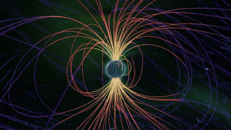
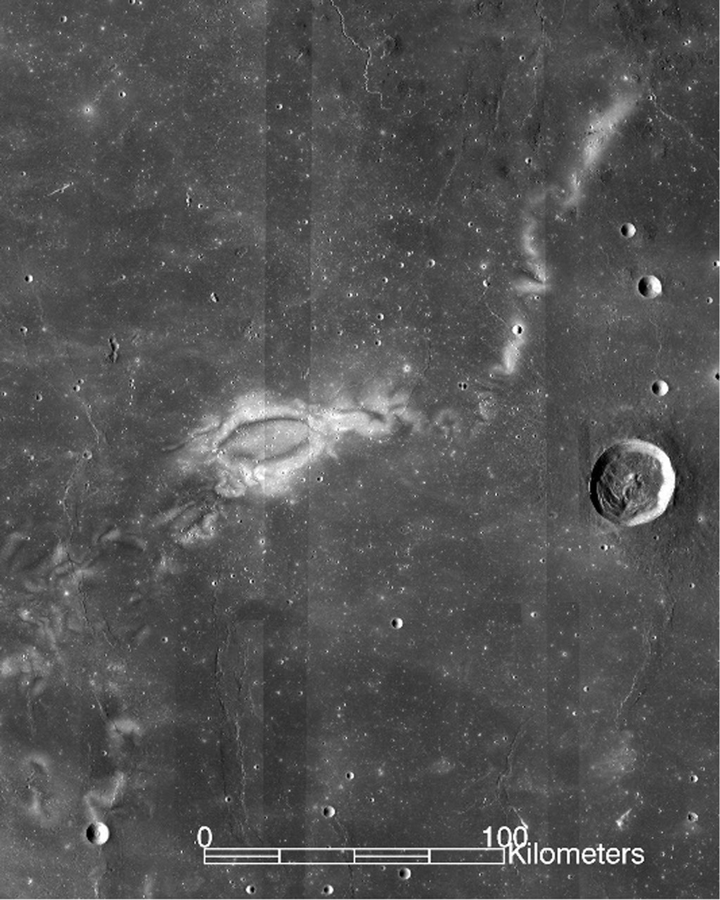
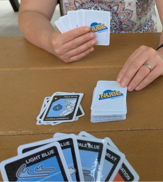
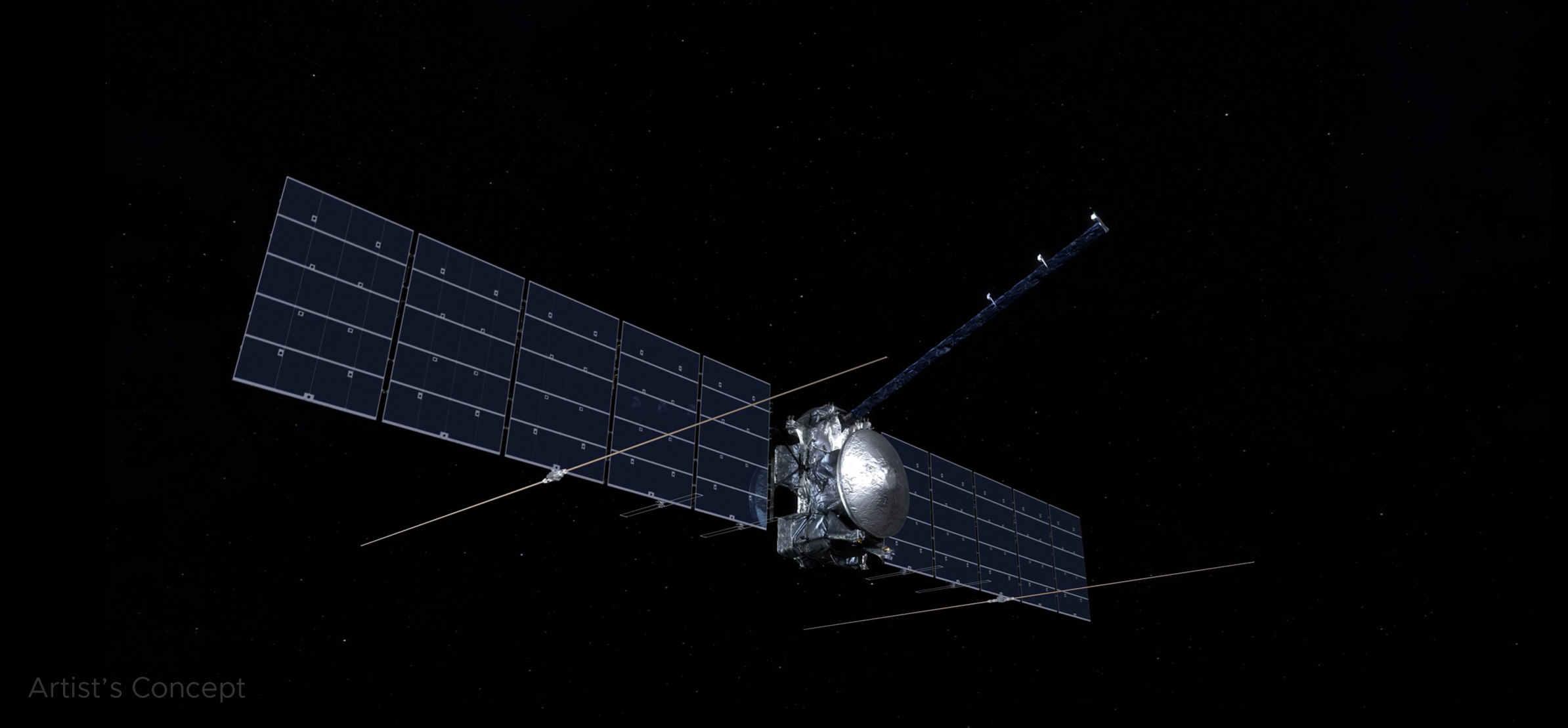
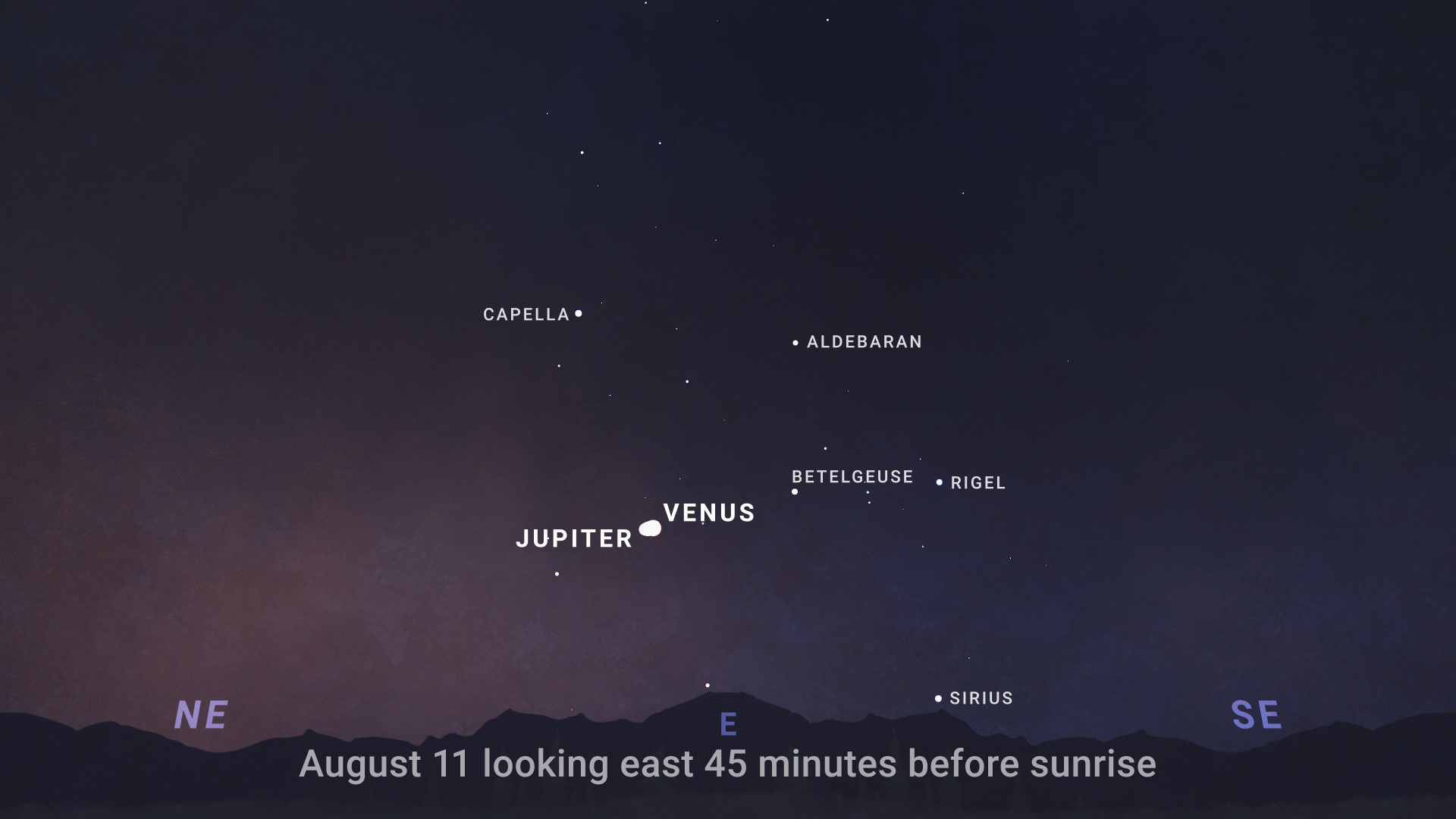
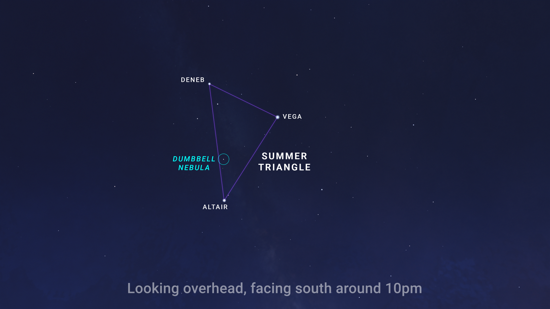
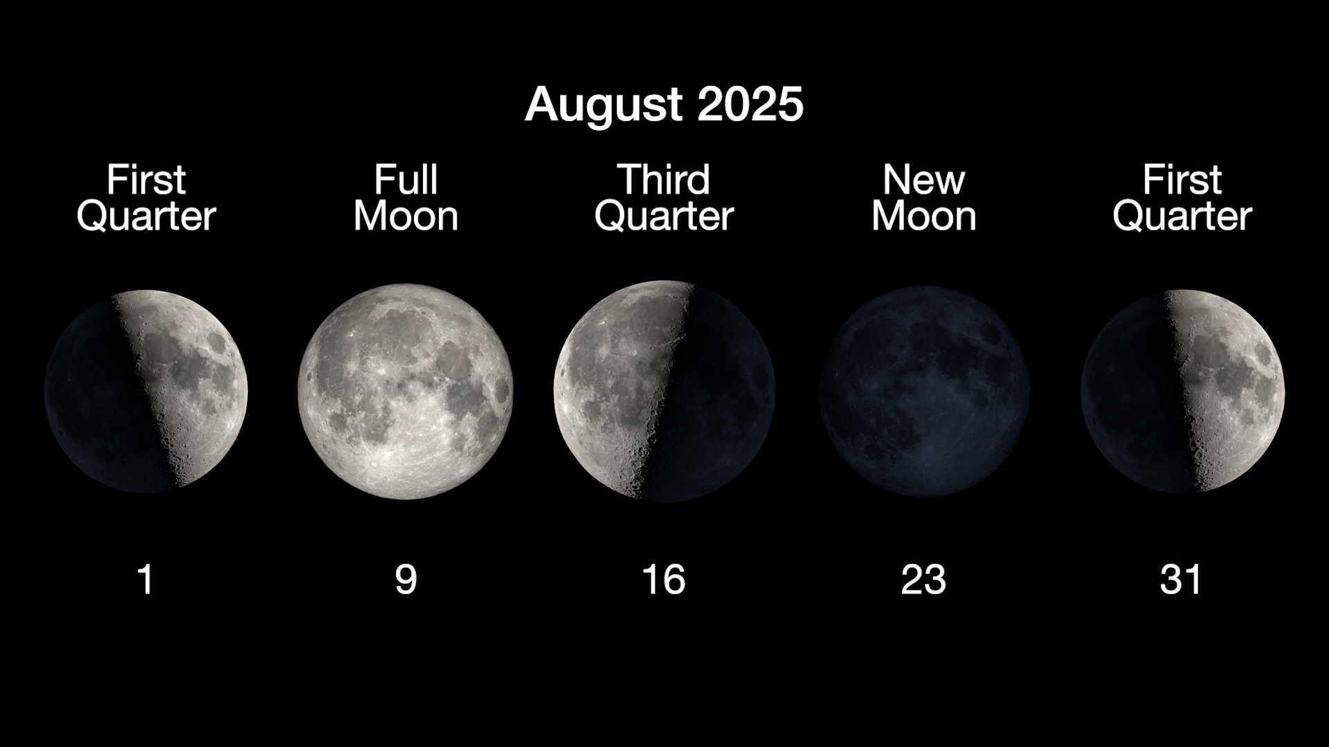
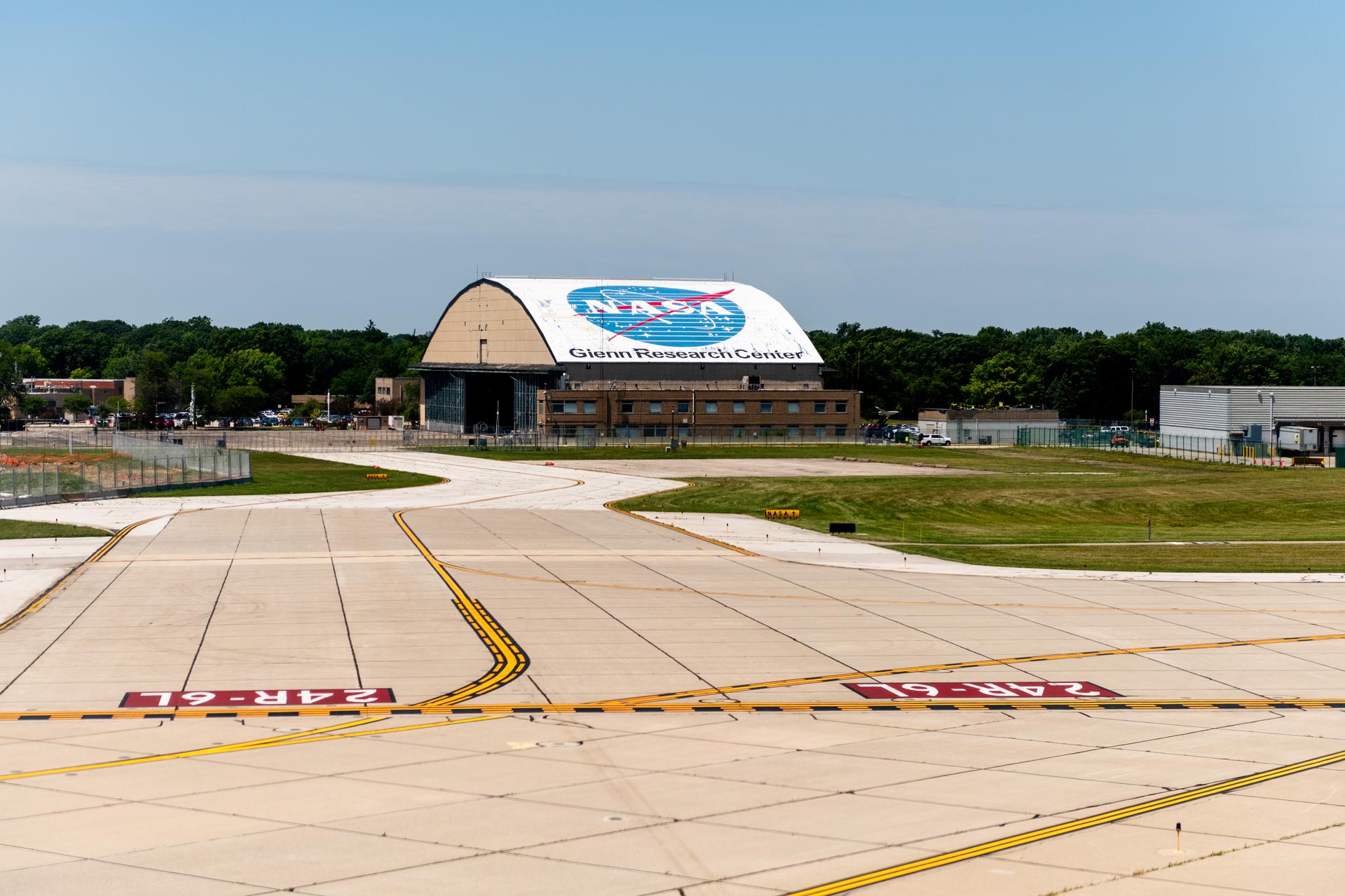
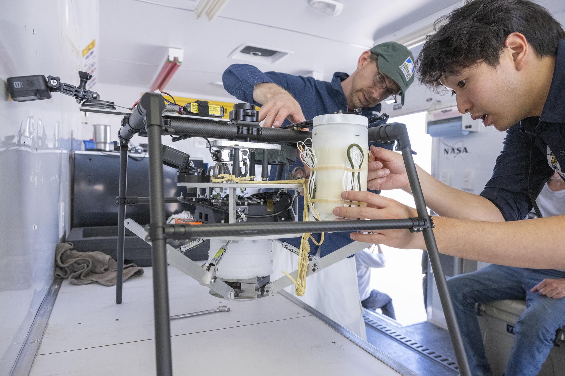
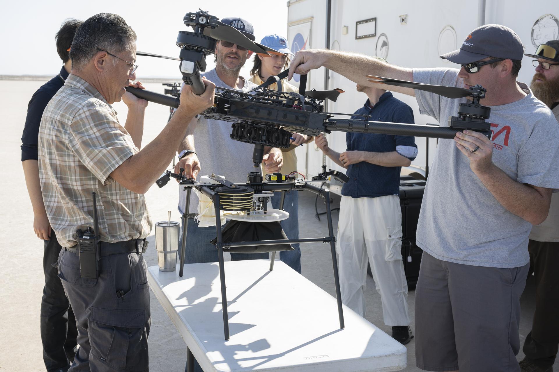
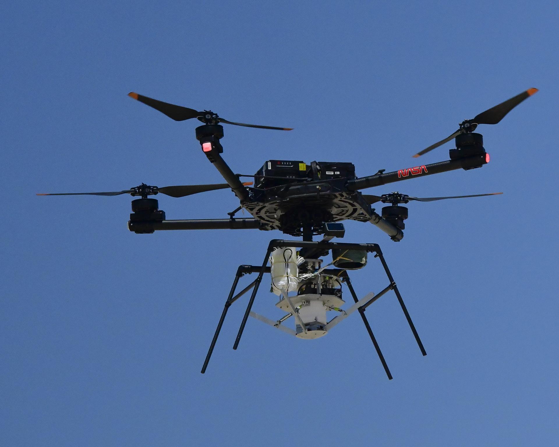
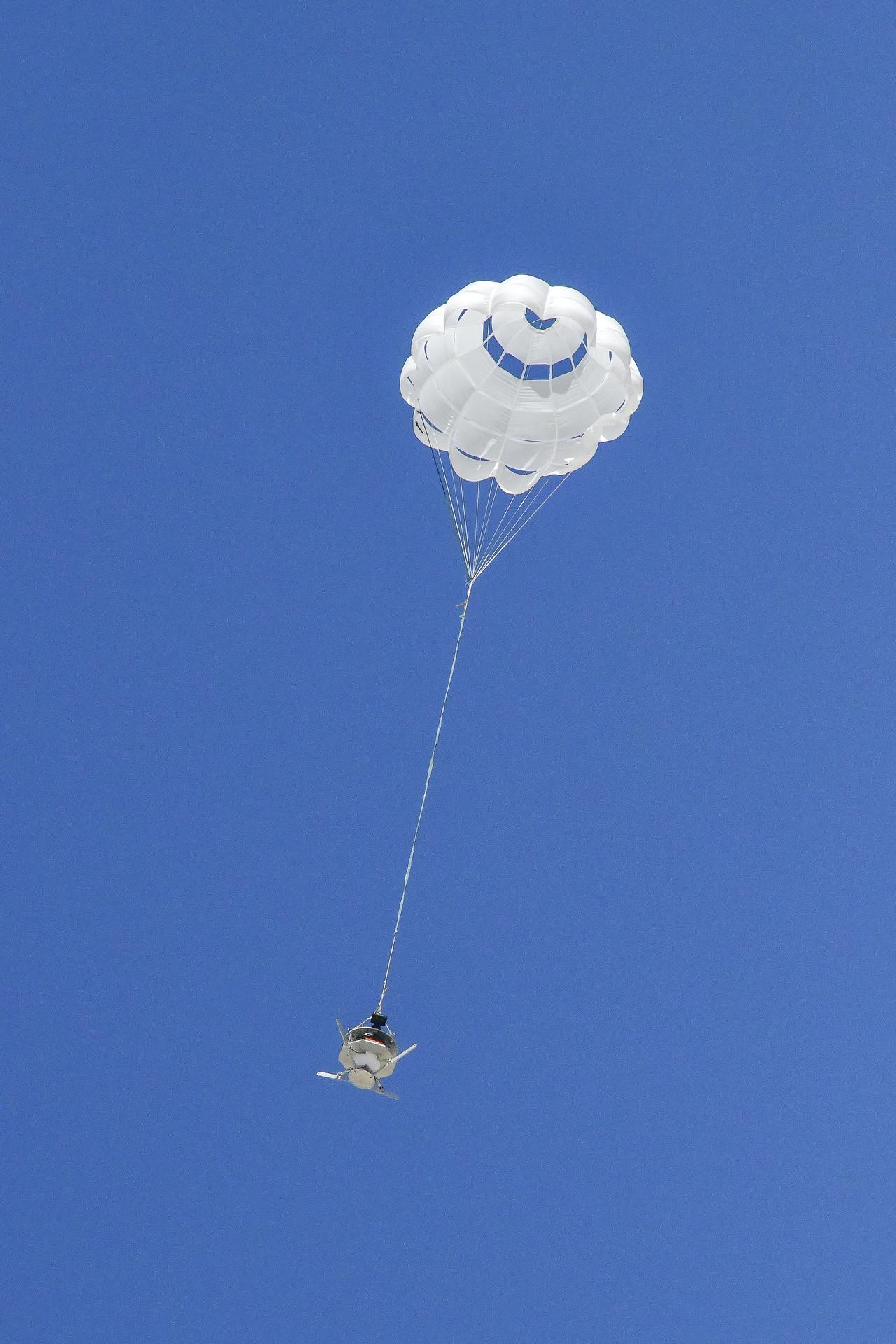
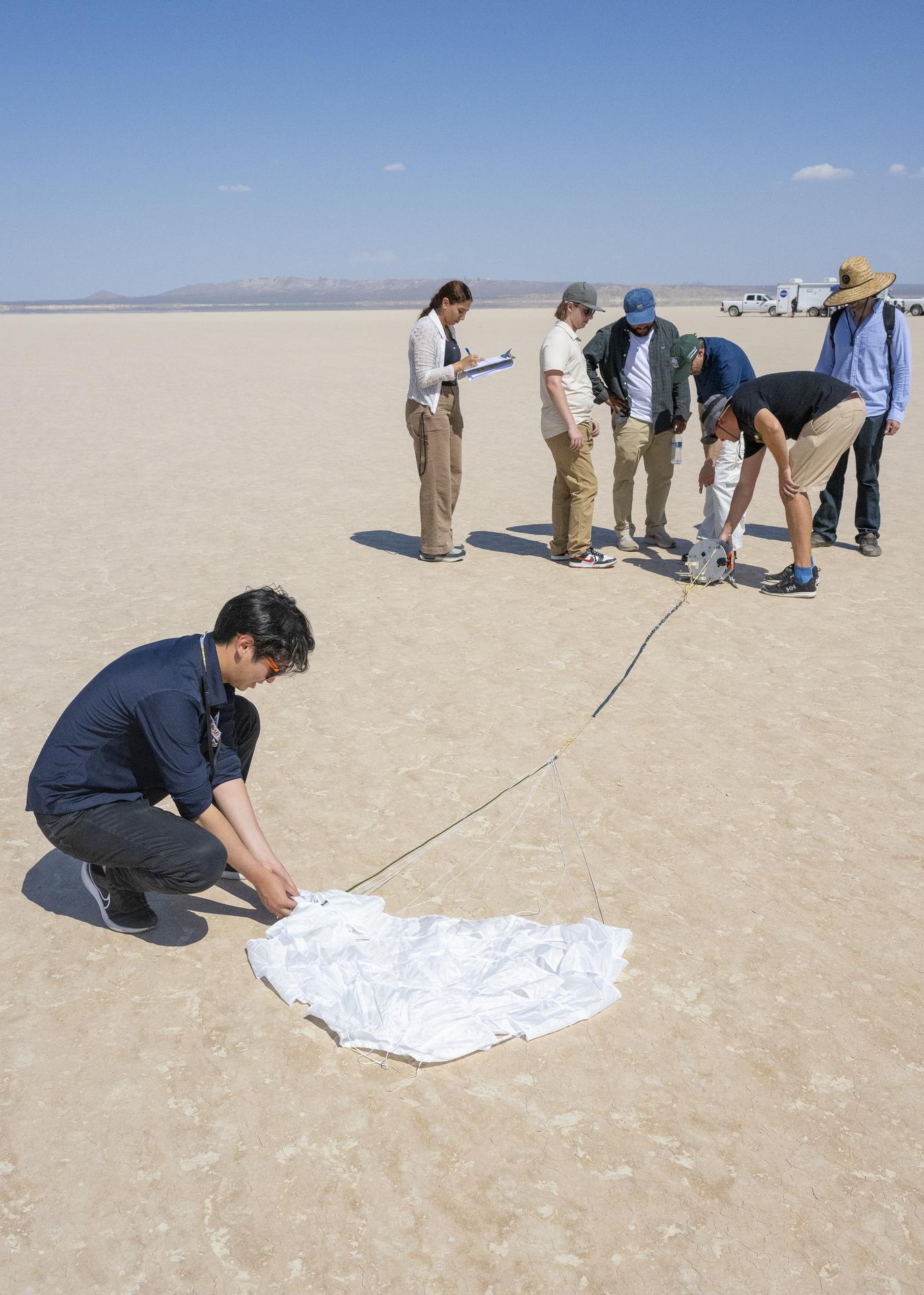
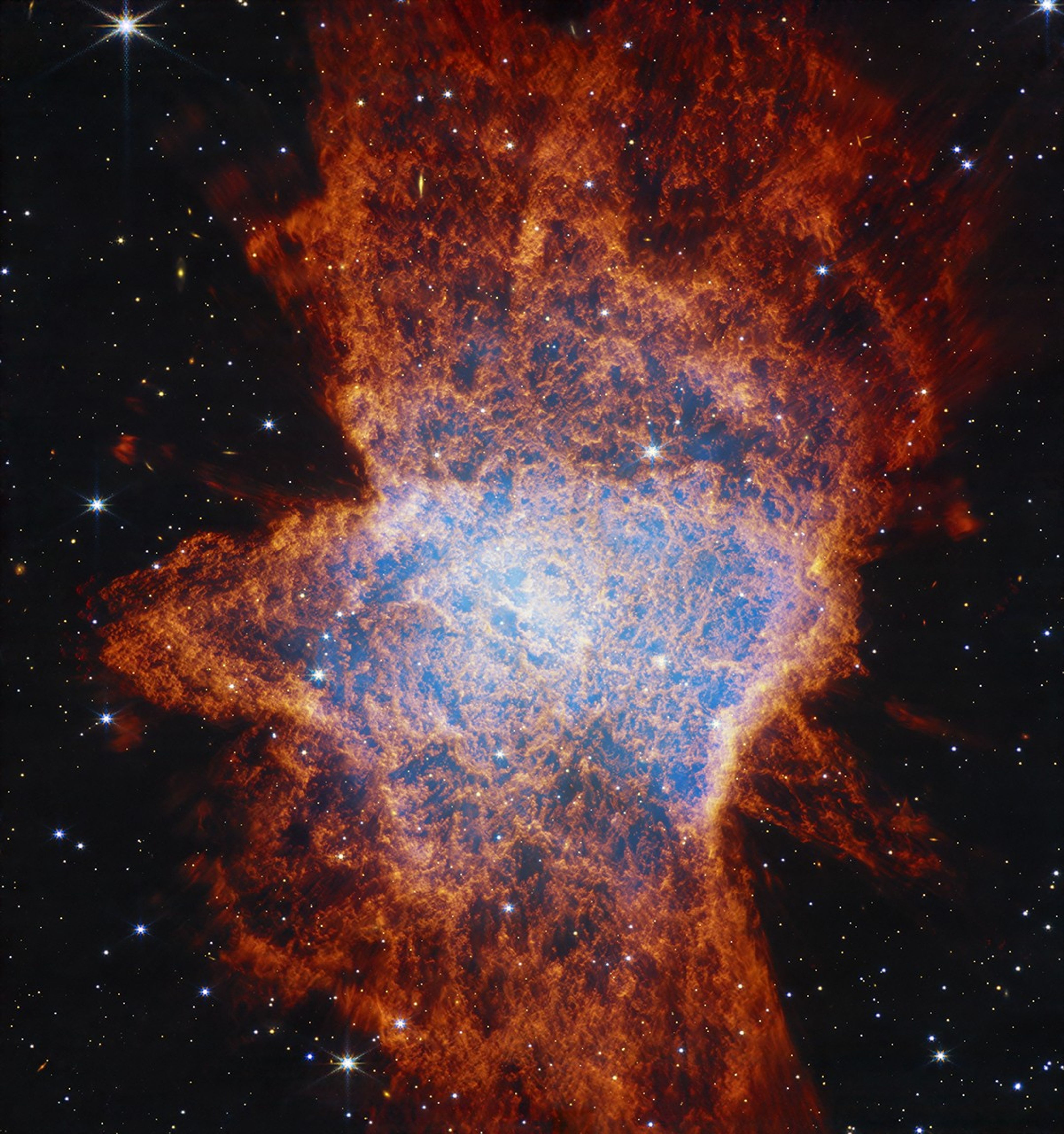
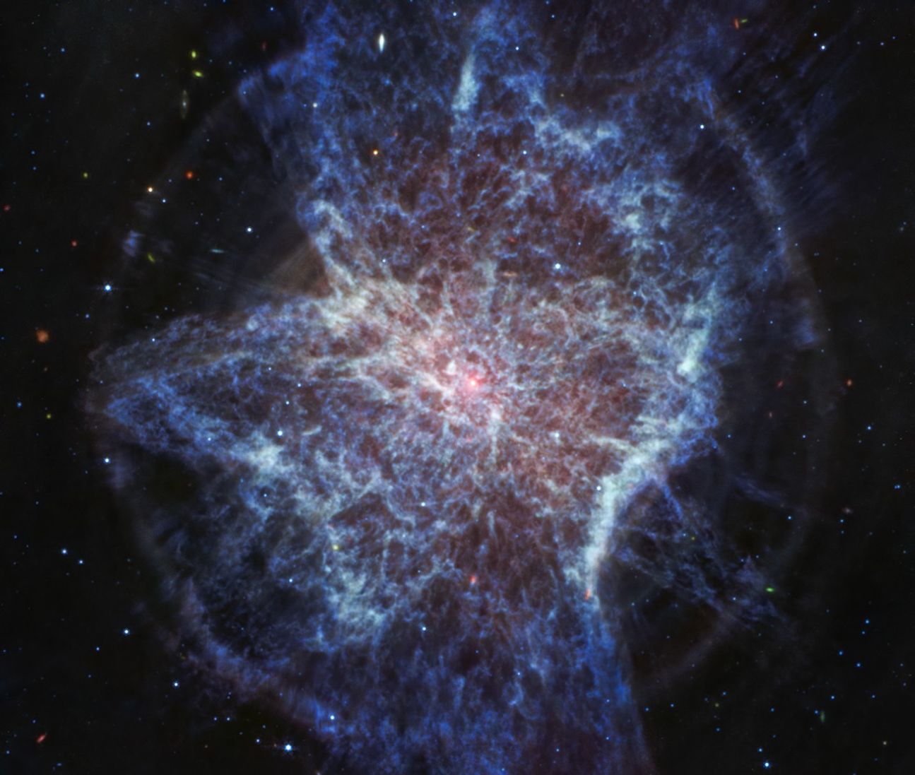
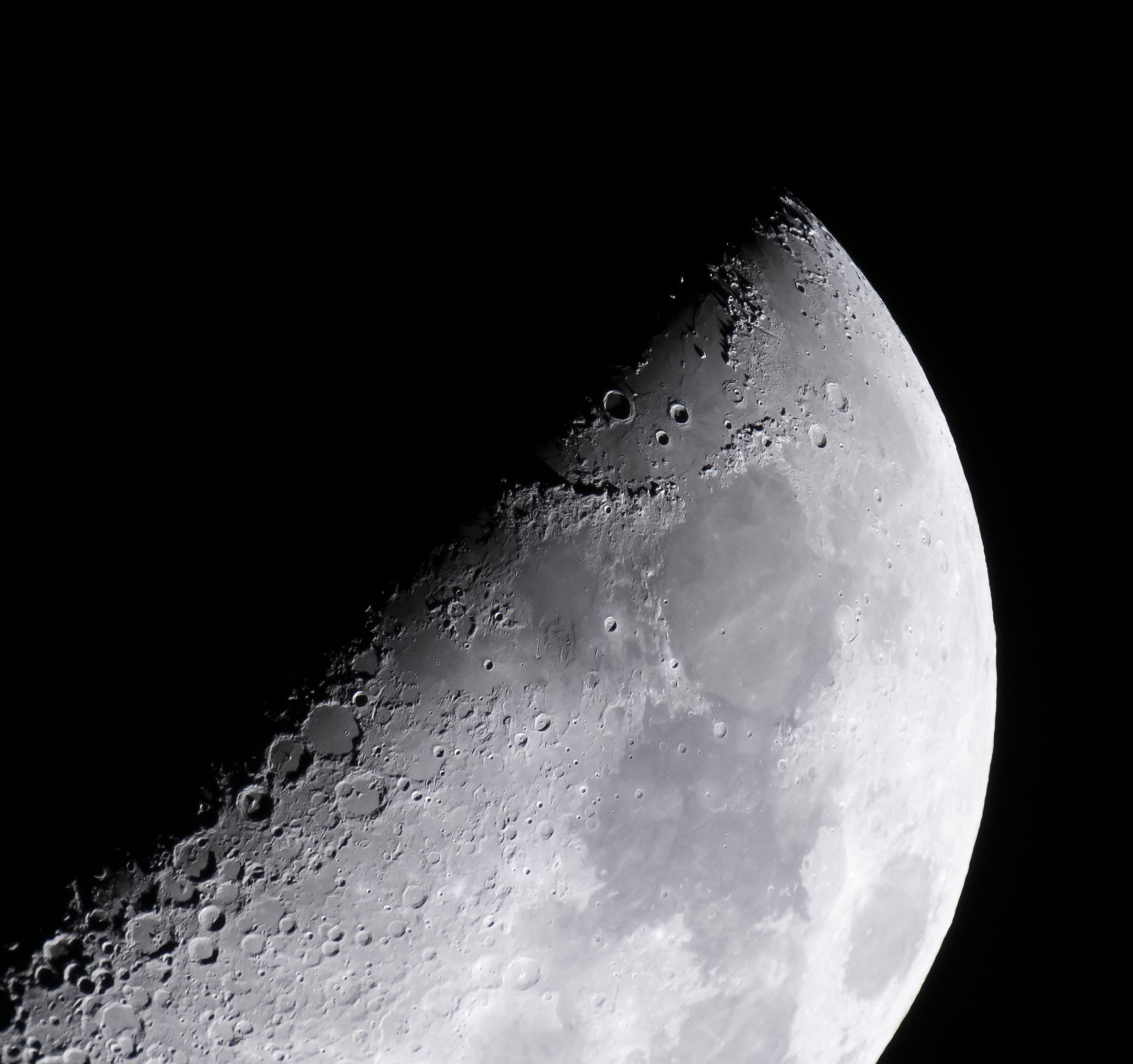
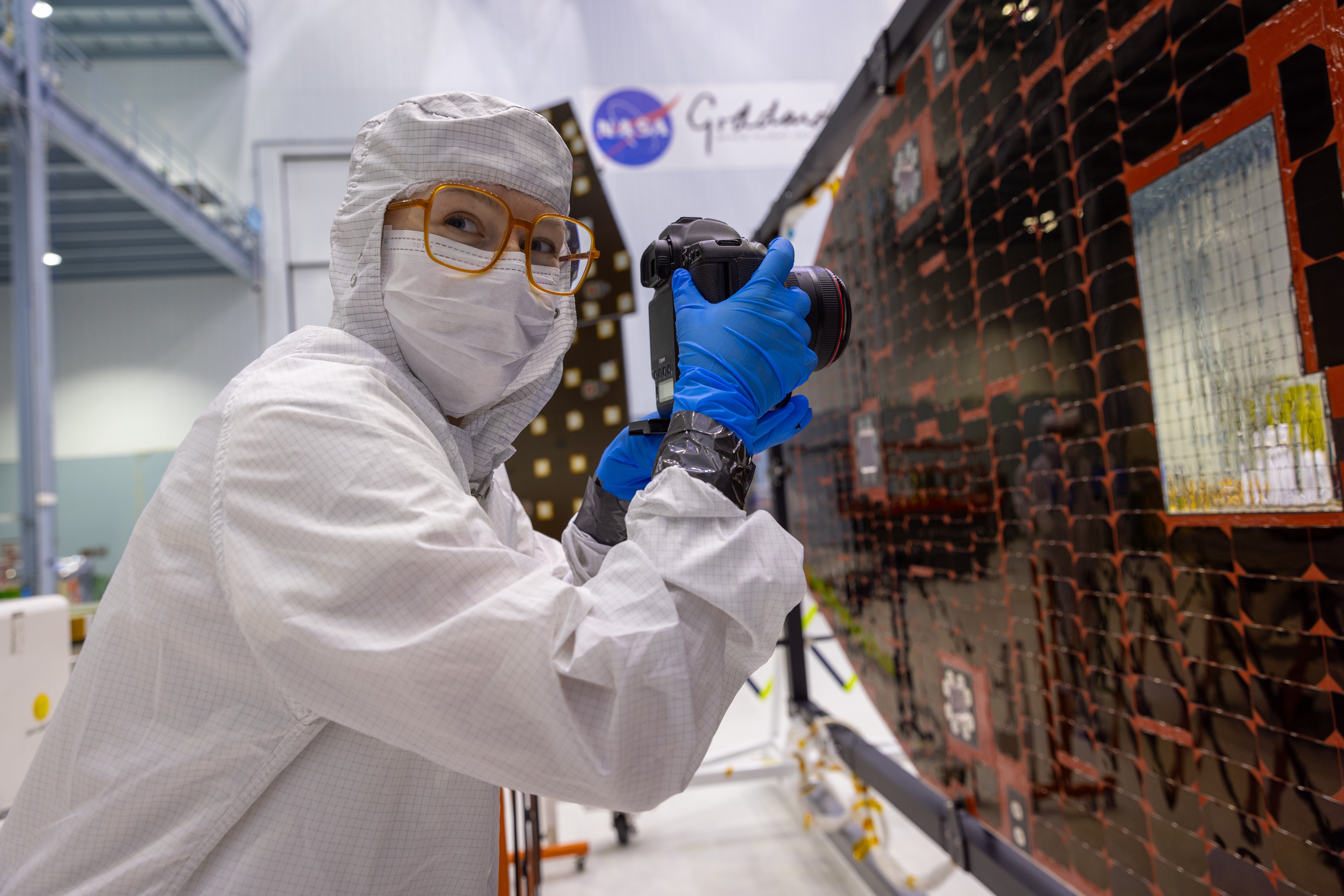
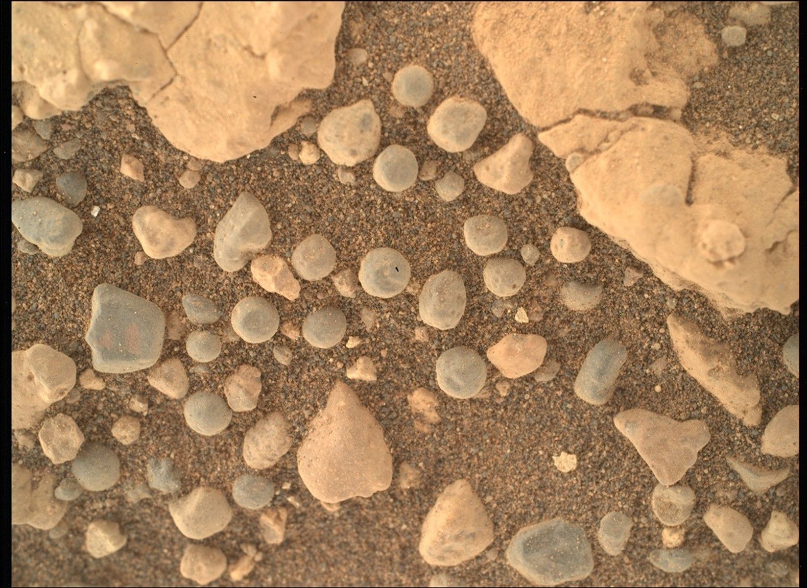