
Feed aggregator
Top climate research center at risk of cuts sues Trump administration
Universities that run the National Center for Atmospheric Research want to keep it from being dismantled
The leader of NASA’s Psyche mission has tips for interplanetary team building
Lindy Elkins-Tanton, principal investigator of NASA’s Psyche mission, explains in her new book how lessons from interplanetary exploration can help people solve problems together
A vast dam across the Bering Strait could stop the AMOC collapsing
A vast dam across the Bering Strait could stop the AMOC collapsing
Pluto-Like World's Thin Atmosphere Poses a Mystery for Astronomers
Astronomers are puzzling over another oddball on the edge of the solar system: This time, it's an icy object less than a quarter of Pluto's size with a thin atmosphere – a layer of gas that's not typically found around objects so small.
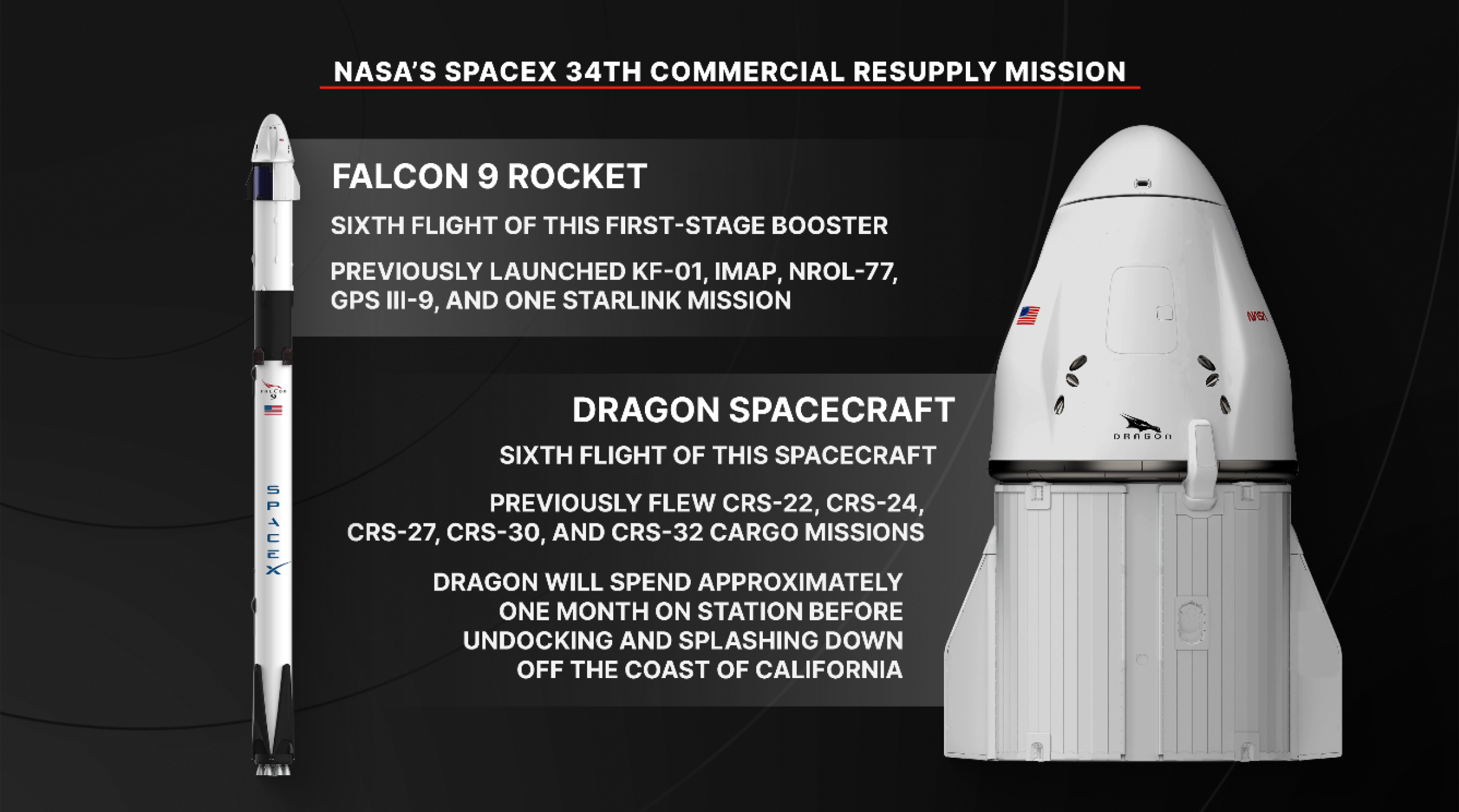
NASA’s SpaceX 34th Commercial Resupply Mission Overview
NASA and SpaceX are targeting a mid-May launch to deliver scientific investigations, supplies, and equipment to the International Space Station.
Loaded with about 6,500 pounds of supplies, the SpaceX Dragon spacecraft will lift off aboard the company’s Falcon 9 rocket from Launch Complex 40 at Cape Canaveral Space Force Station in Florida. Following its arrival to the orbital complex, Dragon will dock autonomously to the forward port of the space station’s Harmony module.
Watch agency launch and arrival coverage on NASA+, Amazon Prime, and NASA’s YouTube channel. Learn how to watch NASA content through a variety of online platforms, including social media.
NASA’s SpaceX 34th commercial resupply mission will launch from Launch Complex 40 at Cape Canaveral Space Force Station in Florida.NASA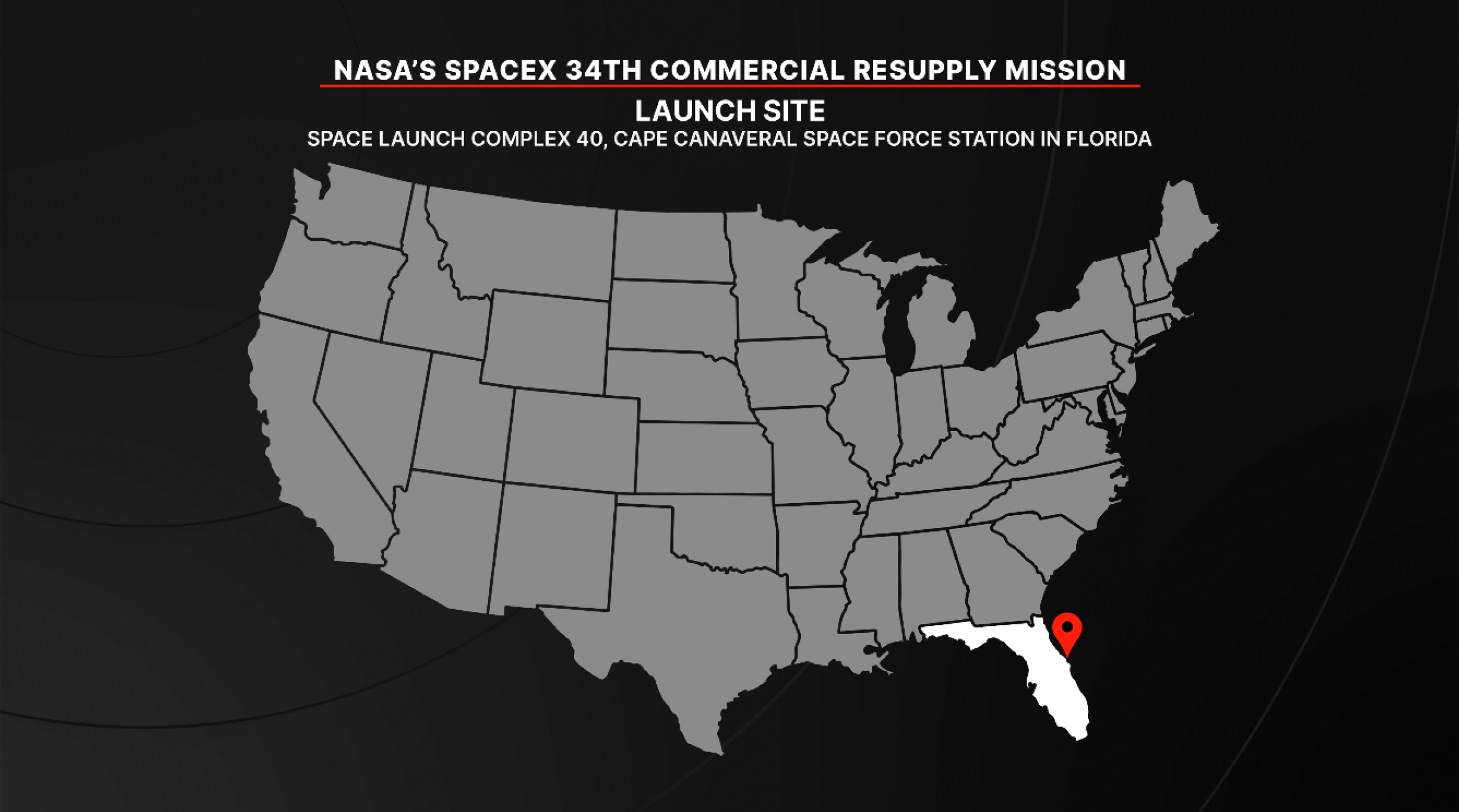
For more than 25 years, the International Space Station has provided research capabilities used by scientists from more than 110 countries to conduct more than 4,000 experiments in microgravity. Research conducted aboard the station helps advance long-duration missions to the Moon as part of the Artemis program and to Mars, while providing multiple benefits to humanity.
Science highlights:In addition to cargo for the crew aboard the space station, Dragon will deliver several new science experiments, including:
ODYSSEY will evaluate how well Earth-based microgravity simulators recreate space conditions.NASA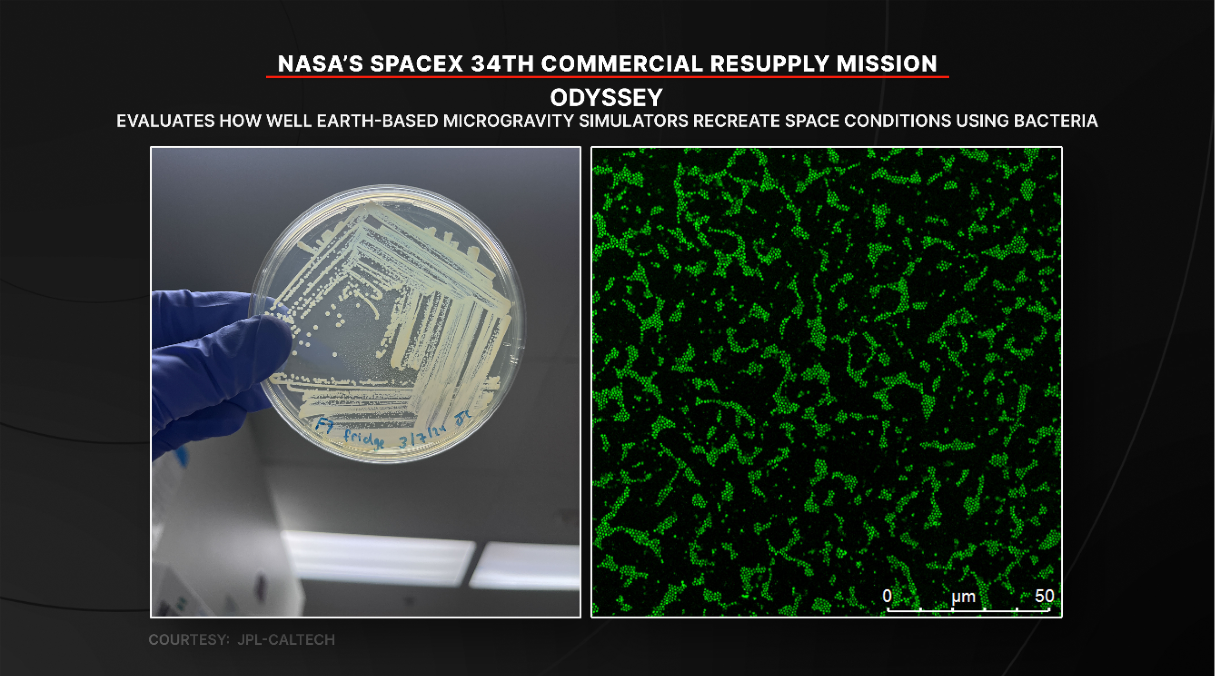
ODYSSEY will evaluate how well Earth-based microgravity simulators recreate space conditions. Researchers will examine bacterial behavior in space and compares the results to experiments conducted in microgravity simulators on Earth.
STORIE will monitor charged particles in orbit around the Earth, which respond to space weather and can affect assets like power grids and satellites.NASA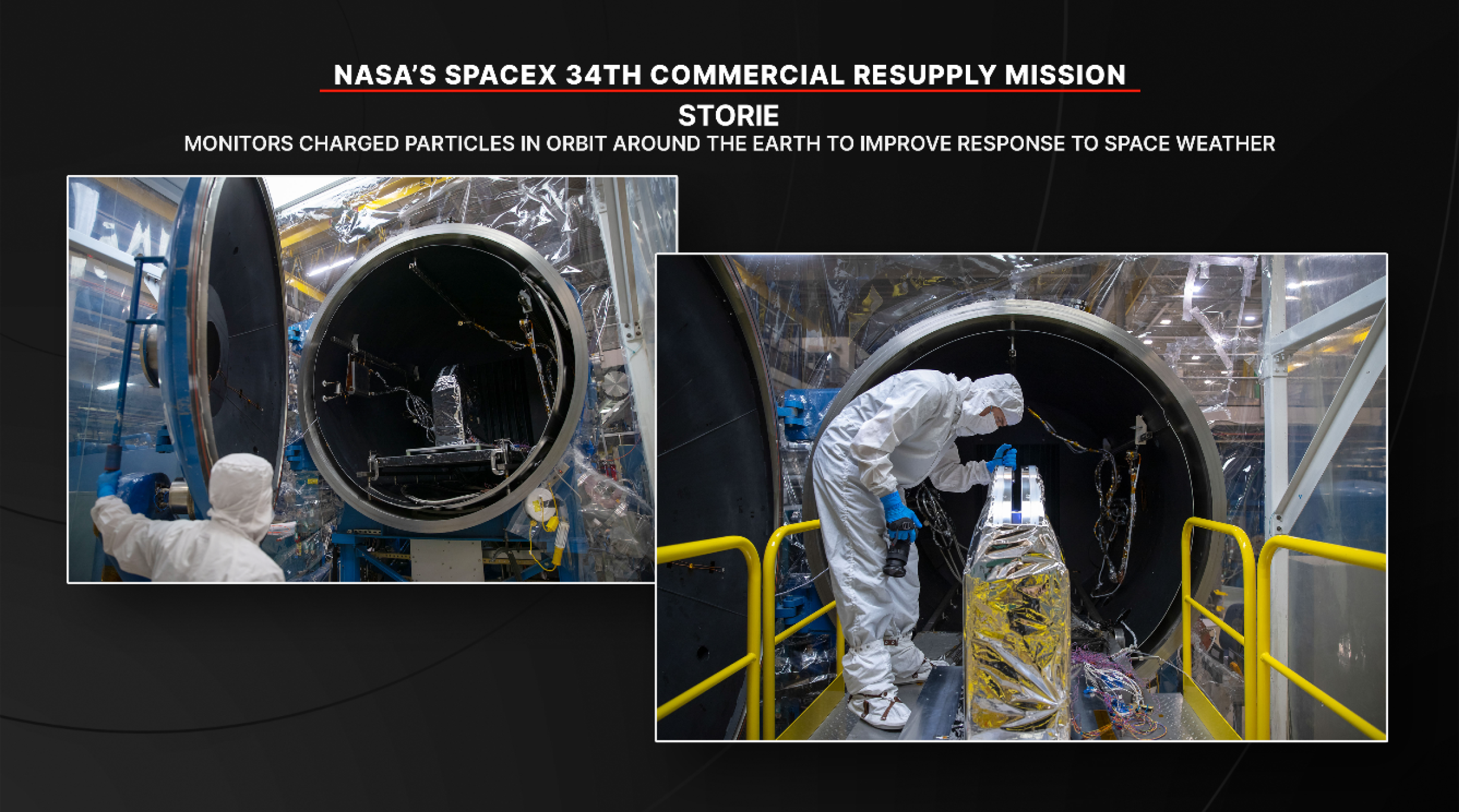
STORIE will monitor charged particles in orbit around the Earth, which respond to space weather and can affect assets like power grids and satellites. The instrument could help researchers gain knowledge to better predict and respond to these changes.
Laplace will study the movement and collision of dust particles in microgravity to understand particle motion in space.NASA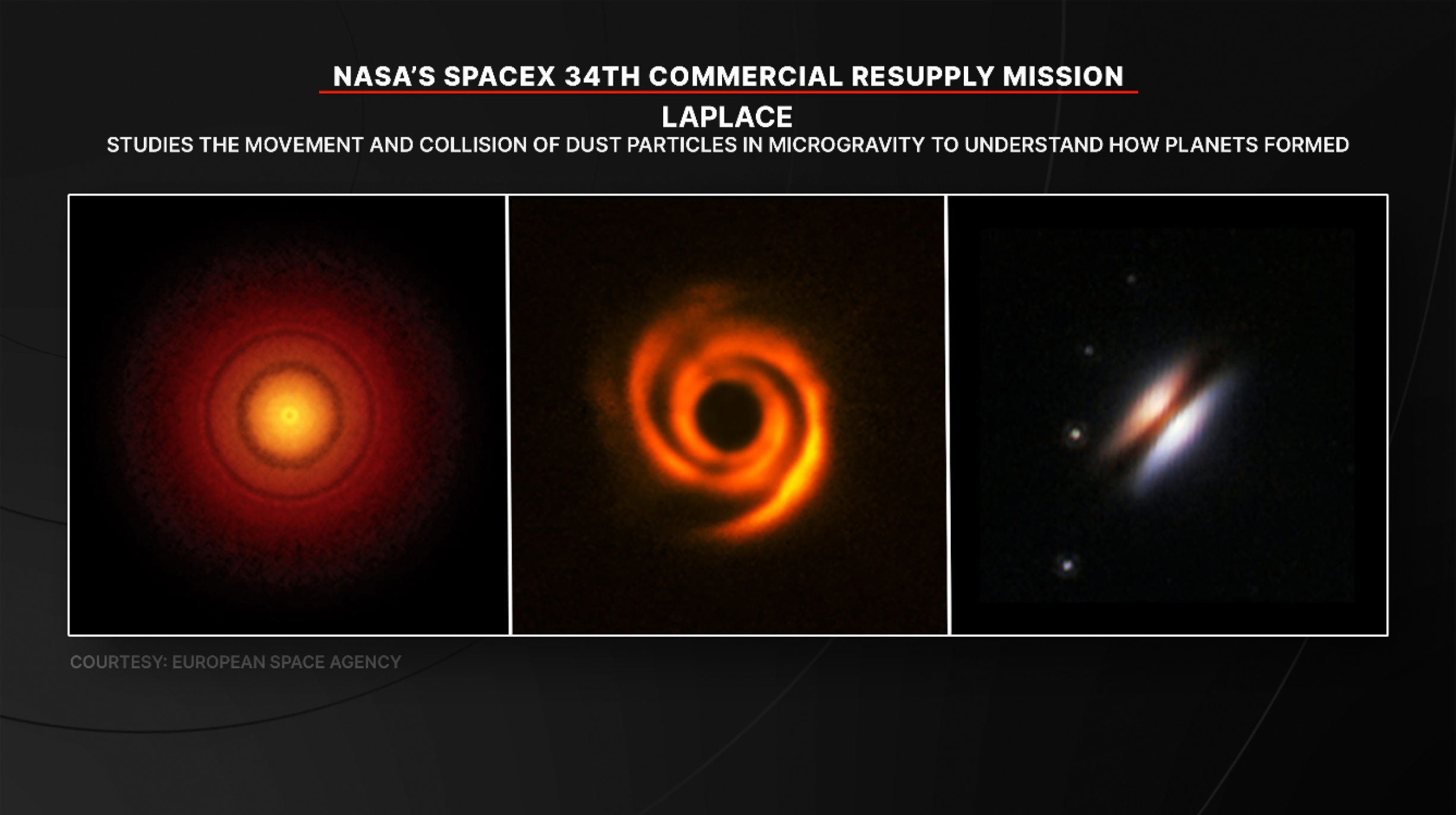
Laplace will study the movement and collision of dust particles in microgravity to understand particle motion in space. Researchers hope to learn more about Earth’s origins and provide fundamental understanding of how planets in our solar system and beyond came into existence.
Green Bone will observe how bone cells grow and develop in space on a bone scaffold made from wood. NASA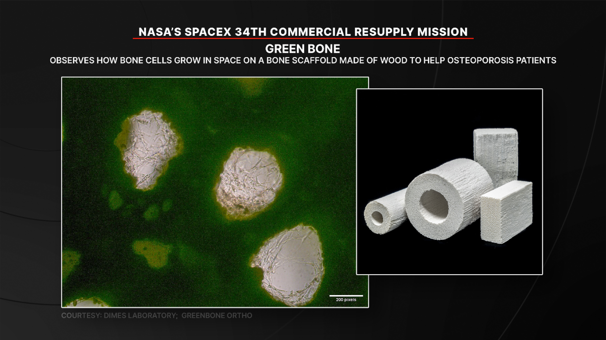
Green Bone will observe how bone cells grow and develop in space on a bone scaffold made from wood. Microgravity results could help researchers improve products that treat fragile bone conditions such as osteoporosis.
SPARK will evaluate how red blood cells and the spleen change in space for future astronauts.NASA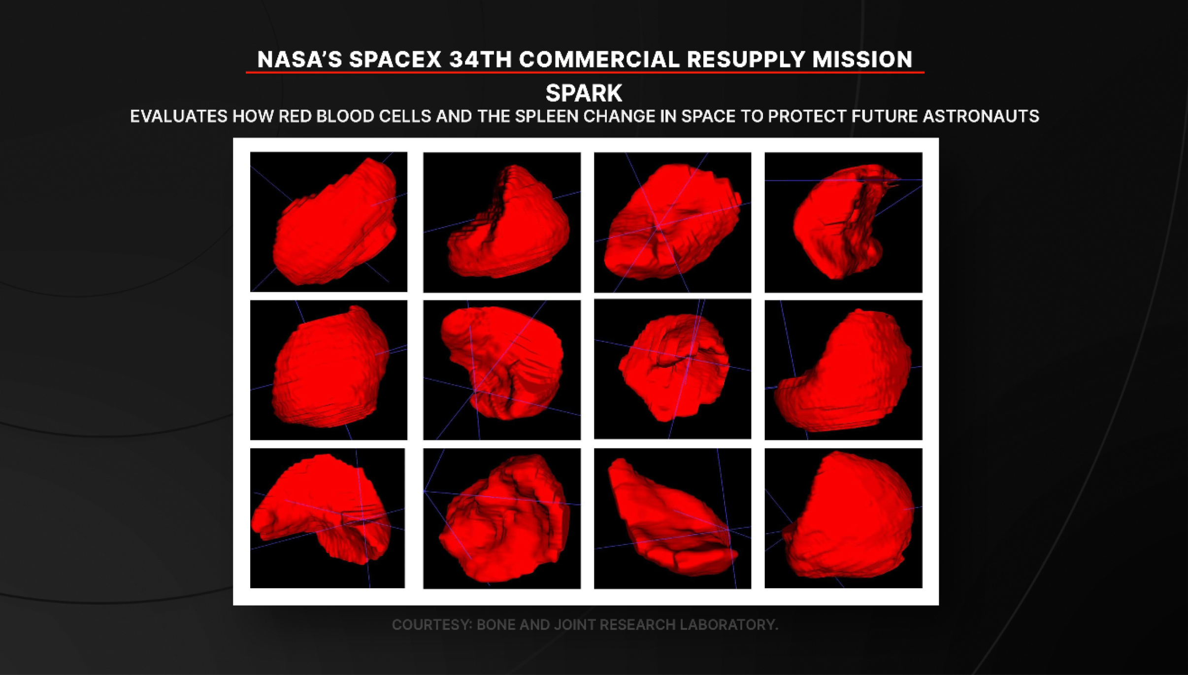
SPARK will evaluate how red blood cells and the spleen change in space for future astronauts. Researchers will observe human samples and imagery taken before, during, and after spaceflight to identify ways to protect astronaut health during long-duration space missions.
Arrival and return: NASA astronaut Jack Hathaway and ESA (European Space Agency) astronaut Sophie Adenot will monitor the arrival of the SpaceX Dragon cargo spacecraft from the International Space Station.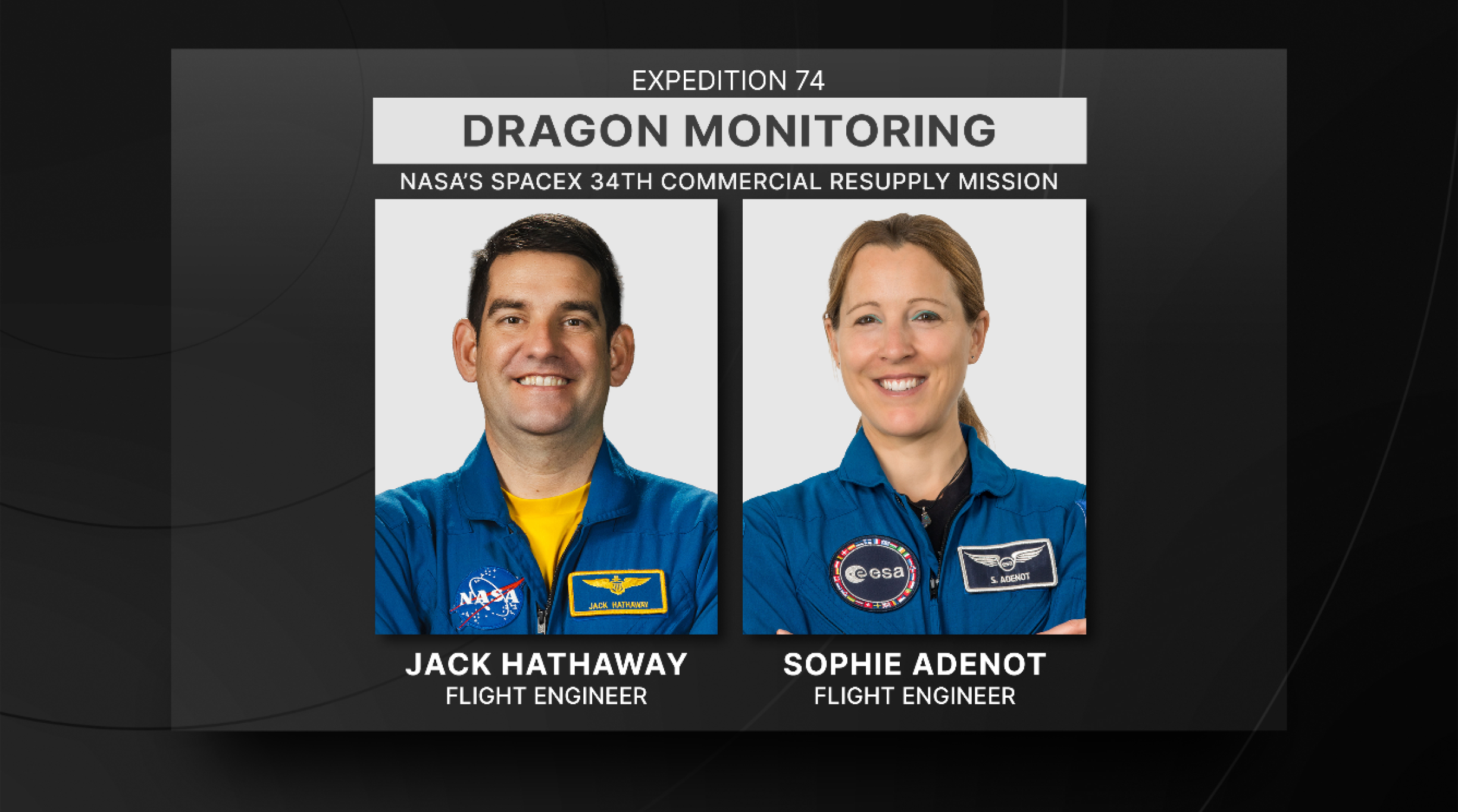
NASA astronaut Jack Hathaway and ESA (European Space Agency) astronaut Sophie Adenot will monitor the spacecraft’s arrival. Dragon will remain docked to the orbiting laboratory for about a month before splashing down in the Pacific Ocean, returning critical science and hardware to teams on Earth.
Cargo highlights: NASA’s SpaceX 34th commercial resupply mission will launch on the company’s Dragon spacecraft on the SpaceX Falcon 9 rocket to deliver research and supplies to the International Space Station Launch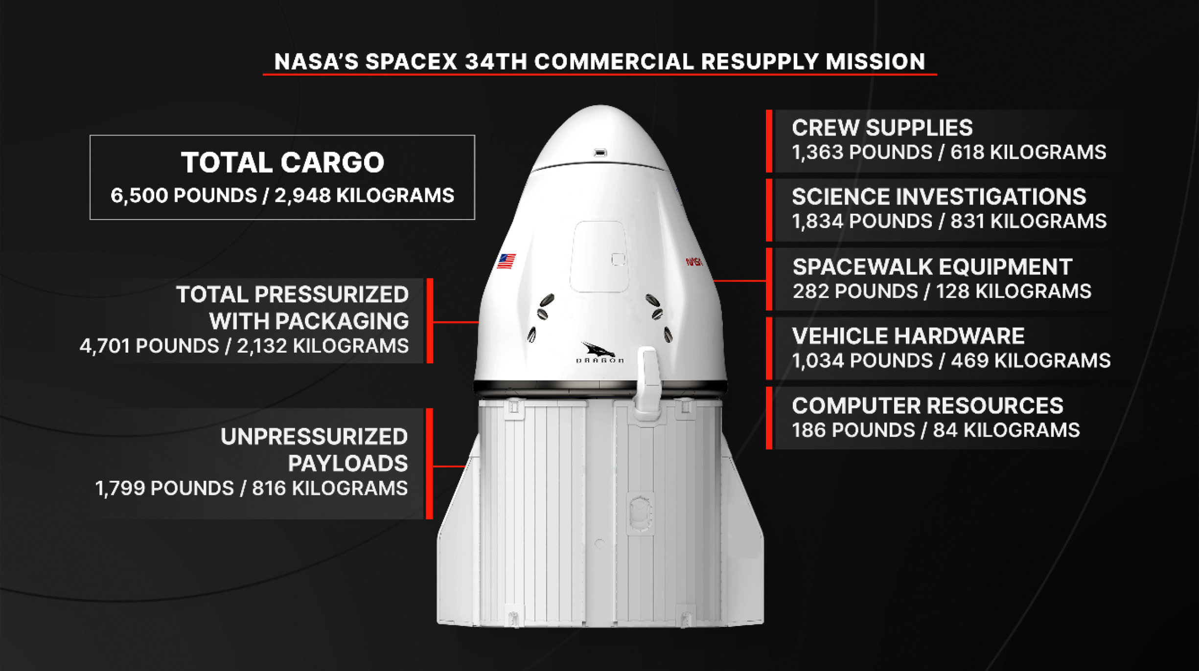
European Enhanced Exploration Exercise Device Power Cable – A replacement power cable is launching for installation on the European Enhanced Exploration Exercise Device.
Catalytic Reactor – A vital component of the Water Recovery and Management System, the catalytic reactor oxidizes volatile organics from wastewater that are removed by the Gas Separator and Ion Exchange Bed orbital replacement units. This part is launching to maintain on orbit sparing.
Universal Pretreat Concentrate Tank – This is a passive tank to provide alternate pretreat concentrate to the Universal Waste Management System (UWMS) and Waste Hygiene Compartment (WHC). Two units are launching to maintain this hardware, in tandem with Russian pretreat tanks currently used. A universal pretreat concentrate tank adapter will accompany the tanks to connect with the Russian hose.
Additional equipment launching includes an Ultraprobe to replace a worn ultrasonic inspection tool, a Remote Sensor Unit to restore spares for the station’s vibration monitoring system, and flexible repair patches for sealing the pressure hull if needed. The mission also will deliver an updated ARMADILLO (AOGA ReMediation, Advanced DeIonization and Limited Life Optimization) cartridge and hose assemblies to improve water processing for oxygen generation, along with a nitrogen recharge tank assembly to help maintain the station’s gas reserves.
ReturnWhen Dragon returns in mid‑June, it will bring back an ocular imaging device used to monitor crew eye health, a sorbent bed that filters trace contaminants from cabin air, and a separator pump from the Waste and Hygiene Compartment. The Advanced Plant Habitat, which supported long-duration plant biology studies, also will return for eventual museum display. A pressure management device that recovers vestibule air during depressurization will come back for repair and storage as a ground spare.
NASA’s SpaceX 34th Commercial Resupply Mission Overview
NASA and SpaceX are targeting a mid-May launch to deliver scientific investigations, supplies, and equipment to the International Space Station.
Loaded with about 6,500 pounds of supplies, the SpaceX Dragon spacecraft will lift off aboard the company’s Falcon 9 rocket from Launch Complex 40 at Cape Canaveral Space Force Station in Florida. Following its arrival to the orbital complex, Dragon will dock autonomously to the forward port of the space station’s Harmony module.
Watch agency launch and arrival coverage on NASA+, Amazon Prime, and NASA’s YouTube channel. Learn how to watch NASA content through a variety of online platforms, including social media.
NASA’s SpaceX 34th commercial resupply mission will launch from Launch Complex 40 at Cape Canaveral Space Force Station in Florida.NASAFor more than 25 years, the International Space Station has provided research capabilities used by scientists from more than 110 countries to conduct more than 4,000 experiments in microgravity. Research conducted aboard the station helps advance long-duration missions to the Moon as part of the Artemis program and to Mars, while providing multiple benefits to humanity.
Science highlights:In addition to cargo for the crew aboard the space station, Dragon will deliver several new science experiments, including:
ODYSSEY will evaluate how well Earth-based microgravity simulators recreate space conditions.NASAODYSSEY will evaluate how well Earth-based microgravity simulators recreate space conditions. Researchers will examine bacterial behavior in space and compares the results to experiments conducted in microgravity simulators on Earth.
STORIE will monitor charged particles in orbit around the Earth, which respond to space weather and can affect assets like power grids and satellites.NASASTORIE will monitor charged particles in orbit around the Earth, which respond to space weather and can affect assets like power grids and satellites. The instrument could help researchers gain knowledge to better predict and respond to these changes.
Laplace will study the movement and collision of dust particles in microgravity to understand particle motion in space.NASALaplace will study the movement and collision of dust particles in microgravity to understand particle motion in space. Researchers hope to learn more about Earth’s origins and provide fundamental understanding of how planets in our solar system and beyond came into existence.
Green Bone will observe how bone cells grow and develop in space on a bone scaffold made from wood. NASAGreen Bone will observe how bone cells grow and develop in space on a bone scaffold made from wood. Microgravity results could help researchers improve products that treat fragile bone conditions such as osteoporosis.
SPARK will evaluate how red blood cells and the spleen change in space for future astronauts.NASASPARK will evaluate how red blood cells and the spleen change in space for future astronauts. Researchers will observe human samples and imagery taken before, during, and after spaceflight to identify ways to protect astronaut health during long-duration space missions.
Arrival and return: NASA astronaut Jack Hathaway and ESA (European Space Agency) astronaut Sophie Adenot will monitor the arrival of the SpaceX Dragon cargo spacecraft from the International Space Station.NASA astronaut Jack Hathaway and ESA (European Space Agency) astronaut Sophie Adenot will monitor the spacecraft’s arrival. Dragon will remain docked to the orbiting laboratory for about a month before splashing down in the Pacific Ocean, returning critical science and hardware to teams on Earth.
Cargo highlights: NASA’s SpaceX 34th commercial resupply mission will launch on the company’s Dragon spacecraft on the SpaceX Falcon 9 rocket to deliver research and supplies to the International Space Station LaunchEuropean Enhanced Exploration Exercise Device Power Cable – A replacement power cable is launching for installation on the European Enhanced Exploration Exercise Device.
Catalytic Reactor – A vital component of the Water Recovery and Management System, the catalytic reactor oxidizes volatile organics from wastewater that are removed by the Gas Separator and Ion Exchange Bed orbital replacement units. This part is launching to maintain on orbit sparing.
Universal Pretreat Concentrate Tank – This is a passive tank to provide alternate pretreat concentrate to the Universal Waste Management System (UWMS) and Waste Hygiene Compartment (WHC). Two units are launching to maintain this hardware, in tandem with Russian pretreat tanks currently used. A universal pretreat concentrate tank adapter will accompany the tanks to connect with the Russian hose.
Additional equipment launching includes an Ultraprobe to replace a worn ultrasonic inspection tool, a Remote Sensor Unit to restore spares for the station’s vibration monitoring system, and flexible repair patches for sealing the pressure hull if needed. The mission also will deliver an updated ARMADILLO (AOGA ReMediation, Advanced DeIonization and Limited Life Optimization) cartridge and hose assemblies to improve water processing for oxygen generation, along with a nitrogen recharge tank assembly to help maintain the station’s gas reserves.
ReturnWhen Dragon returns in mid‑June, it will bring back an ocular imaging device used to monitor crew eye health, a sorbent bed that filters trace contaminants from cabin air, and a separator pump from the Waste and Hygiene Compartment. The Advanced Plant Habitat, which supported long-duration plant biology studies, also will return for eventual museum display. A pressure management device that recovers vestibule air during depressurization will come back for repair and storage as a ground spare.
Pentagon Releases UFO Files That Go Back to the Apollo Moon Missions
The Department of Defense has released a fresh batch of images and transcripts relating to reports of unidentified anomalous phenomena, formerly known as UFOs, including pictures and descriptions from NASA's Apollo missions to the moon.
Wildfire breaks out inside Chernobyl exclusion zone
A fire covering at least five square miles burned through the exclusion zone around the site of the world’s worst nuclear disaster on Friday after two drones crashed into the area
US government releases huge batch of UFO files
US government releases huge batch of UFO files
NASA’s Psyche Mission Captures Mars During Gravity Assist Approach
NASA/JPL-Caltech/ASU Photojournal Navigation Downloads NASA’s Psyche Mission Captures Mars During Gravity Assist Approach
JPEG (132.38 KB)
PIA26750 Figure A
JPEG (105.92 KB)
Description
This colorized image of Mars was captured by NASA’s Psyche mission on May 3, 2026, about 3 million miles (4.8 million kilometers) from the planet. The spacecraft is approaching the planet for a gravity assist on May 15 that will give it a boost in speed and adjust its trajectory toward asteroid Psyche for eventual arrival in 2029.
The spacecraft is approaching Mars from a high-phase angle, meaning that the planet appears only as a thin crescent, like our own crescent Moon seen around its new Moon phase. From this viewing geometry, the Sun is out of frame and “above” both Mars and Psyche.
Figure A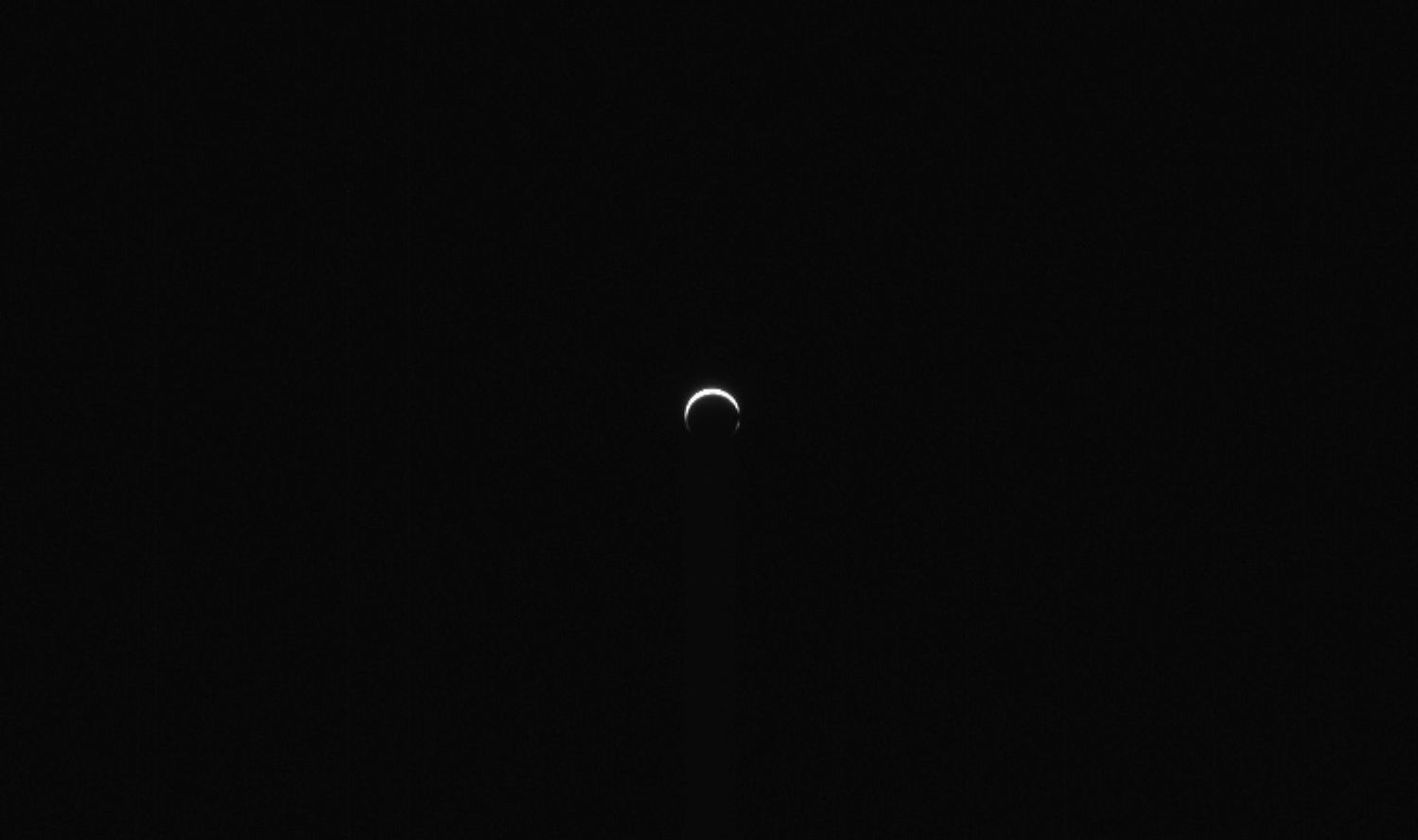
Figure A is a zoomed-out view from the imager. No stars are visible in the background since they are much dimmer than the sunlight being reflected by Mars.
The observation was acquired by the multispectral imager instrument’s panchromatic or broadband filter, with an exposure time of just 2 milliseconds. Even with this very short exposure time, the crescent is extremely bright and parts of the image are oversaturated. The light seen here is sunlight reflected off the surface of Mars and also scattered by dust particles in its atmosphere. Because the quantity of dust in the atmosphere can vary rapidly over time, the anticipated brightness of the crescent was hard to predict before this early image was acquired.
The dustiness of Mars leads to sunlight being scattered by its atmosphere, making the crescent appear to extend farther around the planet than if it had no atmosphere (as with our Moon).Of note, on the right side of the extended crescent, there appears to be a gap, which coincides with the planet’s icy north polar cap. The cap is currently in winter and mission specialists hypothesize that seasonal clouds and hazes may be forming in that region, possibly blocking the atmospheric dust’s ability to scatter sunlight like it does elsewhere around the planet.
The Psyche mission’s imager team will be acquiring, processing, and interpreting similar images in the lead-up to the close approach on May 15. The images are primarily designed to calibrate the cameras and to characterize their performance in flight as a practice run for the approach to asteroid Psyche in 2029.
For more information about the Psyche mission, read: https://science.nasa.gov/mission/psyche/
Keep Exploring Discover More Topics From Photojournal
Photojournal
Search Photojournal
Photojournal’s Latest Content
Feedback
NASA’s Psyche Mission Captures Mars During Gravity Assist Approach
NASA/JPL-Caltech/ASU Photojournal Navigation Downloads NASA’s Psyche Mission Captures Mars During Gravity Assist Approach
JPEG (132.38 KB)
PIA26750 Figure A
JPEG (105.92 KB)
Description
This colorized image of Mars was captured by NASA’s Psyche mission on May 3, 2026, about 3 million miles (4.8 million kilometers) from the planet. The spacecraft is approaching the planet for a gravity assist on May 15 that will give it a boost in speed and adjust its trajectory toward asteroid Psyche for eventual arrival in 2029.
The spacecraft is approaching Mars from a high-phase angle, meaning that the planet appears only as a thin crescent, like our own crescent Moon seen around its new Moon phase. From this viewing geometry, the Sun is out of frame and “above” both Mars and Psyche.
Figure AFigure A is a zoomed-out view from the imager. No stars are visible in the background since they are much dimmer than the sunlight being reflected by Mars.
The observation was acquired by the multispectral imager instrument’s panchromatic or broadband filter, with an exposure time of just 2 milliseconds. Even with this very short exposure time, the crescent is extremely bright and parts of the image are oversaturated. The light seen here is sunlight reflected off the surface of Mars and also scattered by dust particles in its atmosphere. Because the quantity of dust in the atmosphere can vary rapidly over time, the anticipated brightness of the crescent was hard to predict before this early image was acquired.
The dustiness of Mars leads to sunlight being scattered by its atmosphere, making the crescent appear to extend farther around the planet than if it had no atmosphere (as with our Moon).Of note, on the right side of the extended crescent, there appears to be a gap, which coincides with the planet’s icy north polar cap. The cap is currently in winter and mission specialists hypothesize that seasonal clouds and hazes may be forming in that region, possibly blocking the atmospheric dust’s ability to scatter sunlight like it does elsewhere around the planet.
The Psyche mission’s imager team will be acquiring, processing, and interpreting similar images in the lead-up to the close approach on May 15. The images are primarily designed to calibrate the cameras and to characterize their performance in flight as a practice run for the approach to asteroid Psyche in 2029.
For more information about the Psyche mission, read: https://science.nasa.gov/mission/psyche/
Keep Exploring Discover More Topics From Photojournal
Photojournal
Search Photojournal
Photojournal’s Latest Content
Feedback
I Am Artemis: Anton Kiriwas
Listen to this audio excerpt from Anton Kiriwas, senior technical integration manager for NASA’s Exploration Ground Systems Program:
0:00 / 0:00
Your browser does not support the audio element.When Anton Kiriwas first spotted an image of the Moon and Mars hanging over a job fair booth while in college, it captured his imagination, yet felt like a dream too distant to chase. He had no way of knowing that years later he would play a critical role in NASA’s Artemis missions, helping launch humans back to the Moon for the first time in more than half a century.
Kiriwas’ journey to NASA began during the Space Shuttle Program, while he was working for United Launch Alliance, the same organization behind the memorable Moon and Mars booth that he passed by in college. Not long after, he joined NASA as a civil servant, designing electrical systems that set him on a path toward his current role with Exploration Ground Systems as senior technical integration manager. In simpler terms, Kiriwas is a problem solver.
My official title is way too long – what I do is pretty simple: I solve problems for the ground systems. Our goal is to process, launch, and recover the spacecraft. There are a lot of ground systems that are used to go do that and a lot of people involved. A big part of my job is to go solve all the problems that come.Anton Kiriwas
Senior Technical Integration Manager, Exploration Ground Systems Program
A core part of Kiriwas’s role is to serve as a launch project engineer. Strategically positioned at the integration console in the center of Firing Room 1 of the Launch Control Center at the agency’s Kennedy Space Center in Florida, he acts as a bridge for the test management and engineering teams. Kiriwas, along with the other launch project engineers, reports directly to the launch director, making the final technical recommendation on any issues that may arise during launch countdown. From this seat, he works across all engineering disciplines, united under one mission: launch the spacecraft and crew safely.
Anton Kiriwas, senior technical integration manager and senior launch project engineer with NASA’s Exploration Ground Systems Program participates in an Artemis II launch countdown simulation inside Firing Room 1 in the Launch Control Center at the agency’s Kennedy Space Center in Florida on Wednesday, Oct. 8, 2025. The simulations go through launch day scenarios to help launch team members test software and make adjustments if needed during countdown operations. NASA/Glenn Benson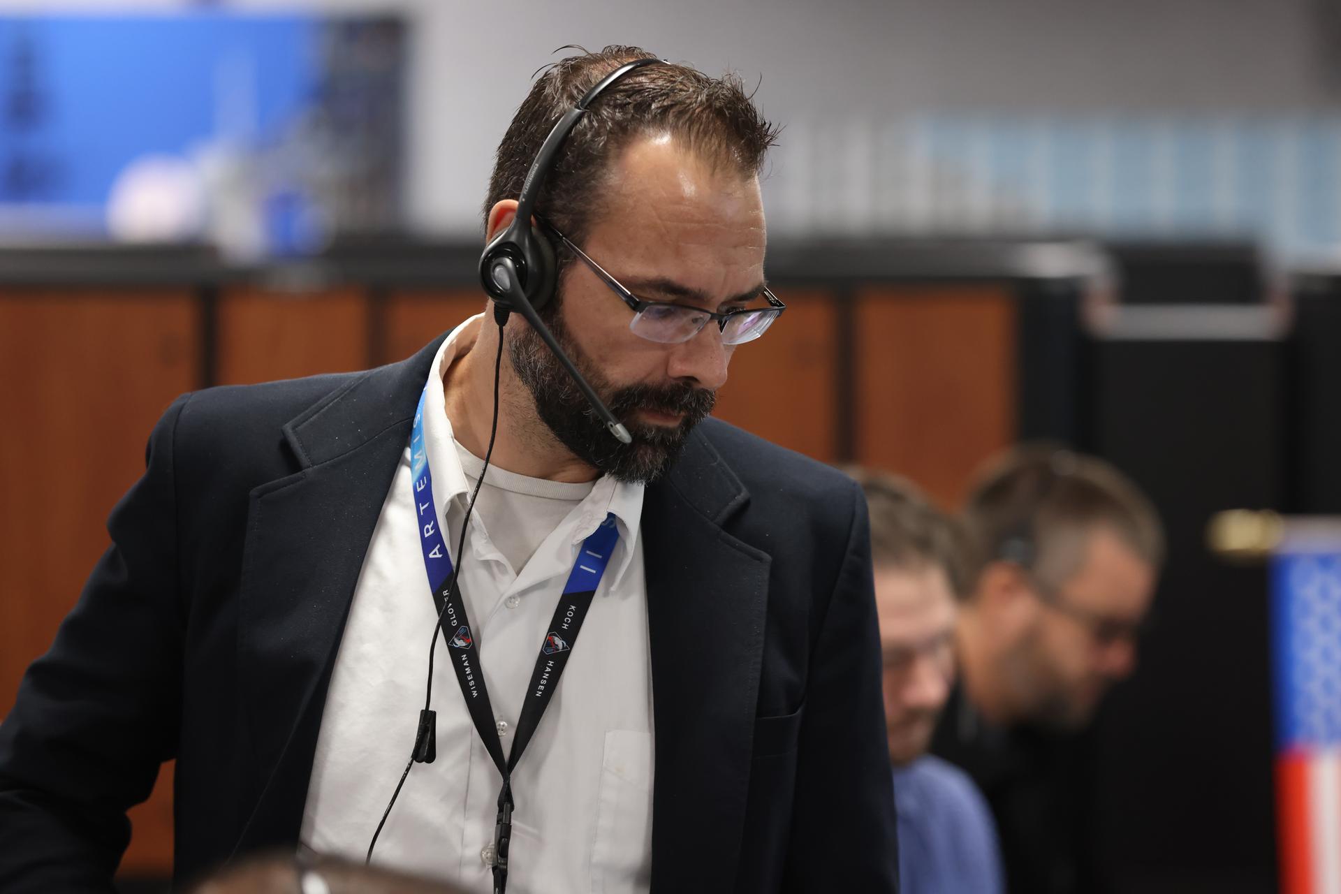
Despite the intensity of launch day, Kiriwas describes it can often feel easier than the hundreds of rehearsals and simulations leading up to it. The team trains rigorously, preparing for every scenario imaginable. The ideal day is smooth and uneventful, but when it’s not, he and the team are ready.
I’m in my element when there is a problem.Anton Kiriwas
Senior Technical Integration Manager, Exploration Ground Systems Program
When an issue arises, Kiriwas and his team begin asking the basic questions: ‘What are the requirements? Which systems are affected? Who needs to be involved?’ He pulls the technical community together to work through the situation, come up with any troubleshooting, and ultimately give the recommendation for a “go” or “no-go” for launch. It takes clarity, experience, and discipline, especially in moments when excitement is running high.
“There is adrenaline to get to launch, but you want to be careful to never let that turn into ‘launch fever,’” said Kiriwas. “We need to launch exactly when we’re ready and not a moment before.”
Anton Kiriwas, a launch project engineer for the Artemis I mission, monitors operations from his position in Firing Room 1 as Artemis teams conduct a launch simulation for the Artemis I launch inside the Rocco A. Petrone Launch Control Center at NASA’s Kennedy Space Center in Florida on Oct. 27, 2022. NASA/Ben Smegelsky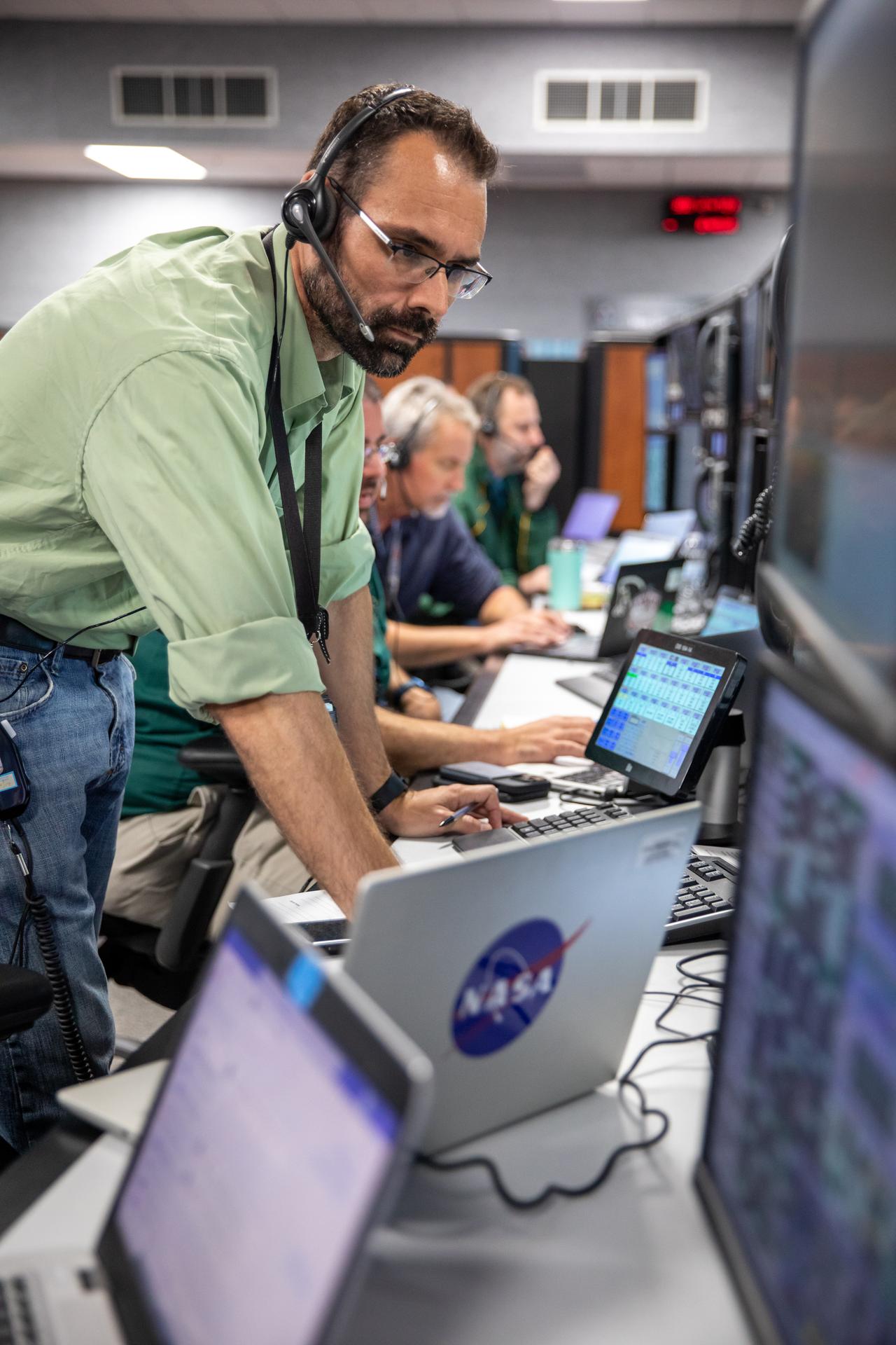
With Artemis II complete, Kiriwas continues applying his problem‑solving expertise, analyzing lessons learned, and shaping future mission requirements. Artemis III hardware is currently being processed at NASA Kennedy, and the teams are carefully preparing the next steps of NASA’s return to the lunar surface.
“There’s a million little pieces that go into this, and I get to be a part of it,” said Kiriwas.
About the AuthorLaura SasaninejadStrategic Communications Specialist Share Details Last Updated May 08, 2026 EditorJason CostaLocationKennedy Space Center Related Terms Explore More 2 min read Nicholas Houghton: Engineering Crew Safety for NASA’s Artemis Missions Article 3 hours ago 4 min read NASA Fuel Cell Tests Pave Way for Energy Storage on Moon Article 3 days ago 3 min read NASA Welcomes Paraguay as 67th Artemis Accords Signatory Article 4 days ago Keep Exploring Discover More Topics From NASAMissions
Humans in Space
Climate Change
Solar System
I Am Artemis: Anton Kiriwas
Listen to this audio excerpt from Anton Kiriwas, senior technical integration manager for NASA’s Exploration Ground Systems Program:
0:00 / 0:00
Your browser does not support the audio element.When Anton Kiriwas first spotted an image of the Moon and Mars hanging over a job fair booth while in college, it captured his imagination, yet felt like a dream too distant to chase. He had no way of knowing that years later he would play a critical role in NASA’s Artemis missions, helping launch humans back to the Moon for the first time in more than half a century.
Kiriwas’ journey to NASA began during the Space Shuttle Program, while he was working for United Launch Alliance, the same organization behind the memorable Moon and Mars booth that he passed by in college. Not long after, he joined NASA as a civil servant, designing electrical systems that set him on a path toward his current role with Exploration Ground Systems as senior technical integration manager. In simpler terms, Kiriwas is a problem solver.
My official title is way too long – what I do is pretty simple: I solve problems for the ground systems. Our goal is to process, launch, and recover the spacecraft. There are a lot of ground systems that are used to go do that and a lot of people involved. A big part of my job is to go solve all the problems that come.Anton Kiriwas
Senior Technical Integration Manager, Exploration Ground Systems Program
A core part of Kiriwas’s role is to serve as a launch project engineer. Strategically positioned at the integration console in the center of Firing Room 1 of the Launch Control Center at the agency’s Kennedy Space Center in Florida, he acts as a bridge for the test management and engineering teams. Kiriwas, along with the other launch project engineers, reports directly to the launch director, making the final technical recommendation on any issues that may arise during launch countdown. From this seat, he works across all engineering disciplines, united under one mission: launch the spacecraft and crew safely.
Anton Kiriwas, senior technical integration manager and senior launch project engineer with NASA’s Exploration Ground Systems Program participates in an Artemis II launch countdown simulation inside Firing Room 1 in the Launch Control Center at the agency’s Kennedy Space Center in Florida on Wednesday, Oct. 8, 2025. The simulations go through launch day scenarios to help launch team members test software and make adjustments if needed during countdown operations. NASA/Glenn BensonDespite the intensity of launch day, Kiriwas describes it can often feel easier than the hundreds of rehearsals and simulations leading up to it. The team trains rigorously, preparing for every scenario imaginable. The ideal day is smooth and uneventful, but when it’s not, he and the team are ready.
I’m in my element when there is a problem.Anton Kiriwas
Senior Technical Integration Manager, Exploration Ground Systems Program
When an issue arises, Kiriwas and his team begin asking the basic questions: ‘What are the requirements? Which systems are affected? Who needs to be involved?’ He pulls the technical community together to work through the situation, come up with any troubleshooting, and ultimately give the recommendation for a “go” or “no-go” for launch. It takes clarity, experience, and discipline, especially in moments when excitement is running high.
“There is adrenaline to get to launch, but you want to be careful to never let that turn into ‘launch fever,’” said Kiriwas. “We need to launch exactly when we’re ready and not a moment before.”
Anton Kiriwas, a launch project engineer for the Artemis I mission, monitors operations from his position in Firing Room 1 as Artemis teams conduct a launch simulation for the Artemis I launch inside the Rocco A. Petrone Launch Control Center at NASA’s Kennedy Space Center in Florida on Oct. 27, 2022. NASA/Ben SmegelskyWith Artemis II complete, Kiriwas continues applying his problem‑solving expertise, analyzing lessons learned, and shaping future mission requirements. Artemis III hardware is currently being processed at NASA Kennedy, and the teams are carefully preparing the next steps of NASA’s return to the lunar surface.
“There’s a million little pieces that go into this, and I get to be a part of it,” said Kiriwas.
About the AuthorLaura SasaninejadStrategic Communications Specialist Share Details Last Updated May 08, 2026 EditorJason CostaLocationKennedy Space Center Related Terms Explore More 4 min read NASA Fuel Cell Tests Pave Way for Energy Storage on Moon Article 3 days ago 3 min read NASA Welcomes Paraguay as 67th Artemis Accords Signatory Article 4 days ago 3 min read Industry Moon Lander Training Cabin Lands at NASA for Artemis Article 4 days ago Keep Exploring Discover More Topics From NASAMissions
Humans in Space
Climate Change
Solar System
See the Pentagon’s new UFO image release
The Pentagon has started releasing files related to unidentified anomalous phenomena (UAP), also called UFOs. Here are the images released so far
AI’s Power Needs Will Destroy the Renewable Energy Revolution
After decades of fighting for renewable energy, solar power is finally achieving economic dominance. But AI data centers threaten to consume those energy gains
NASA, Industry Advance High Performance Spaceflight Computing
3 min read
Preparations for Next Moonwalk Simulations Underway (and Underwater) High Performance Spaceflight Computing System on ChipNASA/Ryan Lannom
For decades, NASA has advanced on-board spacecraft computer processors that coordinate and execute the functions needed to support mission success.
Space computing originated in the 1960s with the Apollo Guidance Computers, which were pivotal for guidance, navigation, and control computations during NASA’s first Moon missions. For decades, radiation-hardened processors have been the backbone of the agency’s space exploration missions.
NASA has landed computers on other planets and operated them for years in extreme conditions, as demonstrated by the Mars rovers. These computer processors have also powered several NASA orbiters, capsules, and space telescopes.
While legacy processors have enabled some of NASA’s greatest achievements, the next generation of space missions will increase in complexity and length, which will benefit from greater computing power, autonomy, and resilience. To meet the needs of this challenge, NASA and industry leader Microchip Technology Inc. entered a public, private partnership combining agency and commercial investments to develop a new solution: High-Performance Spaceflight Computing.
Advanced ComputingThe High-Performance Spaceflight Computing project is a next-generation system-on-chip that delivers over 100 times the computing capability of current space processors. By integrating computing and networking into a single device, this technology significantly reduces system cost and power consumption. Its scalable architecture allows unused functions to power down, optimizing energy efficiency for critical operations.
The High-Performance Spaceflight Computing family of processors includes multiple distinct but compatible technologies for scalable mission needs. The radiation-hardened version of the processor is built for geosynchronous, deep-space, and long-duration missions to the Moon, Mars, and beyond, capable of operating in harsh environments while supporting real-time autonomous tasks. Tailored for the commercial space sector, the radiation-tolerant version of the processor provides fault tolerance and cybersecurity for low Earth orbit satellites.
High Performance Spaceflight Computing System on ChipNASA/Ryan Lannom
Using advanced Ethernet to connect multiple sensors or cluster several chips, High-Performance Spaceflight Computing technology allows spacecraft to process massive amounts of data onboard and autonomously make real-time decisions, such as driving rovers at high speeds or filtering scientific images. Continuous system health monitoring and an integrated security controller ensure these complex operations remain safe and reliable.
Computing power for Golden Age of ExplorationThe High-Performance Spaceflight Computing technology is a nationwide, public-private development effort anchored by NASA, Microchip, and a broad ecosystem of academic and industry partners. This collaboration reinforces U.S. leadership in spaceflight computing, strengthens supply chain resilience and security, stimulates regional economies, and drives innovation and high-tech workforce development across the nation.
This new technology has the potential for use on all future space missions, but unlike traditional space-specific chips, High-Performance Spaceflight Computing has a design platform for other Earth-based uses.
Adopting the same high-performance computing, network switching, high-reliability and cybersecurity technologies, the company’s processors enable mission-critical edge computing for Earth-based industries such as automotive, aviation, consumer electronics, industrial systems, and aerospace. These potential applications include drones, energy grids, medical equipment, communication services, artificial intelligence, and data transmission.
By leveraging a common technology base across space and terrestrial markets, High-Performance Spaceflight Computing helps strengthen domestic industrial capabilities and reduce risk and cost for both government and commercial users.
The Space Technology Mission Directorate’s Game Changing Development program based at NASA’s Langley Research Center in Hampton, Virginia, and NASA’s Jet Propulsion Laboratory led the end-to-end maturation of NASA’s High-Performance Spaceflight Computing by developing mission requirements, funding competitive industry studies, selecting and contracting with Microchip, and guiding the project through design reviews and the project life cycle to delivery.
To learn more about these chips, visit:
By: Jessica Jelke
Explore More 3 min read NASA Developing AI to Steer Using Landmarks – On the MoonA NASA engineer is teaching an AI machine to use features on the Moon’s horizon…
Article 3 years ago 3 min read NASA to Test Solution for Radiation-Tolerant Computing in Space Article 1 year ago 2 min read NASA Ames to Host Supercomputing Resources for UC Berkeley Researchers Article 2 years ago Share Details Last Updated May 08, 2026 EditorLoura Hall Related TermsNASA, Industry Advance High Performance Spaceflight Computing
3 min read
Preparations for Next Moonwalk Simulations Underway (and Underwater) High Performance Spaceflight Computing System on ChipNASA/Ryan LannomFor decades, NASA has advanced on-board spacecraft computer processors that coordinate and execute the functions needed to support mission success.
Space computing originated in the 1960s with the Apollo Guidance Computers, which were pivotal for guidance, navigation, and control computations during NASA’s first Moon missions. For decades, radiation-hardened processors have been the backbone of the agency’s space exploration missions.
NASA has landed computers on other planets and operated them for years in extreme conditions, as demonstrated by the Mars rovers. These computer processors have also powered several NASA orbiters, capsules, and space telescopes.
While legacy processors have enabled some of NASA’s greatest achievements, the next generation of space missions will increase in complexity and length, which will benefit from greater computing power, autonomy, and resilience. To meet the needs of this challenge, NASA and industry leader Microchip Technology Inc. entered a public, private partnership combining agency and commercial investments to develop a new solution: High-Performance Spaceflight Computing.
Advanced ComputingThe High-Performance Spaceflight Computing project is a next-generation system-on-chip that delivers over 100 times the computing capability of current space processors. By integrating computing and networking into a single device, this technology significantly reduces system cost and power consumption. Its scalable architecture allows unused functions to power down, optimizing energy efficiency for critical operations.
The High-Performance Spaceflight Computing family of processors includes multiple distinct but compatible technologies for scalable mission needs. The radiation-hardened version of the processor is built for geosynchronous, deep-space, and long-duration missions to the Moon, Mars, and beyond, capable of operating in harsh environments while supporting real-time autonomous tasks. Tailored for the commercial space sector, the radiation-tolerant version of the processor provides fault tolerance and cybersecurity for low Earth orbit satellites.
High Performance Spaceflight Computing System on ChipNASA/Ryan LannomUsing advanced Ethernet to connect multiple sensors or cluster several chips, High-Performance Spaceflight Computing technology allows spacecraft to process massive amounts of data onboard and autonomously make real-time decisions, such as driving rovers at high speeds or filtering scientific images. Continuous system health monitoring and an integrated security controller ensure these complex operations remain safe and reliable.
Computing power for Golden Age of ExplorationThe High-Performance Spaceflight Computing technology is a nationwide, public-private development effort anchored by NASA, Microchip, and a broad ecosystem of academic and industry partners. This collaboration reinforces U.S. leadership in spaceflight computing, strengthens supply chain resilience and security, stimulates regional economies, and drives innovation and high-tech workforce development across the nation.
This new technology has the potential for use on all future space missions, but unlike traditional space-specific chips, High-Performance Spaceflight Computing has a design platform for other Earth-based uses.
Adopting the same high-performance computing, network switching, high-reliability and cybersecurity technologies, the company’s processors enable mission-critical edge computing for Earth-based industries such as automotive, aviation, consumer electronics, industrial systems, and aerospace. These potential applications include drones, energy grids, medical equipment, communication services, artificial intelligence, and data transmission.
By leveraging a common technology base across space and terrestrial markets, High-Performance Spaceflight Computing helps strengthen domestic industrial capabilities and reduce risk and cost for both government and commercial users.
The Space Technology Mission Directorate’s Game Changing Development program based at NASA’s Langley Research Center in Hampton, Virginia, and NASA’s Jet Propulsion Laboratory led the end-to-end maturation of NASA’s High-Performance Spaceflight Computing by developing mission requirements, funding competitive industry studies, selecting and contracting with Microchip, and guiding the project through design reviews and the project life cycle to delivery.
To learn more about these chips, visit:
By: Jessica Jelke
Explore More 3 min read NASA Developing AI to Steer Using Landmarks – On the MoonA NASA engineer is teaching an AI machine to use features on the Moon’s horizon…
Article 3 years ago 3 min read NASA to Test Solution for Radiation-Tolerant Computing in Space Article 1 year ago 2 min read NASA Ames to Host Supercomputing Resources for UC Berkeley Researchers Article 2 years ago Share Details Last Updated May 08, 2026 EditorLoura Hall Related TermsBlack Holes Don't Live Forever, But They Might Live Long Enough To Look Like White Holes
Black holes evaporate through Hawking radiation, meaning their days are numbered. But a new study finds they could enter a metastable stage where they look similar to white holes.