
Feed aggregator
I Am Artemis: Jen Madsen and Trey Perryman
Listen to this audio excerpt from Jen Madsen and Trey Perryman, leads of the Orion Mission Evaluation Room for the Artemis II mission:
0:00 / 0:00
Your browser does not support the audio element.During NASA’s Artemis II mission, Jen Madsen and Trey Perryman will be leading a team monitoring the Orion spacecraft as it carries four astronauts around the Moon. The team works in the Orion Mission Evaluation Room where they will monitor and analyze Orion’s systems and performance in real time to help ensure crew safety and mission success.
As the leaders of the Orion Mission Evaluation Room located inside the Mission Control Center at NASA’s Johnson Space Center in Houston, Madsen and Perryman are responsible for ensuring that the dozens of NASA, Lockheed Martin, ESA (European Space Agency), and Airbus expert engineers that staff the room’s consoles are ready for Artemis II.
Jen and I are responsible for the organization, training, and execution of the entire team. We’ll also play a key role in communicating the findings of the Mission Evaluation Room to our program and agency leadership.Trey Perryman
Lead for Orion Mission and Systems Integration
The flight control team operating Orion from mission control’s White Flight Control Room will rely on the Mission Evaluation Room’s crucial findings to help with unexpected spacecraft behaviors that may arise and help analyze Orion’s performance data during the mission.
With crew aboard Orion, Artemis II brings new challenges, new opportunities, and a new space in mission control for the Orion Mission Evaluation Room. More spacecraft systems will be put to the test, requiring more evaluation room expertise and new consoles to monitor systems not previously flown, like life support.
“There’s loads of excitement — for the new capabilities, the mission, and having a new, wonderful space to operate in,” said Perryman.
Besides leading the Mission Evaluation Room, Perryman is also the lead for Orion Mission and Systems Integration, and Madsen is deputy manager for Orion’s Avionics, Power, and Software. Their co-leadership styles complement each other — Perryman leads with energy and team spirit, while Madsen brings a steadiness and structure.
Artemis II Orion Mission Evaluation Room Leads Jen Madsen and Trey Perryman stand in the Orion Mission Evaluation Room in the Mission Control Center at NASA’s Johnson Space Center in Houston.NASA/Rad Sinyak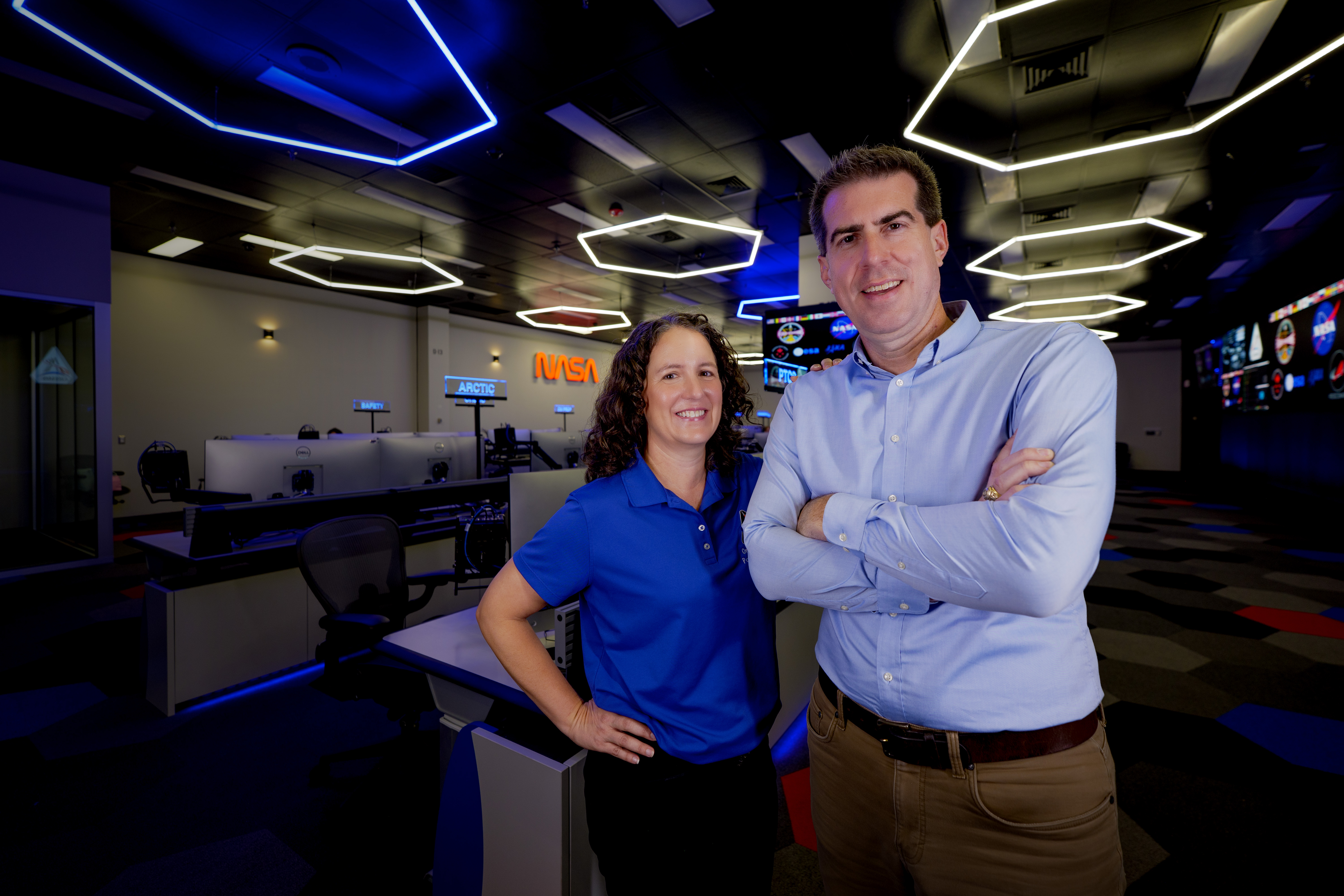
“We balance each other out,” Madsen said. “And that balance is reflected in our team.”
For Perryman, a former flight controller with a background in space shuttle and space station operations, the MER represents the culmination of a career in human spaceflight that’s personal.
“I couldn’t imagine being anywhere else right now,” Perryman said. “My wife and I have four boys, and my boys are very excited about Artemis…that’s meaningful to me. And they like seeing a father who’s really connected to this mission.”
Madsen began her NASA career in engineering, designing and simulating Orion’s guidance, navigation, and control systems early on in the program.
I spent many years doing computer simulations, writing code, doing analysis… we designed, built, and tested Orion. So now it's amazing to me to get to be a part of the legacy of operating the vehicle.Jen Madsen
Deputy Manager for Orion’s Avionics, Power, and Software
For both leaders, the Artemis II mission is more than technical. With crew flying aboard the spacecraft, it’s deeply human.
“I do feel an extra sense of importance and mindfulness about what we’re doing in this building,” Perryman said, “making sure — specifically in the Orion MER — that we understand how the vehicle supports the crew, because it is so important to return them home safely.”
“We all feel like Reid, Victor, Christina, and Jeremy are part of the Orion family,” Madsen said. “When we have discussions about risk, from design all the way through operations, we’re thinking about our friends aboard the spacecraft.”
About the AuthorErika Peters Share Details Last Updated Dec 29, 2025 Related Terms Explore More 3 min read Get In, We’re Going Moonbound: Meet NASA’s Artemis Closeout Crew Article 7 days ago 4 min read Artemis II Flight Crew, Teams Conduct Demonstration Ahead of Launch Article 1 week ago 3 min read I Am Artemis: Grace Lauderdale Article 1 week ago Keep Exploring Discover More Topics From NASAMissions
Humans in Space
Climate Change
Solar System
I Am Artemis: Jen Madsen and Trey Perryman
Listen to this audio excerpt from Jen Madsen and Trey Perryman, leads of the Orion Mission Evaluation Room for the Artemis II mission:
0:00 / 0:00
Your browser does not support the audio element.During NASA’s Artemis II mission, Jen Madsen and Trey Perryman will be leading a team monitoring the Orion spacecraft as it carries four astronauts around the Moon. The team works in the Orion Mission Evaluation Room where they will monitor and analyze Orion’s systems and performance in real time to help ensure crew safety and mission success.
As the leaders of the Orion Mission Evaluation Room located inside the Mission Control Center at NASA’s Johnson Space Center in Houston, Madsen and Perryman are responsible for ensuring that the dozens of NASA, Lockheed Martin, ESA (European Space Agency), and Airbus expert engineers that staff the room’s consoles are ready for Artemis II.
Jen and I are responsible for the organization, training, and execution of the entire team. We’ll also play a key role in communicating the findings of the Mission Evaluation Room to our program and agency leadership.Trey Perryman
Lead for Orion Mission and Systems Integration
The flight control team operating Orion from mission control’s White Flight Control Room will rely on the Mission Evaluation Room’s crucial findings to help with unexpected spacecraft behaviors that may arise and help analyze Orion’s performance data during the mission.
With crew aboard Orion, Artemis II brings new challenges, new opportunities, and a new space in mission control for the Orion Mission Evaluation Room. More spacecraft systems will be put to the test, requiring more evaluation room expertise and new consoles to monitor systems not previously flown, like life support.
“There’s loads of excitement — for the new capabilities, the mission, and having a new, wonderful space to operate in,” said Perryman.
Besides leading the Mission Evaluation Room, Perryman is also the lead for Orion Mission and Systems Integration, and Madsen is deputy manager for Orion’s Avionics, Power, and Software. Their co-leadership styles complement each other — Perryman leads with energy and team spirit, while Madsen brings a steadiness and structure.
Artemis II Orion Mission Evaluation Room Leads Jen Madsen and Trey Perryman stand in the Orion Mission Evaluation Room in the Mission Control Center at NASA’s Johnson Space Center in Houston.NASA/Rad Sinyak“We balance each other out,” Madsen said. “And that balance is reflected in our team.”
For Perryman, a former flight controller with a background in space shuttle and space station operations, the MER represents the culmination of a career in human spaceflight that’s personal.
“I couldn’t imagine being anywhere else right now,” Perryman said. “My wife and I have four boys, and my boys are very excited about Artemis…that’s meaningful to me. And they like seeing a father who’s really connected to this mission.”
Madsen began her NASA career in engineering, designing and simulating Orion’s guidance, navigation, and control systems early on in the program.
I spent many years doing computer simulations, writing code, doing analysis… we designed, built, and tested Orion. So now it's amazing to me to get to be a part of the legacy of operating the vehicle.Jen Madsen
Deputy Manager for Orion’s Avionics, Power, and Software
For both leaders, the Artemis II mission is more than technical. With crew flying aboard the spacecraft, it’s deeply human.
“I do feel an extra sense of importance and mindfulness about what we’re doing in this building,” Perryman said, “making sure — specifically in the Orion MER — that we understand how the vehicle supports the crew, because it is so important to return them home safely.”
“We all feel like Reid, Victor, Christina, and Jeremy are part of the Orion family,” Madsen said. “When we have discussions about risk, from design all the way through operations, we’re thinking about our friends aboard the spacecraft.”
About the AuthorErika Peters Share Details Last Updated Dec 29, 2025 Related Terms Explore More 3 min read Get In, We’re Going Moonbound: Meet NASA’s Artemis Closeout Crew Article 6 days ago 4 min read Artemis II Flight Crew, Teams Conduct Demonstration Ahead of Launch Article 7 days ago 3 min read I Am Artemis: Grace Lauderdale Article 7 days ago Keep Exploring Discover More Topics From NASAMissions
Humans in Space
Climate Change
Solar System
Spaceflight for Astronomy — A Look Back and Ahead
The highlights of spaceflight in 2025 have included missions to explore the Moon, Mars, and the Sun — and more is coming in the New Year.
The post Spaceflight for Astronomy — A Look Back and Ahead appeared first on Sky & Telescope.
Inside world's ultimate X-ray machine before it becomes more powerful
Inside world's ultimate X-ray machine before it becomes more powerful
Russia Scales Back Ambitions for Its Next Space Station
The proposed Russian Orbital Station will stick to a familiar path instead of an ambitious polar orbit
7 Important Health Stories We’ll Be Following in 2026
From immune cell therapies to measles outbreaks to federal attacks on public health, these are some of the health topics we’ll be watching next year
Microsoft made a splash with a controversial quantum computer in 2025
Microsoft made a splash with a controversial quantum computer in 2025
Human-plant hybrid cells reveal truth about dark DNA in our genome
Human-plant hybrid cells reveal truth about dark DNA in our genome
The Origami Wheel That Could Explore Lunar Caves
A joint research team from South Korea has developed a fascinating wheel inspired by origami and Da Vinci bridge principles that could unlock access to the Moon’s most dangerous and scientifically useful terrain. The wheel expands from 230 mm to 500 mm in diameter on demand, allowing small rovers to navigate steep lunar pits and lava tube entrances that would trap conventional vehicles.
Hubble Reveals Chaos in the Largest Planet Nursery Ever Seen
Astronomers using the Hubble Space Telescope have discovered the largest planet forming disk ever observed around a young star, stretching nearly 40 times the diameter of our Solar System. Nicknamed “Dracula’s Chivito” for its hamburger like appearance when viewed edge on, this massive disk reveals an unexpectedly chaotic and asymmetric structure with wisps of material extending far above and below its central plane. The discovery offers an unprecedented window into how planets might form in extreme environments, challenging previous assumptions about the orderly nature of planetary nurseries.
Gene-edited babies are the future – but these CRISPR start-ups aren’t
Gene-edited babies are the future – but these CRISPR start-ups aren’t
Rethinking How We End A Satellite's Mission
At the end of their lives, most satellites fall to their death. Many of the smaller ones, including most of those going up as part of the “mega-constellations” currently under construction, are intended to burn up in the atmosphere. This Design for Demise (D4D) principle has unintended consequences, according to a paper by Antoinette Ott and Christophe Bonnal, both of whom work for MaiaSpace, a company designing reusable launch vehicles for the small satellite market.
NASA’s SPHEREx Observatory Completes Its First Map of the Cosmos in 102 Infrared Wavelengths
Launched in March, NASA’s SPHEREx space telescope has completed its first infrared map of the entire sky in 102 colors. This map will enable 3D distance measurements to other galaxies and allow astronomers to measure the influence of Cosmic Inflation on the large-scale structure of the Universe.