
NASA - Breaking News
One of NASA’s Key Cameras Orbiting Mars Takes 100,000th Image
3 min read
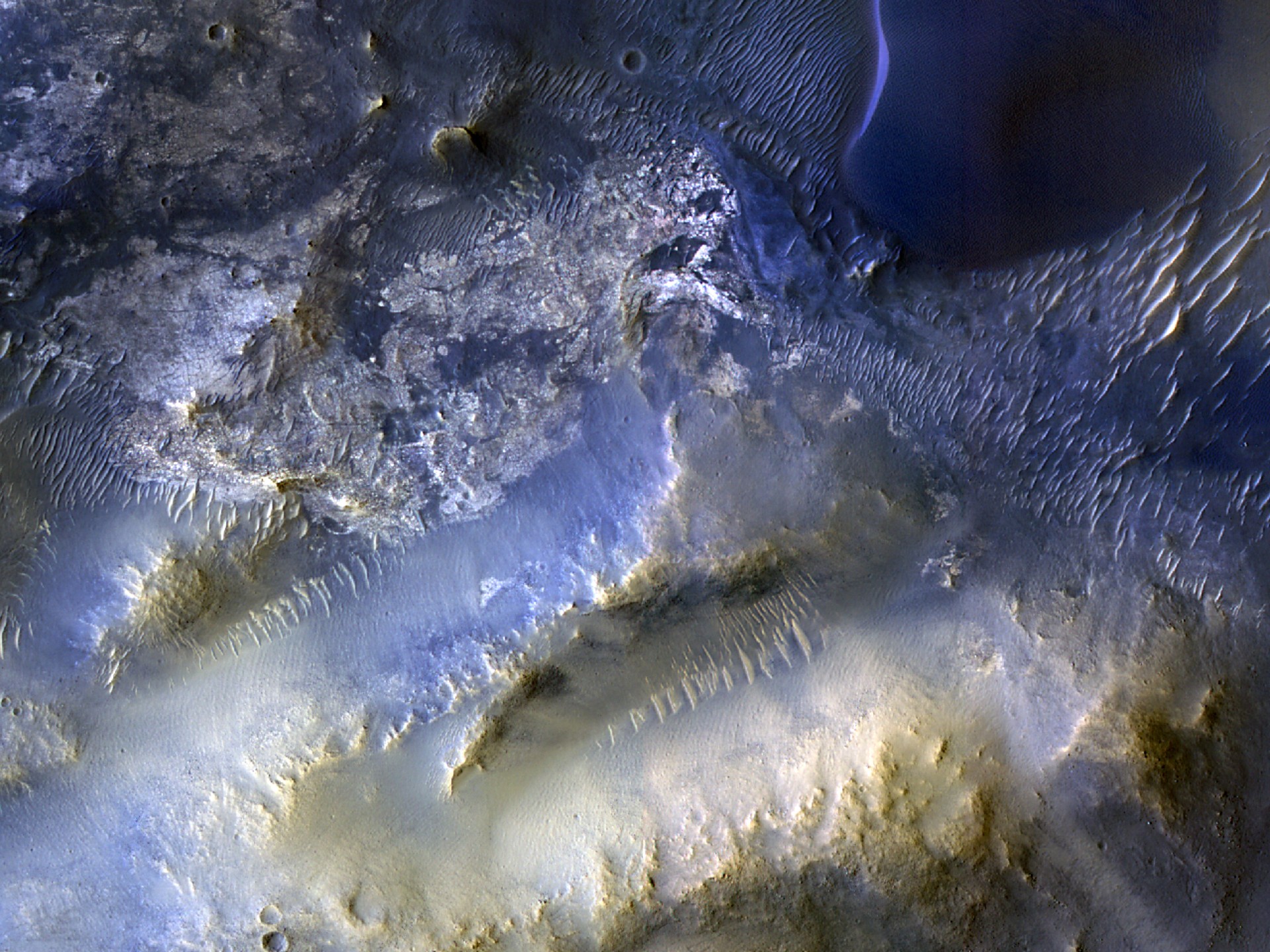
Preparations for Next Moonwalk Simulations Underway (and Underwater) This view of a region called Syrtis Major is from the 100,000th image captured by NASA’s Mars Reconnaissance Orbiter using its HiRISE camera. Over nearly 20 years, HiRISE has helped scientists understand how the Red Planet’s surface is constantly changing. NASA/JPL-Caltech/University of ArizonaMesas and dunes stand out in the view snapped by HiRISE, one of the imagers aboard the agency’s Mars Reconnaissance Orbiter.
After nearly 20 years at the Red Planet, NASA’s Mars Reconnaissance Orbiter (MRO) has snapped its 100,000th image of the surface with its HiRISE camera. Short for High Resolution Imaging Science Experiment, HiRISE is the instrument the mission relies on for high-resolution images of features ranging from impact craters, sand dunes, and ice deposits to potential landing sites. Those images, in turn, help improve our understanding of Mars and prepare for NASA’s future human missions there.
Captured Oct. 7, this milestone image from the spacecraft shows mesas and dunes within Syrtis Major, a region about 50 miles (80 kilometers) southeast of Jezero Crater, which NASA’s Perseverance rover is exploring. Scientists are analyzing the image to better understand the source of windblown sand that gets trapped in the region’s landscape, eventually forming dunes.
“HiRISE hasn’t just discovered how different the Martian surface is from Earth, it’s also shown us how that surface changes over time,” said MRO’s project scientist, Leslie Tamppari of NASA’s Jet Propulsion Laboratory in Southern California. “We’ve seen dune fields marching along with the wind and avalanches careening down steep slopes.”
To view this video please enable JavaScript, and consider upgrading to a web browser that supports HTML5 video
Watch highlights of images captured by HiRISE, the high-resolution camera aboard NASA’s Mars Reconnaissance Orbiter, including its 100,000th image, showing the plains and dunes of Syrtis Major.NASA/JPL-Caltech/University of ArizonaThe subject of the 100,000th image was recommended by a high school student through the HiWish site, where anyone can suggest parts of the planet to study. Team members at University of Arizona in Tucson, which operates the camera, also make 3D models of HiRISE imagery so that viewers can experience virtual flyover videos.
“Rapid data releases, as well as imaging targets suggested by the broader science community and public, have been a hallmark of HiRISE,” said the camera’s principal investigator, Shane Byrne of the University of Arizona in Tucson. “One hundred thousand images just like this one have made Mars more familiar and accessible for everyone.”
More about MRO
NASA’s Jet Propulsion Laboratory in Southern California manages MRO for NASA’s Science Mission Directorate in Washington as part of NASA’s Mars Exploration Program portfolio. Lockheed Martin Space in Denver built MRO and supports its operations.
The University of Arizona in Tucson operates HiRISE, which was built by Ball Aerospace & Technologies Corp., in Boulder, Colorado.
For more information, visit:
https://science.nasa.gov/mission/mars-reconnaissance-orbiter
MRO Captures Images of Comet 3I/ATLAS Mars Orbiter Shines New Light on Martian Mystery Mars Orbiter Learns New Moves After Nearly 20 YearsNews Media Contacts
Andrew Good
Jet Propulsion Laboratory, Pasadena, Calif.
818-393-2433
andrew.c.good@jpl.nasa.gov
Karen Fox / Molly Wasser
NASA Headquarters, Washington
202-358-1600
karen.c.fox@nasa.gov / molly.l.wasser@nasa.gov
2025-140
Share Details Last Updated Dec 16, 2025 Related Terms Explore More 6 min read NASA JPL Shakes Things Up Testing Future Commercial Lunar Spacecraft Article 1 hour ago 5 min read NASA, Partners Share First Data From New US-European Sea Satellite Article 7 hours ago 3 min read NASA’s Webb, Curiosity Named in TIME’s Best Inventions Hall of FameTwo icons of discovery, NASA’s James Webb Space Telescope and NASA’s Curiosity rover, have earned…
Article 4 days ago Keep Exploring Discover Related Topics Mars ExplorationMars is the only planet we know of inhabited entirely by robots. Learn more about the Mars Missions.
Mars Reconnaissance OrbiterNASA’s Mars Reconnaissance Orbiter (MRO) is the second longest-lived spacecraft to orbit Mars, after 2001 Mars Odyssey.
MRO ScienceOverview Among other ongoing achievements, data collected by Mars Reconnaissance Orbiter continues to help Mars scientists and engineers characterize potential…
All Mars ResourcesExplore this collection of Mars images, videos, resources, PDFs, and toolkits. Discover valuable content designed to inform, educate, and inspire,…
Maintaining the Gold Standard: The Future of Landsat Calibration and Validation
By Amit Angal, Senior Engineer at Goddard Space Flight Center
The Landsat Calibration and Validation (Cal/Val) group helps uphold Landsat’s reputation as the gold standard of satellite imagery. They ensure that the Operational Land Imager (OLI) and the Thermal Infrared Sensor (TIRS) aboard Landsats 8 and 9 provide high-quality scientific measurements to users around the world. In 2025, the Cal/Val group contributed over 60 pages to the second edition of “Comprehensive Remote Sensing” (Kaita et. al, 2026), organizing content from NASA, USGS, academia, and industry scientists. Cal/Val support staff authored multiple sections, including a summary of results from Landsat 9 and of the evolution of spectral, spatial, and radiometric characteristics throughout the Landsat missions.
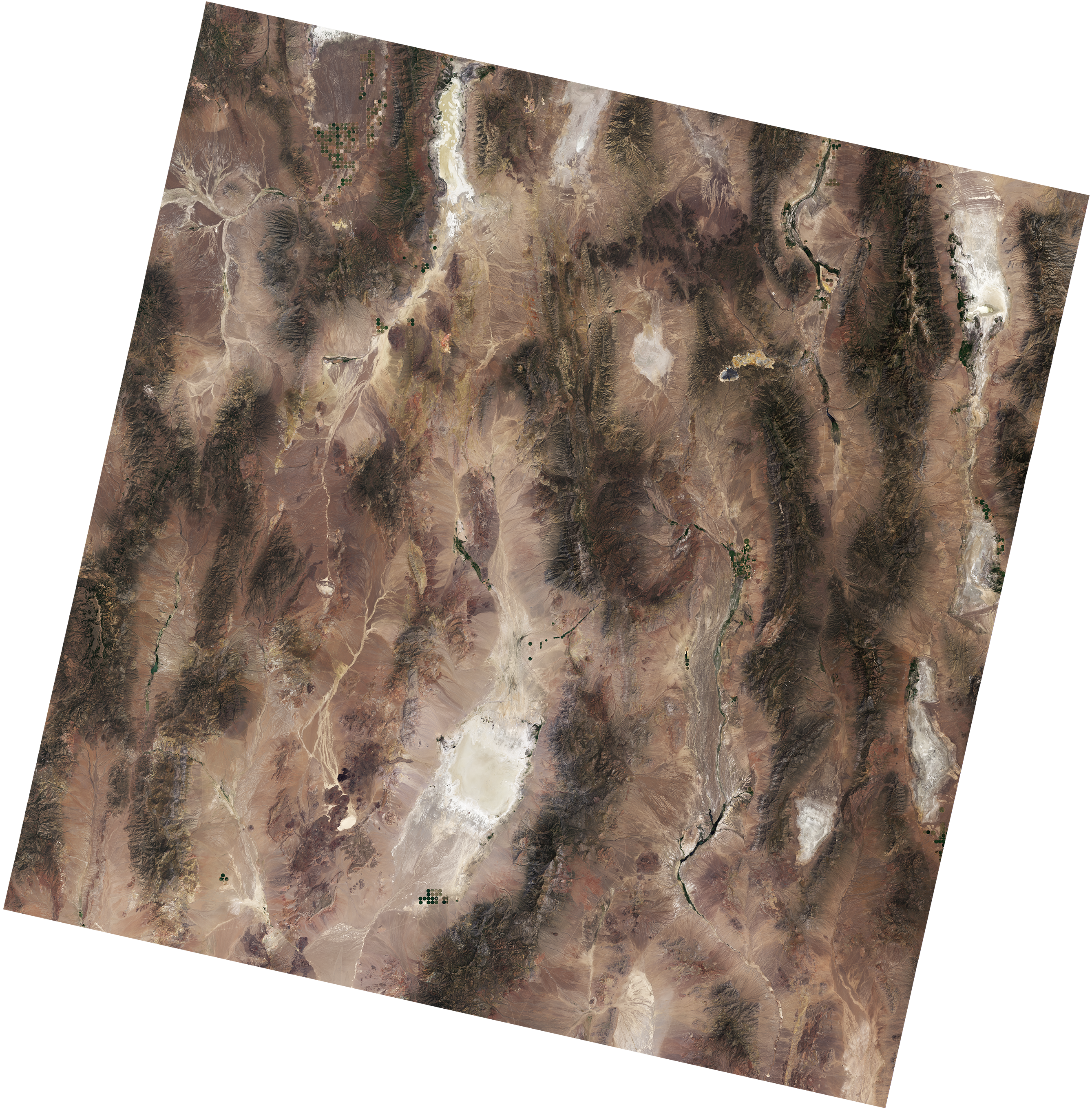
A natural-color Landsat 9 image of Railroad Valley Playa in Nevada, acquired on June 29, 2024. A portion of the playa is used as a radiometric calibration and validation site for various satellite sensors including Landsat 8 and 9’s OLI instruments.NASA/USGSThe Cal/Val team at NASA Goddard Space Flight Center works closely with the Landsat Flight Operations Team to plan weekly calibration activities to maintain the radiometric accuracy of Landsat products. In October 2025, a Landsat 9 anomaly occurred related to its solar array drive assembly (SADA) potentiometer. The spacecraft and instruments were placed in a safehold, pausing data collections. The Cal/Val team assessed the instruments after they recovered from this anomaly, including monitoring the instrument telemetry, detector gains, and noise performance. The team identified a mis-loaded detector map and updated the calibration of both the reflective and thermal emissive bands to ensure consistent, accurate data. After six days in the safehold, the instrument resumed normal operations.
The NASA Cal/Val team supports their USGS counterparts with quarterly updates to the Calibration Parameter File (CPF) by providing inputs for relative and absolute gains as needed. This work involves collaborating with USGS scientists to ensure the consistency of the Combined Radiometric Model (CRaM). The CRaM approach integrates radiometric responses from on-board calibrators to enhance long-term calibration stability throughout mission lifetimes. The CRaM algorithm also provides an extensible framework for future satellite missions. A peer-reviewed publication detailing the CRaM’s approach and future applications was submitted to Science of Remote Sensing.
On January 14-16, 2025, the Landsat Cal/Val team organized and hosted the first semiannual Technical Information Meeting (TIM) at NASA Goddard Space Flight Center. NASA and USGS scientists welcomed collaborating scientists from South Dakota State University (SDSU), the University of Arizona Tucson, and Rochester Institute of Technology for presentations and discussions on Landsat imaging performance, algorithms, and instrument health. On May 28-29, 2025, the Cal/Val team attended the second semiannual TIM at SDSU.
The Landsat Cal/Val Team is validating the accuracy of the Harmonized Landsat and Sentinel-2 (HLS) v2.0 product, which combines data from multiple satellites to create a continuous record of Earth’s surface reflectance measurements since 2013. The team is testing the dataset using RadCalNet, a global network of automated ground stations that provide precise, standardized measurements. The team compared measurements from four RadCalNet sites, including the well-established Railroad Valley Playa site in Nevada, against near-simultaneous HLS data. Their analysis shows the satellite and ground measurements agree within expected uncertainty ranges—a strong validation of the HLS product’s accuracy.
The team presented these findings at the CEOS IVOS calibration meeting in Tucson, Arizona (September 1-5, 2025) and is currently preparing a peer-reviewed article to share the complete results.
Path ForwardThe Cal/Val team applies lessons learned from Landsat missions to better plan calibration efforts for the next generation of instruments. Using instrument performance checklists from Landsat 8/9, the team is building a framework of in-house geometric and radiometric testing and extending algorithms for future Landsat instruments.
The Landsat Cal/Val Team is actively tackling a critical challenge in solar irradiance modeling. While new hyperspectral sensor technologies have made it possible to create highly accurate solar models with much lower uncertainty, the remote sensing community still lacks agreed-upon methods for applying these advanced models. A dedicated subgroup within the Landsat Cal/Val Team is now developing and testing standardized approaches to bridge this gap. Their goal is to create clear recommendations and best practices that the scientific community can refine together and implement consistently.
This work addresses a fundamental need—transforming promising hyperspectral solar modeling capabilities into practical, standardized tools that researchers can confidently use across different projects and applications.
Explore More 3 min read What’s Next for HLSIn 2025, the Harmonized Landsat and Sentinel-2 (HLS) program established itself as a cornerstone for…
Article 2 hours ago 2 min read GLOBE Expands with Landsat Land Cover ComparisonsThe Global Learning and Observations to Benefit the Environment (GLOBE) Program has launched a new…
Article 6 days ago 4 min read Tool Uses NASA Data to Take Temperature of Rivers from SpaceNew research uses more than 40 years of data from NASA and the U.S. Geological…
Article 2 weeks agoNextSTEP-3 B: Moon to Mars Architecture Studies
Notice ID: M2M-MSFC-0001
NAICS Codes:
- 541715 – Research and Development in the Physical, Engineering, and Life Sciences (except Nanotechnology and Biotechnology)
NASA seeks industry-led architecture concept development, concept refinement studies, and risk-reduction activities that address Moon to Mars Architecture gaps through the Next Space Technologies for Exploration Partnerships-3 (NextSTEP-3). NASA plans to release this solicitation — NextSTEP-3 Appendix B: Moon to Mars Architectural Studies — near the beginning of calendar year 2026. For full details, consult the links under the notice ID above.
NASA’s Moon to Mars Architecture defines capabilities needed for long-term, human-led scientific discovery in deep space. The agency’s architecture approach distills agency-developed objectives into capabilities and elements that support exploration and science goals. NASA continuously evolves that blueprint for crewed exploration, setting humanity on a path to the Moon, Mars, and beyond by collaborating with experts across industry, academia, and the international community.
This proposed solicitation seeks partner participation on a recurring basis, targeting several calls per year for proposal submissions. The proposals should focus on topics addressing infrastructure, transportation, habitation, concepts of operations, and planetary science capabilities identified in the latest revision of the Architecture Definition Document. The solicitation establishes a flexible acquisition strategy that accommodates both directed-topic calls on specific areas of government interest, as well as open topic calls.
NASA anticipates the first Appendix B directed-topic study calls will focus on lunar and Mars mission concepts. NASA intends to issue a directed call for research into an integrated surface power infrastructure (or power grid) that can evolve to support increasingly ambitious lunar missions. (Note: this call excludes proposals addressing the Fission Surface Power System Announcement for Partnership Proposal but may include all technology solutions including alternate fission, solar hybrid, or other power grid approaches.)
Concurrently, NASA will issue a directed call for Mars crew transportation concept development, trade studies, and identification of risk reduction activities. This call would include in-space transportation, Mars surface access, and Mars ascent options for crew and cargo.
Bassac River, Southern Vietnam
A camera on the International Space Station captured this Oct. 2, 2025, photo of the Bassac River in Cù Lao Dung, a river islet district in southern Vietnam. The Bassac River surrounds the district before emptying into the South China Sea. The river’s brown waters at its mouth result from massive amounts of silt, clay, and organic matter carried from upstream regions of the Mekong River Basin, combined with tidal forces from the sea that stir up sediment. This photograph was taken from as the space station orbited 260 miles above Earth.
Image credit: NASA
NASA’s Roman Telescope Will Observe Thousands of Newfound Cosmic Voids
Lee esta nota de prensa en español aquí.
Our universe is filled with galaxies, in all directions as far as our instruments can see. Some researchers estimate that there are as many as two trillion galaxies in the observable universe. At first glance, these galaxies might appear to be randomly scattered across space, but they’re not. Careful mapping has shown that they are distributed across the surfaces of giant cosmic “bubbles” up to several hundred million light-years across. Inside these bubbles, few galaxies are found, so those regions are called cosmic voids. NASA’s Nancy Grace Roman Space Telescope will allow us to measure these voids with new precision, which can tell us about the history of the universe’s expansion.
To view this video please enable JavaScript, and consider upgrading to a web browser that supports HTML5 video
This narrated video sequence illustrates how NASA's Nancy Grace Roman Space Telescope will be able to observe cosmic voids in the universe. These highly detailed measurements will help constrain cosmological models.Credit: Video: NASA, STScI; Visualization: Frank Summers (STScI); Script Writer: Frank Summers (STScI); Narration: Frank Summers (STScI); Audio: Danielle Kirshenblat (STScI); Science: Giulia Degni (Roma Tre University), Alice Pisani (CPPM), Giovanni Verza (Center for Computational Astrophysics/Flatiron Inst.)“Roman’s ability to observe wide areas of the sky to great depths, spotting an abundance of faint and distant galaxies, will revolutionize the study of cosmic voids,” said Giovanni Verza of the Flatiron Institute and New York University, lead author on a paper published in The Astrophysical Journal.
Cosmic RecipeThe cosmos is made of three key components: normal matter, dark matter, and dark energy. The gravity of normal and dark matter tries to slow the expansion of the universe, while dark energy opposes gravity to speed up the universe’s expansion. The nature of both dark matter and dark energy are currently unknown. Scientists are trying to understand them by studying their effects on things we can observe, such as the distribution of galaxies across space.
“Since they’re relatively empty of matter, voids are regions of space that are dominated by dark energy. By studying voids, we should be able to put powerful constraints on the nature of dark energy,” said co-author Alice Pisani of CNRS (the French National Centre for Scientific Research) in France and Princeton University in New Jersey.
To determine how Roman might study voids, the researchers considered one potential design of the Roman High-Latitude Wide-Area Survey, one of three core community surveys that Roman will conduct. The High-Latitude Wide-Area Survey will look away from the plane of our galaxy (hence the term high latitude in galactic coordinates). The team found that this survey should be able to detect and measure tens of thousands of cosmic voids, some as small as just 20 million light-years across. Such large numbers of voids will allow scientists to use statistical methods to determine how their observed shapes are influenced by the key components of the universe.
To determine the actual, 3D shapes of the voids, astronomers will use two types of data from Roman — the positions of galaxies in the sky and their cosmological redshift, the latter of which is determined using spectroscopic data. To convert redshift to a physical distance, astronomers make assumptions about the components of the universe, including the strength of dark energy and how it might have evolved over time.
Pisani compared it to trying to infer a cake recipe (i.e., the universe’s makeup) from the final dessert served to you. “You try to put in the right ingredients — the right amount of matter, the right amount of dark energy — and then you check whether your cake looks as it should. If it doesn’t, that means you put in the wrong ingredients.”
In this case, the appearance of the “cake” is the shape found by statistically stacking all of the voids detected by Roman on top of each other. On average, voids are expected to have a spherical shape because there is no “preferred” location or direction in the universe (i.e., the universe is both homogeneous and isotropic on large scales). This means that, if the stacking is done correctly, the resulting shape will be perfectly round (or spherically symmetric). If not, then you have to adjust your cosmic recipe.
Power of RomanThe researchers emphasized that to study cosmic voids in large numbers, an observatory must be able to probe a large volume of the universe, because the voids themselves can be tens or hundreds of millions of light-years across. The spectroscopic data necessary to study voids will come from a portion of the Roman High-Latitude Wide-Area Survey that will cover on the order of 2,400 square degrees of the sky, or 12,000 full moons. It will also be able to see fainter and more distant objects, yielding a greater density of galaxies than complementary missions like ESA’s (European Space Agency’s) Euclid.
“Voids are defined by the fact that they contain so few galaxies. So to detect voids, you have to be able to observe galaxies that are quite sparse and faint. With Roman, we can better look at the galaxies that populate voids, which ultimately will give us greater understanding of the cosmological parameters like dark energy that are sculpting voids,” said co-author Giulia Degni of Roma Tre University and INFN (the National Institute of Nuclear Physics) in Rome.
The Nancy Grace Roman Space Telescope is managed at NASA’s Goddard Space Flight Center in Greenbelt, Maryland, with participation by NASA’s Jet Propulsion Laboratory in Southern California; Caltech/IPAC in Pasadena, California; the Space Telescope Science Institute in Baltimore; and a science team comprising scientists from various research institutions. The primary industrial partners are BAE Systems, Inc. in Boulder, Colorado; L3Harris Technologies in Melbourne, Florida; and Teledyne Scientific & Imaging in Thousand Oaks, California.
By Christine Pulliam
Space Telescope Science Institute, Baltimore, Md.
cpulliam@stsci.edu
Unexpected Trajectory: Erin Sholl’s Path to Human Spaceflight Safety
Career paths are rarely a straight line and often include some unexpected curves. That is certainly true for Erin Sholl, deputy chief of the Space Transportation Systems Division within the Safety and Mission Assurance Directorate at NASA’s Johnson Space Center in Houston. From struggling with multiplication tables in elementary school to supporting the International Space Station from the Mission Control Center, her journey has been full of twists and turns.
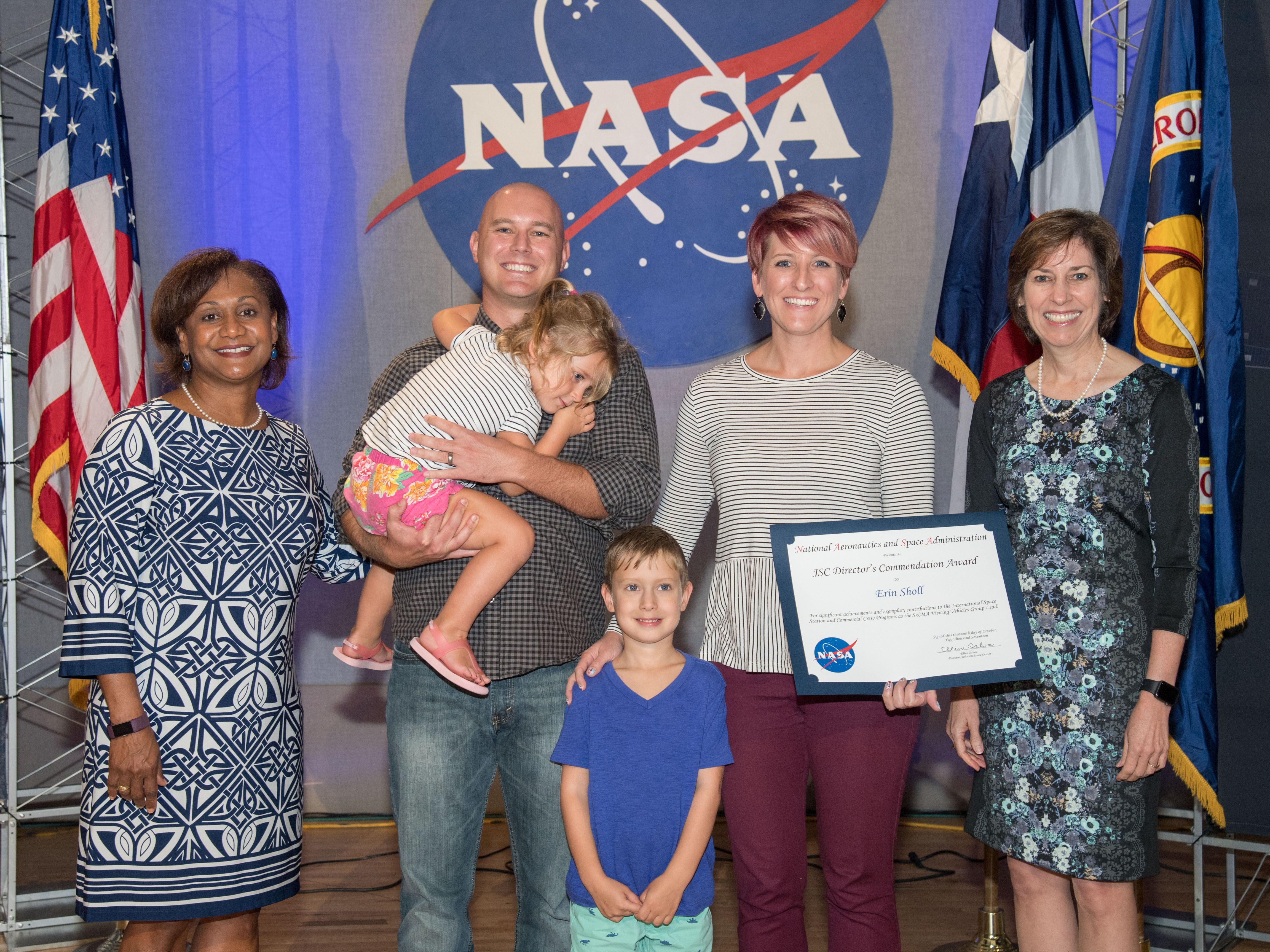
Erin Sholl (second from right) received the Johnson Space Center Director’s Commendation Award in 2017 for significant achievements and exemplary contributions to the International Space Station and Commercial Crew Programs as the Safety and Mission Assurance Visiting Vehicles Group lead. NASA/James BlairDespite her early difficulties in math and science, Sholl eventually grew to love and excel in both subjects. She planned to study chemical engineering in college – inspired by a love of chemistry and a favorite high school teacher – but discovered a greater affinity for physics once she arrived at Pennsylvania State University. She switched her major to aerospace engineering and soon met a classmate who had interned at Johnson. After that, Sholl declared, “The dream was born!”
Her first position at Johnson was as a trajectory operations officer for the Flight Operations Directorate. She spent six years supporting the space station on console in the Mission Control Center, describing the experience as “something out of the movies.” When Sholl went looking for a new challenge, she landed in the Safety and Mission Assurance Directorate.
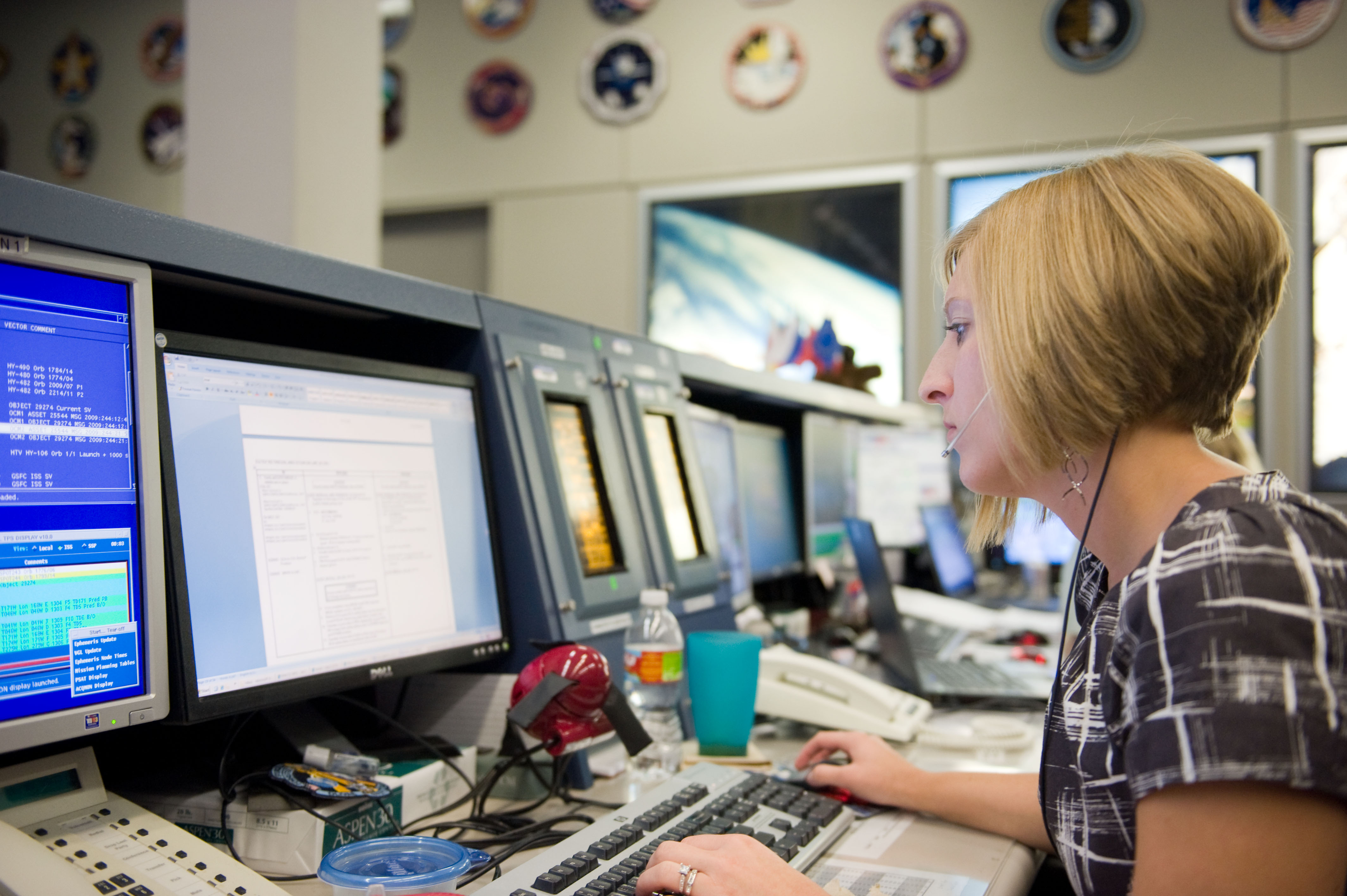
Erin Sholl working on console as a trajectory operations officer in the Mission Control Center during the STS-128/17A mission in 2009. NASA/Lauren Harnett“I was drawn to the Operations and Visiting Vehicles Branch because it had many similar aspects to my previous position – real-time operations and visiting vehicles,” she said. “I worked various roles over the next 12 years, gradually taking on more responsibility, and eventually becoming a group lead, then branch chief.” Sholl also served as acting deputy chief for the Space Habitation Systems Division, which oversees the Operations and Visiting Vehicles Branch. Her performance drew the attention of the Space Transportation Systems Division’s chief. “He asked me to come be his deputy, and that is where I still am today!”
The Space Transportation Systems Division provides system safety, reliability, and risk analysis for human spaceflight programs. The division works with the different program offices to reduce risk through technical assessments and guidance on Safety and Mission Assurance requirements throughout program and project lifecycles.
Sholl works closely with the division chief to support strategic planning, budgeting, and operations. “A key part of my role is connecting with people – both inside and outside the division – to ensure smooth communication and representation of the team’s needs,” she said. She leverages her relationship-building and strategic thinking skills to lead initiatives that advance the division’s and the directorate’s goals and to mentor employees.
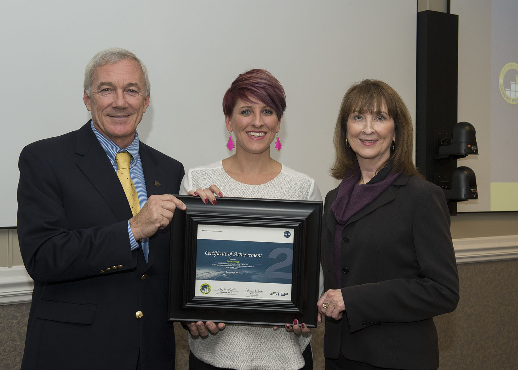
Erin Sholl (center) receives a certificate of achievement from Terrence Wilcutt, former director of the Office of Safety and Mission Assurance (SMA) at NASA Headquarters, and Patricia Petete, former director of SMA at Johnson, after completing requirements for the Safety and Mission Assurance Technical Excellence Program in System Safety. Image courtesy of Erin ShollSholl believes strongly in the power of mentorship. “Having various mentors, both formal and informal, has been so important throughout my career,” she said. “Listening to what these people were saying about my strengths led me to a path I’d never considered because I hadn’t seen those things in myself.” Being a mentor and advocate for team members is one of Sholl’s favorite parts of the leadership positions she has held, particularly as branch chief. “I really felt like I could connect with my people and advocate for them in a way that felt meaningful,” she said.
She encourages young professionals to seek out mentors or opportunities to shadow colleagues in different roles. “Relationships are the key to everything,” she said. “The more people you meet and the more you learn about different paths in space exploration, the better off you will be in your career.”
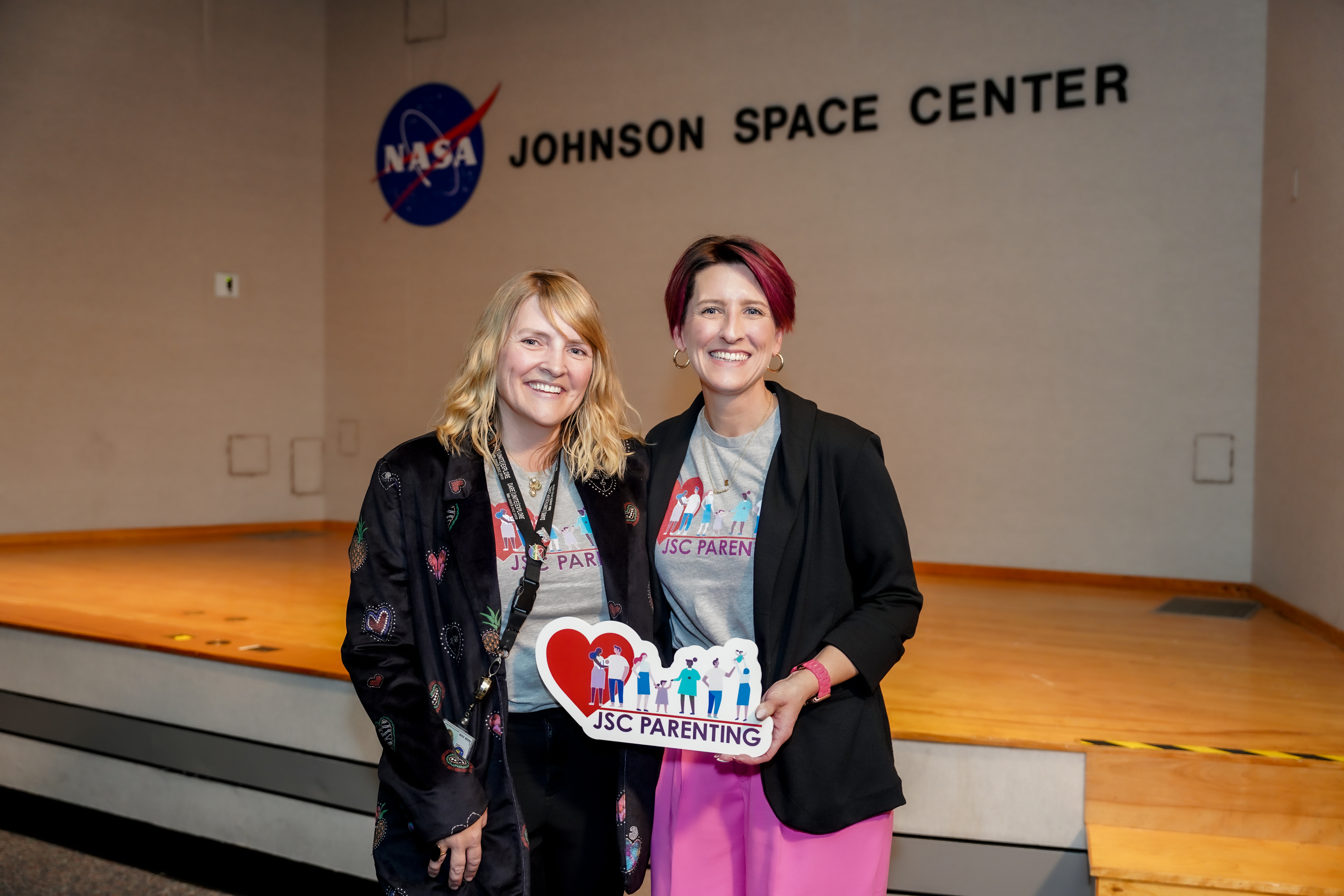
Susan Schuh, Flight Crew Integration Operational Habitability (OpsHab) team lead and Erin Sholl host a JSC Parenting community event in 2023.Image courtesy of Erin ShollSholl noted that professional relationships can be bolstered by activities outside of the office. She played a key role in establishing and growing JSC Parenting, a virtual community of about 600 employees who share information and support each other on issues related to caregiving, schooling, and balancing work with family life. “My leadership within the community enhances my professional leadership and positively impacts my colleagues,” she said.
Sholl also emphasized the importance of being open to trying new things, even if an opportunity seems to diverge from your expected career path. “I volunteer for everything because I am always eager to learn more and find out what else I might be good at and how else I can serve my team,” she said. “I think it’s easy to feel intimidated hearing about other people’s career paths, because they often sound so perfectly planned and successful. You rarely hear about the pivots, setbacks, or decisions made for personal reasons.”
The reality, she added, is more complex. “I tried for many roles I didn’t get, and it took a lot of trial and error to find my path to a career I really love.”
Explore More 6 min read 25 Years of Space Station Technology Driving Exploration Article 5 days ago 4 min read Artemis II Vehicle Manager Branelle Rodriguez Gets Orion Ready for “Go” Article 1 week ago 5 min read Student Art Murals at Johnson Celebrate 25 Years of Humanity in Space Article 2 weeks agoNew Timing for Stubble Burning in India
- Earth
- Earth Observatory
- Image of the Day
- EO Explorer
- Topics
- More Content
- About
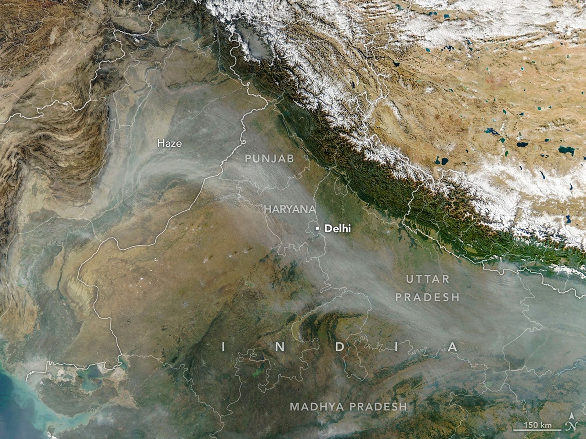
Every year for decades, long rivers of smoke and haze have spread across the Indo-Gangetic Plain in northern India from October to December. That’s when farmers in Punjab, Haryana, Uttar Pradesh, Madhya Pradesh, and other states burn off plant “stubble” after the rice harvest.
When winds are weak and the atmosphere becomes stagnant, the haze can push levels of air pollution several times higher than limits recommended by the World Health Organization. Smoke typically mixes with particles and gases from other sources, such as industry, vehicles, domestic fires (heating and cooking), fireworks, and dust storms, to form the haze, though scientists consider stubble burning to be a major factor.
In some ways, the seasonal timing of stubble fires in 2025 followed typical patterns. Air quality deteriorated in Delhi and several other cities for about a month after crop fires intensified during the last week of October, explained Hiren Jethva, a Morgan State University atmospheric scientist based at NASA’s Goddard Space Flight Center. For about a decade, Jethva has tracked the stubble burning season in India using satellites, and has made predictions about the intensity of the upcoming fire season based on vegetation observations.
The MODIS (Moderate Resolution Imaging Spectroradiometer) on NASA’s Aqua satellite captured this image of a smoky haze darkening skies over much of the plain on November 11, 2025. According to news reports, it was the first of several days in 2025 when pollution levels exceeded 400 on India’s air quality index, the strongest rating on the scale. As in past years, the poor air quality prompted officials in some areas to close schools and institute more stringent air quality controls on construction.
However, the daily timing of burning departs from what Jethva has seen in the past. He started tracking the number of fires years ago by primarily tallying observations from MODIS—which pass over locations on Earth each morning and afternoon on the Terra and Aqua satellites, respectively. Then, most fires were lit in the early afternoon between 1 p.m. and 2 p.m. local time.
But in the past few years, stubble fires have occurred progressively later in the day, Jethva said. He identified the shift by analyzing observations from GEO-KOMPSAT-2A, a South Korean geostationary satellite launched in late 2018 that collects data every 10 minutes.
Most stubble fires now happen between 4 p.m. and 6 p.m., he said, meaning that fire-monitoring systems that rely solely on MODIS, or similar sensors like VIIRS (Visible Infrared Imaging Radiometer Suite), miss many of the fires. “Farmers have changed their behavior,” he said.
His analysis of GEO-KOMPSAT-2A observations indicates that the stubble burning activity in Punjab and Haryana was moderate in 2025 compared to other recent years. This year had higher numbers of fires compared to 2024, 2020, and 2019 but fewer fires than 2023, 2022, and 2021, he found.
Indian Space Research Organization researchers have also pointed out the shift in the timing of stubble burning. In a Current Science study published in 2025, one group reported that MSG (Meteosat Second Generation) satellite observations showed a shift in peak fire activity from about 1:30 p.m. in 2020 to about 5:00 p.m. in 2024. In December 2025, researchers with the International Forum for Environment, Sustainability, & Technology (iForest) released a multi-satellite analysis that came to a similar conclusion.
Meanwhile, parsing out precisely how much stubble fires contribute to poor air quality in Delhi compared to other sources of pollution remains a topic of active study and debate among scientists. “Studies report contributions ranging from 10 to 50 percent,” said Pawan Gupta, a NASA research scientist who specializes in air quality.
Gupta estimates that the stubble burning contribution ranges from 40 to 70 percent on a given day, dropping to 20 to 30 percent if averaged over a month or burning season, and under 10 percent if averaged annually. “Meteorological conditions—like a shallow boundary layer height and low temperature—during the burning season add extra complexity,” he said.
The timing of the fires may influence the degree to which stubble burning affects air quality. Some modeling research suggests that evening fires may lead to a stronger overnight buildup of particle pollution than early-afternoon fires because the planetary boundary layer, the lowest part of the atmosphere, tends to be shallower and have weaker winds at night, allowing pollutants to accumulate.
NASA Earth Observatory image by Michala Garrison, using MODIS data from NASA EOSDIS LANCE and GIBS/Worldview. Story by Adam Voiland.
References and Resources- Biswal, A., et al. (2025) Emission time and amount of crop residue burning play critical role on PM2.5 variability during October–November in northwestern India during 2022–2024. Environmental Science: Atmospheres, 11.
- Burki, T. (2025) Stubble: The Farmer’s Bane. The Lancet Respiratory Medicine, 13(2), 207.
- The Deccan Herald (2025, December 8) Punjab, Haryana farmers change stubble burning time window to avoid satellite detection. Accessed December 9, 2025.
- Down to Earth (2025, November 26) Why has Madhya Pradesh burnt more paddy stubble for the second year in a row? Accessed December 9, 2025.
- Jethva, H., et al. (2019) Connecting Crop Productivity, Residue Fires, and Air Quality over Northern India. Scientific Reports, 9, 16594.
- Ministry of Environment, Forest and Climate Change (2025, December 1) Paddy Harvesting Season 2025 concludes with significant Reduction in Farm Fire Incidents across Punjab and Haryana. Accessed December 9, 2025.
- NASA (2024, October 18) What is Air Quality? Accessed December 9, 2025.
- NASA Earth Observatory (2020, November 17) A Busy Season for Crop Fires in Northwestern India. Accessed December 9, 2025.
- NASA Earth Observatory (2025, January 22) Is Fire Activity Declining in Northwestern India? Accessed December 9, 2025.
- NDTV (2025, December 1) Stubble Burning Down By 90% In Punjab, Haryana, Centre Informs Parliament. Accessed December 9, 2025.
- NDTV (2025, December 9) Farm Fires Didn’t End, They Just Moved To Afternoon: Satellite Data Analysis. Accessed December 9, 2025.
- The New Indian Express (2025, November 11) AQI spikes to 428 in first ‘severe’ air day of this year, GRAP-III invoked in capital. Accessed December 9, 2025.
- Singh, N., et al. (2025) Evidence of shift in stubble burning timing over northwest India from geostationary satellite observations. Current Science, 129(10), 921-923.
- The Times of India (2025, December 6) Stubble burning cases jump by 18% in UP this year. Accessed December 9, 2025.
JPEG (2.90 MB)
You may also be interested in:
Stay up-to-date with the latest content from NASA as we explore the universe and discover more about our home planet.
Widespread Smoke from Canadian Fires
3 min read
Fires burning in boreal forests created hazy skies across North America in summer 2025.
ArticleSeeing the Monroe Canyon Fire in a New Light
5 min read
As wildland fires raged in the American West, NASA airborne technology was there to image it in incredible detail.
ArticleB.C. Wildfires Send Smoke Skyward
2 min read
Lightning likely ignited several large fires that sent smoke pouring over the Canadian province in early September 2025.
Article1
2
3
4
Next
Keep Exploring Discover More from NASA Earth Science Subscribe to Earth Observatory Newsletters
Subscribe to the Earth Observatory and get the Earth in your inbox.
Earth Observatory Image of the Day
NASA’s Earth Observatory brings you the Earth, every day, with in-depth stories and stunning imagery.
Explore Earth Science
Earth Science Data
